Hebron and its surroundings: Where are they building today? Where were they demolishing today?
- Highway 60: The entrance to Samu’ is open, and the entrance to Dura is also open. The entrance to Al-Fawwar is closed.
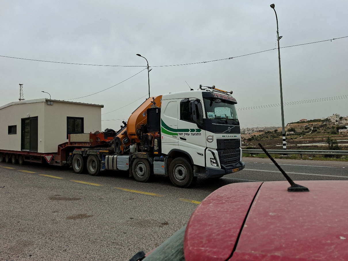
- A truck carrying a trailer is traveling north. From where and where? Where are they building today? Also, a large bulldozer –
- A visit to Atta Jaber, east of the road, opposite Kiryat Arba. We bring him a donation of money to help him, as well as groceries for his brother.
- Down by the road, he has a vineyard, he ploughed furrows along the rows of vines, to loosen the soil. The last cabbages are visible between the vines, it is already the end of the season.

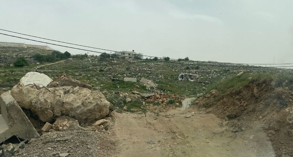
- The only exit to Highway 60 is blocked again and again by mounds of dirt that have to be broken through every time. And when you get out on the road, it is dangerous to stand there, for example to hail a taxi, for that you have to move forward to the next intersection.
- When we visit his home, his wife Rudina holds the one-month-old baby, Yusuf, the fourth son of the son who lives with them. Atta recalls how in 1998 they demolished 2 of his houses near the road, demanding 20,000 shekels. Rabbi Arik Asherman said in the trial that he would pay, in the end the judge gave up, understanding the absurdity of the situation. His thoughts on the current situation: Human rights are due to everyone; the entire Israeli people are guilty of the situation because the government must be opposed and replaced. In this war the settlers and the army are working together against them. As for the events of 7.10 – he emphasizes that all religions forbid killing children, women and the elderly and not even in war time.
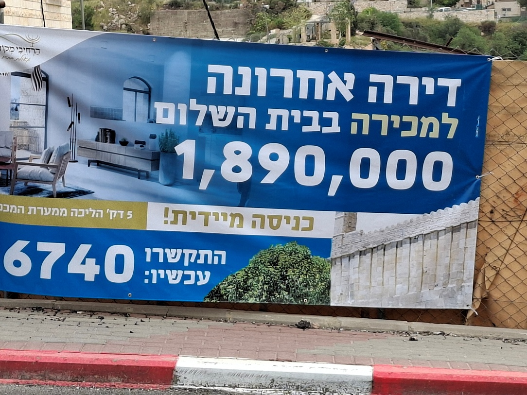
- Hebron is full of this ad – indeed, very tempting real estate:
- Near the Cave of the Patriarchs, a pre-military preparatory school awaits me. We walk up through Maayan Avraham to Issa Amro’s house, where we meet with Muhannad, one of the activists from the “Youth Against Settlements” group, who explains what nonviolent resistance to the occupation is. I complete the information.
- Back through Route 317. At the Zif Junction a traffic jam, works on the road.
Location Description
Hebron
See all reports for this place-
According to Wye Plantation Accords (1997), Hebron is divided in two: H1 is under Palestinian Authority control, H2 is under Israeli control. In Hebron there are 170,000 Palestinian citizens, 60,000 of them in H2. Between the two areas are permanent checkpoints, manned at all hours, preventing Palestinian movement between them and controlling passage of permit holders such as teachers and schoolchildren. Some 800 Jews live in Avraham Avinu Quarter and Tel Rumeida, on Givat HaAvot and in the wholesale market.
Checkpoints observed in H2:
- Bet Hameriva CP- manned with a pillbox
- Kapisha quarter CP (the northern side of Zion axis) - manned with a pillbox
- The 160 turn CP (the southern side of Zion axis) - manned with a pillbox
- Avraham Avinu quarter - watch station
- The pharmacy CP - checking inside a caravan with a magnometer
- Tarpat (1929) CP - checking inside a caravan with a magnometer
- Tel Rumeida CP - guarding station
- Beit Hadassah CP - guarding station
Three checkpoints around the Tomb of the Patriarchs
 Raya YeorDec-18-2025Hebron - Yusri Jaber and part of his family
-
South Hebron Hills
See all reports for this place-
South Hebron Hills
South Hebron Hills is a large area in the West Bank's southern part.
Yatta is a major city in this area: right in the border zone between the fertile region of Hebron and its surroundings and the desert of the Hebron Hills. Yatta has about 64,000 inhabitants.
The surrounding villages are called Masafer Yatta (Yatta's daughter villages). Their inhabitants subsist on livestock and agriculture. Agriculture is possible only in small plots, especially near streams. Most of the area consists of rocky terraces.Since the beginning of the 1980s, many settlements have been established on the agricultural land cultivated by the Palestinians in the South Hebron Hills region: Carmel, Maon, Susia, Masadot Yehuda, Othniel, and more. Since the settlements were established and Palestinians cultivation areas have been reduced; the residents of the South Hebron Hills have been suffering from harassment by the settlers. Attempts to evict and demolish houses have continued, along with withholding water and electricity. The military and police usually refrain from intervening in violent incidents between settlers and Palestinians do not enforce the law when it comes to the investigation of extensive violent Jewish settlers. The harassment in the South Hebron Hills includes attacking and attempting to burn residential tents, harassing dogs, harming herds, and preventing access to pastures.
There are several checkpoints in the South Hebron Hills, on Routes 317 and 60. In most of them, no military presence is apparent, but rather an array of pillboxes monitor the villages. Roadblocks are frequently set up according to the settlers and the army's needs. These are located at the Zif Junction, the Dura-al Fawwar crossing, and the Sheep Junction at the southern entrance to Hebron.
Updated April 2022
 MuhammadFeb-24-2026South Hebron Hill, Beit Hagai: Paving an internal security road
-