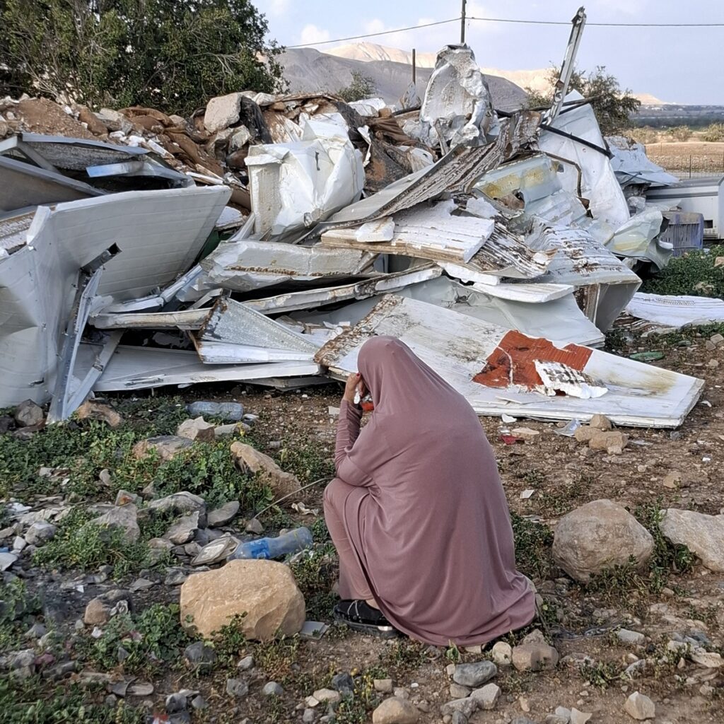
Hebron - Engineering vehicles arrived to widen Route 60 and nibbled on Ata Jaber's beautiful vineyard
Highway 60
Meitar Checkpoint – The parking areas on both sides of the checkpoint were almost empty. On our way back, at 12:30 p.m., we saw that several dozen cars had gathered on the Palestinian side of the checkpoint.
Samu’ – The yellow gate was closed. Vehicles were bypassing it via dirt roads, but several cars were waiting for it to reopen, supposedly at 10:00 a.m. When we returned more than two hours later, the gate was still closed, and cars were still waiting on its western side.
Before Deir Razih, on the eastern side of the road, we saw evidence of a recent fire that had consumed harvested fields and damaged Palestinian olive trees as well. Muhammad recalled seeing a report on Channel 12 News about a fire in Afeka. Afeka is a settlement established about a year ago, east of this area. Could there be a connection?
Dura–Al-Fawwar – Both checkpoints were open. We saw no pedestrians or taxis traveling between them.
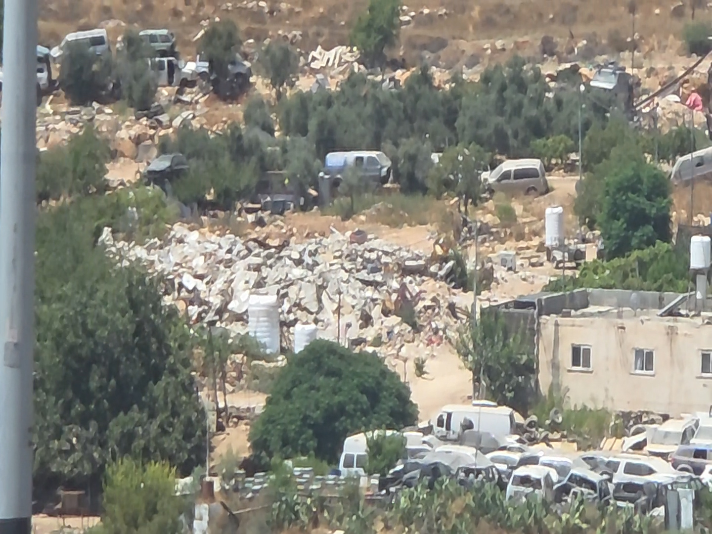
North of Beit Hagai, we saw piles of rubble from stone houses. An entire village had been demolished. Only one house remained standing, surrounded by the shells of cars that attested to the former residents’ livelihood. [Photo attached]
The junction of Highways 60 and 316 – On the hill above the junction, a front-end loader could be seen at work, with a dirt road leading up to it. This is the site of land preparation for the Aviad outpost.
Bani Na’im – We took the dirt road toward the community to check on the old vineyard, approximately 17 years old, belonging to the settler Livni. The vineyard is flourishing. The yellow gate, which is usually locked, was open this time, indicating that work was being carried out in the vineyard.
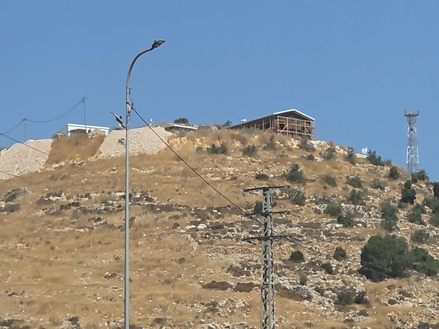
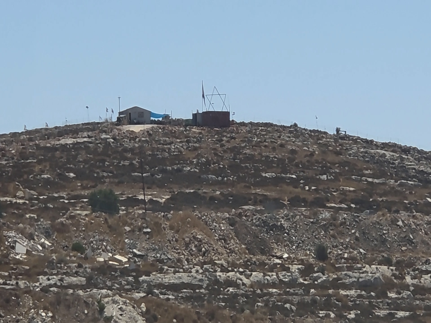
Gal Farm – A new public building and several previously reported caravans could be seen on the hill. Flags lined the dirt road leading up to the farm. [Photo attached]
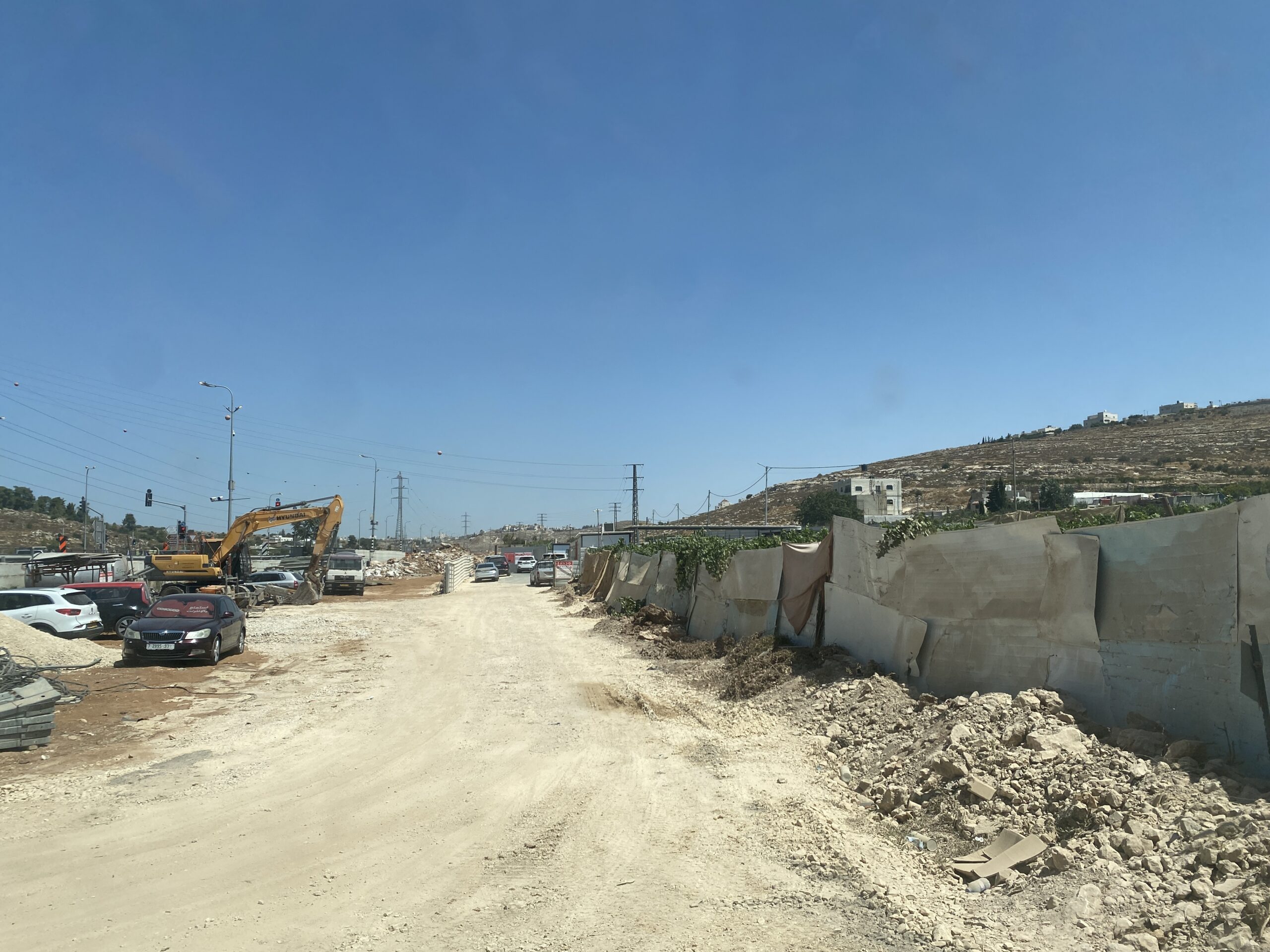
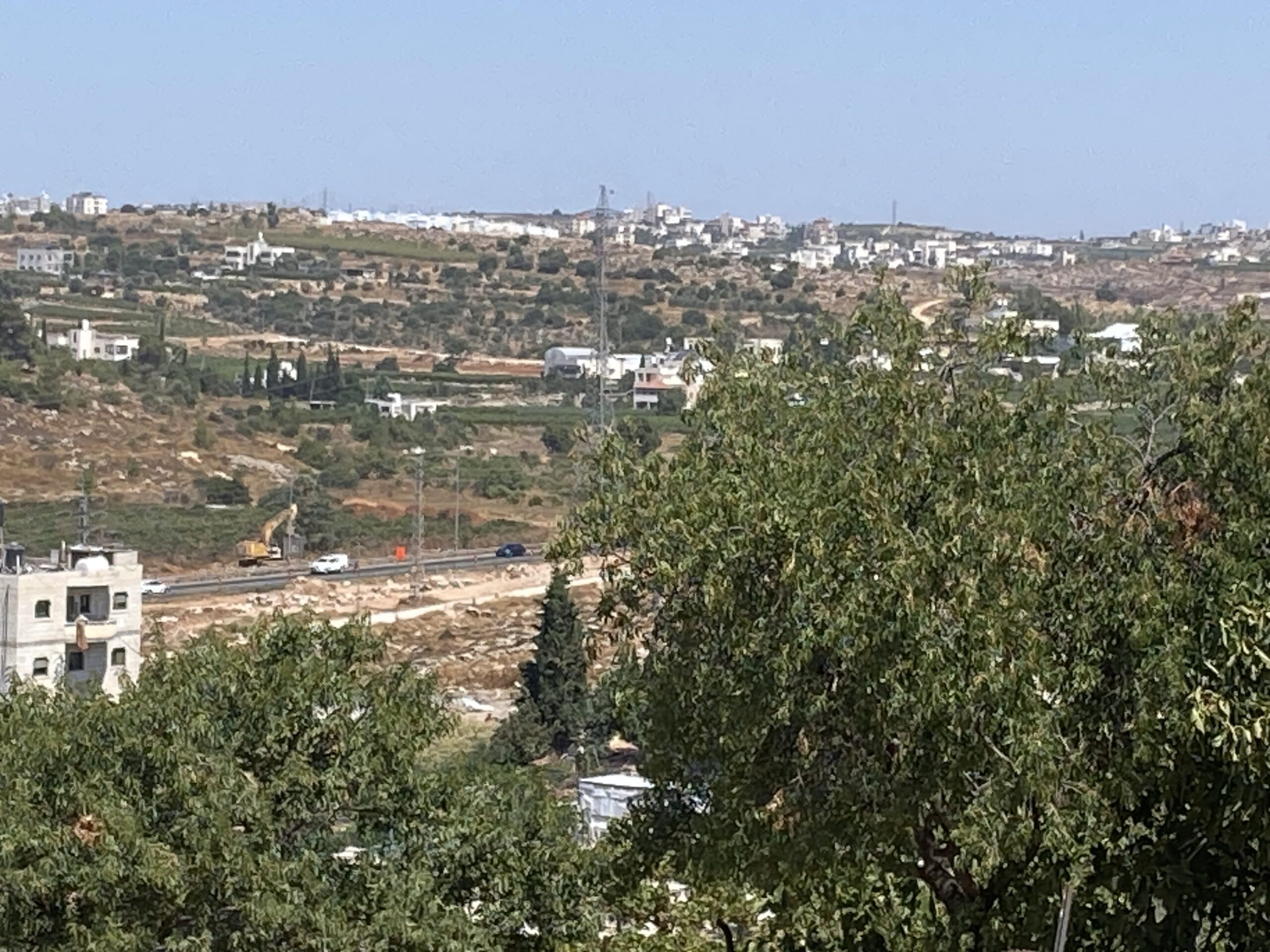
Opposite the entrance to Kiryat Arba, on the eastern side of the road, lies ‘Ata Jaber’s old, well-tended vineyard. His house stands at the top of a steep and dangerous dirt road, overlooking the plots below and Highway 60. [Photo attached]
Inside the house, a television displays the footage captured by the security cameras, but this offers little comfort. In the yard there is a pump above a well that no longer provides enough water to irrigate the fields near the house. The drip-irrigation lines lie scattered across the ground, unused.
On an earlier visit to ‘Ata’s vineyard, we saw how he had planted vegetables beneath the vines—making wonderful use of both the land and the irrigation water. One day in May, the family was taken by surprise when heavy machinery arrived to widen the road, taking approximately one dunam from the beautiful vineyard. Caravans were placed on part of the land, and an entire development compound was established there. ‘Ata built an improvised plywood wall to protect what remained of the vineyard from the dust and from the Jewish plunderers. [Photos attached]
We brought vegetables from the market in Lakiya, as well as clothes and toys for the children. Over a glass of juice, ‘Ata told us about the family’s most recent ordeal. The previous day, he had accompanied his wife to a hospital in Hebron. She suffers from heart disease and underwent cardiac catheterization for the fourth time. ‘Ata showed us all their documents, including their medical insurance certificate. It emerged that they had been required to pay a NIS 400 co-payment for the procedure, provided that it was performed on an outpatient basis. Had his wife needed to be hospitalized, even for just one night of observation, he would have had to pay considerably more.
The Girls’ School Junction – We met Ahmad from the village of Sa’ir. The village lies at the top of the hill, but its entrance is blocked by a yellow gate. Residents must take a taxi to travel up to and down from the village.
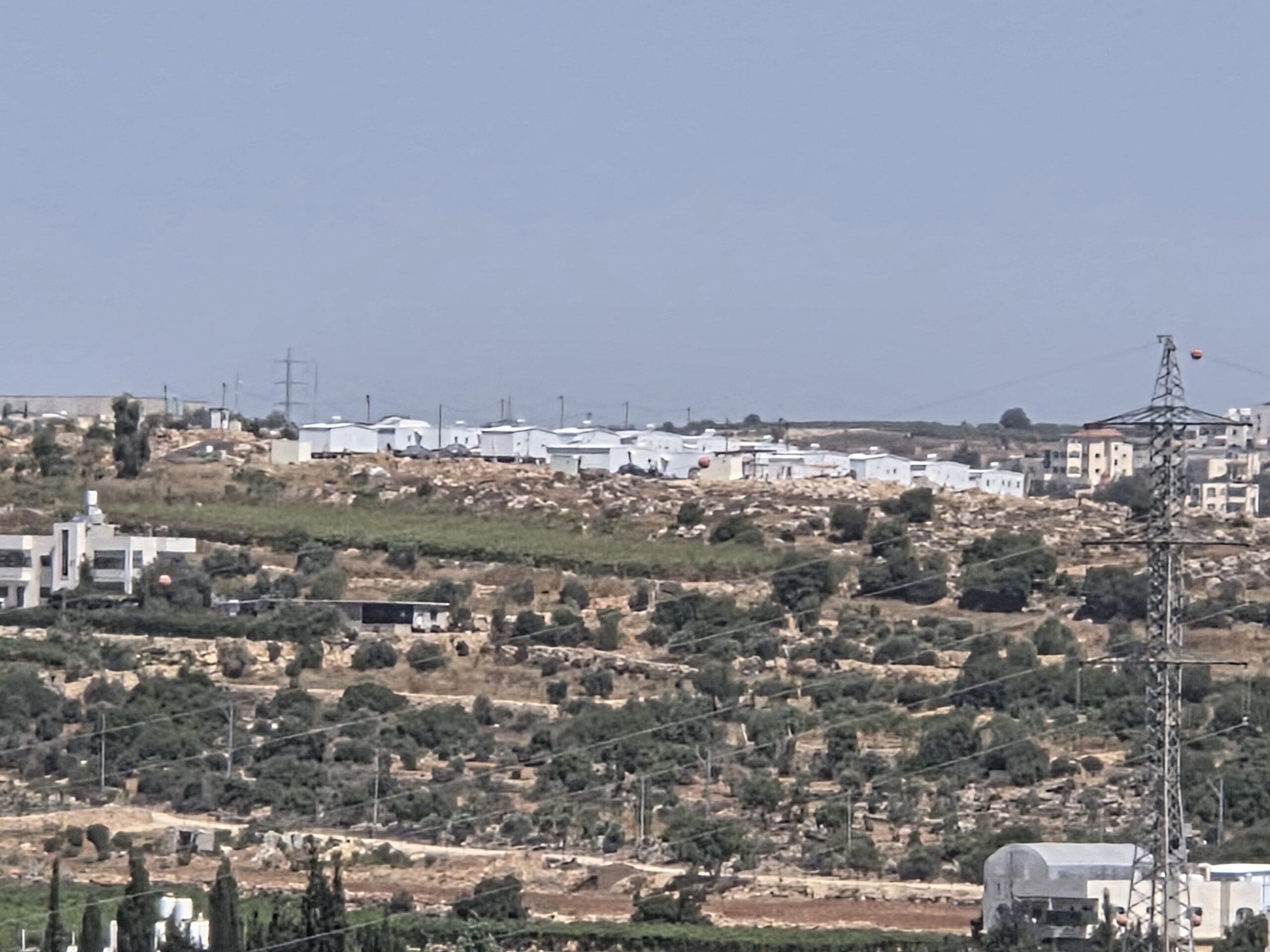
Ahmad told us that he had recently noticed red-and-white marking tape enclosing an area on a nearby hill south of Sa’ir. Within two months, buildings belonging to a new farm had appeared there. [Photo attached] A veteran settler, whom Ahmad knows but whose name he could not recall, runs the place. He has also begun patrolling the area on an all-terrain vehicle, frightening the villagers.
We returned along Highway 60, only to see yet another paradise destroyed, like ‘Ata’s vineyard: the vegetable plots surrounding the spring at Al-Fawwar. Fortunately, the residents managed to build greenhouses, and some of the produce is apparently able to grow there undisturbed. The roadside produce stands that once lined the highway were removed long ago.
Location Description
Dura Al-Fawwar Junction
See all reports for this place-
Junction on Route 60: west - the town of El Dura, east - the Al Fawwar refugee camp. There is a manned pillbox at the junction. From time to time the army sets up flying checkpoints at the entrance to El Fawwar and Al Dura. Al-Fawwar is a large refugee camp (7,000 inhabitants in 2007) established in 1949 to accommodate Palestinian refugees from Be'er Sheva and Beit Jubrin and environs. There are many incidents of stone-throwing. In the vicinity of the pillbox there are excellent agricultural areas, Farmers set up stalls adjacent to the plots close to the road. In recent months the civil administration has set up dirt embankments thereby blocking access to the stalls, and making it impossible for the farmers to sell their vegetables. Updated April 2021, Michal T.
-
Hebron
See all reports for this place-
According to Wye Plantation Accords (1997), Hebron is divided in two: H1 is under Palestinian Authority control, H2 is under Israeli control. In Hebron there are 170,000 Palestinian citizens, 60,000 of them in H2. Between the two areas are permanent checkpoints, manned at all hours, preventing Palestinian movement between them and controlling passage of permit holders such as teachers and schoolchildren. Some 800 Jews live in Avraham Avinu Quarter and Tel Rumeida, on Givat HaAvot and in the wholesale market.
Checkpoints observed in H2:
- Bet Hameriva CP- manned with a pillbox
- Kapisha quarter CP (the northern side of Zion axis) - manned with a pillbox
- The 160 turn CP (the southern side of Zion axis) - manned with a pillbox
- Avraham Avinu quarter - watch station
- The pharmacy CP - checking inside a caravan with a magnometer
- Tarpat (1929) CP - checking inside a caravan with a magnometer
- Tel Rumeida CP - guarding station
- Beit Hadassah CP - guarding station
Three checkpoints around the Tomb of the Patriarchs
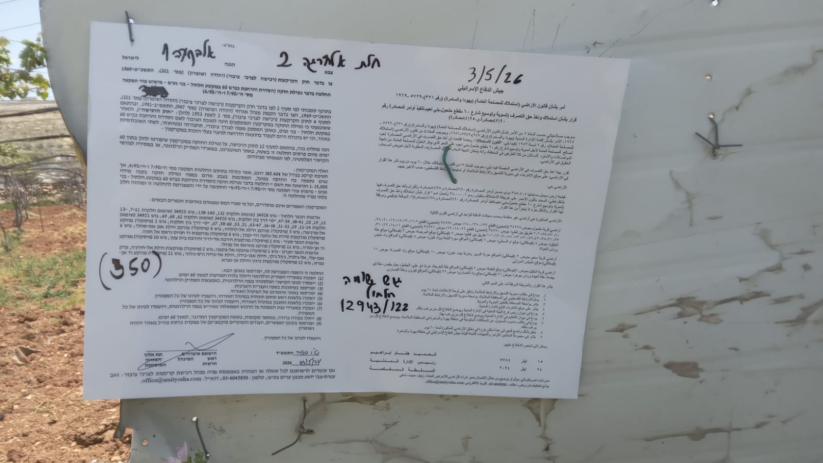 Muhammad D.May-13-2026Hebron - Request for compensation for land expropriation
-
Meitar checkpoint / Sansana
See all reports for this place-
Meitar Checkpoint / Sansana The checkpoint is located on the Green Line and serves as a border crossing between Israel and the West Bank. It is managed by the Border Crossing Authority of the Defense Ministry. It is comprised of sections for the transfer of goods as well as a vehicle checkpoint (intended for holders of blue identity cards, foreign nationals or diplomats and international organizations). Passing of Palestinians is prohibited, except for those with entry permits to Israel. Palestinians are permitted to cross on foot only. The crossing has a DCO / DCL / DCL / DCL (District Coordination Office), a customs unit, supervision, and a police unit. In the last year, a breach has been opened in the fence, not far from the crossing. This breach is known to all, including the army. There does not appear to be any interest in blocking it, probably as it permits needed Palestinian workers without the bureaucratic permits to get to work in Israel. Food stalls and a parking area economy have been created, but incidents of violent abuse by border police have also been recorded. Updated April 2022
-
South Hebron Hills
See all reports for this place-
South Hebron Hills
South Hebron Hills is a large area in the West Bank's southern part.
Yatta is a major city in this area: right in the border zone between the fertile region of Hebron and its surroundings and the desert of the Hebron Hills. Yatta has about 64,000 inhabitants.
The surrounding villages are called Masafer Yatta (Yatta's daughter villages). Their inhabitants subsist on livestock and agriculture. Agriculture is possible only in small plots, especially near streams. Most of the area consists of rocky terraces.Since the beginning of the 1980s, many settlements have been established on the agricultural land cultivated by the Palestinians in the South Hebron Hills region: Carmel, Maon, Susia, Masadot Yehuda, Othniel, and more. Since the settlements were established and Palestinians cultivation areas have been reduced; the residents of the South Hebron Hills have been suffering from harassment by the settlers. Attempts to evict and demolish houses have continued, along with withholding water and electricity. The military and police usually refrain from intervening in violent incidents between settlers and Palestinians do not enforce the law when it comes to the investigation of extensive violent Jewish settlers. The harassment in the South Hebron Hills includes attacking and attempting to burn residential tents, harassing dogs, harming herds, and preventing access to pastures.
There are several checkpoints in the South Hebron Hills, on Routes 317 and 60. In most of them, no military presence is apparent, but rather an array of pillboxes monitor the villages. Roadblocks are frequently set up according to the settlers and the army's needs. These are located at the Zif Junction, the Dura-al Fawwar crossing, and the Sheep Junction at the southern entrance to Hebron.
Updated April 2022
Yael ZoranAug-20-2026Ata's vineyard on the right, cut down to make way for the expansion of Highway 60
-