
Hebron, South Hebron Hills, Tarqumiya, Wed 16.11.11, Morning
Translator: Charles K.
We saw the first workers from the Sansana checkpoint when we left Omer at 6:30 AM. And when we went through on the way to Hebron, the shed on the Palestinian side was empty. The road was pretty crowded, mostly with cars bearing PA license plates. Boys and girls walked to school by the side of the road. The landscape these days, just before winter, is particularly lovely, the plowed fields a deep brown color, the vineyards turning yellow. Clouds slowly cover the blue skies. And here we are, at the checkpoint before Giv’at HaMoreh. On our left, the buildings of the illegal outpost that keeps growing.
Soldiers stationed in the house opposite the Worshippers Route, some watching the road. Checkpoint 160 is open; two PA cars go through. We meet CPT and TIPH people, who monitor the crossings used by schoolchildren. It’s nearly 8 AM; the air fills with the sound of some march coming from loudspeakers of nearby schools. I was able, for the first time, to peek in the Havat Yehuda compound adjoining the military base on Shuohada Street – King David Street – the apartheid road, divided by a green net fence that begins at the base’s courtyard. It looks like the crossing via the base isn’t operating these days.
We returned via the Tarqumiyya crossing without being delayed. We briefly glanced from a distance but saw no improvement in the dilapidated shed or the overall cleanliness of the Palestinian side, despite promises to improve and clean up that entrance area.
Hebron
See all reports for this place-
According to Wye Plantation Accords (1997), Hebron is divided in two: H1 is under Palestinian Authority control, H2 is under Israeli control. In Hebron there are 170,000 Palestinian citizens, 60,000 of them in H2. Between the two areas are permanent checkpoints, manned at all hours, preventing Palestinian movement between them and controlling passage of permit holders such as teachers and schoolchildren. Some 800 Jews live in Avraham Avinu Quarter and Tel Rumeida, on Givat HaAvot and in the wholesale market.
Checkpoints observed in H2:
- Bet Hameriva CP- manned with a pillbox
- Kapisha quarter CP (the northern side of Zion axis) - manned with a pillbox
- The 160 turn CP (the southern side of Zion axis) - manned with a pillbox
- Avraham Avinu quarter - watch station
- The pharmacy CP - checking inside a caravan with a magnometer
- Tarpat (1929) CP - checking inside a caravan with a magnometer
- Tel Rumeida CP - guarding station
- Beit Hadassah CP - guarding station
Three checkpoints around the Tomb of the Patriarchs
 Raya YeorDec-18-2025Hebron - Yusri Jaber and part of his family
-
South Hebron Hills
See all reports for this place-
South Hebron Hills
South Hebron Hills is a large area in the West Bank's southern part.
Yatta is a major city in this area: right in the border zone between the fertile region of Hebron and its surroundings and the desert of the Hebron Hills. Yatta has about 64,000 inhabitants.
The surrounding villages are called Masafer Yatta (Yatta's daughter villages). Their inhabitants subsist on livestock and agriculture. Agriculture is possible only in small plots, especially near streams. Most of the area consists of rocky terraces.Since the beginning of the 1980s, many settlements have been established on the agricultural land cultivated by the Palestinians in the South Hebron Hills region: Carmel, Maon, Susia, Masadot Yehuda, Othniel, and more. Since the settlements were established and Palestinians cultivation areas have been reduced; the residents of the South Hebron Hills have been suffering from harassment by the settlers. Attempts to evict and demolish houses have continued, along with withholding water and electricity. The military and police usually refrain from intervening in violent incidents between settlers and Palestinians do not enforce the law when it comes to the investigation of extensive violent Jewish settlers. The harassment in the South Hebron Hills includes attacking and attempting to burn residential tents, harassing dogs, harming herds, and preventing access to pastures.
There are several checkpoints in the South Hebron Hills, on Routes 317 and 60. In most of them, no military presence is apparent, but rather an array of pillboxes monitor the villages. Roadblocks are frequently set up according to the settlers and the army's needs. These are located at the Zif Junction, the Dura-al Fawwar crossing, and the Sheep Junction at the southern entrance to Hebron.
Updated April 2022
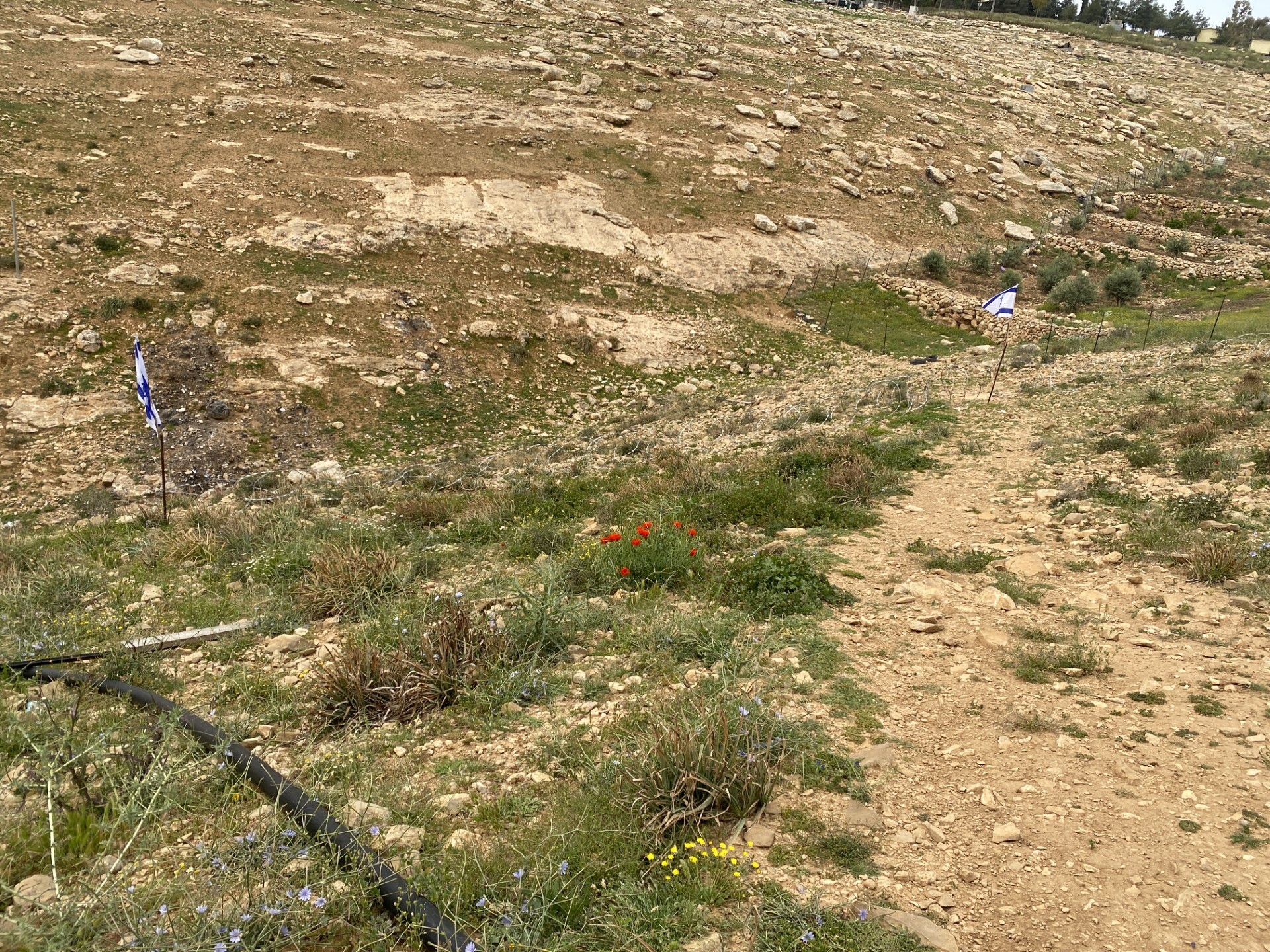 Yael ZoranApr-15-2026Between the flags, barbed wire blocks passage to the dirt path.
-
Tarqumiya CP
See all reports for this place-
The Tarqumiya Checkpoint is one of the largest and busiest checkpoints where people and goods cross into Israel. It is located on the Separation Barrier close to the Green Line, on Road 35 (connecting Beer Sheva and Hebron). It is run by the Israel Defense Ministry’s Crossings Administration with civilian secuirty companies running the day to day operations. The checkpoint is indeed open to vehicles in both directions 24/7, but Palestinians are prevented from crossing in vehicles, except in special cases. MachsomWatch activists visit the checkpoint as it opens at 3:45 am, in order to observe the daily passage of nearly 10,000 Palestinian workers. The workers arrive from throughout the Southern West Bank. Our activists report on the tremendous overcrowding at this checkpoint; they have observed young men climbing and scrambling on the fences and roofs of the ‘access cages’. This is how the work day begins for those who ‘build the land of Israel’. updated November 2019
-