Hebron, South Hebron Hills
At the illegal colonist outposts – Mitzpe Asa’el, Mitzpe Avigail and Mitzpe Yair (all of them along road 317) – construction expands. Same happens in Susya – the gate was open and we entered to have a look. The industrial zone Meitarim is growing as well.
All of this is happening at the expense of a possible two-state solution for the two peoples.
We took no chances – no photos there.
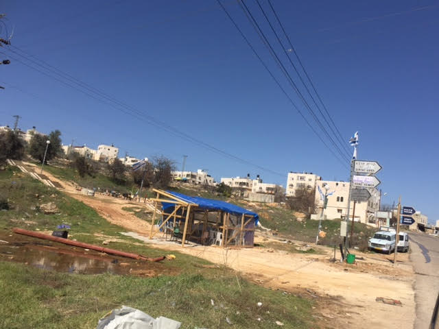
Along road 356 we see this idyllic view.
Quiet overall, no army vehicles in sight.

Today’s story in Hebron is that of the Kapisha neighborhood. Situated on the Zion road, to the east is Ashmoret Yitzhak Border Police base, and within the coming month this neighborhood will be moved over to H1 zone (‘Palestinian Hebron’).

A large checkpoint will be constructed right behind the area belonging to the Jaabari family, resembling checkpoints ‘curve 150’, ‘the Pharmacy’ and ‘the Policeman’.
The garages and grocery stores who do good business here with the Kiryat Arba colonists will be impacted and this is probably the reason for many new businesses opening in the other part of Zion road.
Hazon David synagogue remains active. The Jaabari family is still being harassed. There’s nothing new about this.

A large group of people is seen touring Hebron, guided by Breaking the Silence.
New graffiti appears on the wall on the Tel Rumeida slope.
A large protest demonstration is planned by Palesitnians and peace activists under the slogan “Open all Hebron!”

This is what a large checkpoint in Hebron looks like. There are three such positions at present, in one month there will already be four.
Hebron
See all reports for this place-
According to Wye Plantation Accords (1997), Hebron is divided in two: H1 is under Palestinian Authority control, H2 is under Israeli control. In Hebron there are 170,000 Palestinian citizens, 60,000 of them in H2. Between the two areas are permanent checkpoints, manned at all hours, preventing Palestinian movement between them and controlling passage of permit holders such as teachers and schoolchildren. Some 800 Jews live in Avraham Avinu Quarter and Tel Rumeida, on Givat HaAvot and in the wholesale market.
Checkpoints observed in H2:
- Bet Hameriva CP- manned with a pillbox
- Kapisha quarter CP (the northern side of Zion axis) - manned with a pillbox
- The 160 turn CP (the southern side of Zion axis) - manned with a pillbox
- Avraham Avinu quarter - watch station
- The pharmacy CP - checking inside a caravan with a magnometer
- Tarpat (1929) CP - checking inside a caravan with a magnometer
- Tel Rumeida CP - guarding station
- Beit Hadassah CP - guarding station
Three checkpoints around the Tomb of the Patriarchs
 Raya YeorDec-18-2025Hebron - Yusri Jaber and part of his family
-
South Hebron Hills
See all reports for this place-
South Hebron Hills
South Hebron Hills is a large area in the West Bank's southern part.
Yatta is a major city in this area: right in the border zone between the fertile region of Hebron and its surroundings and the desert of the Hebron Hills. Yatta has about 64,000 inhabitants.
The surrounding villages are called Masafer Yatta (Yatta's daughter villages). Their inhabitants subsist on livestock and agriculture. Agriculture is possible only in small plots, especially near streams. Most of the area consists of rocky terraces.Since the beginning of the 1980s, many settlements have been established on the agricultural land cultivated by the Palestinians in the South Hebron Hills region: Carmel, Maon, Susia, Masadot Yehuda, Othniel, and more. Since the settlements were established and Palestinians cultivation areas have been reduced; the residents of the South Hebron Hills have been suffering from harassment by the settlers. Attempts to evict and demolish houses have continued, along with withholding water and electricity. The military and police usually refrain from intervening in violent incidents between settlers and Palestinians do not enforce the law when it comes to the investigation of extensive violent Jewish settlers. The harassment in the South Hebron Hills includes attacking and attempting to burn residential tents, harassing dogs, harming herds, and preventing access to pastures.
There are several checkpoints in the South Hebron Hills, on Routes 317 and 60. In most of them, no military presence is apparent, but rather an array of pillboxes monitor the villages. Roadblocks are frequently set up according to the settlers and the army's needs. These are located at the Zif Junction, the Dura-al Fawwar crossing, and the Sheep Junction at the southern entrance to Hebron.
Updated April 2022
 MuhammadFeb-24-2026South Hebron Hill, Beit Hagai: Paving an internal security road
-