
South Hebron Hills, Susiya, Zif Junction

1. Meitar checkpointg 7 p.m. In the parking lot on the Israeli side, buses – families of prisoners on their way to visit a prison in Israel. Towards the end of the passage for the workers, there are still very many (including 3 women, waiting to be transported to work in the Ramon camp), many cars in makeshift parking lots all around. Everyone says it’s the most efficient crossing, the crossing manager sometimes moves to the Palestinian side to check the crossing arrangements. Someone complains that in the afternoon when many workers return, cars are waiting for them up the hill on Route 60 after turning right in the direction of Shim’a, etc. Here the police hand out reports wholesale for stopping illegally. They ask that a legitimate parking area should be made there.
On the way to Ramadin. At the turn, in a strictly Zionist cement block in front of a guard post of soldiers. Before turning to Dahariya, a wide new road is paved in a northerly direction. It turns out that this is a way out of a Palestinian private quarry in Area A, probably according to an arrangement between the PA and Israel. Later, the road ends at the western entrance to Ramadin, next to the high and threatening separation fence that surrounds the Eshkolot , a settlement in an area that is de facto annexed to Israel (like Beit Yatir), and the entrance to it is of course not from here but from Israel.
On the road to the settlement Tene-Omarim, a sign about Israeli quarries indicating interesting non-local business partnerships, including Kfar Giladi (!). At the entrance to the settlement, Palestinian cars of those working in the settlement and instructions to leave the vehicles outside the settlement (the arrangement I know from the Gush Etzion area: there is one Palestinian who is coordinated with the settlement itself, and it serves as the “rais” (the boss0 of other workers). . Nearby, the sign indicating the integration of residents as well as trees from Gush Katif in this settlement (Photo No. 4).
A phone call from Nasser from Susiya to find out if we can come today. It turns out that he is on his way to documenting the demolition of houses in the town of Bany Hever (near the settlement of Pney Hever, southeast of Bany Naim). From here began our pursuit together with Nasser and other Palestinian activists after the demolition force.
We first saw them at the point where the demolition forces are gathered descending east from the main road Bani Naim: two soldiers with drawn weapons secure the intersection, in front of a bulldozer truck, vehicles that look like the Civil Administration and other cars with an Israeli license (GSS?). We wait on the side, then the force goes out south and localizes on the village of Rafia, east of the road in the area of Masafer Yatta, south of Zif. . There is no sign at the entrance to the village, and we get lost here and there as we drove according to vague and contradictory instructions of passers-by, until we arrived.
The entrance was probably once blocked by concrete blocks because the first meters are completely ruined, and only beyond them does the inner road begin. The passage to the demolition area is blocked by the aforementioned demolition force that looks like an IDF operation headquarters which it to conquer a large and fortified target. We are watching what is happening downhill, together with the villagers and Palestinian activists: the State of Israel against a dilapidated structure – a shed or a house – built from scrap metal. In the distance are the shouts of the truck driver of the bulldozer, claiming that there is no way he will be able to enter the path leading to the building. That’s why some determined heroes climb a ladder with a screwdriver and dismantle the structure with their own hands (see photos). Around them they are guarded by our wonderful soldiers
Every Hebrew mother should know exactly what her son has enlisted for. There is no connection to security, an expensive operation in anyone’s opinion , wasteful and unnecessary, abuse just to abuse an occupied population. Because these demolitions occur completely randomly, this is the definition of terrorism – imposing fear on the entire population precisely because there is no logic. No system and no way anyone can avoid falling a victim to this policy.
South Hebron Hills
See all reports for this place-
South Hebron Hills
South Hebron Hills is a large area in the West Bank's southern part.
Yatta is a major city in this area: right in the border zone between the fertile region of Hebron and its surroundings and the desert of the Hebron Hills. Yatta has about 64,000 inhabitants.
The surrounding villages are called Masafer Yatta (Yatta's daughter villages). Their inhabitants subsist on livestock and agriculture. Agriculture is possible only in small plots, especially near streams. Most of the area consists of rocky terraces.Since the beginning of the 1980s, many settlements have been established on the agricultural land cultivated by the Palestinians in the South Hebron Hills region: Carmel, Maon, Susia, Masadot Yehuda, Othniel, and more. Since the settlements were established and Palestinians cultivation areas have been reduced; the residents of the South Hebron Hills have been suffering from harassment by the settlers. Attempts to evict and demolish houses have continued, along with withholding water and electricity. The military and police usually refrain from intervening in violent incidents between settlers and Palestinians do not enforce the law when it comes to the investigation of extensive violent Jewish settlers. The harassment in the South Hebron Hills includes attacking and attempting to burn residential tents, harassing dogs, harming herds, and preventing access to pastures.
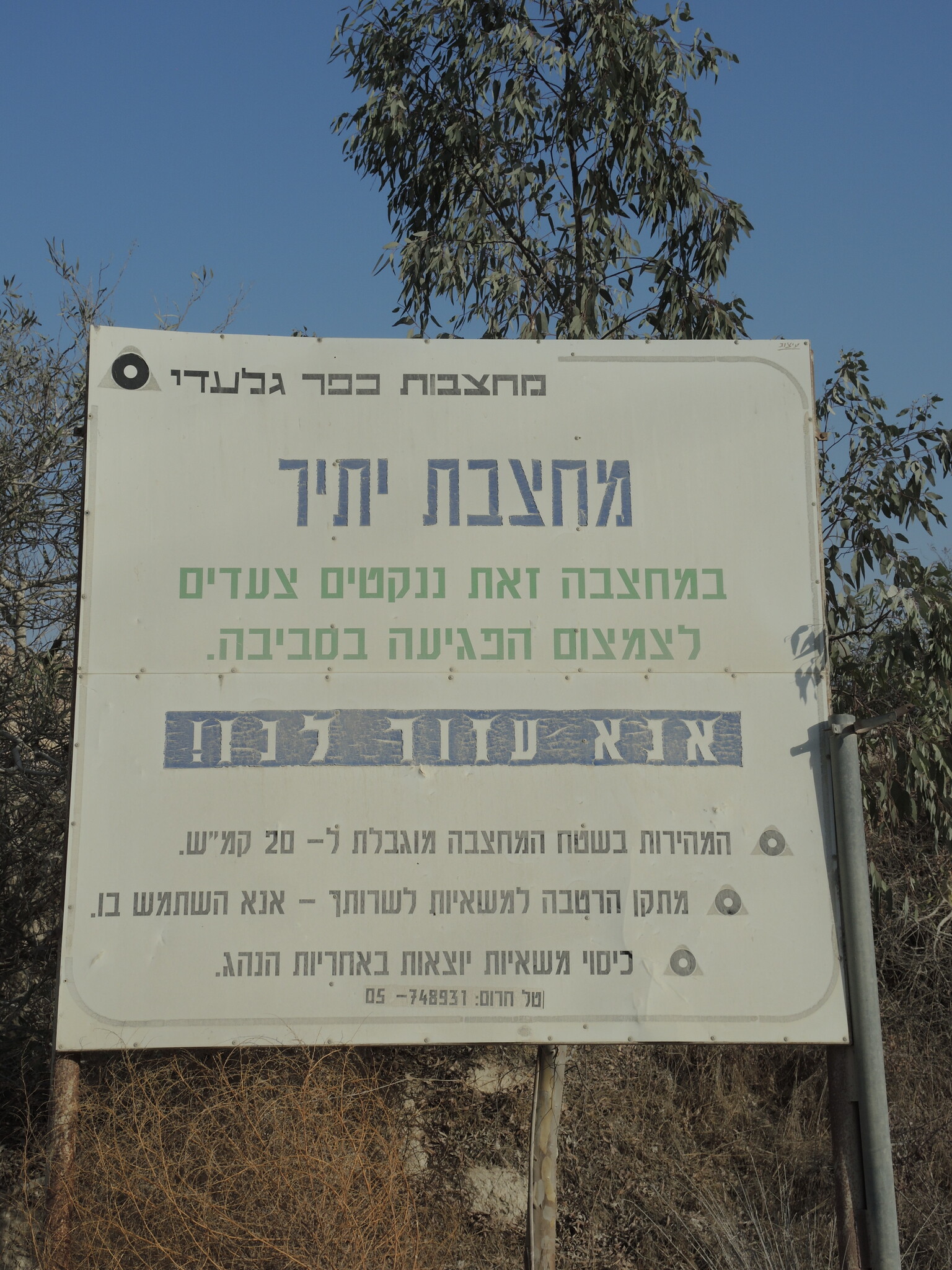
There are several checkpoints in the South Hebron Hills, on Routes 317 and 60. In most of them, no military presence is apparent, but rather an array of pillboxes monitor the villages. Roadblocks are frequently set up according to the settlers and the army's needs. These are located at the Zif Junction, the Dura-al Fawwar crossing, and the Sheep Junction at the southern entrance to Hebron.
Updated April 2022
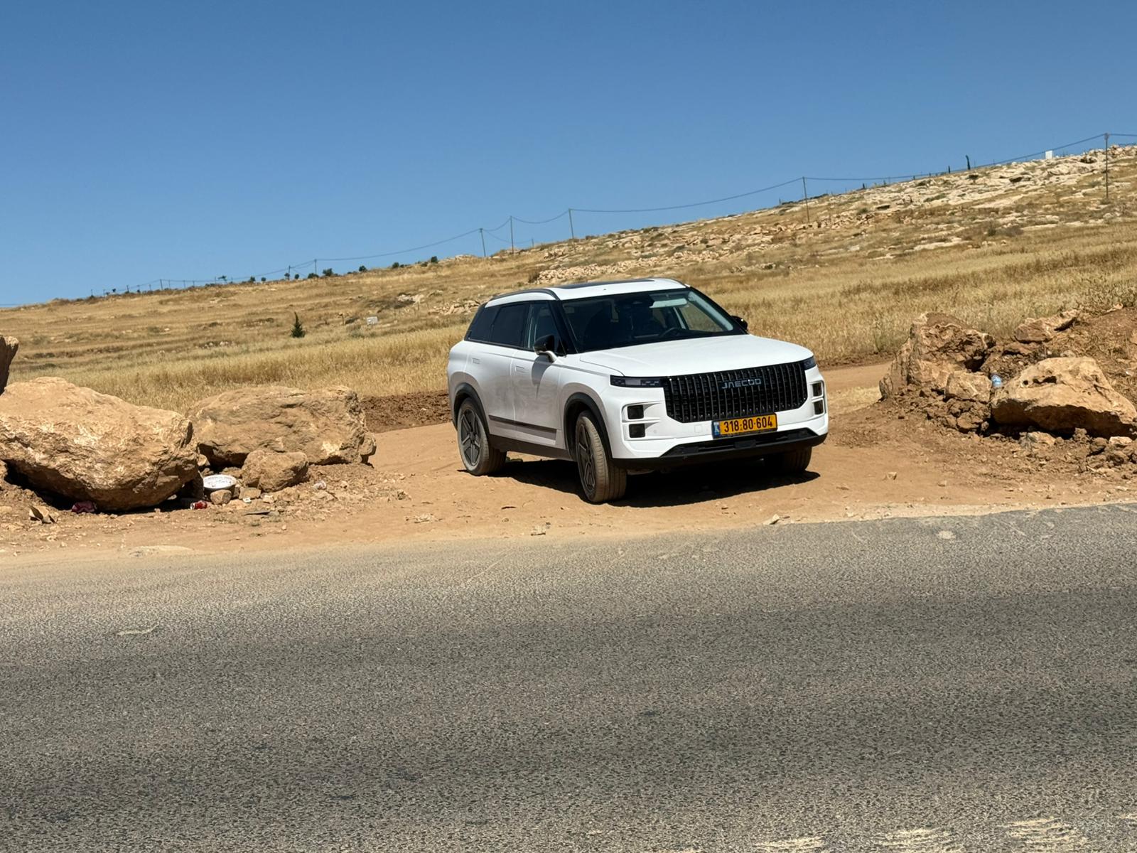 Muhammad D.Jun-2-2026The Israeli car blocking one of the entrances to Simiya
-
Susiya
See all reports for this place-
Susiya The Palestinian area lies between the settlement of Susya and a military base. The residents began to settle in areas outside the villages in the 1830s and lived in caves, tents and sukkot. To this day they maintain a traditional lifestyle and their livelihood is based on agriculture and herding. Until the 1948 war, the farmers cultivated areas that extended to the Arad area. As a result of the war, a significant portion of their land left on the Israeli side was lost. After the 1967 war and the Israeli occupation, military camps were established in the area, fire zones and nature reserves were declared, and the land area was further reduced. The Jewish settlement in Susya began in 1979. Since then, there has been a stubborn struggle to remove the remains of Palestinian residents who refuse to leave their place of birth and move to nearby town Yatta. With the development of a tourist site in Khirbet Susya in the late 1980s (an ancient synagogue), dozens of families living in caves in its vicinity were deported. In the second half of the 1990s, a new form of settlement developed in the area - shepherds' farms of individual settlers. This phenomenon increased the tension between the settlers and the original, Palestinian residents, and led to repeated harassment of the residents of the farms towards the Palestinians. At the same time, demolition of buildings and crop destruction by security forces continued, as well as water and electricity prevention. In the Palestinian Susya, as in a large part of the villages of the southern Hebron Mountains, there is no running water, but the water pipe that supplies water to the Susya Jewish settlement passes through it. Palestinians have to buy expensive water that comes in tankers. Solar electricity is provided by a collector system, installed with donation funds. But the frequent demolitions in the villages do not spare water cisterns or the solar panels and power poles designed to transfer solar electricity between the villages. Updated April 2021, Anat T.
-
Zif Junction
See all reports for this place-
Zif Junction located on the crossroads that directs towards Road 356 to Yata. Yata is the district city of the southern Hebron Mountains. Usually, this junction is open to traffic. The nearby pillbox is unmanned. But the army and police are present occasionally, sometimes setting up a checkpoint and sometimes detaining residents from the big city. Often, the Israeli policemen inspect vehicles and distribute driving reports to Palestinian vehicles. s
-