
Umm al-Khair - The longing for beauty does not subside even when everything is so discouraging
Route 60, before turning onto Route 317:
From the east side, the abandoned Zanuta. A convoy of SUVs, accompanied by UN vehicles, descends from the road leading to the village. Fares tells Mohammad over the phone that these are PA vehicles. They came to support the return to the village, after a legal ruling on their right to live in their village. Only they can’t really return, because of the violent harassment from the settlers of the surrounding farms. Especially from Yinon’s Meitarim farm.
And indeed, on the way back, we saw a herd of cows with a settler shepherd, right in the village area.
From the other side of the road, we see a hill that has been levelled by heavy equipment. At the top of the hill is a hut. New. Mohammad thinks it is probably a new outpost.
Route 317:
We follow the convoy of SUVs. The convoy heads to a Tuwani. Fares reports that they are traveling to Khalet a-Daba’, where the last massive demolitions were, and now there is only a tent. The Palestinian Authority states that they want to help in the construction of the village anew.
Ma’on:
A bulldozer is leveling a road. They are probably building a promenade on a winding route along the road. Perhaps with the aim of reaching Carmel. How beautiful! “Field tourism”!
Indeed, the entire area opposite Carmel is planted with vineyards, and “swathed” with Israeli flags, even though this is an area of Palestinian settlements only. A complete disconnect between the cruelty of the ruins and the misery around them, and the inviting pastoral beauty of the settlements.
Umm al-Khair:
We stopped by the Diwan compound. The compound has two tin huts, playground equipment, benches, and spectacular landscaping that the residents cultivate. Really impressive. Another example of disconnection from all the surrounding ruins. It turns out that the longing for beauty is not forgotten even when everything is so despairing.
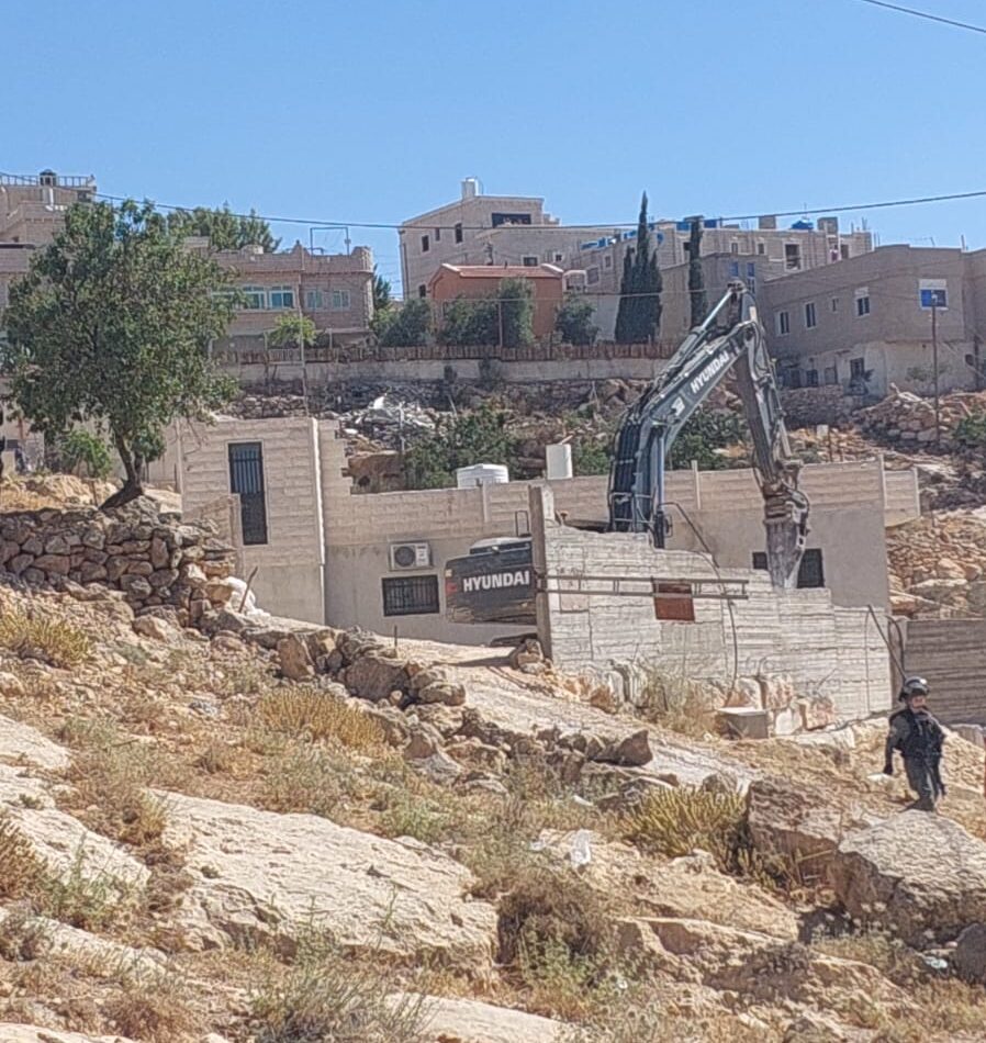
We arrived in Umm al-Khair with the aim of meeting Eid. However, this is a day of demolition, and we also saw vehicles and heavy demolition equipment on the road. Eid is watching, probably between the Zif junction and the village of Dirat and the Umm al-Khair junction. There is a report of the demolition of a large house in Rafaiya, near Dirat. Later, there are also reports of demolitions in the village opposite a-Tuwani, across Highway 317. There are fears of more demolitions in Umm al-Khair. Eid’s house has already been demolished, and his family – 6 people, is currently living in a shack that is not really habitable in the hot summer.
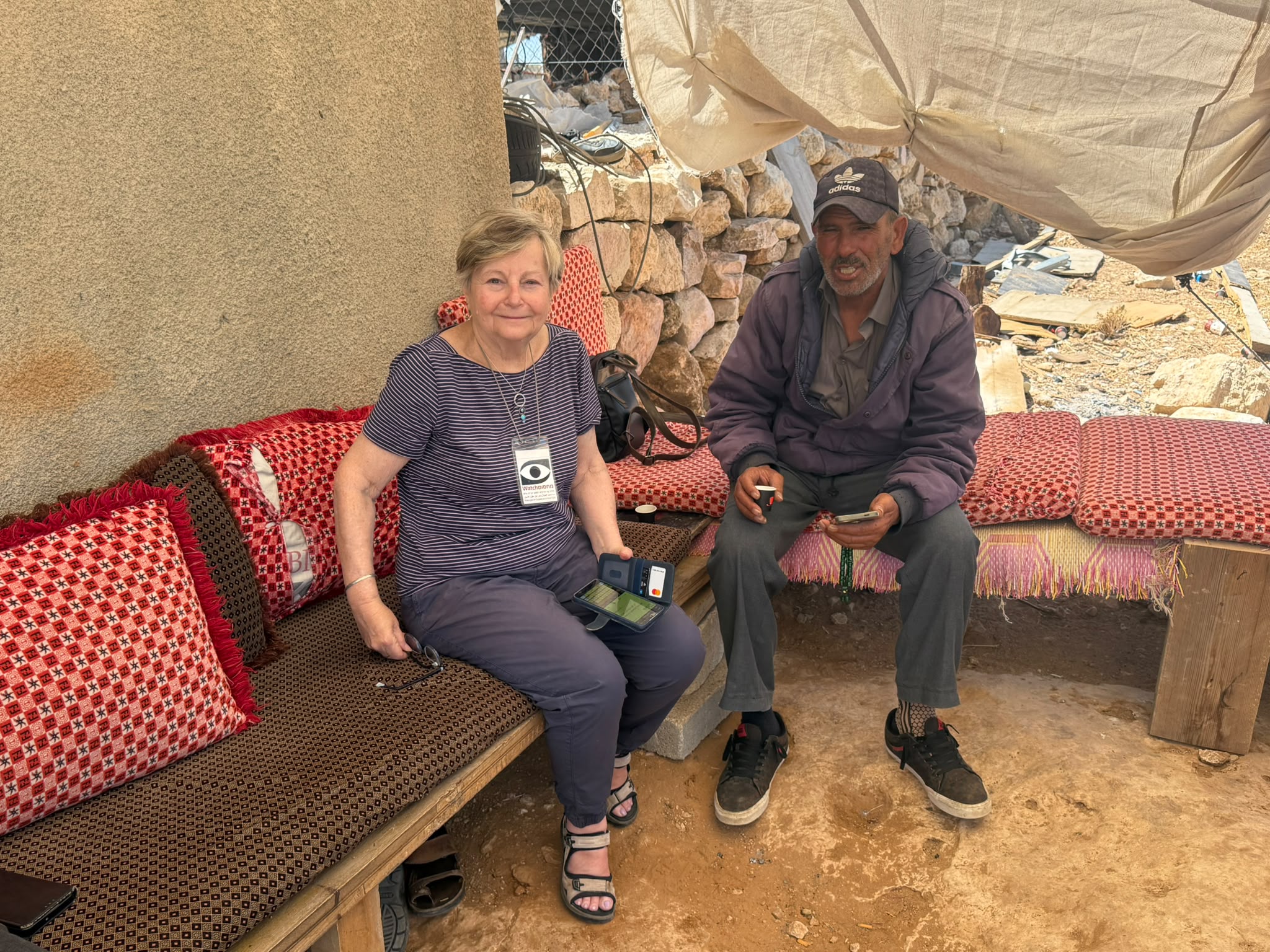
In the Diwan compound, we met some of the villagers. We mainly spoke with Khalil. An engineer who works in Ramallah: a week in the village and a week in Ramallah. He says that when he is in Ramallah he is always stressed – will his house still be there when he returns. Aziz, the other engineer, works in Hebron. Odeh is the teacher. Aziz and Odeh are at work. They all receive partial salaries from the Authority. The Authority does not have the money to pay. We have known them all, Khalil, Eid, Aziz, Odeh, for many years.
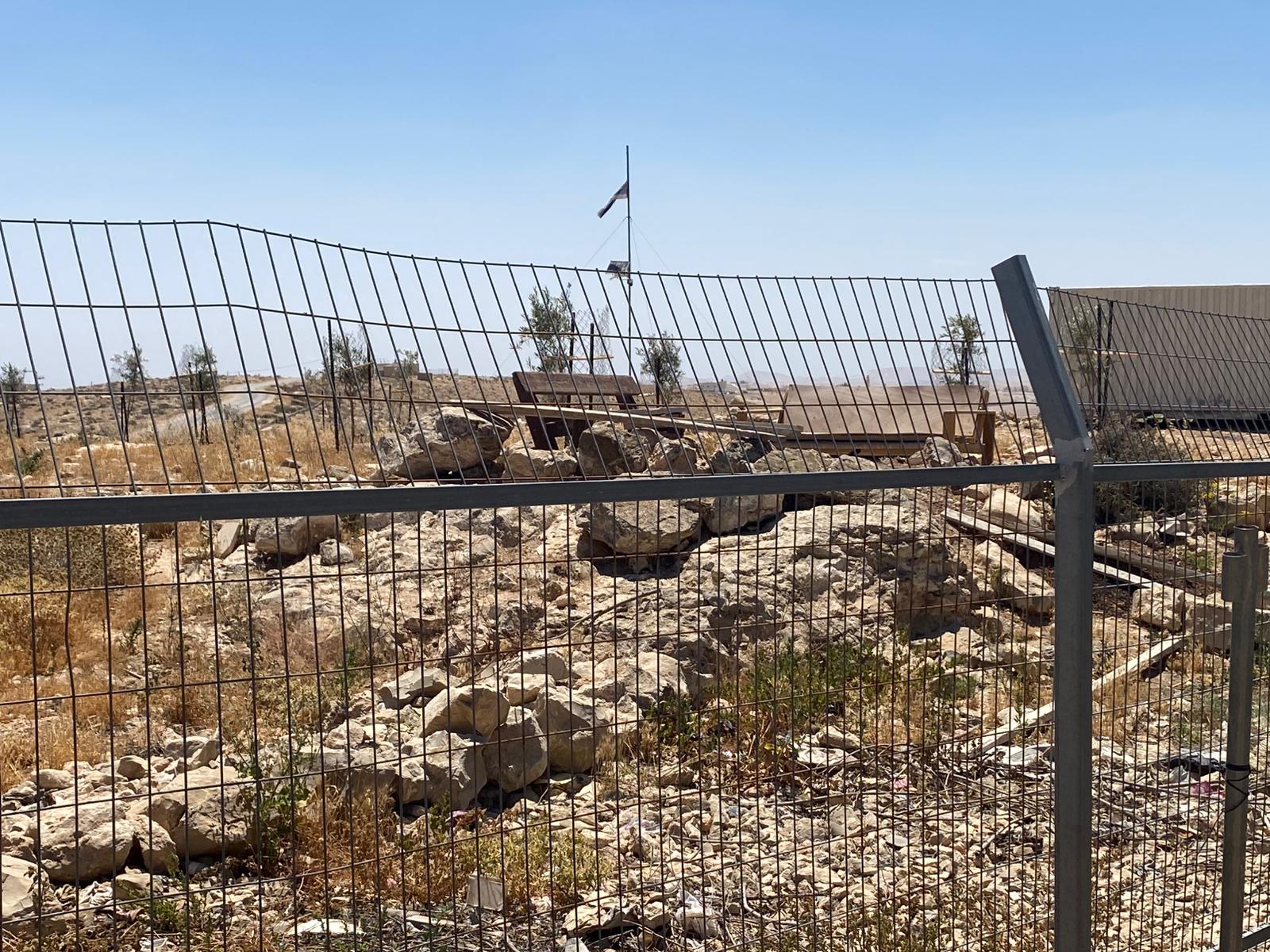
An area for relaxing and hanging out of Carmel settlers: Next to the fence, just next to one of the families’ houses, the Carmel settlers have built an area for relaxing and hanging: a wooden platform with decorated benches, in the centre of which is a pole with an Israeli flag and a camera on top. Every night, late, the settlement’s youth gather for a party. Loud music, projectors into Umm al-Khair. Khalil warns me not to go up to the area: there is a camera, and the settlers will come immediately and there will be a mess. Now they are afraid that the settlers will take over an area of Umm al-Khair that leads to the site, in order to level a road and perhaps pave a path.
Khalil tours with me around the diwan. Points to new plantings of tree seedlings. Explains that the residents’ sheep are kept in pens, because of the settlers’ attacks, and the shepherds’ expulsion of all the surrounding grazing areas. They have to buy food for the sheep. Expensive. Around and inside the village, the settlers have placed Israeli flags, and the Palestinians don’t dare not take them.
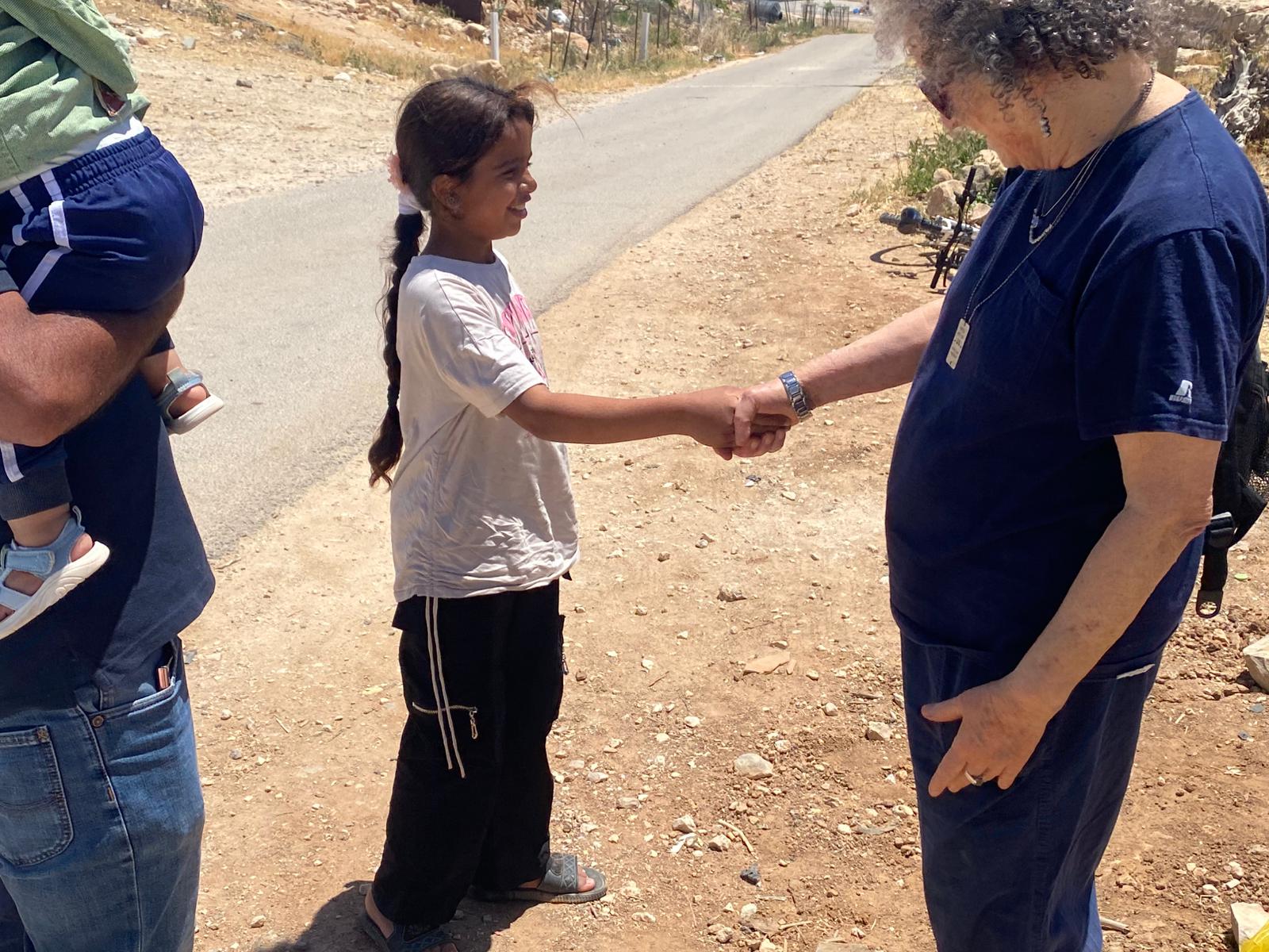
As we turn to leave, the 9-year-old daughter of Khalil and his partner Dalal: Mira, comes out of the compound. Mira was born while we were still working with the kindergartens in Hashem al-Daraj and Umm al-Khair. Dalal is one of the kindergarten teachers. Khalil is really proud: she is an excellent student, and just this morning she got 29.5 out of 30 on the test.
Location Description
A-Tuwani
See all reports for this place-
A-Tuwani
The locals came to a-Tuwani during the 20th century from the village of Yatta. They settled in abandoned ruins, utilizing the arable land, pastures for grazing sheep and the abundance of natural caves for habitation. The residents who settled in the caves came from families who could not purchase land for houses in the mother villages, as well as shepherds who did not have enough land to graze. They were joined by clan members who quarreled with other families in the mother locality.
Some of the residents today live in concrete buildings built above the caves. In the area of the village are several water cisterns and an ancient water well called 'Ein a-Tuwani. Local residents are forced to buy water in containers and transport them through many road blocks to the village. With the help of international organizations, an electrical system was installed in the village. In the late 90s of the 20tTh century, an elementary school was established in the serving several small villages in the area.
In 2004, MachsomWatch began visiting and reporting from the Khirbet Tuwani cave village, which suffers badly from the settlers of nearby outposts, and especially from the extremist Ma'on outpost. . The settlers contaminate cisterns, poison the flocks and uproot trees.Particularly notable is the harassment of children from the surrounding villages on their way to school in a-Tuwani, so much so that military escort of children is required to separate them from the attackers (this was arranged following an initiative of the organization's members). In the past year, the escort has been without the vital presence of overseas volunteers.
Near a-Tuwani there are several families who have returned to the caves due to the incessant demolitions of the civil administration (as there is a total construction ban in all of area C). Destroyed are not only residential and agricultural buildings, but also water pipes, machinery. Even water cisterns are clogged up. a-Tuwani residents have created an association for non-violent demolition protests, but in the past year the army’s harsh harassment and settler violence have intensified and escalated. The incident of the small generator confiscation, which left a young man paralyzed, is one of many examples - any legitimate protection of property rights leads to violence and even shootings by the army and the civil administration.
Updated April 2022
 Muhammad D.Jul-12-2026Smadar with Taleb on duty at Qawawis
-
South Hebron Hills
See all reports for this place-
South Hebron Hills
South Hebron Hills is a large area in the West Bank's southern part.
Yatta is a major city in this area: right in the border zone between the fertile region of Hebron and its surroundings and the desert of the Hebron Hills. Yatta has about 64,000 inhabitants.
The surrounding villages are called Masafer Yatta (Yatta's daughter villages). Their inhabitants subsist on livestock and agriculture. Agriculture is possible only in small plots, especially near streams. Most of the area consists of rocky terraces.Since the beginning of the 1980s, many settlements have been established on the agricultural land cultivated by the Palestinians in the South Hebron Hills region: Carmel, Maon, Susia, Masadot Yehuda, Othniel, and more. Since the settlements were established and Palestinians cultivation areas have been reduced; the residents of the South Hebron Hills have been suffering from harassment by the settlers. Attempts to evict and demolish houses have continued, along with withholding water and electricity. The military and police usually refrain from intervening in violent incidents between settlers and Palestinians do not enforce the law when it comes to the investigation of extensive violent Jewish settlers. The harassment in the South Hebron Hills includes attacking and attempting to burn residential tents, harassing dogs, harming herds, and preventing access to pastures.
There are several checkpoints in the South Hebron Hills, on Routes 317 and 60. In most of them, no military presence is apparent, but rather an array of pillboxes monitor the villages. Roadblocks are frequently set up according to the settlers and the army's needs. These are located at the Zif Junction, the Dura-al Fawwar crossing, and the Sheep Junction at the southern entrance to Hebron.
Updated April 2022
Muhammad D.Jul-12-2026Smadar with Taleb on duty at Qawawis
-
Umm al-Khair
See all reports for this place-
Umm al-Kheir
A Palestinian village in the southern Hebron governorate, populated by five families. The Palestinian residents settled there decades ago, after Israel expelled them from the Arad desert and purchased the land from the residents of the Palestinian village of Yatta. The village suffers from the violence of nearby Carmel settlers, from water shortage and is subject to frequent demolition of buildings by the Civil Administration.
-
Zanuta
See all reports for this place-
Zanuta was a small rural Palestinian locality until its demolition. It was situated in the space around the town Dahariya in the South Hebron Hills, about a ten-minute ride from Meitar Checkpoint. There are documented remains of a large Byzantine settlement in the area. Since the Ottoman (Turkish Empire) period (1516-1917) Zanuta was documented as a locality of shepherds and farmers who live in the remains of the ancient structures and the residential caves near them.
Two individual ranches of colonists were created next to Zanuta: Meitarim (of the colonist Yinon Levi) to the east, and Yehudah (of the colonist Elyashiv Nachum) to the north. Endless attacks, harassments and attempt to chase away the Zanuta villagers have originated in these two outposts.
Until the expulsion, four families lived in the village: A-Samama, Al-Tel, Al Batat, and Al-Qaisia. Farming constituted their main economic activity and employed most of the villagers. The total area of the village is about 12,000 dunams, of which about 3,000 are tended, mostly with field crops.
This village has never had a master plan that would legitimize construction permits. The Civil Administration claimed it was too small and the distance to the next town, Dahariya, too great. For this reason, the Israeli authorities pressured the villagers to leave. The colonists did the job for them.
-
Zif Junction
See all reports for this place-
Zif Junction located on the crossroads that directs towards Road 356 to Yata. Yata is the district city of the southern Hebron Mountains. Usually, this junction is open to traffic. The nearby pillbox is unmanned. But the army and police are present occasionally, sometimes setting up a checkpoint and sometimes detaining residents from the big city. Often, the Israeli policemen inspect vehicles and distribute driving reports to Palestinian vehicles. s
-