
Umm al-Khair - The army has become a private security company for all the farm owners in the area
We drive on Route 60 to report on the checkpoints.
Samu’ South – open, no soldiers.
Simiya – open. Vehicles are seen traveling to Dahariya.
Dahariya North – closed. Vehicles are waiting on both sides of the checkpoint as goods are transferred back to back.
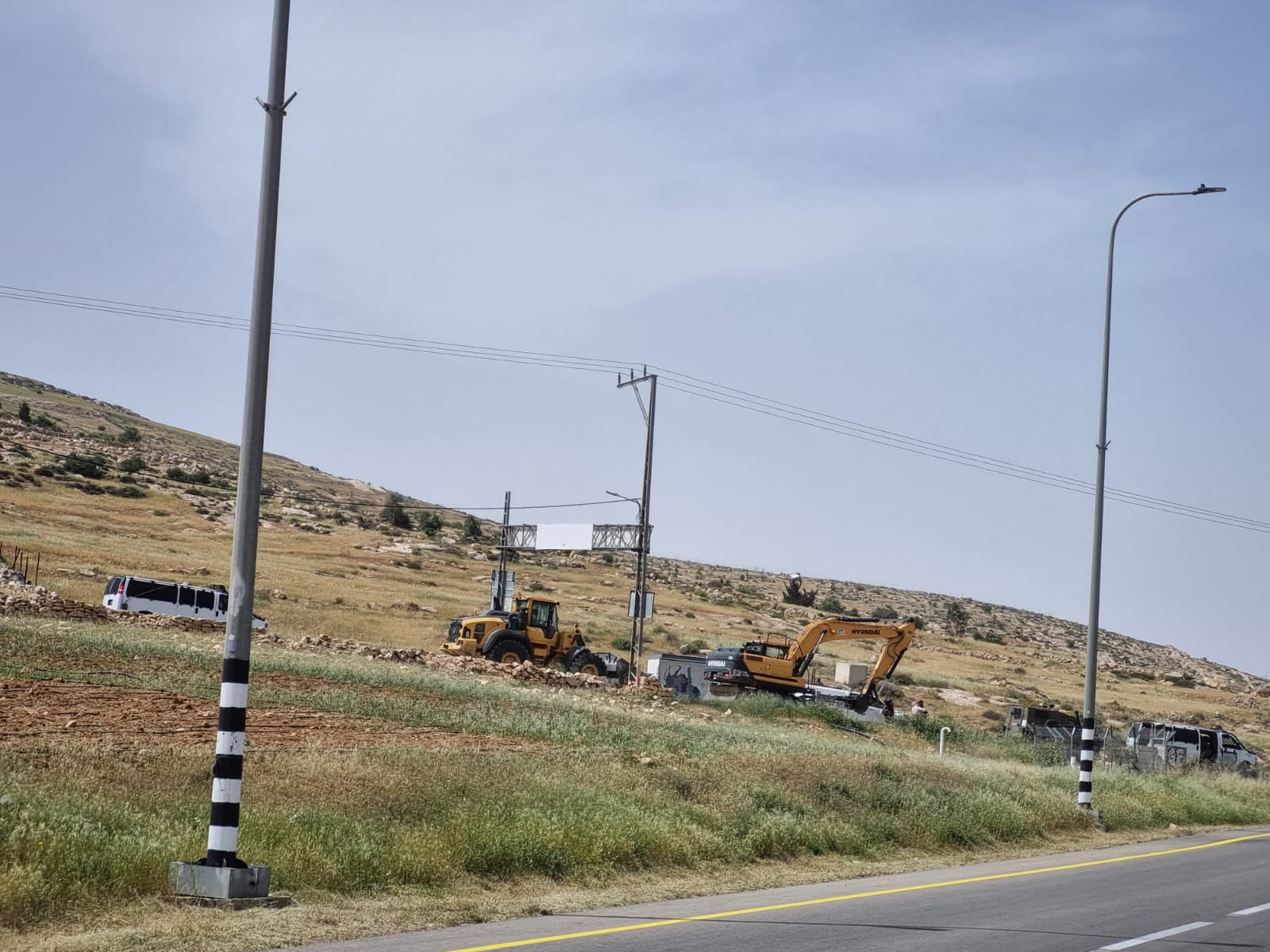
Abda – a car, maybe Savannah, is seen at the entrance to Abda. On the right side of the road is a convey or belt of engineering equipment. It is possible that a bulldozer has entered. Only speculation.
Dura – closed.
Near Qilqis – an armored military jeep is standing by the side of the road.
The Sheep Junction – towards Yatta is closed. Towards Hebron, open. Two soldiers are standing on the left side, near the road to the right of the checkpoint.
Zif Junction – open. A police jeep is seen entering Yatta.
Khalet al-Mai – open.
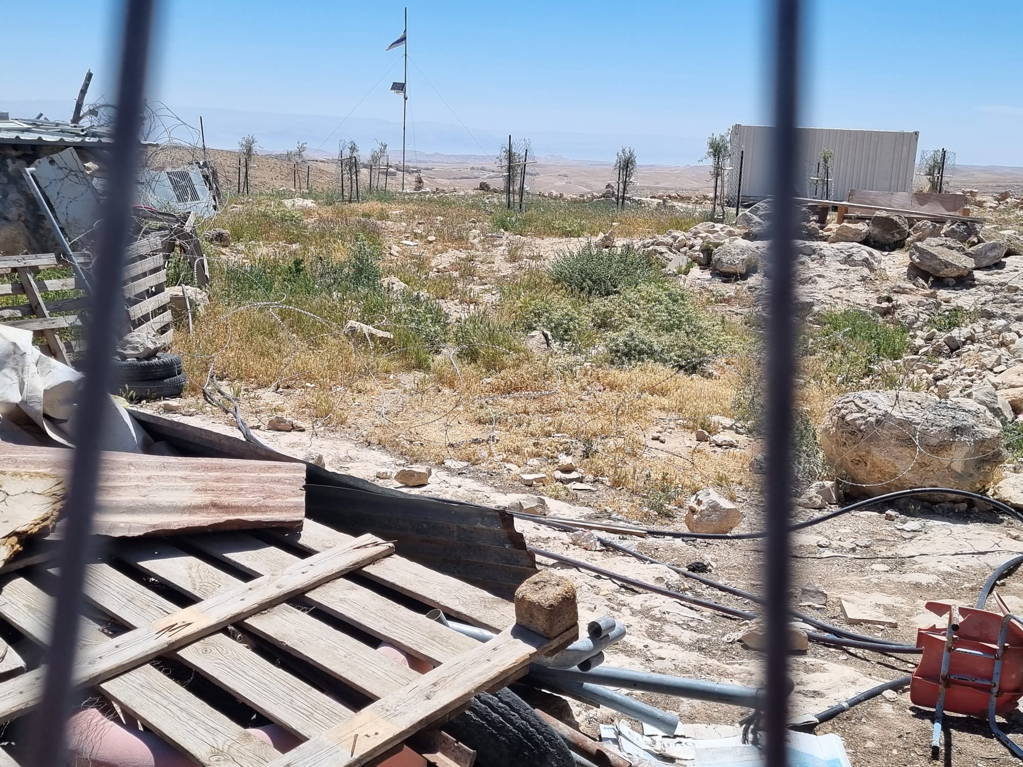
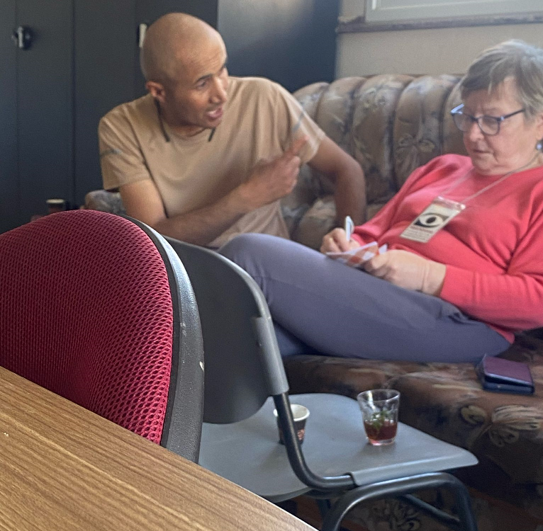
Eid and Ahmad from Umm al-Khair are already waiting for us. It is impossible not to be impressed by the small playground and the flowers that have been planted to give a feeling of life in all this hell.
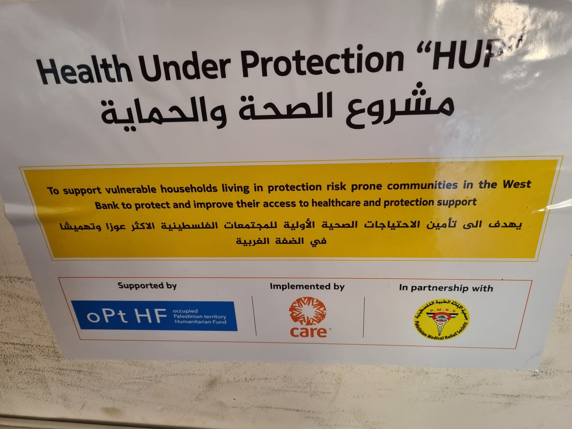
Sitting in an office located next to what tells the tragedy of Suleiman Hadalin, Eid’s father, who was brutally murdered. You can see the posters of organizations such as Doctors Without Borders and HUP, who come several times a month and help with health issues.
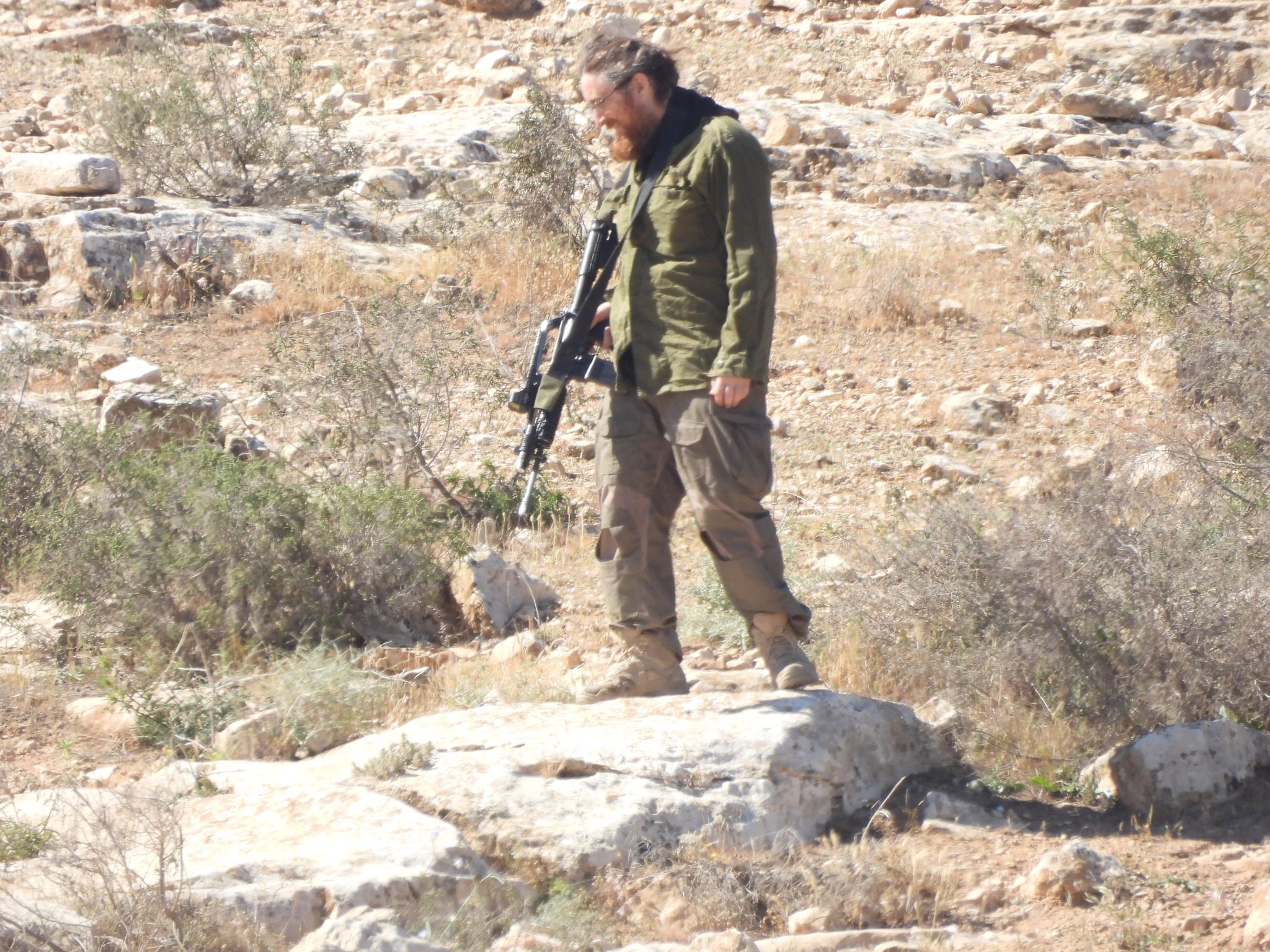
Reminding you that on the right of Umm al-Khair, near the Carmel settlement, is Issachar Man Farm, an outpost that takes over the surrounding areas. On the left, Shimon Atiya’s Roots Farm. Attia recently established another outpost adjacent to his farm.
Both Shimon and Issachar, settlers who sow Jewish terror at every opportunity.
The army has become a private security company for all the farm owners in the area. A united hand and clear and documented cooperation.
The army accompanies them. Sometimes the Palestinians are beaten and arrested, even though it is clear that it is the settlers who have invaded the grazing land of the Umm al-Khair shepherds.
The summer, which started early this year, has worsened the situation of the shepherds. Most of them have been forced to sell some of their flocks to buy food for their families and feed the sheep.
Eid shows me the trailer they have set up a few meters from the office and the garden where we are. The settlers from the Atiya farm have planted olive trees. They water them using water pipes they have laid.
On a bench they have placed there, they sit and do parties at night.
It is impossible to describe how infuriating this whole situation is, there is not much we can do to help. There has been a drastic change since October 7, and even before that, since Ben Gvir and Smotritch became landlords in the occupied territories. Depression and pain with every visit.
We brought clothes and basic food supplies.
#ThisIsTheOccupation
Location Description
Dura Al-Fawwar Junction
See all reports for this place-
Junction on Route 60: west - the town of El Dura, east - the Al Fawwar refugee camp. There is a manned pillbox at the junction. From time to time the army sets up flying checkpoints at the entrance to El Fawwar and Al Dura. Al-Fawwar is a large refugee camp (7,000 inhabitants in 2007) established in 1949 to accommodate Palestinian refugees from Be'er Sheva and Beit Jubrin and environs. There are many incidents of stone-throwing. In the vicinity of the pillbox there are excellent agricultural areas, Farmers set up stalls adjacent to the plots close to the road. In recent months the civil administration has set up dirt embankments thereby blocking access to the stalls, and making it impossible for the farmers to sell their vegetables. Updated April 2021, Michal T.
-
Hakvasim (sheep) Junction
See all reports for this place-
One of the roadblocks (earthworks, rocks, concrete blocks or iron gates) that prevent transit of vehicles to Route 60 in the southern West Bank and block the southern entrance to Hebron. A manned pillbox supervises the place.
-
South Hebron Hills
See all reports for this place-
South Hebron Hills
South Hebron Hills is a large area in the West Bank's southern part.
Yatta is a major city in this area: right in the border zone between the fertile region of Hebron and its surroundings and the desert of the Hebron Hills. Yatta has about 64,000 inhabitants.
The surrounding villages are called Masafer Yatta (Yatta's daughter villages). Their inhabitants subsist on livestock and agriculture. Agriculture is possible only in small plots, especially near streams. Most of the area consists of rocky terraces.Since the beginning of the 1980s, many settlements have been established on the agricultural land cultivated by the Palestinians in the South Hebron Hills region: Carmel, Maon, Susia, Masadot Yehuda, Othniel, and more. Since the settlements were established and Palestinians cultivation areas have been reduced; the residents of the South Hebron Hills have been suffering from harassment by the settlers. Attempts to evict and demolish houses have continued, along with withholding water and electricity. The military and police usually refrain from intervening in violent incidents between settlers and Palestinians do not enforce the law when it comes to the investigation of extensive violent Jewish settlers. The harassment in the South Hebron Hills includes attacking and attempting to burn residential tents, harassing dogs, harming herds, and preventing access to pastures.
There are several checkpoints in the South Hebron Hills, on Routes 317 and 60. In most of them, no military presence is apparent, but rather an array of pillboxes monitor the villages. Roadblocks are frequently set up according to the settlers and the army's needs. These are located at the Zif Junction, the Dura-al Fawwar crossing, and the Sheep Junction at the southern entrance to Hebron.
Updated April 2022
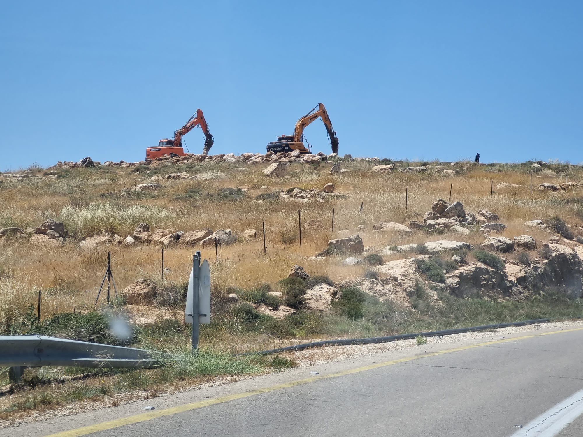 Smadar BeckerMay-7-2026Two bulldozers are cultivating the vineyard area of the Meitarim Farm (Yinon Levi) in the South Hebron Hills.
-
Umm al-Khair
See all reports for this place-
Umm al-Kheir
A Palestinian village in the southern Hebron governorate, populated by five families. The Palestinian residents settled there decades ago, after Israel expelled them from the Arad desert and purchased the land from the residents of the Palestinian village of Yatta. The village suffers from the violence of nearby Carmel settlers, from water shortage and is subject to frequent demolition of buildings by the Civil Administration.
-
Zif Junction
See all reports for this place-
Zif Junction located on the crossroads that directs towards Road 356 to Yata. Yata is the district city of the southern Hebron Mountains. Usually, this junction is open to traffic. The nearby pillbox is unmanned. But the army and police are present occasionally, sometimes setting up a checkpoint and sometimes detaining residents from the big city. Often, the Israeli policemen inspect vehicles and distribute driving reports to Palestinian vehicles. s
-