
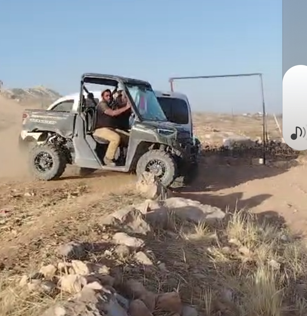
Settlers received ATVs from Smotrich and are using them to harass shepherds and children
Route 60: In Zanuta, opposite the school, on the left side when traveling from south to north, a new fence is being erected on Zanuta B’s territory.
Highway 317 near the settlement Asa’el, a large presence of soldiers was observed on the sides of the road.
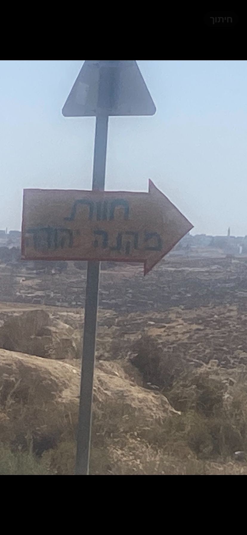
New farm: Israel Kaplan moved to a new farm, dismantled the old farm east of Asael, and is now establishing “Havat (Farm) Mikne Yehuda” with a new sign in place.
ATVs for settlers: According to Nasser Adra from a-Tuwani, settlers received ATVs from Finance Minister Smotrich, and are using them to harass shepherds and children, and the army does not interfere in their actions.
Location Description
A-Tuwani
See all reports for this place-
A-Tuwani
The locals came to a-Tuwani during the 20th century from the village of Yatta. They settled in abandoned ruins, utilizing the arable land, pastures for grazing sheep and the abundance of natural caves for habitation. The residents who settled in the caves came from families who could not purchase land for houses in the mother villages, as well as shepherds who did not have enough land to graze. They were joined by clan members who quarreled with other families in the mother locality.
Some of the residents today live in concrete buildings built above the caves. In the area of the village are several water cisterns and an ancient water well called 'Ein a-Tuwani. Local residents are forced to buy water in containers and transport them through many road blocks to the village. With the help of international organizations, an electrical system was installed in the village. In the late 90s of the 20tTh century, an elementary school was established in the serving several small villages in the area.
In 2004, MachsomWatch began visiting and reporting from the Khirbet Tuwani cave village, which suffers badly from the settlers of nearby outposts, and especially from the extremist Ma'on outpost. . The settlers contaminate cisterns, poison the flocks and uproot trees.Particularly notable is the harassment of children from the surrounding villages on their way to school in a-Tuwani, so much so that military escort of children is required to separate them from the attackers (this was arranged following an initiative of the organization's members). In the past year, the escort has been without the vital presence of overseas volunteers.
Near a-Tuwani there are several families who have returned to the caves due to the incessant demolitions of the civil administration (as there is a total construction ban in all of area C). Destroyed are not only residential and agricultural buildings, but also water pipes, machinery. Even water cisterns are clogged up. a-Tuwani residents have created an association for non-violent demolition protests, but in the past year the army’s harsh harassment and settler violence have intensified and escalated. The incident of the small generator confiscation, which left a young man paralyzed, is one of many examples - any legitimate protection of property rights leads to violence and even shootings by the army and the civil administration.
Updated April 2022
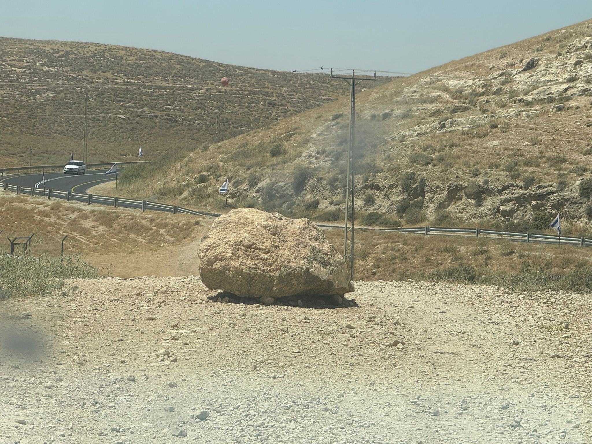 Muhammad D.Jun-7-2026A stone placed by settlers on the road leading to the Thiel family's territory in Rahwa
-
South Hebron Hills
See all reports for this place-
South Hebron Hills
South Hebron Hills is a large area in the West Bank's southern part.
Yatta is a major city in this area: right in the border zone between the fertile region of Hebron and its surroundings and the desert of the Hebron Hills. Yatta has about 64,000 inhabitants.
The surrounding villages are called Masafer Yatta (Yatta's daughter villages). Their inhabitants subsist on livestock and agriculture. Agriculture is possible only in small plots, especially near streams. Most of the area consists of rocky terraces.Since the beginning of the 1980s, many settlements have been established on the agricultural land cultivated by the Palestinians in the South Hebron Hills region: Carmel, Maon, Susia, Masadot Yehuda, Othniel, and more. Since the settlements were established and Palestinians cultivation areas have been reduced; the residents of the South Hebron Hills have been suffering from harassment by the settlers. Attempts to evict and demolish houses have continued, along with withholding water and electricity. The military and police usually refrain from intervening in violent incidents between settlers and Palestinians do not enforce the law when it comes to the investigation of extensive violent Jewish settlers. The harassment in the South Hebron Hills includes attacking and attempting to burn residential tents, harassing dogs, harming herds, and preventing access to pastures.
There are several checkpoints in the South Hebron Hills, on Routes 317 and 60. In most of them, no military presence is apparent, but rather an array of pillboxes monitor the villages. Roadblocks are frequently set up according to the settlers and the army's needs. These are located at the Zif Junction, the Dura-al Fawwar crossing, and the Sheep Junction at the southern entrance to Hebron.
Updated April 2022
Muhammad D.Jun-7-2026A stone placed by settlers on the road leading to the Thiel family's territory in Rahwa
-
Zanuta
See all reports for this place-
Zanuta was a small rural Palestinian locality until its demolition. It was situated in the space around the town Dahariya in the South Hebron Hills, about a ten-minute ride from Meitar Checkpoint. There are documented remains of a large Byzantine settlement in the area. Since the Ottoman (Turkish Empire) period (1516-1917) Zanuta was documented as a locality of shepherds and farmers who live in the remains of the ancient structures and the residential caves near them.
Two individual ranches of colonists were created next to Zanuta: Meitarim (of the colonist Yinon Levi) to the east, and Yehudah (of the colonist Elyashiv Nachum) to the north. Endless attacks, harassments and attempt to chase away the Zanuta villagers have originated in these two outposts.
Until the expulsion, four families lived in the village: A-Samama, Al-Tel, Al Batat, and Al-Qaisia. Farming constituted their main economic activity and employed most of the villagers. The total area of the village is about 12,000 dunams, of which about 3,000 are tended, mostly with field crops.
This village has never had a master plan that would legitimize construction permits. The Civil Administration claimed it was too small and the distance to the next town, Dahariya, too great. For this reason, the Israeli authorities pressured the villagers to leave. The colonists did the job for them.
-