The checkpoints in the southern Hebron Hills make the situation unbearable


At the Meitar crossing, we met Wassim al-Battab from Dahariya. Wassim said that the situation at the checkpoint is very difficult. The checkpoint is completely closed and there is a real lockdown. Usually, people come from Israel on foot to pick up workers, but now there is almost no work because no one can pass. Even the Bedouins who used to come to shop in Dahariya can no longer enter.
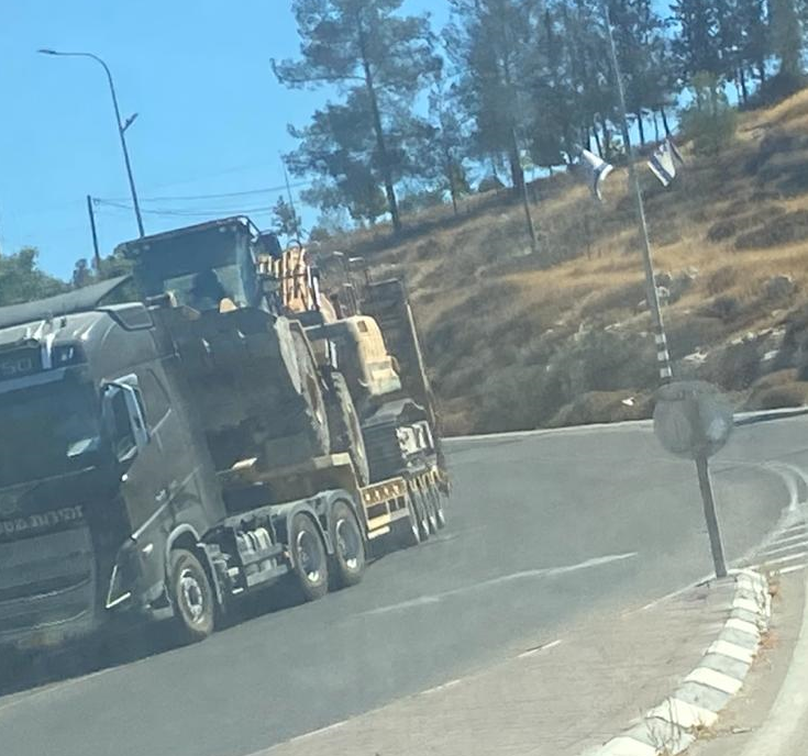
Bulldozers arrive every day to reinforce the closure. Sometimes people manage to open and pass, but immediately a tractor arrives and blocks it again.
There are strict checks – people are forced to leave their cars, and the trip that should take fifteen minutes takes an hour and a half and sometimes more. All in all, the situation has become unbearable.
Driving on Highway 60, opposite the village of Zanuta, on the left side, a winery is being built. There are many settlers there who volunteer and work in the vineyards and agricultural areas. There are many vehicles in the area, right in front of Zanuta, on land belonging to Zanuta.
Continuing on Highway 60, you see Yehuda Farm, which is constantly expanding and taking up more and more Palestinian land belonging to the city of Dahariya.
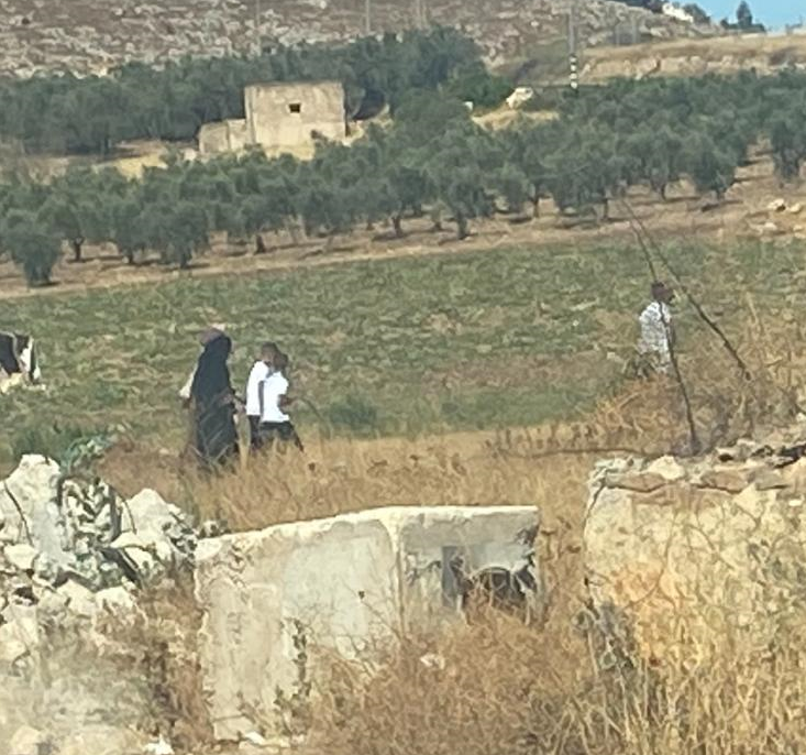
Yusri Jaber said that he does some farming, growing beans and will soon have quality grapes. He is busy working on his land.
We helped him with some food from donations that Smadar and Michal collected. Jaber also says that his brother, Jaudi, and his son have been in prison for more than two months.
Location Description
Meitar checkpoint / Sansana
See all reports for this place-
Meitar Checkpoint / Sansana The checkpoint is located on the Green Line and serves as a border crossing between Israel and the West Bank. It is managed by the Border Crossing Authority of the Defense Ministry. It is comprised of sections for the transfer of goods as well as a vehicle checkpoint (intended for holders of blue identity cards, foreign nationals or diplomats and international organizations). Passing of Palestinians is prohibited, except for those with entry permits to Israel. Palestinians are permitted to cross on foot only. The crossing has a DCO / DCL / DCL / DCL (District Coordination Office), a customs unit, supervision, and a police unit. In the last year, a breach has been opened in the fence, not far from the crossing. This breach is known to all, including the army. There does not appear to be any interest in blocking it, probably as it permits needed Palestinian workers without the bureaucratic permits to get to work in Israel. Food stalls and a parking area economy have been created, but incidents of violent abuse by border police have also been recorded. Updated April 2022
-
South Hebron Hills
See all reports for this place-
South Hebron Hills
South Hebron Hills is a large area in the West Bank's southern part.
Yatta is a major city in this area: right in the border zone between the fertile region of Hebron and its surroundings and the desert of the Hebron Hills. Yatta has about 64,000 inhabitants.
The surrounding villages are called Masafer Yatta (Yatta's daughter villages). Their inhabitants subsist on livestock and agriculture. Agriculture is possible only in small plots, especially near streams. Most of the area consists of rocky terraces.Since the beginning of the 1980s, many settlements have been established on the agricultural land cultivated by the Palestinians in the South Hebron Hills region: Carmel, Maon, Susia, Masadot Yehuda, Othniel, and more. Since the settlements were established and Palestinians cultivation areas have been reduced; the residents of the South Hebron Hills have been suffering from harassment by the settlers. Attempts to evict and demolish houses have continued, along with withholding water and electricity. The military and police usually refrain from intervening in violent incidents between settlers and Palestinians do not enforce the law when it comes to the investigation of extensive violent Jewish settlers. The harassment in the South Hebron Hills includes attacking and attempting to burn residential tents, harassing dogs, harming herds, and preventing access to pastures.
There are several checkpoints in the South Hebron Hills, on Routes 317 and 60. In most of them, no military presence is apparent, but rather an array of pillboxes monitor the villages. Roadblocks are frequently set up according to the settlers and the army's needs. These are located at the Zif Junction, the Dura-al Fawwar crossing, and the Sheep Junction at the southern entrance to Hebron.
Updated April 2022
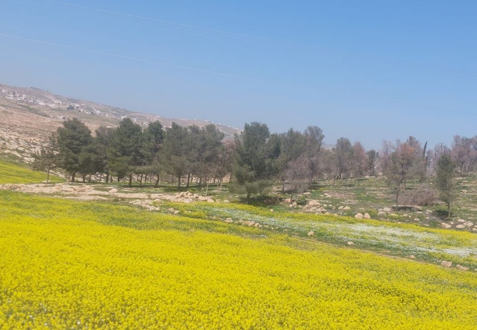 Michal TzadikFeb-10-2026And nature celebrates, Sha'ab Al-Butum
-
Zanuta
See all reports for this place-
Zanuta was a small rural Palestinian locality until its demolition. It was situated in the space around the town Dahariya in the South Hebron Hills, about a ten-minute ride from Meitar Checkpoint. There are documented remains of a large Byzantine settlement in the area. Since the Ottoman (Turkish Empire) period (1516-1917) Zanuta was documented as a locality of shepherds and farmers who live in the remains of the ancient structures and the residential caves near them.
Two individual ranches of colonists were created next to Zanuta: Meitarim (of the colonist Yinon Levi) to the east, and Yehudah (of the colonist Elyashiv Nachum) to the north. Endless attacks, harassments and attempt to chase away the Zanuta villagers have originated in these two outposts.
Until the expulsion, four families lived in the village: A-Samama, Al-Tel, Al Batat, and Al-Qaisia. Farming constituted their main economic activity and employed most of the villagers. The total area of the village is about 12,000 dunams, of which about 3,000 are tended, mostly with field crops.
This village has never had a master plan that would legitimize construction permits. The Civil Administration claimed it was too small and the distance to the next town, Dahariya, too great. For this reason, the Israeli authorities pressured the villagers to leave. The colonists did the job for them.
-