From Carmel to Ma'on - paved promenade for settlers only
Along Highway 60:
Dahariya checkpoint – closed
Karma checkpoint – open
Samu’ – open
Abda – the checkpoint is closed, a car without a driver is blocking the dirt road. The keys were probably taken by the army.
Checkpoints in Dura and al-Fawwar – closed
South Hebron – closed
At the Beit Hanun junction, which is still closed, we met Ahmad to transfer money to him.
He talks about how hard and difficult the times are: no work, the orchards are drying up from lack of water, the refrigerator is empty, even though the grocery store has everything, even at cheap prices – he can’t buy anything. He will use the money to buy medicine for his son who has epilepsy and for groceries. There’s also no money to buy firewood for the winter.
Back via Highway 317:
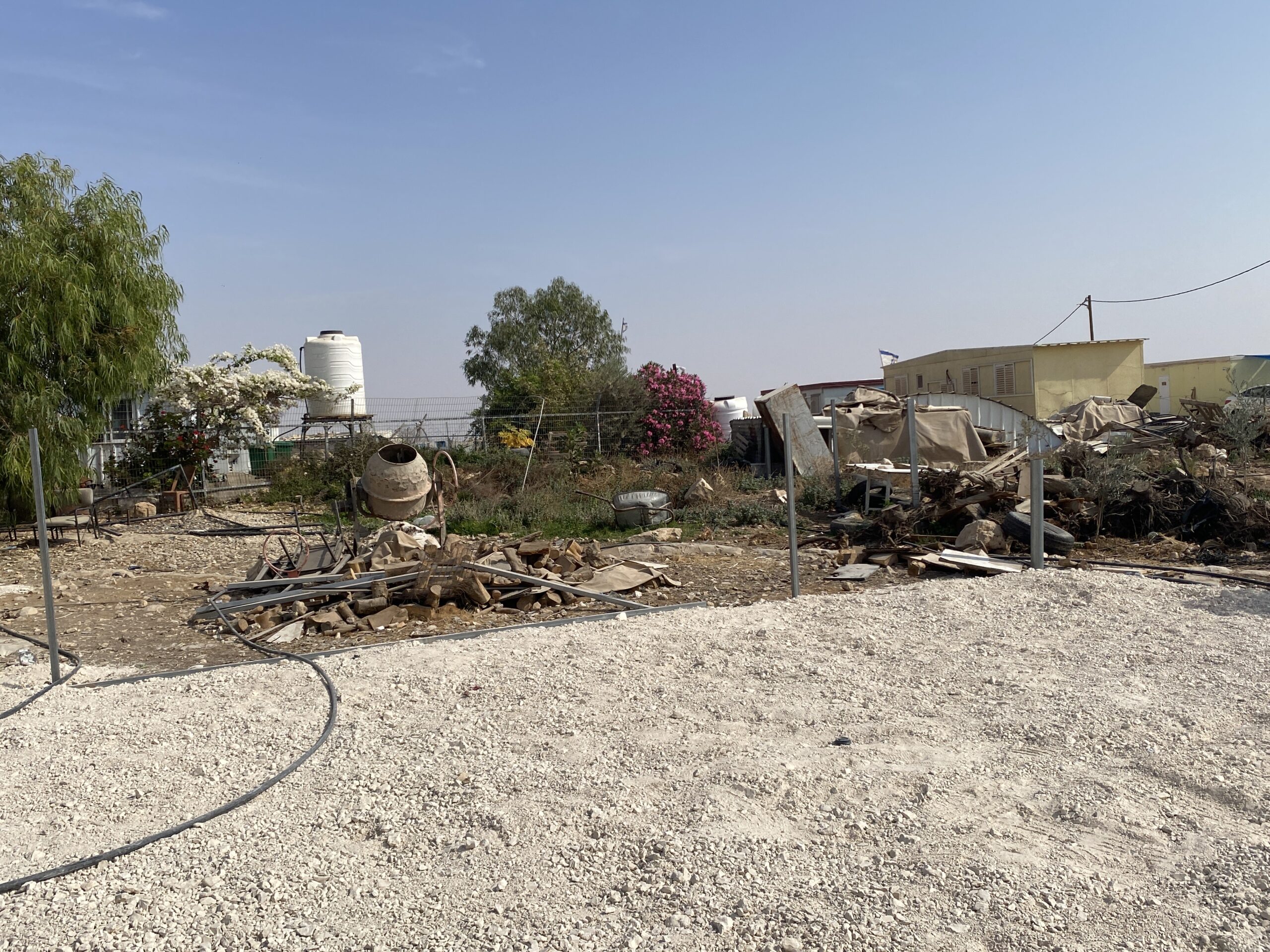
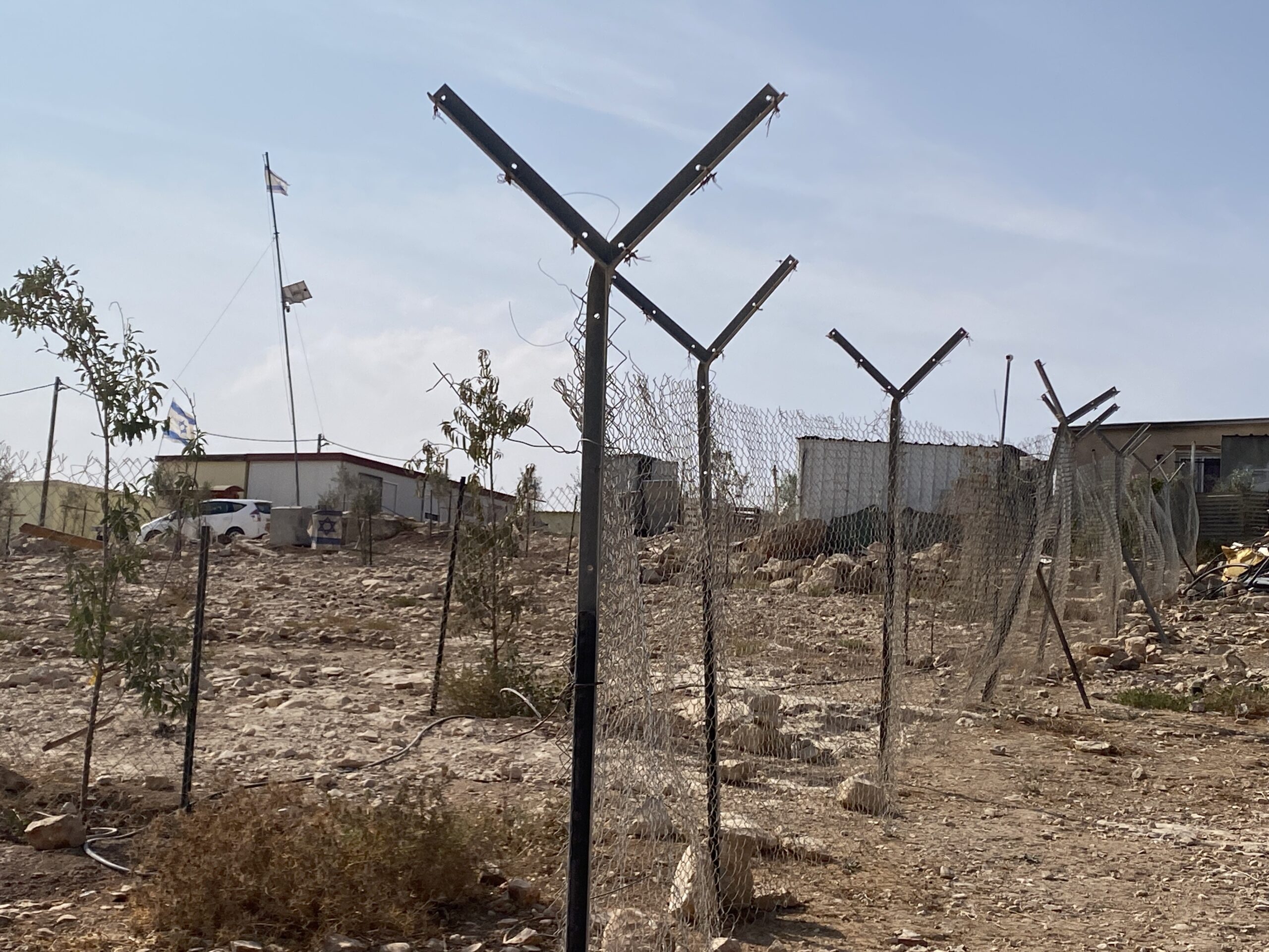
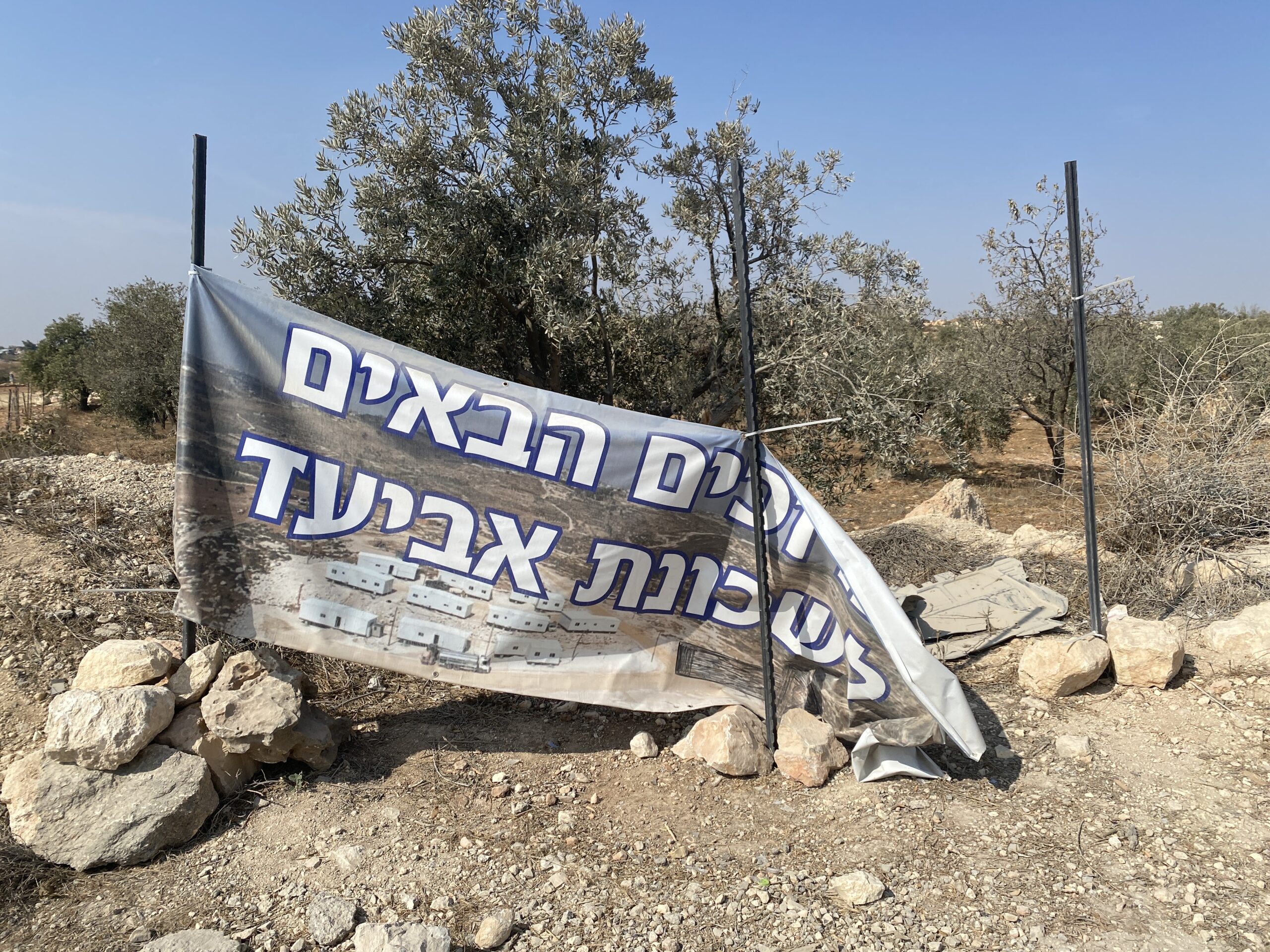
In front of Mitzpe Ziv (relatively new) there are signs about the establishment of a new neighbourhood – the Aviad neighbourhood. There is already a sign, an area has been opened near the road, put a tanker and poured a pile of plaster and there is a declaration of territory.
At the Zif junction, the tiny grocery store has become a large and spacious supermarket and provided us with good dairy products from Hebron.
We went to hear what’s new in Umm al-Khair.
In the courtyard of the “Council House”, a group of foreigners under the auspices of the European Union’s humanitarian aid came to hear a lecture from Eid. When he is finished, he tells us about the constant harassment of the people of Carmel, which is adjacent to them. Carmel is expanding to the west as more and more vineyards are planted, and to the east as caravans are set up right on the fence of Umm al-Khair. The gap between the shabby village houses and the well-watered trees and luxurious houses of the nearby settlement is stark. The next day we received pictures of the Jewish goats munching on the geranium bushes in the yard where we were sitting.
From Carmel to the southern Ma’on, where a paved promenade with railings on both sides has been built, a 3 km road for settlers only.
There is no limit to the occupier’s arrogance.
Location Description
Dura Al-Fawwar Junction
See all reports for this place-
Junction on Route 60: west - the town of El Dura, east - the Al Fawwar refugee camp. There is a manned pillbox at the junction. From time to time the army sets up flying checkpoints at the entrance to El Fawwar and Al Dura. Al-Fawwar is a large refugee camp (7,000 inhabitants in 2007) established in 1949 to accommodate Palestinian refugees from Be'er Sheva and Beit Jubrin and environs. There are many incidents of stone-throwing. In the vicinity of the pillbox there are excellent agricultural areas, Farmers set up stalls adjacent to the plots close to the road. In recent months the civil administration has set up dirt embankments thereby blocking access to the stalls, and making it impossible for the farmers to sell their vegetables. Updated April 2021, Michal T.
-
Mesafer Yatta
See all reports for this place-
This is happening in Fire Area 918 in the South Hebron Hills
On the eve of Remembrance Day (the day before Israel Independence Day), 4th May, 2022, the Israeli High Court decided on the transfer and expulsion of residents from 8 Palestinian communities in the area of Masafar Yata in the South Hebron Hills. Residents of the villages have been living under the threat of demolition, evacuation and expropriation since the IDF issued evacuation orders in 1999 based on the 1980s proclamation of their area of residence as a firing zone for IDF drills. None of the nearby settlements were included in this zone. The Masafer Yata Palestinian villages retain a special lifestyle and ancient agricultural culture. They also posess a clear historical documentation that testifies to a Palestinian settlement in this area, generations before the establishment of Israel, long ago in the caves and at later times outside them.
Evacuating residents from the area means destroying these historic villages and leaving entire families (about 2,000 people, children, adults, and the elderly) homeless. This is contrary to international law.
In June 2022, a firing drill started, and life became harder.
-
South Hebron Hills
See all reports for this place-
South Hebron Hills
South Hebron Hills is a large area in the West Bank's southern part.
Yatta is a major city in this area: right in the border zone between the fertile region of Hebron and its surroundings and the desert of the Hebron Hills. Yatta has about 64,000 inhabitants.
The surrounding villages are called Masafer Yatta (Yatta's daughter villages). Their inhabitants subsist on livestock and agriculture. Agriculture is possible only in small plots, especially near streams. Most of the area consists of rocky terraces.Since the beginning of the 1980s, many settlements have been established on the agricultural land cultivated by the Palestinians in the South Hebron Hills region: Carmel, Maon, Susia, Masadot Yehuda, Othniel, and more. Since the settlements were established and Palestinians cultivation areas have been reduced; the residents of the South Hebron Hills have been suffering from harassment by the settlers. Attempts to evict and demolish houses have continued, along with withholding water and electricity. The military and police usually refrain from intervening in violent incidents between settlers and Palestinians do not enforce the law when it comes to the investigation of extensive violent Jewish settlers. The harassment in the South Hebron Hills includes attacking and attempting to burn residential tents, harassing dogs, harming herds, and preventing access to pastures.
There are several checkpoints in the South Hebron Hills, on Routes 317 and 60. In most of them, no military presence is apparent, but rather an array of pillboxes monitor the villages. Roadblocks are frequently set up according to the settlers and the army's needs. These are located at the Zif Junction, the Dura-al Fawwar crossing, and the Sheep Junction at the southern entrance to Hebron.
Updated April 2022
 Smadar BeckerDec-14-2025A World Food Program (WFP) sticker at the entrance to a grocery store in Tuwani
-
Umm al-Kheir
See all reports for this place-
Umm al-Kheir
A Palestinian village in the southern Hebron governorate, populated by five families. The Palestinian residents settled there decades ago, after Israel expelled them from the Arad desert and purchased the land from the residents of the Palestinian village of Yatta. The village suffers from the violence of nearby Carmel settlers, from water shortage and is subject to frequent demolition of buildings by the Civil Administration.
-
Zif Junction
See all reports for this place-
Zif Junction located on the crossroads that directs towards Road 356 to Yata. Yata is the district city of the southern Hebron Mountains. Usually, this junction is open to traffic. The nearby pillbox is unmanned. But the army and police are present occasionally, sometimes setting up a checkpoint and sometimes detaining residents from the big city. Often, the Israeli policemen inspect vehicles and distribute driving reports to Palestinian vehicles. s
-