סיור בעוטף דרום ירושלים
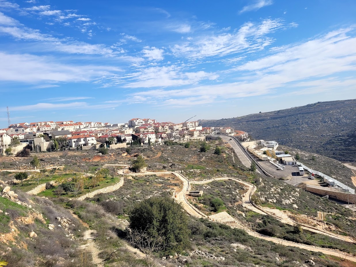
פתחנו בסיור בהתנחלות “נוף ציון”.
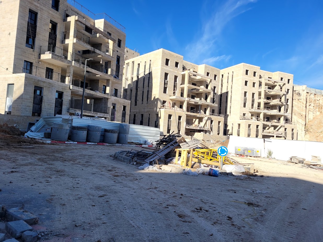
לפני כשלושים שנה הצליחו יזמים ישראלים לרכוש חלקת קרקע מפלסטינים בג’בל מוכבר, עליה הם יזמו הקמה של שכונת דירות יוקרה בשם “נוף ציון” וקיבלו אישור לבנית 390 יחידות דיור וכמה בתי מלון. בתחילת שנות ה-2000 החלה בניית שלב א’ של ההתנחלות. הפרויקט נקלע לקשיים, כי הסתבר שדירות יוקרה בלב שכונה פלסטינית אינן אטרקטיביות והיחידים שמעוניינים לגור בו הם מתנחלים אידיאולוגיים ולאו דווקא בעלי אמצעים. החברה היזמית פשטה את הרגל וקיימה משא ומתן למכירת הזכויות לחברה בבעלות פלסטינית. גורמי התנחלות גייסו מיליארדר אוסטרלי ואת רמי לוי, שהעמידו את הסכום הדרוש כדי לרכוש את הזכויות בפרויקט ומנעו את העברתו לידי פלסטינים.
היום כבר גרות בשכונה 170 משפחות. הדירות הן בנות 3, 4 ו-5 חדרים. דירת 3 חדרים עולה 2,5 מליון ₪ – זול מאד במושגים ירושלמיים. הבנייה במקום מתנהלת במלוא המרץ ומדי ביקור נאכלת פסגת הגבעה בעוד ועוד בניינים. עיריית ירושלים השקיעה כ-15 מיליון ₪ והקימה בתי כנסת, מקווה טהרה ומגרשי משחקים. יש שירות אוטובוסים לשכונה.

פגשנו באחד הפועלים הפלסטיניים ושוחחנו על התקדמות הבנייה באתר הענק. הסתובבנו מעט בשטח וצילמנו. עוד אנו בשלנו הופיעה מכונית והנהג, כנראה איש הביטחון, הסביר לנו באדיבות שאסור לנו להיות בשטח “ללא בגדים נעליים וקסדה” מתאימים ודרש שנעזוב. “אין לנו ביטוח עבורכם, ומה יקרה עם חס וחלילה תפגעו”. הבנו את הרמז. עזבנו והמשכנו בדרכנו.
נסענו דרך ג’בל מוכבר
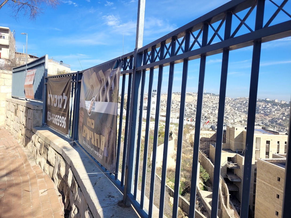
שכונת ג’בל מוכבר היא שכונה במזרח ירושלים,במקורה כפר ערבי שסופח לעיר. השכונה ממוקמת על המורדות המזרחיים והצפוניים של הר אצל (או “ג’בל מוכבר” בשמו הערבי), מיסודם של בני השבט הבדואי ערב א-סוואחרה. הכפר נחשב מבחינה מוניציפלית לאחת משכונות העיר ירושלים
המשכנו על הכביש האמריקאי כביש הטבעת המזרחי שהוא חלק מכביש טבעתי, אשר חוצה את ירושלים דרך שכונותיה המזרחיות, וכיוון נסיעתו הוא מצפון לדרום. הוא נסלל במימון אמריקאי בזמן השלטון הירדני ומכאן שמו.
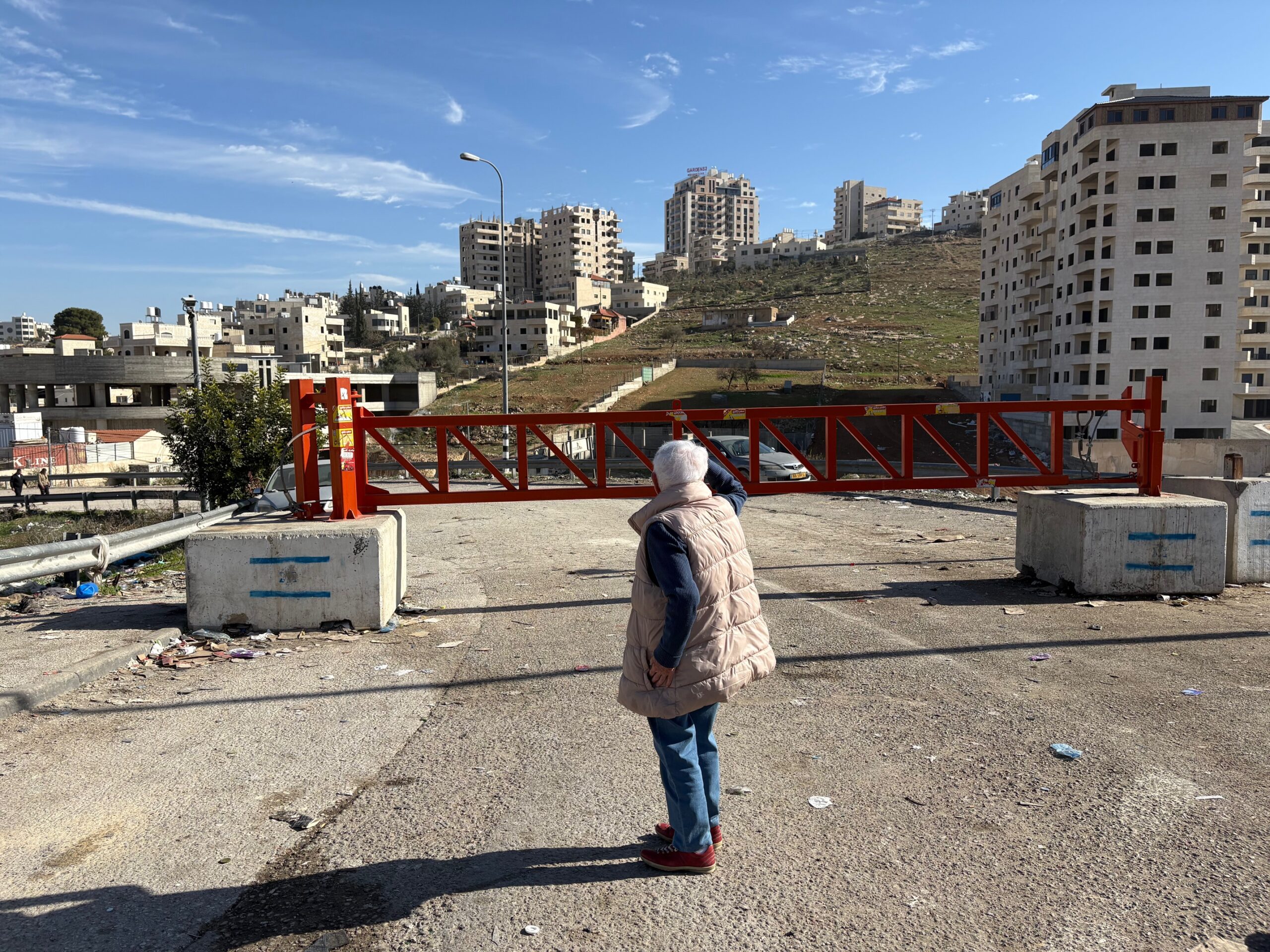
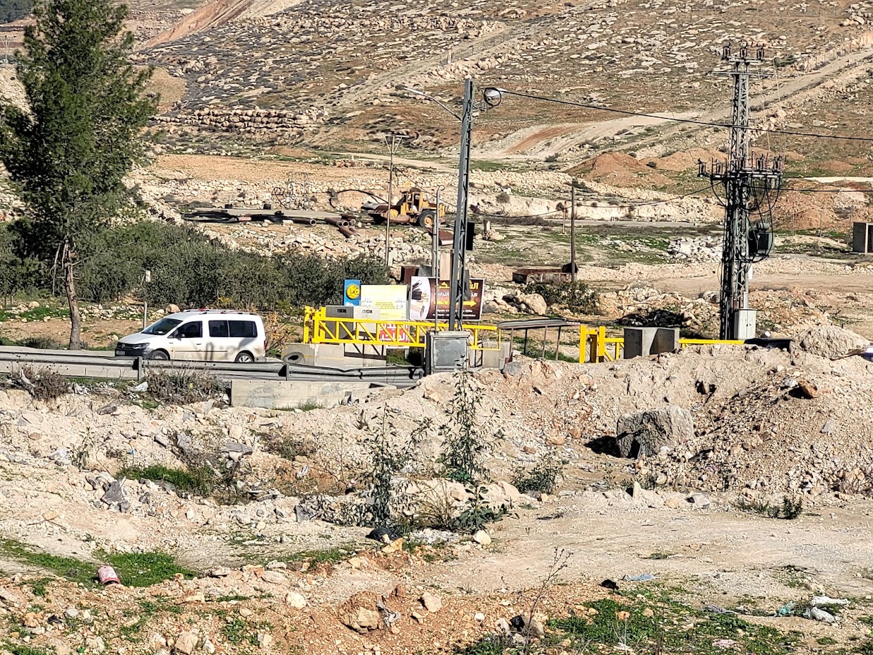
עד לכביש ליברמן. בלחץ תושבי גוש עציון ובראשם אביגדור ליברמן שגר בהתנחלות נוקדים נסלל הכביש על מנת למנוע מעבר של תושבי גוש עציון בכפרים פלסטיניים. הכניסות לכפרים שבדרך סגורות, אין יוצא ואין בא. ליד אחד המחסומים פגשנו שני פלסטיניים מיואשים שהסבירו לנו, מה שכמובן ידענו, כמה קשה המצב.
המשכנו לאפרת, שהולכת ומתפשטת עוד ועוד. ההתרחבות הזו היא חלק ממדיניות השואפת ליצור רצף בין יישובי גוש עציון המזרחי, ולחזק את האחיזה הישראלית באזור.
סיימנו את הסיור בביקור אצל ידידתנו משכבר הימים נפוז. אלמנה, אם ל-7 שעל ביתה יש צו הריסה שאושר למרות עתירה הומניטרית ע”י בית המשפט העליון.
הפחד המתמיד שההורסים יבואו באישון לילה מלווה את נפוז כבר שנים. במהלך השנים היא קיבלה בעקבות פניות שלנו לחברי מחסוםווטש בחו”ל שיפוץ פנימי בתמיכת עמותת AMOS.
בעלה המנוח, שהיה נשוי לשתי נשים, השאיר אותה חסרת כול. היא חיה ממש מן היד אל הפה. אנו משתדלות לעזור באופן סדיר כמיטב יכולתנו.
Location Description
Jabel Mukaber (Jerusalem)
See all reports for this place-
Jabal Mukaber is located on the eastern and northern slopes of Mount Atz (or "Jabal Mukaber" in its Arabic name). It was founded by the Bedouin tribe of Arab a-Sawahra. Today, the village is considered one of East Jerusalem neighborhoods. It numbers about 30,000 residents living on 1,010 dunams. The village has five main clans, numbering several hundred families. During the British Mandate, the tribe moved to live in a huge complex of permanent housing that was named as-Sawahra, with the part east of the Kidron Valley called as-Sawahra a-Sharqiya (Eastern Sawahra) and the western part – Sawahra al-Gharbiyya. The separation fence currently separates Jabal Mukaber from Sawahra a-Sharqiya.
The houses of Jabal Mukaber wrap around the ridge from the north and east, along one of the tributaries of the Kidron River. In the eastern part, the village houses border the Jewish East Talpiot neighborhood. most of the residents of the village are considered residents of Jerusalem, have blue identity cards and enjoy full civil rights in Israel, except for the right to vote for the Knesset and receive an Israeli passport.
The residents of Jabel Mukaber suffer from lack of Outline Plan for the village, overcrowding and a lack of residential and public spaces. Thus, there is a phenomenon of illegal construction in the neighborhood. Demolitions of houses without building permits have been carried out over the years, but since the 7th October War, their rate has increased.
In 2010, a wall was built separating it from its sub-neighborhood A-Sheikh Sa'ed. The wall left many residents with Palestinian IDs without Jerusalem residency and they lost their freedom of movement in Jerusalem.
In the northern part of the neighborhood, construction began in 2005 of a luxury Jewish neighborhood called Nof Zion. The neighborhood was planned to have about 400 housing units, a commercial center and a hotel. However, in April 2025, it was announced that it would be expanded. The apartments were marketed mainly to the religious community in the United States. Alongside the Nof Zion neighborhood, a plan is being promoted to establish the Nof Zahav neighborhood on state land in the Jabal Mukaber neighborhood. This plan also includes residential areas and hotels for tourists, and a place has been allocated for a synagogue, but not for the construction of a mosque.
During and after the Second Intifada, several residents of the neighborhood were involved in terrorist attacks: On March 6, 2008, the attack on Merkaz HaRav Yeshiva in the Kiryat Moshe neighborhood of Jerusalem, in which eight of the yeshiva's students were murdered; On November 18, 2014, an attack on the "Kehilat Bnei Torah" synagogue during morning prayers in the Har Nof neighborhood of Jerusalem; A resident of Jabal Mukaber carried out a car bombing on the Armon Hanatziv promenade. The terrorist drove his truck into a group of cadets. Updated April 2025
-