Sha'ab al-Butum - Confirmation of ownership of the village's lands after a lengthy legal battle
מוחמד היה בקשר עם המשפחה של ליילה בשעב אל–בוטום. תושבי הכפר הזעיר הזה מתמודדים עם איום ותקיפות תמידיות מצד פורעי המאחזים הפזורים בראשי הגבעות מסביב.
נסענו על כביש 60 עד צומת 356, ומשם לצומת זיף על מנת להצטייד במצרכים למסירה בשעב אל-בוטום.
בכביש 60, כל הכניסות לסמוע, דהרייה, סימיא סגורות. לסמוע, הכניסה רק מצפון, מצד כרמה. אבל החיים עושים את שלהם: ערימות עפר נפרצות, סלעים מוזזים. אבל עם שערים צהובים סגורים — לא מתעסקים, והכמות של אלה הולכת וגדלה. עולם של חסימות וגדרות.
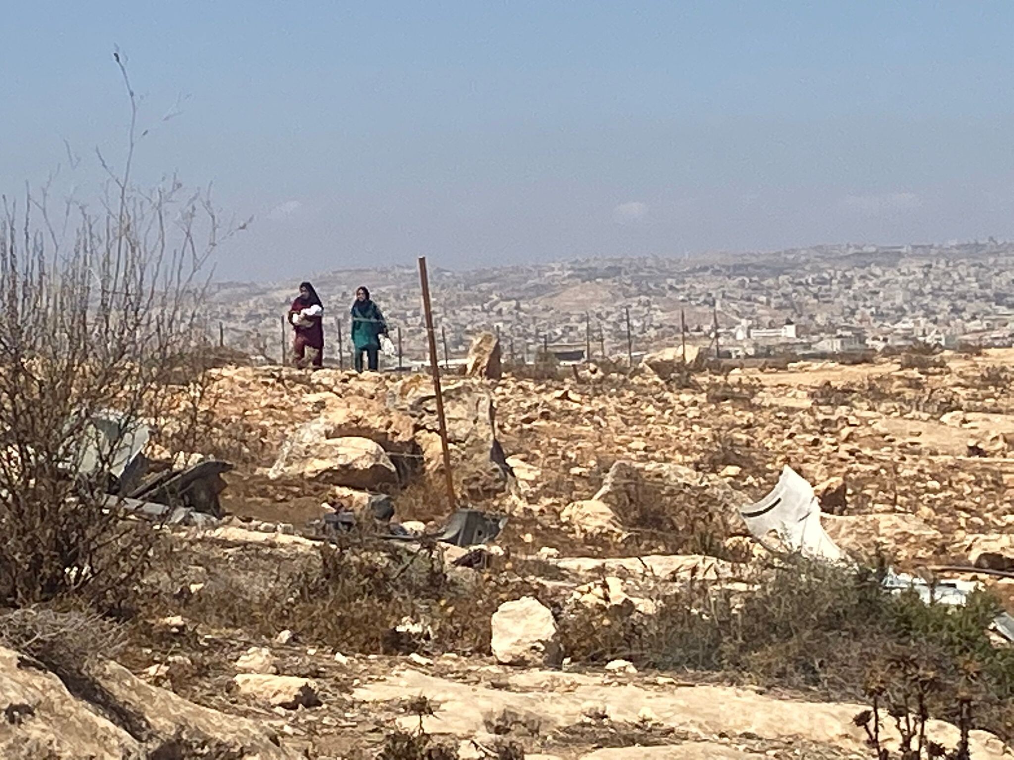
שעב אל-בוטום נמצא מדרום לכביש 317, בעומק השטח. פעם אפשר היה להגיע דרך המאחז אביגיל (שבינתיים עבר הסדרה למעמד התנחלות). אבל את הדרך מאביגיל סגרו. יש שביל עפר משובש, ובסופו עביר רק לרכב שטח, שאורכו כנראה מעל שלושה ק”מ. תושבי שעב אל-בוטום ללא רכב שטח מגיעים ברגל — אומרים שהליכה של בערך שעה. באביגיל מתגורר רבש”צ בשם בודי, המטיל את חיתיתו על תושבי הכפרים הפלסטיניים. הוא זה שירה ברגלו של שיח’ סעיד מא-רכיז (שכרתו את רגלו). אנחנו הגענו בג’יפ של מוחמד.
מסביב, בראשי הגבעות: אביגיל, חוות מעון, חוות דרומא, מצפה יאיר, ועוד מיני נקודות יישוב זעירות ולא ברורות. כולן בראשי הגבעות. במפה של בצלם מופיעים: האוהל-של-שמעון-בן-גיגי, המאחז-של-בודי. וגם חוות שבו, בצמוד למצפה יאיר. מאחזי פרא ללא מעקב ואכיפה.
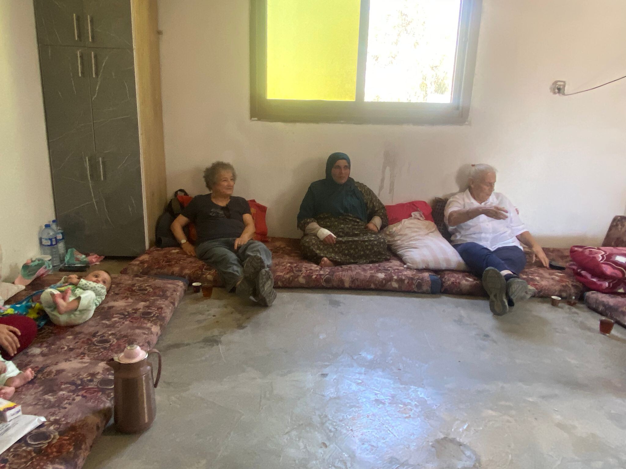
המתחם המשפחתי של ליילה ומוחמד נמצא בקצה הכפר, קצת מבודד, הדרך משובשת מאד, הכי קרוב למאחזים שמסביב. פגשנו שם את אראלה ועוד פעיל מקבוצת הכפרים.
אחרי השבעה באוקטובר הם גורשו מהמתחם שלהם על ידי מתנחלים מסביב. הורשו לחזור רק באפריל 2024. מאז הם ניהלו מאבק משפטי שיאשר את הבעלות שלהם על השטח שמסביב. אראלה מספרת שסוף סוף המשפט הסתיים בהצלחתם, ויש לליילה ומוחמד אישור בעלות על אדמת המתחם המשפחתי שלהם! חדשות משמחות ממש, שאולי באמת יעזרו.
האירוח, כרגיל נדיב. אוכל, תה, קפה. אראלה והבחור שעמה מנהלים שיחה בערבית. אחת הבנות מציגה ציורים מרשימים. השארנו את המצרכים שהבאנו והביגוד הרב (שברגיל נאסף על ידי סמדר).
כביש 317 ו-60 בחזרה: סמוע סגורה גם מצד זה. מתחם מקתל מסלם מצפון, שתושביו גורשו, עכשיו מגודר, והפרות של ינון לוי (המתנחל הרוצח מחוות מיתרים) רועות בו. מעבר לכביש, מצד זנותא שננטשה בגלל אלימות קשה, האזור כולו נטוע בכרמים של אותו ינון לוי. זוכרים: “הרצחת וגם ירשת?”
Location Description
Masafer Yatta*
See all reports for this placeSouth Hebron Hills
See all reports for this place-
South Hebron Hills
South Hebron Hills is a large area in the West Bank's southern part.
Yatta is a major city in this area: right in the border zone between the fertile region of Hebron and its surroundings and the desert of the Hebron Hills. Yatta has about 64,000 inhabitants.
The surrounding villages are called Masafer Yatta (Yatta's daughter villages). Their inhabitants subsist on livestock and agriculture. Agriculture is possible only in small plots, especially near streams. Most of the area consists of rocky terraces.Since the beginning of the 1980s, many settlements have been established on the agricultural land cultivated by the Palestinians in the South Hebron Hills region: Carmel, Maon, Susia, Masadot Yehuda, Othniel, and more. Since the settlements were established and Palestinians cultivation areas have been reduced; the residents of the South Hebron Hills have been suffering from harassment by the settlers. Attempts to evict and demolish houses have continued, along with withholding water and electricity. The military and police usually refrain from intervening in violent incidents between settlers and Palestinians do not enforce the law when it comes to the investigation of extensive violent Jewish settlers. The harassment in the South Hebron Hills includes attacking and attempting to burn residential tents, harassing dogs, harming herds, and preventing access to pastures.
There are several checkpoints in the South Hebron Hills, on Routes 317 and 60. In most of them, no military presence is apparent, but rather an array of pillboxes monitor the villages. Roadblocks are frequently set up according to the settlers and the army's needs. These are located at the Zif Junction, the Dura-al Fawwar crossing, and the Sheep Junction at the southern entrance to Hebron.
Updated April 2022
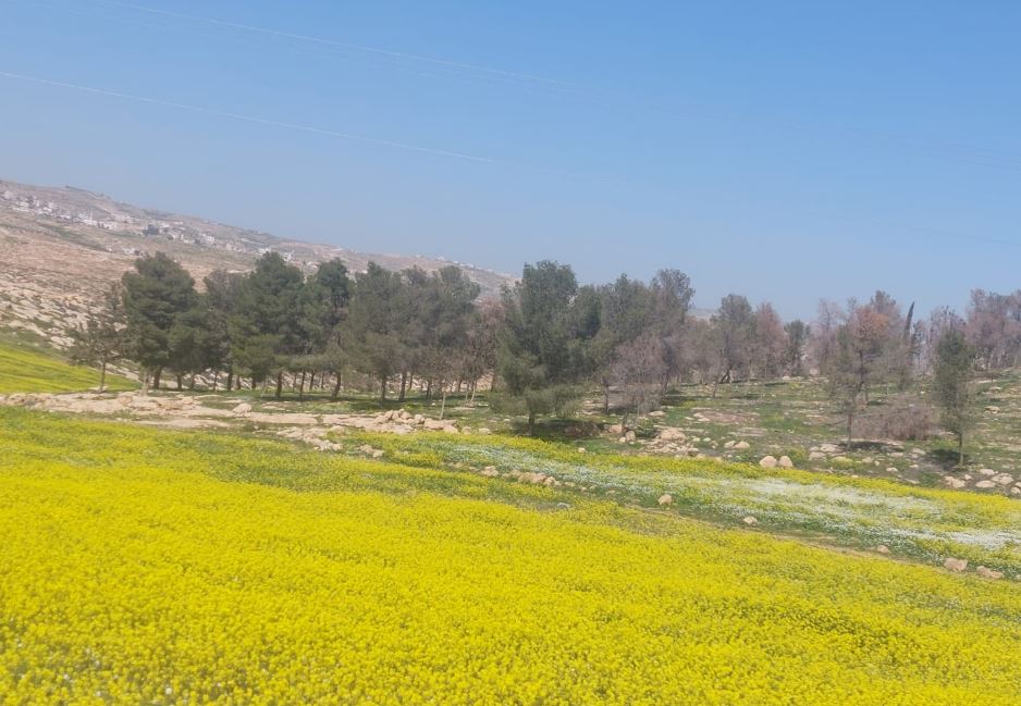 Michal TzadikFeb-10-2026And nature celebrates, Sha'ab Al-Butum
-
Zanuta
See all reports for this place-
Zanuta was a small rural Palestinian locality until its demolition. It was situated in the space around the town Dahariya in the South Hebron Hills, about a ten-minute ride from Meitar Checkpoint. There are documented remains of a large Byzantine settlement in the area. Since the Ottoman (Turkish Empire) period (1516-1917) Zanuta was documented as a locality of shepherds and farmers who live in the remains of the ancient structures and the residential caves near them.
Two individual ranches of colonists were created next to Zanuta: Meitarim (of the colonist Yinon Levi) to the east, and Yehudah (of the colonist Elyashiv Nachum) to the north. Endless attacks, harassments and attempt to chase away the Zanuta villagers have originated in these two outposts.
Until the expulsion, four families lived in the village: A-Samama, Al-Tel, Al Batat, and Al-Qaisia. Farming constituted their main economic activity and employed most of the villagers. The total area of the village is about 12,000 dunams, of which about 3,000 are tended, mostly with field crops.
This village has never had a master plan that would legitimize construction permits. The Civil Administration claimed it was too small and the distance to the next town, Dahariya, too great. For this reason, the Israeli authorities pressured the villagers to leave. The colonists did the job for them.
-
Zif Junction
See all reports for this place-
Zif Junction located on the crossroads that directs towards Road 356 to Yata. Yata is the district city of the southern Hebron Mountains. Usually, this junction is open to traffic. The nearby pillbox is unmanned. But the army and police are present occasionally, sometimes setting up a checkpoint and sometimes detaining residents from the big city. Often, the Israeli policemen inspect vehicles and distribute driving reports to Palestinian vehicles. s
-