A visit to the Yaqin Maqam
1. Highway 60, heading north from the Meitar crossing.
The entrance to Samu‘ is open, but the entrance to Dahariya is closed. Near the expanding settlement of Adorayim, between the fortress (“Beit Dror”) and Highway 60, stand greenhouses belonging to families from Dura and Hebron. They are forbidden from approaching them — their source of livelihood is gone. The entrance to Al-Fawwar is open only for a few hours each morning. Soldiers at the checkpoint conduct thorough inspections of every vehicle, while in the meantime many people are forced to walk on foot between Al-Fawwar and Dura.
The Kilkis junction is closed in both directions. Occasionally it is opened only to allow soldiers to enter in order to conduct searches and make arrests. The “Sheep Junction” is open toward Hebron but closed toward Yatta.
2. Highway 356. We turn left (east) toward Pnei Hever. The gate to Bani Na‘im is closed. We continue and stop to climb the hill between Bani Na‘im and Pnei Hever, where there is an IDF outpost with a pillbox, located near some trees and the small Maqam Yaqin shrine.
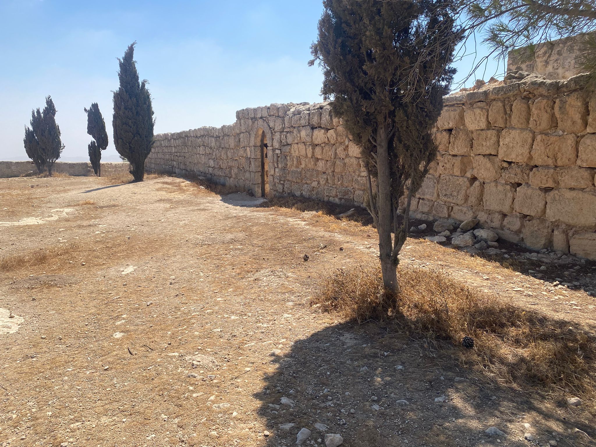
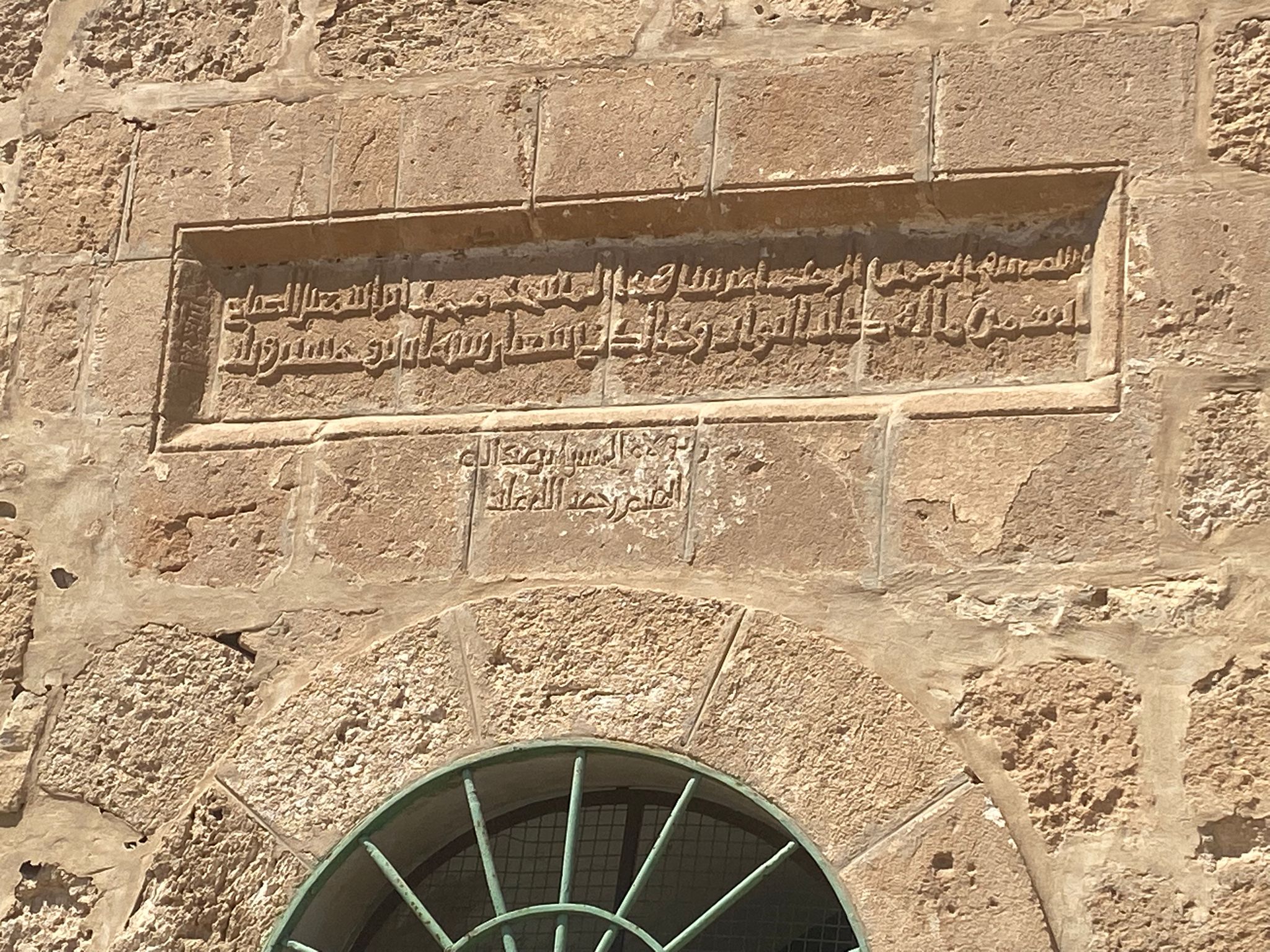
This is a holy site for Muslims. At the entrance there is an inscription in ancient Arabic script, known as Kufic script, a dedication from the builders of the site.
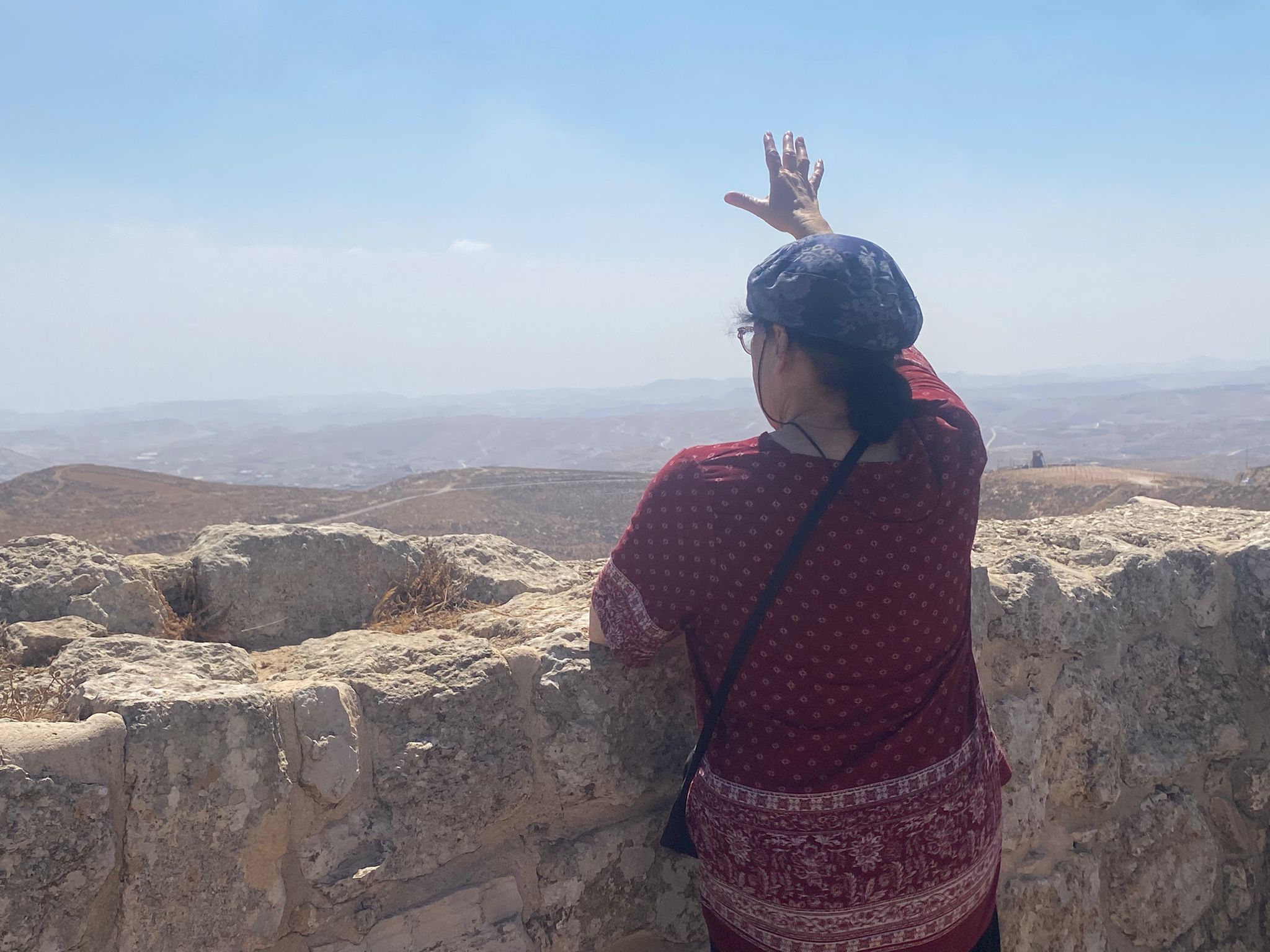
Inside, according to tradition, are the footprints of Ibrahim. From here he looked out over the destruction of Sodom and Gomorrah.
Indeed, this is the edge of the Hebron Hills, and from here one can see the southern Jordan Valley stretching toward the Dead Sea.
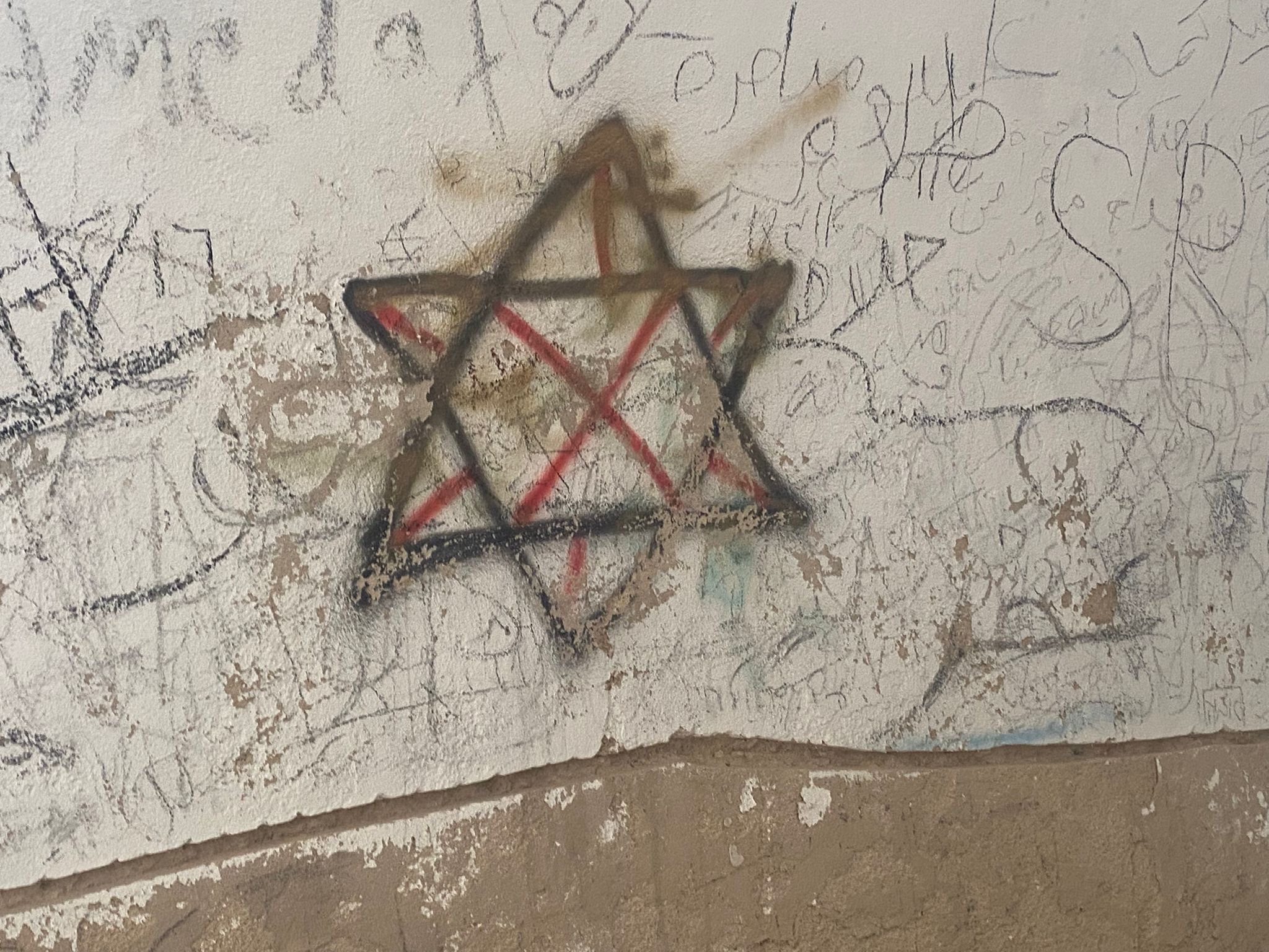
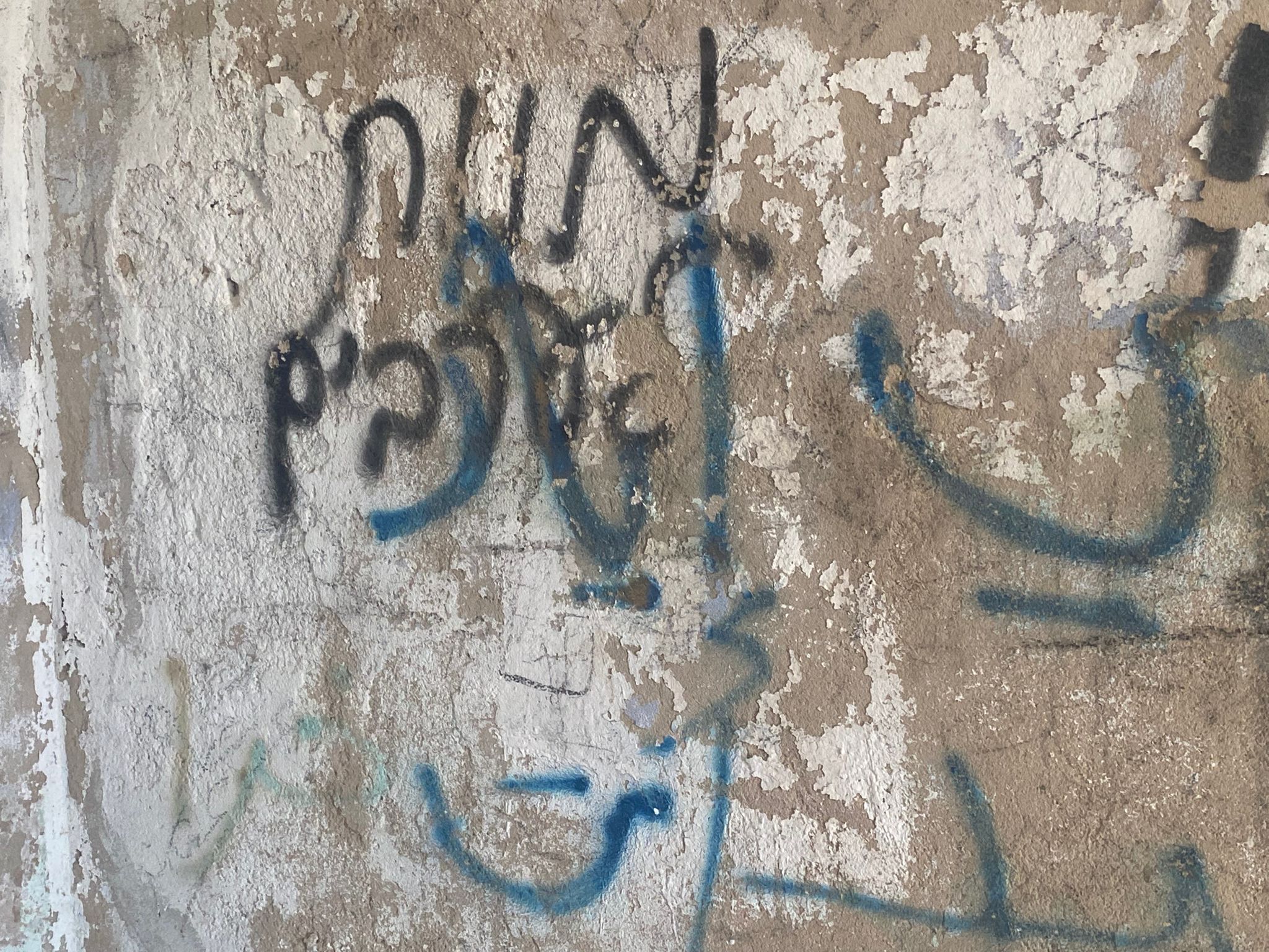
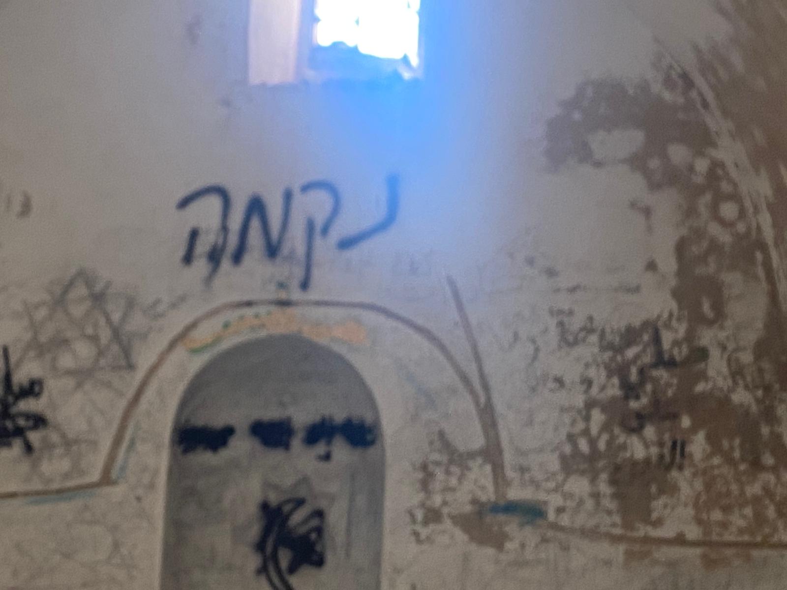
The graffiti desecrating the holy site is truly appalling:
And here is information about the site from the website of Jewish Susya – suggestions for hiking routes in the area:
Activity location: Near the settlement of Ma‘ale Hever
Difficulty level: Easy
What’s there: Viewpoint and historical site
Other things to do nearby: The Ma‘ale Hever study center and viewpoint from the settlement
On a prominent hill, 946 meters above sea level and near the settlement of Ma‘ale Hever, lies the shrine of Nabi Yaqin. According to Muslim tradition, this is the place where Abraham and Lot looked out upon the destruction of Sodom. On a rock surface outside the shrine are depressions resembling the footprints of human sandals; according to local tradition, these are the footprints of Lot. Inside the shrine itself is another footprint on a rock surface, which Muslim tradition attributes to Abraham, who stood here watching the destruction of Sodom and Gomorrah.
From Nabi Yaqin there is a wide view southward toward the communities of the southern Hebron Hills, and eastward over the northern and southern Judean Desert. Near Nabi Yaqin are the ruins of Bani Dar, identified with “Haqin” — a city mentioned in the list of towns of Judah in the Book of Joshua, Chapter 15. During the Second Temple period its name changed to “Yaqim.” We also know this name from documents from the time of Bar Kochba found in the Judean Desert. At some point in history, the name “Haqin–Yaqim” shifted from the ruins of Bani Dar to the nearby hill now called “Nabi Yaqin.” About half a kilometer southwest of the ruins of Bani Dar grows a large Palestine oak, one of the biggest and easternmost oaks in the Hebron Hills. This oak is a remnant of ancient times when Mediterranean woodland covered the central mountain ridge.
3. The entrance to Zif Junction is open. We meet Ziyad Hushiyyeh, whose daughter is seriously ill with cancer. We give him the money collected by Sylvia and her friends, along with clothes gathered by Smadar. Further along the road, the entrance to Khalet al-Maiyya is also open.
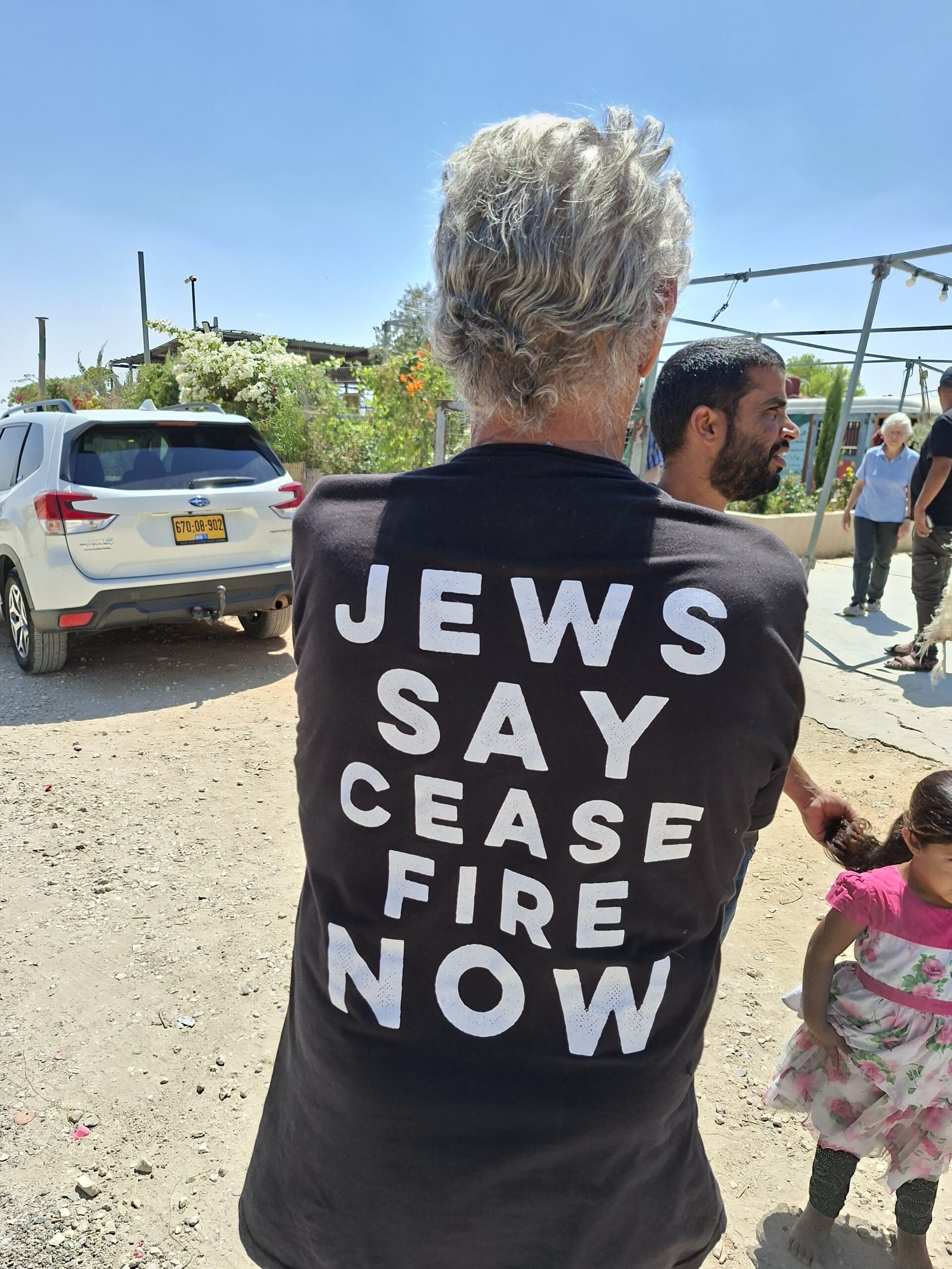
4. Umm al-Khair: Without prior coordination, we meet Yehudit Elkana and Hanna Bar-G from Machsom Watch Jerusalem. They are working as part of their activities with the organization Yesh Din, together with another activist, Sarah Marles, and field researcher Rima Hawash. We do not interfere as the women conduct their thorough investigation, aimed at gathering evidence for a legal case against ongoing settler attacks, culminating with the murder. Among other things, I photographed both sides of a T-shirt belonging to a volunteer from the United States.
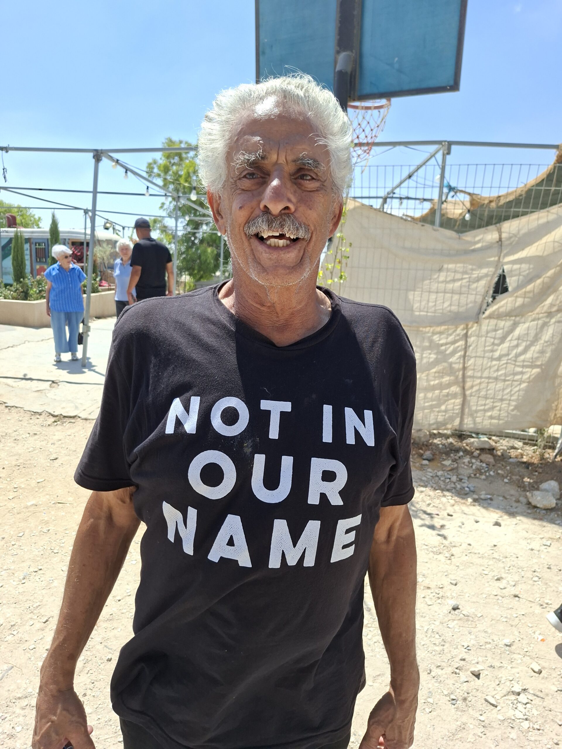
I also met Eliana Padua from New York, an activist in the U.S. with the organization Halachic Left, which could be described as the Jewish-American counterpart of “Bnei Avraham,” a group of religious left-wing activists. She speaks Hebrew and Arabic fluently and stays in the field from one Sabbath to the next, as part of a diverse group that can be described as a “protective presence.”
Every visit to this place, with its cultivation, gardens, and wonderful people, is truly inspiring.
Location Description
Dura Al-Fawwar Junction
See all reports for this place-
Junction on Route 60: west - the town of El Dura, east - the Al Fawwar refugee camp. There is a manned pillbox at the junction. From time to time the army sets up flying checkpoints at the entrance to El Fawwar and Al Dura. Al-Fawwar is a large refugee camp (7,000 inhabitants in 2007) established in 1949 to accommodate Palestinian refugees from Be'er Sheva and Beit Jubrin and environs. There are many incidents of stone-throwing. In the vicinity of the pillbox there are excellent agricultural areas, Farmers set up stalls adjacent to the plots close to the road. In recent months the civil administration has set up dirt embankments thereby blocking access to the stalls, and making it impossible for the farmers to sell their vegetables. Updated April 2021, Michal T.
-
Hakvasim (sheep) Junction
See all reports for this place-
One of the roadblocks (earthworks, rocks, concrete blocks or iron gates) that prevent transit of vehicles to Route 60 in the southern West Bank and block the southern entrance to Hebron. A manned pillbox supervises the place.
-
Meitar checkpoint / Sansana
See all reports for this place-
Meitar Checkpoint / Sansana The checkpoint is located on the Green Line and serves as a border crossing between Israel and the West Bank. It is managed by the Border Crossing Authority of the Defense Ministry. It is comprised of sections for the transfer of goods as well as a vehicle checkpoint (intended for holders of blue identity cards, foreign nationals or diplomats and international organizations). Passing of Palestinians is prohibited, except for those with entry permits to Israel. Palestinians are permitted to cross on foot only. The crossing has a DCO / DCL / DCL / DCL (District Coordination Office), a customs unit, supervision, and a police unit. In the last year, a breach has been opened in the fence, not far from the crossing. This breach is known to all, including the army. There does not appear to be any interest in blocking it, probably as it permits needed Palestinian workers without the bureaucratic permits to get to work in Israel. Food stalls and a parking area economy have been created, but incidents of violent abuse by border police have also been recorded. Updated April 2022
-
South Hebron Hills
See all reports for this place-
South Hebron Hills
South Hebron Hills is a large area in the West Bank's southern part.
Yatta is a major city in this area: right in the border zone between the fertile region of Hebron and its surroundings and the desert of the Hebron Hills. Yatta has about 64,000 inhabitants.
The surrounding villages are called Masafer Yatta (Yatta's daughter villages). Their inhabitants subsist on livestock and agriculture. Agriculture is possible only in small plots, especially near streams. Most of the area consists of rocky terraces.Since the beginning of the 1980s, many settlements have been established on the agricultural land cultivated by the Palestinians in the South Hebron Hills region: Carmel, Maon, Susia, Masadot Yehuda, Othniel, and more. Since the settlements were established and Palestinians cultivation areas have been reduced; the residents of the South Hebron Hills have been suffering from harassment by the settlers. Attempts to evict and demolish houses have continued, along with withholding water and electricity. The military and police usually refrain from intervening in violent incidents between settlers and Palestinians do not enforce the law when it comes to the investigation of extensive violent Jewish settlers. The harassment in the South Hebron Hills includes attacking and attempting to burn residential tents, harassing dogs, harming herds, and preventing access to pastures.
There are several checkpoints in the South Hebron Hills, on Routes 317 and 60. In most of them, no military presence is apparent, but rather an array of pillboxes monitor the villages. Roadblocks are frequently set up according to the settlers and the army's needs. These are located at the Zif Junction, the Dura-al Fawwar crossing, and the Sheep Junction at the southern entrance to Hebron.
Updated April 2022
 Muhammad D.Jan-6-2026Sha,ab al-Butum - Sabha after the attack
-
Umm al-Kheir
See all reports for this place-
Umm al-Kheir
A Palestinian village in the southern Hebron governorate, populated by five families. The Palestinian residents settled there decades ago, after Israel expelled them from the Arad desert and purchased the land from the residents of the Palestinian village of Yatta. The village suffers from the violence of nearby Carmel settlers, from water shortage and is subject to frequent demolition of buildings by the Civil Administration.
-
Zif Junction
See all reports for this place-
Zif Junction located on the crossroads that directs towards Road 356 to Yata. Yata is the district city of the southern Hebron Mountains. Usually, this junction is open to traffic. The nearby pillbox is unmanned. But the army and police are present occasionally, sometimes setting up a checkpoint and sometimes detaining residents from the big city. Often, the Israeli policemen inspect vehicles and distribute driving reports to Palestinian vehicles. s
-