After a night of protests in the neighborhoods around East Jerusalem – it is now quiet


7:15 a.m. Jabal Mukaber and Sheikh Sa’ed checkpoint
After a night of protests in East Jerusalem neighborhoods against the Israeli army’s operation in Jenin, we saw here and at other East Jerusalem neighborhoods pairs of the municipality’s sanitation workers removing debris: smoking upside bins, improvised roadblocks… It seems the protest was very limited compared to the protests against the latest attack on Gaza.
At Sheikh Sa’ed Checkpoint no schoolchildren are seen crossing to their school in Jabal Mukaber because summer vacation has started. We met three young Palestinian men holding a (blue) Israeli ID, whose families are split between Sheikh Sa’ed and the mother-neighborhood of Jabal Mukaber. It is not really clear who lives where, but they are the fortunate waiting to be picked up to go to work.
Silwan
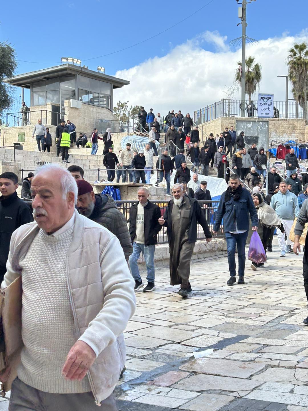
We take a turn at the bottom of Batan Al Hawa (this neighborhood is threatened with the demolition of 70 homes), there is nothing new here. Colonist children are picked up in several spots to reach their schools (at our expense).
The sign declaring the attraction of the Shiloach pool being dug out has been taken down. Nothing has been discovered yet. But the digs are ongoing and deep. The spokesperson of Emek Shave – archeologists against the occupation – explains that the area belongs to the El’ad association in some real-estate deal, and promised that eventually a pool will be there alright, called the Shiloach Pool, even if it will not be the original one.
Opposite the City of David, the uphill section of Wadi Hilwa Street has been severely narrowed. The Giv’ati car park and its growing digs are becoming a huge tourist center of the El’ad association. This makes the mostly Palestinian residents’ exit here very difficult when they wish to drive along the road circling the walls, opposite Dung Gate.
Ras Al Amoud on the way to The Olives Checkpoint
The media often mentioned riots here tonight. Right now, things are “quiet”. The guys are either sleeping or in custody… The road turns. Workers of the Moriah Company are clearing a broad area on the old Jericho Road, above the turnoff to the upgraded road going down to the Wadi Qaddoum neighborhood below. Why this area? We are suspicious and try to find out whether preparations are in store to a tunnel planned to pass under Abu Dis and A-Ram that would connect to the northern American Road (see route at https://peacenow.org.il/eastern-ring-road-consfiscation We shall report further.
The Olives Checkpoint
Good news: the DCO here has begun to work again, after closing down in the 2021 Ramadan, issuing magnetic cards and lightening the pressure on the Qalandiya DCO. It opens at 9 a.m. and there is already a waiting line (a bit after 8a.m.). Among the people waiting is a nice radio anchor who gave birth a year ago, and now wants to visit Jerusalem occasionally. We wish her luck.
The toilets on the Palestinian side are locked, as always. The man in the phone cards booth above the car-park for those arriving from Azariyah tells us that thousands of people passed here today between 4 and 7 a.m. Now it is fairly empty, but at times even now a sudden long waiting line forms for document inspection. This is a ‘primitive’ checkpoint on all accounts – no electronic posts, and all contact facilities between people wishing to cross and the checkpoint workers are totally inactive. But the woman-soldier was efficient and the waiting line dwindled.
Shu’afat refugee camp
Our driver tells us that every night, and especially last night, many soldiers enter the camp and throw teargas canisters, reacting to the roadblocks and stones and firecrackers thrown by Palestinian youth. Strangely there is a traffic jam in the vehicle checkpoint leading to Jerusalem. This time the reason is that only a single lane was opened, although there is another lane blocked with a yellow metal gate. There are enough people at the checkpoint to open another lane, so what’s the story?
I disembark to see what the boys’ elementary school grades 1-6 looks like now, on a side alley close to the checkpoint. The area always seems strange to us as a school. Apparently, this was once a meat market (including a slaughterhouse). Now there is a summer camp and children arrive here on days of their choice. The principal tells us that it is financed by the education association “Lavee” (that supplies transport and support for educational institutions in Jerusalem. It is a right-oriented association, as far as I’ve checked). But the school is no longer subject to the Israeli school system, except for Hebrew and English classes. In these subjects the graduates may continue for Israeli matriculation. The rest of the program is the PA’s). It is nice to witness preparations for the children studying about outer space. But saddening to hear that today the superintendent found 2-3 stub grenades thrown in the schoolyard, left over from a nocturnal clash.
At the exit from Anata, at the Anatot Junction, bulldozers are broadening an are which will probably be used to widen a road or roundabout to Almon and Kfar Adumim (colonies).
The sign stuck at the entrance of Shu’afat refugee camp, declaring a main road to Anatot is upgraded, is already an anachronism. Works were supposed to begin in 2022, but apparently only the sign sufficed.
Checkpoint Shu'afat camp / Anata-Shu'afat (Jerusalem)
See all reports for this place-
The Shu’afat checkpoint is located in the northern part of East Jerusalem at the exit from the village of Anata and the Shu’afat refugee camp, which are located in the area annexed to Jerusalem in 1967. The refugee camp borders the Shu’afat neighborhood to the west, Pisgat Ze’ev to the north, the French Hill neighborhood to the south and the planned expansion of Ma’aleh Adumim to E-1 in the east. It was established in 1966 for 1948 refugees from the West Bank and was populated after the Six Day War by persons who had been expelled from the Jewish Quarter. Today its population comprises some 25,000 people holding blue ID cards and some 15,000 people with Palestinian ID cards. The camp lacks adequate infrastructure and services, and suffers from poverty, neglect and overcrowding. All its buildings are connected to the public electricity and water infrastructure, but not all are connected to the sewer system. The camp’s services are provided by UNRWA, except for those such as health clinics and transportation of pupils to schools in Jerusalem. In 2005, the Israeli High Court of Justice rejected a suit by the residents requesting that the route of the separation fence be drawn such that the camp would remain on the Israeli side, but conditioned its approval of the route on the establishment of a convenient and rapid crossing facility for the inhabitants of the neighborhood, most of whom are residents of Jerusalem.
A temporary checkpoint operated there until December, 2011. It was extremely congested during rush hours, and dangerous for pedestrians (especially children) because of inadequate safety provisions. The new checkpoint was inaugurated south of the old one, for public and private transportation and for pedestrians, intended solely for the residents of the camp – holders of blue ID cards, and those with Palestinian ID cards who possess appropriate permits. There are five vehicle inspection stations at the checkpoint, and two for pedestrians (one of which is currently closed) where scanners have been installed but are not yet operating. According to the army, representatives of government agencies will also be present to provide services to residents of the neighbourhood. The pedestrian lanes are very long, located far from the small parking lots, and accessible through only a single revolving gate. Anat TuegJan-25-2026Anata: A new outpost has been built south of the junction
-
Jabel Mukaber (Jerusalem)
See all reports for this place-
Jabal Mukaber is located on the eastern and northern slopes of Mount Atz (or "Jabal Mukaber" in its Arabic name). It was founded by the Bedouin tribe of Arab a-Sawahra. Today, the village is considered one of East Jerusalem neighborhoods. It numbers about 30,000 residents living on 1,010 dunams. The village has five main clans, numbering several hundred families. During the British Mandate, the tribe moved to live in a huge complex of permanent housing that was named as-Sawahra, with the part east of the Kidron Valley called as-Sawahra a-Sharqiya (Eastern Sawahra) and the western part – Sawahra al-Gharbiyya. The separation fence currently separates Jabal Mukaber from Sawahra a-Sharqiya.
The houses of Jabal Mukaber wrap around the ridge from the north and east, along one of the tributaries of the Kidron River. In the eastern part, the village houses border the Jewish East Talpiot neighborhood. most of the residents of the village are considered residents of Jerusalem, have blue identity cards and enjoy full civil rights in Israel, except for the right to vote for the Knesset and receive an Israeli passport.
The residents of Jabel Mukaber suffer from lack of Outline Plan for the village, overcrowding and a lack of residential and public spaces. Thus, there is a phenomenon of illegal construction in the neighborhood. Demolitions of houses without building permits have been carried out over the years, but since the 7th October War, their rate has increased.
In 2010, a wall was built separating it from its sub-neighborhood A-Sheikh Sa'ed. The wall left many residents with Palestinian IDs without Jerusalem residency and they lost their freedom of movement in Jerusalem.
In the northern part of the neighborhood, construction began in 2005 of a luxury Jewish neighborhood called Nof Zion. The neighborhood was planned to have about 400 housing units, a commercial center and a hotel. However, in April 2025, it was announced that it would be expanded. The apartments were marketed mainly to the religious community in the United States. Alongside the Nof Zion neighborhood, a plan is being promoted to establish the Nof Zahav neighborhood on state land in the Jabal Mukaber neighborhood. This plan also includes residential areas and hotels for tourists, and a place has been allocated for a synagogue, but not for the construction of a mosque.
During and after the Second Intifada, several residents of the neighborhood were involved in terrorist attacks: On March 6, 2008, the attack on Merkaz HaRav Yeshiva in the Kiryat Moshe neighborhood of Jerusalem, in which eight of the yeshiva's students were murdered; On November 18, 2014, an attack on the "Kehilat Bnei Torah" synagogue during morning prayers in the Har Nof neighborhood of Jerusalem; A resident of Jabal Mukaber carried out a car bombing on the Armon Hanatziv promenade. The terrorist drove his truck into a group of cadets. Updated April 2025
-
Ras Abu Sbitan (Olive Terminal)
See all reports for this place-
A large checkpoint/crossing to the area of a-Tur, Abu Dis and the Old City; only for pedestrians. Located on Jerusalem’s municipal boundary.
One of the major crossings in Jerusalem’s central sector. It is located on the separation fence between the northern portion of the al-Ezariya neighborhood and the neighborhood of a-Tur and the rest of East Jerusalem. It is manned by Border Police soldiers and private security companies and operates 24 hours a day. Palestinians are forbidden to go through, other than permanent residents of East Jerusalem (holders of blue ID cards) and holders of work and commercial permits who are allowed through only on foot.
-
Sheikh Sa'ed
See all reports for this place-
A checkpoint limited to pedestrians, located on Jerusalem’s municipal boundary.
The checkpoint sits on the separation fence at the entrance to Sheikh Sa’ad, dividing it from its neighbourhood of Jabel Mukkabar. It’s manned by Border Police soldiers and private security companies and operates 24 hours a day. Palestinians are forbidden to go through, other than residents of Jabel Mukkabar or Sheikh Sa'ad who have permits. Both groups are permitted through only on foot. Residents of East Jerusalem who don’t live in Jabel Mukkabar are also allowed to cross to Sheikh Sa’ad, but not in the opposite direction; they must return through the Sawahira ash Sharqiya checkpoint.
 Avital CFeb-27-2026Jerusalem, Damascus Gate: Crowd rushing to prayer
-
Silwan
See all reports for this place-
Silwan is south of the Old City of Jerusalem and has become one of the main confrontation areas with settlers.
-