‘Anabta, ‘Azzun, Deir Sharaf, Eliyahu Crossing, Habla, Irtah (Sha’ar Efrayim), Jit, Jubara (Kafriat), Qalqiliya, Shave Shomron, Sun 25.9.11, Afternoon
Summary
Although we, the women of MachsomWatch, try to shine light on the evils of occupation, we are only too aware that the occupied, the oppressed, the Palestinians rarely make the headlines, let alone the media. Yet, for more than a week, Palestine has been the center of international attention. Whether the shadows will once again obscure the evils of occupation remains to be seen, so it is up to us, those of us who venture to occupied territory, to Palestine, to continue to highlight violations of human rights and focus on the day to day abominations of occupation. Yet, today, the day Abu Mazen returned to Ramallah from the United Nations General Assembly, it would be inexcusable, no, unfeeling of us not to highlight the proudly waving symbol of Palestine’s liberty and freedom atop so many buildings and decorating the many roadways we passed by on our shift.
12:50 Habla
More problems have been created lately at Gate 1392, although rumors that it would be closed in October appear to be unfounded. Every day, there appears to be “something new,” put into place by soldiers on duty and meaning rules and regulations, probably not emanating from high up but made up on the spot by those same soldiers on duty.
13:10 At the gate itself, one solider, one military policeman and one Hummer, joined soon by a jeep and soldiers which soon triple the numbers guarding this agricultural gate. We see the son of the greengrocer who has walked to the concrete house to have his permit, etc. checked, returns to his truck on the Habla side of the Security Barrier and is made to lift up its canvas sides for “checking.” This is a man who crosses here several times a day, and, sure enough, ten minutes later, he returns to cross back to Habla. Again his empty truck is checked, and the same rigmarole goes on and on and on.
We question the soldiers, politely, as to why almost all of them are wearing something around their right ankle, a padded looking “protection” of some sort, or a place to conceal something, maybe a knife? We are left guessing as the answer we receive from the commander, a captain, is that it it is to protect the knee (just the right knee, mind you, and yet so far from the target)!!
13:45 on route 55, the first of many blue Police is seen. This one has pulled over a car bearing Israeli license plates (yellow) and police are questioning a couple of young men. All this before the gas station and the junction to Alfei Menashe.
At the junction, at the turnoff to the settlement, an armored blue police Hummer.
On the road leading to the Security Barrier and to Alfei Menashe, we see that more Bedouin shacks have been pulled down, the homes of many human beings now a mere pile of rubble. Yet, signs of life: on our return from Gate 1360, at 14:00. The green school bus is letting off the elementary school kids that we usually see at the Habla agricultural gate.
Gate 1360
Once again, the gate on the “Israeli” side of the Separation barrier is open, but the many gates on the other side are firmly locked. As we peer across the Separation Barrier, we spy a flag waving in the breeze, high atop the opposite hill. It’s not been there before: yes, it’s the Palestinian flag, and there are many more that we now observe in the village below, flying from private homes, sometimes three at a time.
Route 55
14:10 “Welcome to Eliahu Crossing Point” shouts a new sign in three languages. There is much action at this new and enlarged checkpoint which has been privatized and seems to be run by the same company as at Irtah (Sha’ar Efraim – same uniforms). The welcome is made manifest by Border Police and blue Police, working in tandem, stopping many cars coming from Israel proper. Note: MW should stop and monitor here in the future.
14:15 Qalqiliya
No prize for guessing: more blue Police, and we note that Israeli cars (yellow license plates) bearing Palestinian Israelis — women with hijabs — have been stopped. We should probably monitor here in the future too.
Nabi Elias and Azzun both display Palestinian flags and bunting, and there are flags  also alongside Route 55, except in the areas of settlements where the blue and white flag flies as if it’s Israeli Independence Day (which usually falls in May)! More Palestinian flags at the junction of the road going to Ariel, via Immanuel, more in Funduk, Israeli flags outside Quedumim, Palestinian flags at Jit village, Israeli flags at Jit Junction and again at the Junctions of Routes 57 and 60…..These observations clearly deserve a graph or a more graphic description than mere words….
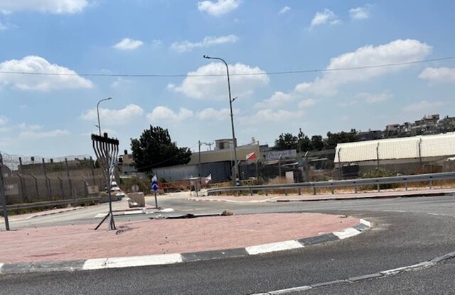
14:45 Shavei Shomron
An armored blue police Hummer, one blue policeman, one solider. The policeman is crudely brusque and commanding, “Turn around and get out…..this is Area A, only security and the army can come here.”
On question: what is the blue Israeli police doing guarding checkpoints today in cahoots with the army ?
?
Deir Sharaf
Here there are not only Palestinian flags but tee shirts and a flag bearing “Palestine 194 UN.”A small crowd of men is absorbed in watching, on the television, Abu Mazen’s joyous return to the Muquata in Ramallah. People are happy although the food delivery man filling the coolers with salads (Israeli salads) mentions that he was beaten by Border Police last Wednesday in Huwwara, and others confirmed rumors of Palestinians being fined for bearing Palestinian flags on their cars. During our whole shift, we saw only one such flag on a car, but many dozens on houses and along roadways.
Anabta
We can’t help but note that Area A which has not figured prominently on signs in the past couple of years seems to have appeared once again on these red signs, often fixed to large concrete boulders. No soldiers visible at Anabta, and the next flags spotted were at Avne Hefetz (Israeli settlement).
15:25 Jubara
The trunk of the car is checked by a gaggle of military police people, and other than a new brightly colored canvas shelter for soldiers guarding the Tulkarm exit checkpoint, northing else to report.
15:35 Irtah (Sh’ar Efraim)
Here we listen to stories of harassment and of waiting for hours to enter Israel in the early morning hours. We note that the packing case that has been placed on the far side of the turnstile leading back home for the Palestinian workers has been joined by a large load of building material, strategically placed in front of the turnstile – just a mere new obstacle! Dozens and dozens of men returning home, many bearing sweetly smelling guavas being sold by an enterprising driver at the entrance to the stop off area. One can’t help but notice the general bonhomie and good mood of the Palestinians. They have achieved much in the past week in spite of the continuation of this endless occupation.
.
'Anabta CP
See all reports for this place-
'Anabta CP
The checkpoint is located south of the village of 'Anabta, at the intersection of Road 60 (leading to Nablus at the entrance to Area A), with Road (57, 557, 5576) facing west towards the Einav settlement and the checkpoint at the exit from the West Bank - Figs checkpoint. Until 2010 we used to watch the intersection and report the long columns created due to a slow inspection of the vehicles in both directions. Oct-28-2011Anabta checkpoint 24.10.11
-
'Azzun
See all reports for this place-
Azoun (updated February 2019)
A Palestinian town situated in Area B (under civil Palestinian control and Israeli security control),
on road 5 between Nablus and Qalqiliya, east of Nabi Elias village. The inhabitants are allowed to construct and improve infrastructures. The Separation Fence has confiscated lands belonging to the town's people. In 2018 olive tree groves owned by one of its inhabitants were confiscated for the sake of paving a road to bypass Nabi Elias. Azoun population numbers 13,000, its economic state dire. Its infrastructures are poor, neglect and poverty rampant. In the meantime, the town council has completed paving an internal road for the inhabitants' welfare.
Because of its proximity to the Jewish settler-colony of Karnei Shomron and its outposts, the town suffers the intense presence of the Israeli army, especially at nighttime: soldiers enter homes, arrest suspects, trash the house and sometimes ruin it, as they do in numerous places in the West Bank. At times a checkpoint closes the entrance to the town, so no one can come in or get out.
-
Deir Sharaf checkpoint
See all reports for this place-
Deir Sharaf checkpoint is located west of Nablus and south of the settlement of Shavei Shomron, at the entrance to the village of Deir Sharaf on the road leading to Nablus. The checkpoint was activated in early March 2009 after the Beit Iba checkpoint was closed. Palestinians are allowed through the checkpoint , but not for Israelis. Unlike the checkpoints leading to Qalqilya and Tulkarm, crossing of Israeli Palestinians is only allowed on Saturdays.
 Nina SebaFeb-28-2024Deir Sharaf - the entrance to the village
-
Eliyahu CP (109) / Crossing
See all reports for this place-
Eliyahu CP (109) / Crossing This checkpoint, also known as the Fruit Crossing, is one of the main checkpoints between Israel and the West Bank. It is located on Route 55 between Alfei Menashe and the turn to Qalqilya and Zufin, more than 4 km east of the Green Line, in the separation fence, which separates Qalqilya from its lands to the south, thus leaving Alfei Menashe West of the fence - the Seam Zone. This checkpoint, a few kilometers across the Green Line, is intended for "Israeli settlement in the West Bank and the population of the Seam Zone." It is managed by a civil company. Palestinians with a special permit for their lands in the seam area are also allowed to pass through it, on foot, and sometimes by car.
-
Habla
See all reports for this place-
Habla CP (1393)
The Habla checkpoint (1393) was established on the lands of the residents of Qalqilya, on the short road that
connected it for centuries to the nearby town of Habla. The separation barrier intersects this road twice and cut off the residents of Qalqilya from their lands in the seam zone.(between the fence and the green line).
There is a passage under Road 55 that connects Qalqilya to the sabotage This agricultural barrier is used by the farmers and nursery owners established along Road 55 from the Green Line and on both sides of the kurkar road leading to the checkpoint.
This agricultural checkpoint serves the residents of Arab a-Ramadin al-Janoubi (detached from the West Bank), who pass through it to the West Bank and back to their homes. The opening hours (3 times a day) of this agricultural checkpoint are longer than usual, about an hour (recently shortened to 45 minutes), and are coordinated with the transportation hours of a-Ramadin children studying in the occupied in the West Bank. Nina SebaAug-18-2025Habla: The gate is in the process of closing
-
Irtah (Sha'ar Efrayim)
See all reports for this place-
The checkpoint is for Palestinians only. It is the main barrier to the passage of workers from the northern West Bank to Israel. Workers with a permit to work in Israel and also for trade (with appropriate permissions), medicine, and visiting prisoners. One can cross the checkpoint only on foot. The checkpoint is located north of Road 557 and south of Tulkarm. Operated by a civil security company, opening hours: between 4:00 and 19:00 on weekdays. As members of Machsom Watch, we began our shifts to this location in 2007. We arrived before it opened at 4 in the morning and report since, on the harsh conditions and the long and crowded queues of workers. The workers who pass by continue their journey by transportation to work throughout Israel. In the first period of its activity, about 3,000 and then 5,000 people passed through this checkpoint every day. Due to the small number of checking points and arbitrary delays for long periods of time in the "rooms", workers feared losing their transportation. Hence workers leave their homes at 2:30 at night to be among the first. Today, 15,000 pass and the transition is faster. Workers are still leaving their homes very early to get past the checkpoint at 7 p.m. In an adjacent compound, there is a terminal for the transfer of goods on a commercial scale, using the back-to-back method.
-
Jit Junction
See all reports for this place-
The checkpoint is located on Route 60 near at the junction with Route 55, near the village of Jit. There was a checkpoint for vehicles passing between the north and south of the West Bank, which was abolished towards 2010. Since then, surprise checkpoints have been set up there from time to time with a police or Border Police vehicle, and vehicles and their passengers are inspected.
 Anat PolakJul-17-2025Yitzhar Road, Jit Junction: traffic jam
-
Jubara (Kafriat)
See all reports for this place-
The Jabra checkpoint was on Road 557, south of Tulkarm, on the side of the Figs Pass, which is located within the Palestinian Authority (a few kilometers east of the Green Line), and serves as an entry barrier from the territories to Israel. The checkpoint to the village of Jubara, which until 2013 was in the seam area, blocked and surrounded by a fence, was intended for the passage of the family members of the house next to the checkpoint, and also for the MachsomWatch volunteers (with special permission only), on their way to checkpoint 753. on the other side of the village. The soldiers supervising the "fig crossing" also supervised the crossing at this checkpoint, in our shifts we often waited a long time until the key was found and the gate opened. The checkpoint was abolished and became part of the separation fence that was moved west following the High Court.
-
Qalqiliya checkpoint
See all reports for this place-
Qalqilya is surrounded on all sides by the separation barrier. The only exit from the city is in the east of the city on the road that leaves the city in an easterly direction. This is where the checkpoint was located. When the checkpoint was active until 2009 our shifts watched long queues of cars being inspected at the only exit from the city to the West Bank. The checkpoint was canceled, but there is a military presence at the entrance to the city.
 Nina SebaAug-18-2025Azzun: Enclosed by a high fence and the gate to the village is closed
-
Shave Shomron Checkpoint
See all reports for this place-
The checkpoint is on Route 60 (the main road to the northern West Bank), opposite settlement. Has been blocked to Palestinians since disengagement from Gaza and northern Samaria.
-