‘Anabta, ‘Azzun, Habla, Irtah (Sha’ar Efrayim), Jit Junction , Qalqiliya, Te’enim Crossing, Tue 13.12.11, Morning
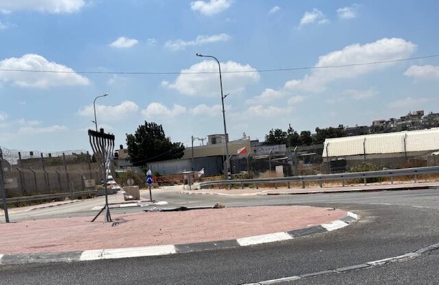
Habla
7:02 –
We arrived. The gate is closed. A military vehicle arrived at the same time we did. About 20 people were already waiting on the village side. A cart and driver waited from the direction of the plant nursery. A few minutes later one of the soldiers standing on the road along the fence turns to the driver of the cart, asking “00”? The driver nods, the soldiers waves “Yalla, come on, come on.”
For some strange reason, the notice in the plastic sleeve listing the hours the checkpoint is open hangs on the gate nearest to the plant nurseries, but the text faces Habla. And if someone coming from the village wants to read what’s on the sign, he’ll need binoculars.
7:13 –
The people from Habla begin to be let in, in groups of 5. Drivers, bicycles, horse and donkey carts – all cross that way. Five reach the revolving gate to the inspection installation, wait one by one at the revolving gate for their turn, enter the inspection room and exit again in a group after 3-4 minutes. People in one of the groups complained that the female soldier conducting the inspection keeps eating and wasting time while carrying out the inspection. The bus with the girls arrives just about now, and the boys’ bus a short time later. The first bus crossed at 7:22.
8:01 –
We left.
Qalqilya – 8:11 – We passed what had been the Qalqilya checkpoint. No soldiers. Nadim said that there had been soldiers at the entrance this past Sunday.
Azzun – 8:18 – Open. On Sunday a military vehicle stood at the entrance to the locality.
8:28 –
A military vehicle stands between Jinsafut and Funduq, soldiers next to it, but we saw no cars or people detained.
8:35 –
A military vehicle parked at the Jit junction, toward Beit Iba. No cars or people detained; a military vehicle near the turn to Yizhar/Burin, a spike barrier across the road, soldiers standing next to it. Cars stopped for inspection. We continued toward Sara and then to Qusin. Only the concrete barriers marking the lanes remain at what was once the Beit Iba checkpoint. As if the massive investment in equipment, fortification and maintaining the notorious checkpoint had never occurred. The road from where the checkpoint once stood to Deir Sharaf is still an obstacle course, filled with potholes, and it looks like additional quarries have been established gnawing away at the hills on both sides.
We continued toward the Anabta checkpoint. There the equipment is still in place. We saw no traffic to or from Tulkarm. We saw no soldiers, but according to the rumors they’re observing from the pillbox.
9:17 –
At the Jubara checkpoint – “Te’anim crossing” in Newspeak – we cross the “border” without stopping. On the roadside, next to Abu Hatem’s house, is heavy construction equipment and we already see mounds of earth. Apparently they’re laying a road to relocate the separation fence so that Jubara will again be connected to the West Bank.
We entered the parking area at the Irtach checkpoint. A metal structure that looks like a kind of bridge has been erected on the security road next to the inspection station. A fence stretches from it to a gate that can prevent access to the revolving gates through which people coming from Irtach enter the installation. We learned that it’s to inspect vehicles purchased in Israel. And it looks like this checkpoint is competing for one of the top places in the competition for “the most beautiful garden.” Drip irrigation and a rock garden have also been installed near the area of concrete barriers next to the area where cars pick up laborers in the morning.
9:34 –
We left.
'Anabta CP
See all reports for this place-
'Anabta CP
The checkpoint is located south of the village of 'Anabta, at the intersection of Road 60 (leading to Nablus at the entrance to Area A), with Road (57, 557, 5576) facing west towards the Einav settlement and the checkpoint at the exit from the West Bank - Figs checkpoint. Until 2010 we used to watch the intersection and report the long columns created due to a slow inspection of the vehicles in both directions. Oct-28-2011Anabta checkpoint 24.10.11
-
'Azzun
See all reports for this place-
Azoun (updated February 2019)
A Palestinian town situated in Area B (under civil Palestinian control and Israeli security control),
on road 5 between Nablus and Qalqiliya, east of Nabi Elias village. The inhabitants are allowed to construct and improve infrastructures. The Separation Fence has confiscated lands belonging to the town's people. In 2018 olive tree groves owned by one of its inhabitants were confiscated for the sake of paving a road to bypass Nabi Elias. Azoun population numbers 13,000, its economic state dire. Its infrastructures are poor, neglect and poverty rampant. In the meantime, the town council has completed paving an internal road for the inhabitants' welfare.
Because of its proximity to the Jewish settler-colony of Karnei Shomron and its outposts, the town suffers the intense presence of the Israeli army, especially at nighttime: soldiers enter homes, arrest suspects, trash the house and sometimes ruin it, as they do in numerous places in the West Bank. At times a checkpoint closes the entrance to the town, so no one can come in or get out.
-
Habla
See all reports for this place-
Habla CP (1393)
The Habla checkpoint (1393) was established on the lands of the residents of Qalqilya, on the short road that
connected it for centuries to the nearby town of Habla. The separation barrier intersects this road twice and cut off the residents of Qalqilya from their lands in the seam zone.(between the fence and the green line).
There is a passage under Road 55 that connects Qalqilya to the sabotage This agricultural barrier is used by the farmers and nursery owners established along Road 55 from the Green Line and on both sides of the kurkar road leading to the checkpoint.
This agricultural checkpoint serves the residents of Arab a-Ramadin al-Janoubi (detached from the West Bank), who pass through it to the West Bank and back to their homes. The opening hours (3 times a day) of this agricultural checkpoint are longer than usual, about an hour (recently shortened to 45 minutes), and are coordinated with the transportation hours of a-Ramadin children studying in the occupied in the West Bank. Nina SebaAug-18-2025Habla: The gate is in the process of closing
-
Irtah (Sha'ar Efrayim)
See all reports for this place-
The checkpoint is for Palestinians only. It is the main barrier to the passage of workers from the northern West Bank to Israel. Workers with a permit to work in Israel and also for trade (with appropriate permissions), medicine, and visiting prisoners. One can cross the checkpoint only on foot. The checkpoint is located north of Road 557 and south of Tulkarm. Operated by a civil security company, opening hours: between 4:00 and 19:00 on weekdays. As members of Machsom Watch, we began our shifts to this location in 2007. We arrived before it opened at 4 in the morning and report since, on the harsh conditions and the long and crowded queues of workers. The workers who pass by continue their journey by transportation to work throughout Israel. In the first period of its activity, about 3,000 and then 5,000 people passed through this checkpoint every day. Due to the small number of checking points and arbitrary delays for long periods of time in the "rooms", workers feared losing their transportation. Hence workers leave their homes at 2:30 at night to be among the first. Today, 15,000 pass and the transition is faster. Workers are still leaving their homes very early to get past the checkpoint at 7 p.m. In an adjacent compound, there is a terminal for the transfer of goods on a commercial scale, using the back-to-back method.
-
Jit Junction
See all reports for this place-
The checkpoint is located on Route 60 near at the junction with Route 55, near the village of Jit. There was a checkpoint for vehicles passing between the north and south of the West Bank, which was abolished towards 2010. Since then, surprise checkpoints have been set up there from time to time with a police or Border Police vehicle, and vehicles and their passengers are inspected.
 Anat PolakJul-17-2025Yitzhar Road, Jit Junction: traffic jam
-
Qalqiliya checkpoint
See all reports for this place-
Qalqilya is surrounded on all sides by the separation barrier. The only exit from the city is in the east of the city on the road that leaves the city in an easterly direction. This is where the checkpoint was located. When the checkpoint was active until 2009 our shifts watched long queues of cars being inspected at the only exit from the city to the West Bank. The checkpoint was canceled, but there is a military presence at the entrance to the city.
 Nina SebaAug-18-2025Azzun: Enclosed by a high fence and the gate to the village is closed
-
Te'enim Crossing
See all reports for this place-
Te'enim Crossing The Figs checkpoint, located on Road 557, east of the Green Line and the Ephraim Checkpoint (Road 444), is a vehicle crossing, open 24/7 all year round. It serves the Israeli population, including those authorized to enter the Palestinian Authority. The passage of foreigners holding international passports recognized by the State of Israel is approved. In exceptional cases will the passage of a Palestinian be allowed here.
-