‘Azzun ‘Atma, Habla, Kifl Harith, Za’tara (Tapuah), Thu 22.8.13, Afternoon

Translation: Shelly K.
13:45 Habla Checkpoint – Few Palestinians walk through, some are in their vehicles, all are checked, on both sides, the checkpoint will close at 14:00 as usual.
13:50 – Eliyahu Gate – There is no police presence at the entrance. Right near the gate, there is a square being built: the design (at first) is reminiscent of the ornamentedsquare that was built near the Huwwara checkpoint…(at the turnoff to the settlement of Bracha)
14:14– A vehicle that appears to be military and has a Biblical poster (!?) on it emerges from the Gilad settlement
14:20– Next to the settlement of Emmanuel we see a path to a new road towards a hilltop that is still unpopulated. Who is this meant for?
14:30 – Kifl Harith Checkpoint – Next to the checkpoint which is open, there is an army jeep.
14:40 – Za’atra Checkpoint – Tapuach Junction – In the checkpoint parking lot there are soldiers. They do not check at the positions. On the other hand, outside of the checkpoint, near the settler’s “Trampiada” (towards Ramallah), a car is parked and two soldiers are checking its contents while the passengers wait outside (pictured). As of late this is a usual occurrence.
We visited Hirbet Yinun which is north of Akrabavillage, a small village on the side of the hill. Of the 40 families that once lived here, 6 remain. The settlement Itamar, its homes and agricultural fields, are closing in on every side and threaten to ‘choke’ what’s left of the village. On the southern part, where it is still possible for Hirbet Yinun residents to reach Akraba, the settlers of Itamar frequently drive on their tractors. Lately, they have been seen fully clothed in the village’s drinking water reservoir, small and temporary, but preventing the villagers from drinking the water. An army patrol jeep passes each day along the village borders. The residents are poor and most of them have no cars to leave the village. They must use Taxis (NIS 20 to Akraba and another NIS 30 to Nablus). Olive trees are their means of support, when they are allowed to access the trees and harvest them. It is fortunate that volunteers from overseas live there: the village’s housing is used as a starting point for volunteer activities in other places. We thanked them.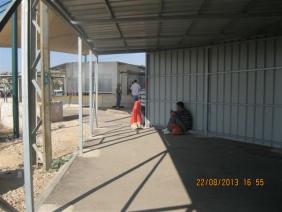
16:00 – Azzun Atma Checkpoint A military command car hides the entrance to the checkpoint. This is the hour that workers return home from a week’s work – there is no crowding on the line. A Palestinian laborer is sent to stand on the side: he went through without a permit and was punished. His papers were taken, and he was told to wait for the police. Delayed and humiliated (see photo). In an evening call to him he said he was freed and allowed to return home at 19:00.
'Azzun 'Atma
See all reports for this place-
'Azzun 'Atma
A Palestinian village of about 1,800 residents. The settlement of Sha'arei Tikva was established on its land adjacent to it, and the settlement of Oranit was established on its agricultural lands. By 2013, the separation fence had passed through the village and a checkpoint staffed by the army allowed the residents to cross from side to side. After building a massive wall surrounding the village and some of its agricultural lands, the residents went daily for five years to their lands that remained in the Seam Zone through the Oranit agricultural checkpoint (4). Since 2018 it has only opened during the olive harvest and the farmers have to pass daily at the Beit Amin / Abu Salman checkpoint (1447), about 3 kilometers north.From a report from March 24, 2021: "The farmers from Beit Amin and Azon Atma are happy that since February 21 the Oranit checkpoint .is going to be open 3 times a day, The farmers are really developing the place."
Report from July 14, 2024: "Ornit checkpoint is closed . The Beit Amin/Abu Salman agricultural checkpoint is closed (there is no contact with the military to check if it opens rarely), the Ezbat Jaloud checkpoint was opened once a day before the war.
Updated for July 2024
 Apr-11-2019Azoun: The main entrance to village blocked now for several weeks
-
Habla
See all reports for this place-
Habla CP (1393)
The Habla checkpoint (1393) was established on the lands of the residents of Qalqilya, on the short road that
connected it for centuries to the nearby town of Habla. The separation barrier intersects this road twice and cut off the residents of Qalqilya from their lands in the seam zone.(between the fence and the green line).
There is a passage under Road 55 that connects Qalqilya to the sabotage This agricultural barrier is used by the farmers and nursery owners established along Road 55 from the Green Line and on both sides of the kurkar road leading to the checkpoint.
This agricultural checkpoint serves the residents of Arab a-Ramadin al-Janoubi (detached from the West Bank), who pass through it to the West Bank and back to their homes. The opening hours (3 times a day) of this agricultural checkpoint are longer than usual, about an hour (recently shortened to 45 minutes), and are coordinated with the transportation hours of a-Ramadin children studying in the occupied in the West Bank. Nina SebaAug-18-2025Habla: The gate is in the process of closing
-
Kifl Harith
See all reports for this place-
Kifl Harith
This is a Palestinian located north-west of the settler-colony town of Ariel, 18 kilometers south of the city of Nablus. It numbers 3, 206 inhabitants, as of 2007. 42% of the village lands lie in Area B, and 58% in Area C. In 1978, some hundreds of dunams of the village’s farmland was sequestered in order to found the settler-colony of Ariel – in total 5,184 dunams from the Palestinian communities of Salfit, Iscaqa, Marda, and Kifl Harith. Dozens of square kilometers were also confiscated for paving road no. 5 as well as road 505 and their buffer zones, and the Israeli electricity company’s power station. Over the years the village has suffered harassment by sometimes-armed settler-colonists, even casualties. In 1968 the army’s rabbinate ruled the maqam site Nabi Yanoun (sanctified grave of the Prophet Yanoun) is in fact the tomb of Joshua, Son of Nun. Another structure in the village, named Nabi Tul Kifl by the Palestinians, has been identified by the Israeli authorities as to the tomb of Caleb, Son of Yefuneh. These sites are located in the heart of the village, near the mosque, and at times of Jewish religious festivities and pilgrimages, the center of the village is illuminated by projectors and thousands of Jews arrive, protected by hundreds of Israeli soldiers. During such a period, a night curfew is imposed on the village and the villagers are forced to stay shut inside their homes.
-
Za'tara (Tapuah)
See all reports for this place-
Za'tara (Tapuah) Za'tara is an internal checkpoint in the heart of the West Bank, at the intersection of Road 60 and Road 505 (Trans-Samaria), east of the Tapuah settlement. This checkpoint is the "border" marked by the IDF between the north and south of the West Bank, in accordance with the policy of separation between the two parts of the West Bank that has been in place since December 2005. At the Za'tara checkpoint, there are separate routes for Israelis and Palestinians. In the route for Israelis, there are no inspections and the route for Palestinians inspects. The queue lengthens and shortens suits. The checkpoint is open 24 hours a day. The checkpoint is partially staffed and the people who pass through it are checked at random.
 Shoshi AnbarSep-27-2023Za'atra (Tapuah Intersection). Signs
-