‘Azzun, Beit Furik, Eliyahu Crossing, Jit Junction , Qalqiliya, Shomron Crossing, Za’tara (Tapuah), Sun 12.5.13, Morning
'Azzun
See all reports for this place-
Azoun (updated February 2019)
A Palestinian town situated in Area B (under civil Palestinian control and Israeli security control),
on road 5 between Nablus and Qalqiliya, east of Nabi Elias village. The inhabitants are allowed to construct and improve infrastructures. The Separation Fence has confiscated lands belonging to the town's people. In 2018 olive tree groves owned by one of its inhabitants were confiscated for the sake of paving a road to bypass Nabi Elias. Azoun population numbers 13,000, its economic state dire. Its infrastructures are poor, neglect and poverty rampant. In the meantime, the town council has completed paving an internal road for the inhabitants' welfare.
Because of its proximity to the Jewish settler-colony of Karnei Shomron and its outposts, the town suffers the intense presence of the Israeli army, especially at nighttime: soldiers enter homes, arrest suspects, trash the house and sometimes ruin it, as they do in numerous places in the West Bank. At times a checkpoint closes the entrance to the town, so no one can come in or get out.
-
Beit Furik checkpoint
See all reports for this place-
One of the three internal checkpoints that closed on the city of Nablus - Beit Furik to the east, Hawara to the south, Beit Iba to the west. The checkpoint is located at the junction of Roads 557 (an apartheid road that was forbidden for Palestinians), leading to the Itamar and Alon Morea settlements and Road 5487. The checkpoint was established in 2001 for pedestrians and vehicles; The opening hours were short and the transition was slow and very problematic.Allegedly, the checkpoint is intended to monitor the movement to and from Nablus of the residents of Beit Furik and Beit Dajan, being the only opening outside their villages. Since May 2009 the checkpoint is open 24 hours a day, the military presence is limited, vehicles can pass through it without inspections, except for random inspections. (Updated April 2010)
-
Eliyahu CP (109) / Crossing
See all reports for this place-
Eliyahu CP (109) / Crossing This checkpoint, also known as the Fruit Crossing, is one of the main checkpoints between Israel and the West Bank. It is located on Route 55 between Alfei Menashe and the turn to Qalqilya and Zufin, more than 4 km east of the Green Line, in the separation fence, which separates Qalqilya from its lands to the south, thus leaving Alfei Menashe West of the fence - the Seam Zone. This checkpoint, a few kilometers across the Green Line, is intended for "Israeli settlement in the West Bank and the population of the Seam Zone." It is managed by a civil company. Palestinians with a special permit for their lands in the seam area are also allowed to pass through it, on foot, and sometimes by car.
-
Jit Junction
See all reports for this place-
The checkpoint is located on Route 60 near at the junction with Route 55, near the village of Jit. There was a checkpoint for vehicles passing between the north and south of the West Bank, which was abolished towards 2010. Since then, surprise checkpoints have been set up there from time to time with a police or Border Police vehicle, and vehicles and their passengers are inspected.
 Anat PolakJul-17-2025Yitzhar Road, Jit Junction: traffic jam
-
Qalqiliya checkpoint
See all reports for this place-
Qalqilya is surrounded on all sides by the separation barrier. The only exit from the city is in the east of the city on the road that leaves the city in an easterly direction. This is where the checkpoint was located. When the checkpoint was active until 2009 our shifts watched long queues of cars being inspected at the only exit from the city to the West Bank. The checkpoint was canceled, but there is a military presence at the entrance to the city.
 Nina SebaAug-18-2025Azzun: Enclosed by a high fence and the gate to the village is closed
-
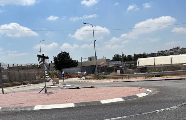
Shomron Crossing
See all reports for this place-
Shomron Crossing The Shomron checkpoint for vehicles. is located east of Rosh HaAyin and Kafr Qassem, on Road 5 (Trans-Samaria) leading to Ariel and the Za'atara junction. It is intended for blue ID cardholders, foreign guests or diplomats, and international organizations only. In 2009 the management was entrusted to a civil security company.
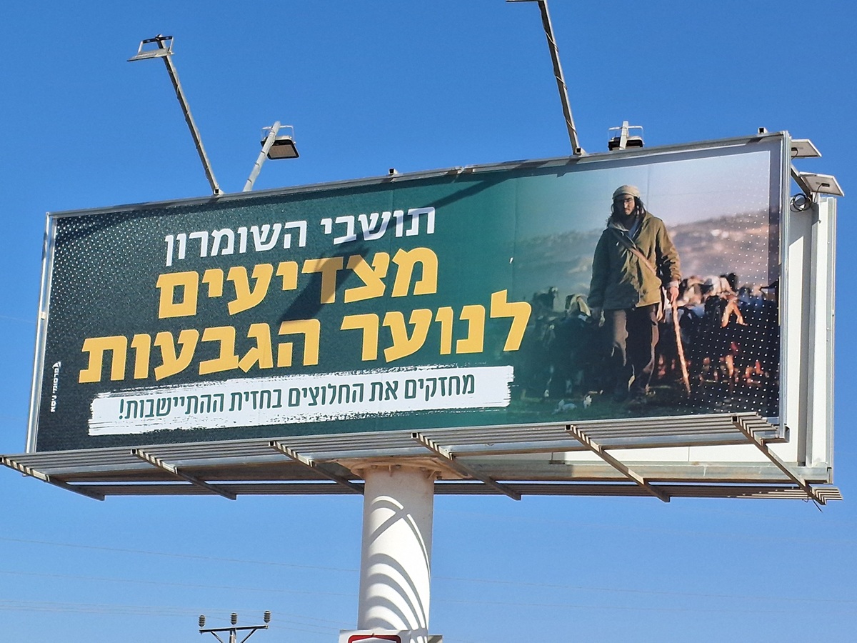 Ronit Dahan-RamatiAug-21-2025Highway 505: Salute to the Hilltop Youth
-
Za'tara (Tapuah)
See all reports for this place-
Za'tara (Tapuah) Za'tara is an internal checkpoint in the heart of the West Bank, at the intersection of Road 60 and Road 505 (Trans-Samaria), east of the Tapuah settlement. This checkpoint is the "border" marked by the IDF between the north and south of the West Bank, in accordance with the policy of separation between the two parts of the West Bank that has been in place since December 2005. At the Za'tara checkpoint, there are separate routes for Israelis and Palestinians. In the route for Israelis, there are no inspections and the route for Palestinians inspects. The queue lengthens and shortens suits. The checkpoint is open 24 hours a day. The checkpoint is partially staffed and the people who pass through it are checked at random.
 Shoshi AnbarSep-27-2023Za'atra (Tapuah Intersection). Signs
-