Central West Bank: gates are closed and soldiers are manning military stations
13:30 – Jinsafut Two gates were recently constructed at the 2 entrances to the village and a military jeep is driving around on the main road.
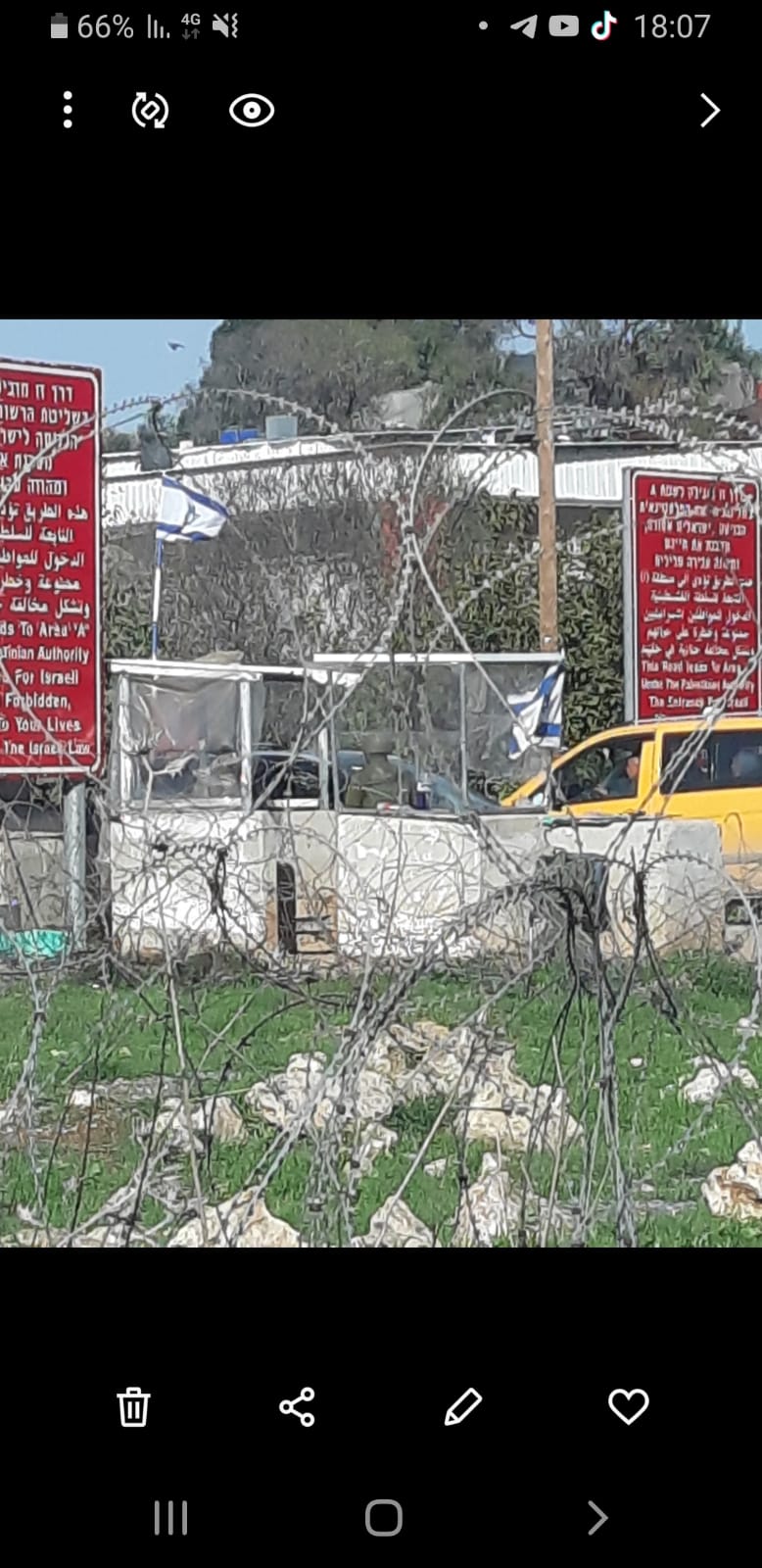
Funduk – Two stations manned at the entrance to the village.
Jit junction – The checkpoint is closed and the turn to the right toward the road to Yizhar/Huwarra there are 3 military stations and a tent manned with soldiers. On the way, the northern entrance of Madama is closed and there is a military vehicle standing next to the gate.

Huwara – Most of the shops are open, but the road is empty and there is almost no traffic. Every few meters there is a station manned by 4 soldiers. Next to the bridge on the road bypassing Huwara there is a manned military station and a Palestinian vehicle being checked. Of course, the checkpoint of Huwara is closed and soldiers are moving about in the area.
Awarta – The checkpoing is open; a line of vehicles from both directions, from north and south, because of the inspections being carried out.
Beit Furik – The checkpoint is open, inspections carried out, not possible to get close.
Burin – There is a manned station next to the school, soldiers in the area.

Asira al-Qibliya – We visited the house which settlers burned on 12.2. The settlers came down at 7:30 to the house near the settlement of Yizhar, accompanied by soldiers. (near the house, on the hill, there is a permanent military post).
Luckily, the doors and windows were made of iron; next to one of the doors, there was door made of plastic screening which the settlers were able to burn. The walls and ceiling of the balcony were charred.
When we left, they began to throw stones. The owner of the house said that he sleeps with one eye open because he never knows when they might return and he has small children and an infant in the house.
'Awarta
See all reports for this place-
Awarta, an internal checkpoint in the heart of the West Bank, is located east of the Hawara checkpoint, at the junction of Roads 555 (which was forbidden for Palestinian traffic in this area) and the entrance road to Nablus. It was one of the four checkpoints that surrounded Nablus until 2009. We used to watch it at Huwwara shifts because it was the only one where goods could be transferred to and from Nablus, using the back-to-back method. It was operated by the army, from 06:00 to 20:00. Until 2009.
 Ronit Dahan-RamatiJan-6-2026Awarta: Traffic jam on the way to Nablus
-
Beit Furik checkpoint
See all reports for this place-
One of the three internal checkpoints that closed on the city of Nablus - Beit Furik to the east, Hawara to the south, Beit Iba to the west. The checkpoint is located at the junction of Roads 557 (an apartheid road that was forbidden for Palestinians), leading to the Itamar and Alon Morea settlements and Road 5487. The checkpoint was established in 2001 for pedestrians and vehicles; The opening hours were short and the transition was slow and very problematic.Allegedly, the checkpoint is intended to monitor the movement to and from Nablus of the residents of Beit Furik and Beit Dajan, being the only opening outside their villages. Since May 2009 the checkpoint is open 24 hours a day, the military presence is limited, vehicles can pass through it without inspections, except for random inspections. (Updated April 2010)
-
Burin (Yitzhar)
See all reports for this place-
Burin (Yitzhar)
This is a Palestinian village in the Nablus governorate, a little south of Nablus, on the main road passing through the West Bank. The settlements: Yitzhar and Har Bracha, settled in locations that surrounded the village, placed fences so it is cut off the main road.
There are around 4000 inhabitants. Most of them are engaged in agriculture and pasture, although many graduates of the two secondary schools continue to study at the university. Academic positions are hardly available, they find work as builderd, or leave for the Gulf countries.
The village lands were appropriated several times for the establishment of Israeli settlements and military bases, and as a result, Burin's land and water resources dwindled. lSince 1982, more than 2,000 dunams of village land have been declared "state land" and then transferred to Har Bracha settlement.
Over the past few years and more so since 2017, the villagers have been terrorized by the residents of Yitzhar and Har Bracha, the Givat Ronen outpost and others. Despite the close proximity of soldiers to an IDF base close to one of the village's schools, residents are suffering from numerous stone-throwing events, vehicle and fire arson, also reported in the press.
In 2023, the prevention of the olive harvest in the village plot was more violent than ever. Soldiers and settlers walked with drawn weapons between the houses of the village and demanded that people stop harvesting in the village itself and in the private plots outside the village. The settlers from Yitzhar and Giv'at Roned raided the olive groves and stole crops. 300 olive trees belonging to the residents of Burin, near Yitzhar, were uprooted. The loss of livelihood from the olives causes long-term economic damage to the farmers' families, bringing them to the point of starvation.
(updated for November 2023)
-
Huwwara
See all reports for this place-
The Huwwara checkpoint is an internal checkpoint south of the city of Nablus, at the intersection of Roads 60 and 5077 (between the settlements of Bracha and Itamar). This checkpoint was one of the four permanent checkpoints that closed on Nablus (Beit Furik and Awarta checkpoints to the east and the Beit Iba checkpoint to the west). It was a pedestrian-only barrier. As MachsomWatch volunteers, we watched therre since 2001 two shifts a day - morning and noon, the thousands of Palestinians leaving Nablus and waiting for hours in queues to reach anywhere else in the West Bank, from the other side of the checkpoint the destination could only be reached by public transport. In early June 2009, as part of the easing of Palestinian traffic in the West Bank, the checkpoint was opened to vehicular traffic. The passage was free, with occasional military presence in the guard tower. Also, there were vehicle inspections from time to time. Since the massacre on 7.10.2023, the checkpoint has been closed to Palestinians.
On February 26, 2023, about 400 settlers attacked the town's residents for 5 hours and set fire to property, such as houses and cars. Disturbances occurred in response to a shooting of two Jewish residents of Har Bracha by a Palestinian Terrorist. The soldiers stationed in the town did not prevent the arson and rescued Palestinian families from their homes only after they were set on fire. No one was punished and Finance Minister Smotrich stated that "the State of Israel should wipe out Hawara." Left and center organizations organized solidarity demonstrations and support actions for the residents of Hawara.Hawara continued to be in the headlines in all the months that followed: more pogroms by the settlers, attacks by Palestinians and a massive presence of the army in the town. It amounted to a de facto curfew of commerce and life in the center of the city. On October 5, 2023, MK Zvi established a Sukkah in the center of Hawara and hundreds of settlers backed the army blocked the main road and held prayers in the heart of the town all night and the next day. On Saturday, October 7, 23 The "Swords of Iron" war began with an attack by Hamas on settlements surrounding Gaza in the face of a poor presence of the IDF. Much criticism has been made of the withdrawal of military forces from the area surrounding Gaza and their placement in the West Bank, and in the Hawara and Samaria region in particular, as a shield for the settlers who were taking over and rioting.
On November 12, 2023, the first section of the Hawara bypass road intended for Israeli traffic only was opened. In this way, the settlers can bypass the road that goes through the center of Hawara, which is the main artery for traffic from the Nablus area to Ramallah and the south of the West Bank. For the construction of the road, the Civil Administration expropriated 406 dunams of private land belonging to Palestinians from the nearby villages. The settlers are not satisfied with this at the moment, and demand to also travel through Hawara itself in order to demonstrate presence and control.(updated November 2023)
. Shoshi AnbarMay-18-2025Huwara: The old houses in Area C
-
Madama
See all reports for this place-
Madama
This village is situated in the Nablus district, about 5 kilometers south of the city of Nablus, at an altitude of 517 meters above sea level. Madama was founded 400 years ago and its villagers originate from the Arabian Peninsula. It numbered 1,728 inhabitants in 2007. 62% of the village area is categorized as Area B, and 38% as Area C.
Over the years, hundreds of dunams have been robbed of the village for the purpose of building settler-colonies, army bases, and paving roads:139 dunams were sequestered to found settler-colony Yitzhar south of the village, and the land was also confiscated for paving road 60. The road and its buffer zone (75 meters on each side) lined by barbed wire fences separate the village’s farmlands to the north and the village farmers are denied access to tend them. The road also separates Madama and Burin, two villages with close neighborly ties, and now not able to access the road directly.
The settler-colony Yitzhar has become a daily threat to the village. The settler-colonists planted trees in fenced-in groves, steal crops, burn, uproot and vandalize Palestinians’ trees, and harm both holy sites and property. They also attack the Palestinian landowners in order to terrorize them and prevent them from accessing their lands.
For further information: http://vprofile.arij.org/nablus/pdfs/vprofile/Madama_vp_en.pdf
-