Hebron, South Hebron Hills
Shima: The construction of the students’ village is very advanced. ( http://kedma-hityashvut.org/shima2) Interesting to know how it is defined – a neighborhood of Shima?
We started the shift at the southern entrance to Hebron, the road to Havat-Gal and the industrial area of Kiryat Arba. Next to Havat-Gal, only meters from the closest caravan, we met Shakar Tamimi – an older Palestinian, whose 9 children live in the area. He took us to his vegetable garden – fenced of course; behind it there is another fenced area that extends to Havat-Gal. A small road leading to Havat-Gal passes next to the vegetable garden and below Tamimi’s house.
There is another road leaving to Havat-Gal, on the other side, but because of Kiryat Arba, the shorter road crosses Tamimi’s property.
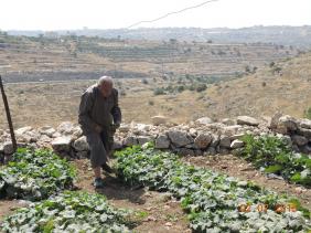
Tamimi tells us that the fenced area next to his vegetable garden belongs to him and that the road was built on his property, naturally without his agreement. He cannot graze his flock of sheep in the fenced area next to his vegetable garden – the Havat-Gal settlers immediately appear, threaten him, and expel him. The soldiers from the adjacent base – located immediately above Tamimi’s property – appear but don’t interfere, even though he showed them the deed to his land. They advised him to call the police. He has a camera from B’tselem. He has a court case against the road that was built on his property – he is being helped by a lawyer from the organization “Rabbis for Human Rights”. Havat-Gal was built 12 years ago. The first settler was Elihu (Baruch) Goldstein – the son of. Tamimi speaks in the tone of a peaceful person but he is determined not to give up.
Hebron
The House of Contention – there is an army position on the roof. Below, there is a checkpoint for Palestinian residents. It seems that the army helps, and perhaps also funds (who knows?), life in the House of Contention. For example – who funds the water tanks on the roof of the building? The army and the apartment residents seem intertwined.
In front of Hadassah house –a lovely garden that seems to be relatively new. Presumably, unlike the garden of the girls’ school (Palestinian), above, this garden will not be neglected (reminder: the garden on the way to the girls’ school was destroyed many times).
Tel-Rumeida: The steep descent from the top of the Tel to the Jewish neighborhood provides a picture of the hard life of the Palestinian residents of the Tel, who are not allowed to bring their cars into the neighborhood: a very young woman the young child with her try to control a cart filled with potatoes that threatens to roll down the steep hill.
Our return trip was by way of the Zif intersection and Yatta.
Pictures appear below:
Hebron
See all reports for this place-
According to Wye Plantation Accords (1997), Hebron is divided in two: H1 is under Palestinian Authority control, H2 is under Israeli control. In Hebron there are 170,000 Palestinian citizens, 60,000 of them in H2. Between the two areas are permanent checkpoints, manned at all hours, preventing Palestinian movement between them and controlling passage of permit holders such as teachers and schoolchildren. Some 800 Jews live in Avraham Avinu Quarter and Tel Rumeida, on Givat HaAvot and in the wholesale market.
Checkpoints observed in H2:
- Bet Hameriva CP- manned with a pillbox
- Kapisha quarter CP (the northern side of Zion axis) - manned with a pillbox
- The 160 turn CP (the southern side of Zion axis) - manned with a pillbox
- Avraham Avinu quarter - watch station
- The pharmacy CP - checking inside a caravan with a magnometer
- Tarpat (1929) CP - checking inside a caravan with a magnometer
- Tel Rumeida CP - guarding station
- Beit Hadassah CP - guarding station
Three checkpoints around the Tomb of the Patriarchs
 Raya YeorDec-18-2025Hebron - Yusri Jaber and part of his family
-
South Hebron Hills
See all reports for this place-
South Hebron Hills
South Hebron Hills is a large area in the West Bank's southern part.
Yatta is a major city in this area: right in the border zone between the fertile region of Hebron and its surroundings and the desert of the Hebron Hills. Yatta has about 64,000 inhabitants.
The surrounding villages are called Masafer Yatta (Yatta's daughter villages). Their inhabitants subsist on livestock and agriculture. Agriculture is possible only in small plots, especially near streams. Most of the area consists of rocky terraces.Since the beginning of the 1980s, many settlements have been established on the agricultural land cultivated by the Palestinians in the South Hebron Hills region: Carmel, Maon, Susia, Masadot Yehuda, Othniel, and more. Since the settlements were established and Palestinians cultivation areas have been reduced; the residents of the South Hebron Hills have been suffering from harassment by the settlers. Attempts to evict and demolish houses have continued, along with withholding water and electricity. The military and police usually refrain from intervening in violent incidents between settlers and Palestinians do not enforce the law when it comes to the investigation of extensive violent Jewish settlers. The harassment in the South Hebron Hills includes attacking and attempting to burn residential tents, harassing dogs, harming herds, and preventing access to pastures.
There are several checkpoints in the South Hebron Hills, on Routes 317 and 60. In most of them, no military presence is apparent, but rather an array of pillboxes monitor the villages. Roadblocks are frequently set up according to the settlers and the army's needs. These are located at the Zif Junction, the Dura-al Fawwar crossing, and the Sheep Junction at the southern entrance to Hebron.
Updated April 2022
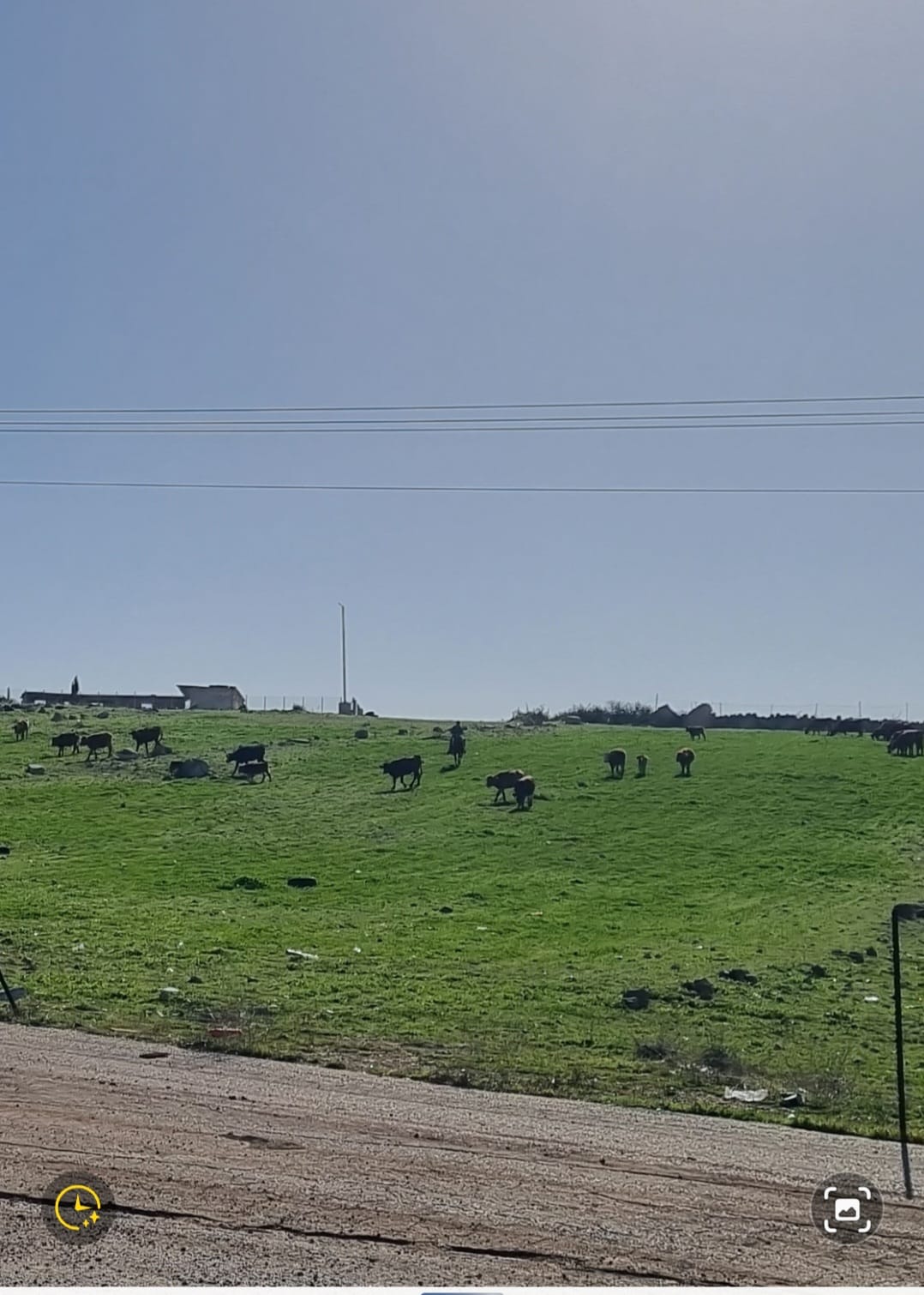 Smadar BeckerJan-12-2026A herd of cows in the area of Zanuta, from which its residents were expelled, accompanied by a settler on horseback
-