Hebron, South Hebron Hills, Sun 14.8.11, Morning


Meitar CP
empty
Road No. 60
little traffic, and side roads open. Near the Matak Yehuda (local DCO), east of Beit Haggai, there appears to be some sort of military exercise, with many army vehicles parked just off the highway.
Entrance to Kiriat Arba
the entry road has been renovated so that there are now 4 lanes, and new bus stops. Your taxes at work.
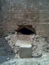
Standing at the lookout above Havat Federman(Federman Farm), an illegal outpost set up by prominent settler leader Noam Federman, former leader of the KachParty. It has been repeatedly dismantled by the army, but it's obvious that people are still living there. In addition to three cars, and several makeshift structures, there is an Indian-style teepee.
Hebron
The city is quiet and almost empty.
The Gutnik Center in front of the Patriarchs' Cave Tomb has been renovated & upgraded. A new pergola boasts the slogan "Israeli sovereignty in Judea and Samaria."
The army base on Shuhada St. has again opened its entry gates so that settlers can use it as a short cut to the adjacent Avraham Avinu neighborhood. This after a ruling last February by the commander of the Hebron Brigade that this was forbidden – in other words, it is against military orders to open the gate to anyone but military personnel. The sign forbidding non-military personnel from entering has been taken down. The huge gate, decorated with the emblems of the various units serving there, now carries additional artwork obviously carried out by settlers, and the huge title above all – "Havron – Hibbur" (hevron = connection, correct linguistic analysis but obviously Jewish-oriented, i. e., sectorial rather than Israeli-neutral.)
Leah gets out of the van and energetically explains this to the young soldiers, who seem to find this amusing, but do not reply.
Further along Shuhada street, another passageway between Palestinian houses linking the street to the adjoining neighborhood has been blocked by cement and stones.
We return to the Meitar CP at 10:15. The female guard asks where Shahar is. (She's the student volunteer who has now gone abroad.)
N.B. Question for anyone who knows: In 2008 Peace Now submitted a petition to the High Court requesting that the army evacuate settlers residing inside the Hebron Military Base referred to above. Was the petition ever heard by the court, and what was the outcome? Are there still Jewish non-military residents of Hebron living on the base? (I've sent a message to Peace Now to ask about this.)
Hebron
See all reports for this place-
According to Wye Plantation Accords (1997), Hebron is divided in two: H1 is under Palestinian Authority control, H2 is under Israeli control. In Hebron there are 170,000 Palestinian citizens, 60,000 of them in H2. Between the two areas are permanent checkpoints, manned at all hours, preventing Palestinian movement between them and controlling passage of permit holders such as teachers and schoolchildren. Some 800 Jews live in Avraham Avinu Quarter and Tel Rumeida, on Givat HaAvot and in the wholesale market.
Checkpoints observed in H2:
- Bet Hameriva CP- manned with a pillbox
- Kapisha quarter CP (the northern side of Zion axis) - manned with a pillbox
- The 160 turn CP (the southern side of Zion axis) - manned with a pillbox
- Avraham Avinu quarter - watch station
- The pharmacy CP - checking inside a caravan with a magnometer
- Tarpat (1929) CP - checking inside a caravan with a magnometer
- Tel Rumeida CP - guarding station
- Beit Hadassah CP - guarding station
Three checkpoints around the Tomb of the Patriarchs
 Raya YeorDec-18-2025Hebron - Yusri Jaber and part of his family
-
South Hebron Hills
See all reports for this place-
South Hebron Hills
South Hebron Hills is a large area in the West Bank's southern part.
Yatta is a major city in this area: right in the border zone between the fertile region of Hebron and its surroundings and the desert of the Hebron Hills. Yatta has about 64,000 inhabitants.
The surrounding villages are called Masafer Yatta (Yatta's daughter villages). Their inhabitants subsist on livestock and agriculture. Agriculture is possible only in small plots, especially near streams. Most of the area consists of rocky terraces.Since the beginning of the 1980s, many settlements have been established on the agricultural land cultivated by the Palestinians in the South Hebron Hills region: Carmel, Maon, Susia, Masadot Yehuda, Othniel, and more. Since the settlements were established and Palestinians cultivation areas have been reduced; the residents of the South Hebron Hills have been suffering from harassment by the settlers. Attempts to evict and demolish houses have continued, along with withholding water and electricity. The military and police usually refrain from intervening in violent incidents between settlers and Palestinians do not enforce the law when it comes to the investigation of extensive violent Jewish settlers. The harassment in the South Hebron Hills includes attacking and attempting to burn residential tents, harassing dogs, harming herds, and preventing access to pastures.
There are several checkpoints in the South Hebron Hills, on Routes 317 and 60. In most of them, no military presence is apparent, but rather an array of pillboxes monitor the villages. Roadblocks are frequently set up according to the settlers and the army's needs. These are located at the Zif Junction, the Dura-al Fawwar crossing, and the Sheep Junction at the southern entrance to Hebron.
Updated April 2022
 MuhammadFeb-24-2026South Hebron Hill, Beit Hagai: Paving an internal security road
-