Jerusalem-surround: Desolate and dreary. It hurts to see the emptiness

Due to traveling abroad, we hadn’t done the rounds for about two months, so this time we spread out on several fronts. We found that there are changes. The routine of “almost closed” has become norm at the large checkpoints, which open in the morning for one and a half hours (the Olives) up to three (Bethlehem), according to a report by Tamar P. The same is true in Qalandiya. it hurts to see the emptiness.
In the afternoons there are changes for the purpose of signing in the returnees (the administration’s wet dream of tracking those who stay beyond working hours has come true). The only option is to find out if there are exceptions. But who can you speak to in this hostile administration? It’s worth checking out the afternoon shift as well, and we’ll do that later.


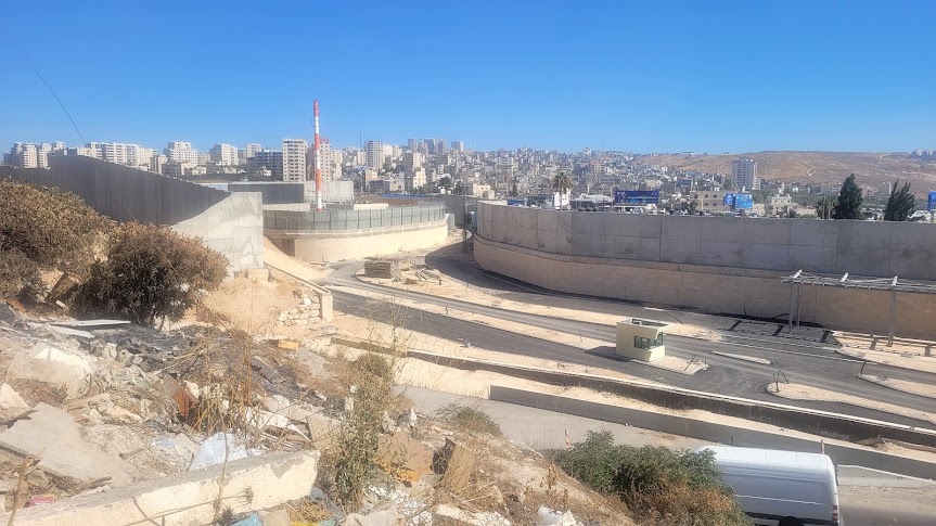
News in the realm of roads and construction – at the Olive checkpoint we discovered that there are preparations for a grandiose excavation of the “Sheikh Inbar Tunnel” – a 1.6 km tunnel from Highway 1 to Silwan under Palestinian neighborhoods.
There is expansion work at Anata, perhaps for a new checkpoint (the residents’ hypothesis), and on the way to Qalandiya, in the town of Hizma, the day before, they destroyed, without warning, a garage belonging to our acquaintance from Sinjil. At the Qalandiya checkpoint we saw advanced stages of a checkpoint-bypassing road for Israelis only, and standstill traffic from Kfar Akab and the Qalandiya camp towards the south. A daily nightmare added to the lack of water.
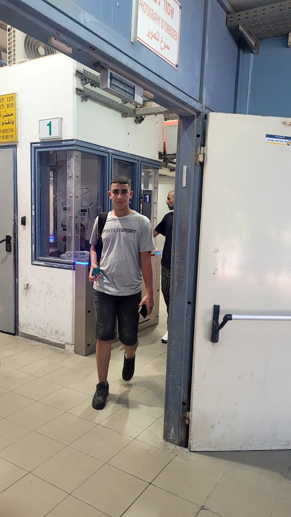
7:15. Bethlehem checkpoint (300) – They opened at 6:00 am and will close at 9:00 am, but it is now a wasteland. There are two open positions and so very few passers. The passage by vehicle to Bethlehem is open. There are no active buses, there is one coffee and pretzel stand. Desolation and dreariness.
Driving on the American highway south of Sheikh Sa’ed, unfortunately, we did not manage to meet with an acquaintance of ours there, to hear what is happening in that village now isolated from its mother-village, Jabell Mukaber. If we pass we will not be able to return because the checkpoint is only for villagers with a blue card or a permit. Because of the school holidays, almost no one passes. All the loosening of restrictions promised to the residents by the Supreme Court were forgotten.
We drove on the American highway that was slightly widened up to the turn to Silwan. From where it is bumpy and narrow (apparently beyond that turn it is no longer interesting because there will be a tunnel for the Israelis). When we arrived in Ras Al Amud the gate of the Ma’ale Ha-Zeytim settlement was open and we photographed the old police station which is at the core of the large settlement, so strategic for the Jews of East Jerusalem. Ultra-Orthodox women and children huddled at the gate and waited for transportation to the schools in the Jewish Quarter and more. More at our (taxpaying)expense: a minibus that is parked opposite and goes to the Western Wall every half hour.


From there to Abu Dis, the old blocked road to Jericho, a look at the Cliff Hotel, which is deteriorating day by day, and checking whether they started building the “Kidmat Zion” neighborhood that was approved a power seizure of expedited and non-standard procedures. 384 housing units under the initiative of “Ateret Kohanim”.
We drove, with the Mount of Olives below us, to the Olive checkpoint located opposite the A-Tur neighborhood (for orientation: Augusta Victoria Hospital), which sits between the Olives and Mount Scopus. A steep ascent made of everything built around leads to the checkpoint. It will be dominating and high and difficult for the target audience…

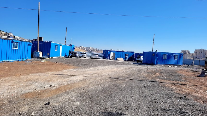
The buses going to Jerusalem are not operating at the moment. Two taxi drivers say that the checkpoint opens for about an hour to an hour and a half in the morning. At the checkpoint – the policeman we have known for many years confirms their words. What has been renewed is the blocked passage with a roundabout and inspection stations for those returning from work to Azaria and south, and a new work camp, whose employees say that any minute work will start on the tunnel from there.
According to Peace Now, this is the Sheikh Inbar tunnel. As you will read in their publication, the execution of the tunnel project is also part of the unfolding “miracle” of the Messianic camp since the Seventh of October:
“The northern part of the Eastern Ring Road is its most ambitious part: about 3 km long, of which 1.6 km is in a tunnel under Palestinian neighborhoods, as well as two bridges. The cost of this section is estimated at over NIS 900 million. The detailed planning of the road was completed last year, at a cost of tens of millions of NIS. The next stage is the execution stage, and it depends on the transfer of the necessary budget by the government.
In March 2022, the detailed plan documents were submitted to the Jerusalem Municipality for the purpose of opening a case for a building permit, a procedure that is expected to take several months, and as mentioned on 5/22/22 the head of the Civil Administration signed the land expropriation order necessary for the northern connection of the road to the Olive Exchange. The various government agencies are completing the bureaucratic preparations so that as soon as there is a moment of political fitness and the funds are approved, the works can begin immediately.”
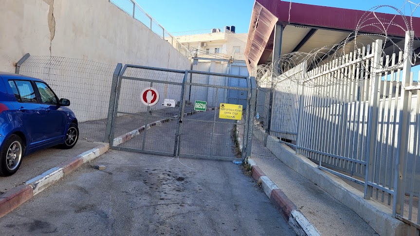
From there we drove on the apartheid road 4370 leading from road 1 to Anata (which is a direct continuation of the Shuafat refugee camp). Beyond the giant traffic circle that has been completed, there is construction work on the road, and Kamal the driver says that they say it will be a new barrier…
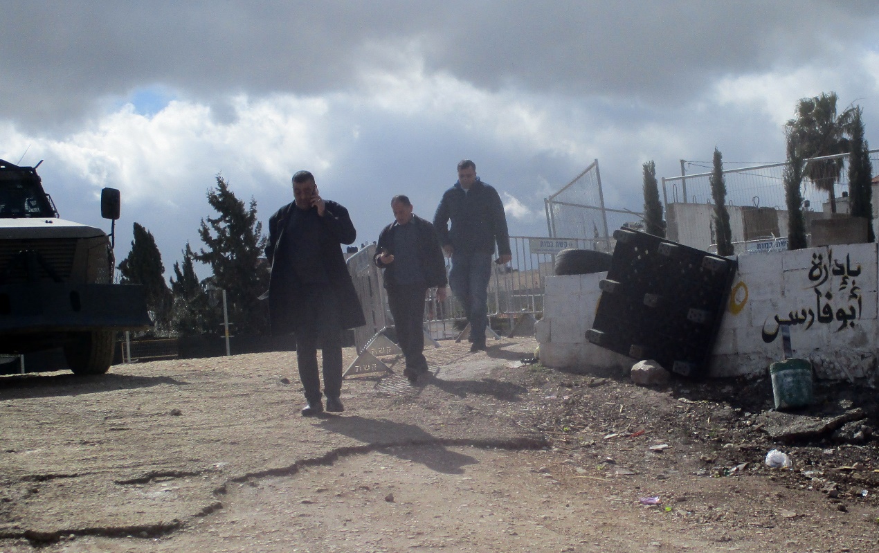
We continue towards Qalandia on road 437 and reach Hizma. We went in to see the garage of our friend E. from Sinjil, which was destroyed yesterday without warning – this is what Irit Segoli told us last night. (Please note, this is not Area C, but Area B, and as published, the administration is pressing to begin extensive demolitions also in lands in Area B, which were defined in Oslo as those that will be transferred to the Palestinian Authority by 1999 (according to the Wye Agreement that Netanyahu signed).
E. could not come to talk to us, but we took pictures, and so we were also able to warn him that a large pile of tires was lying among the ruins, and is a great temptation for theft.


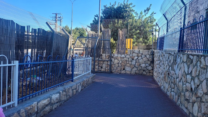
We finished the shift by watching the works for the road bypassing the Qalandiya checkpoint intended for Israelis only and connecting to the roads leading to Jerusalem and Tel Aviv. And so it will be easy to get from the West Bank to the center of the country. It is hard to say that we are clear about what is going to be there, but the picture is becoming clearer. See in the photos a new roadblock, an entrance to the settlement and a continuation that splits into the road back to the West Bank and another road still blocked with dirt to connect to road 443. The wall functions as a separation between the road and the Palestinians between Jerusalem and the southern West Bank (passing near the entrance to the A-Ram enclave) and between the expanded Qalandiya checkpoint.

I know I confused you, so look at the photos or better yet, come, join our shift and see with your own eyes.
Location Description
A-Za'im CP
See all reports for this place-
A-Za'im CP is located on Road 1 near the village of a-Za'im, in the section of the road between Ma'ale Adumim and Jerusalem in the area called E1.
It is adjacent to the separation wall. Only Israeli and Palestinian citizens living in East Jerusalem are allowed to pass through. Vehicles of West Bank residents with entry permits to Israel and public transportation in East Jerusalem are not allowed to pass through this checkpoint. They are obliged to pass only through the Qalandiya checkpoint in north Jerusalem.
Until the construction of the checkpoint, the villagers could enter Jerusalem almost indefinitely. Now, they are denied access and directed to the West Bank via the apartheid road parallel to Road 1 and Road 437 to the Anatot / Anata junction.
In addition, an iron gate was erected in the separation wall, which sometimes allows (we did not have the opportunity to see it open) pedestrians to enter Jerusalem through a-Tour. North to the checkpoint, the Olive Interchange was established, directing traffic from Highway 1 to Jerusalem and Ramallah (for blue ID holders only). The checkpoint is located near the village of a-Za'im, it is managed by border police and private security companies. It is active 24 hours a day.
People crossing the A Za'im checkpoint are checked randomly. The checkpoint suffers from traffic jams in the morning (from Ma'ale Adumim to Jerusalem) and in the afternoon (in the opposite direction).
-
Bethlehem (300)
See all reports for this place-
Located adjacent to the Separation Wall ("Jerusalem Wrap") at the north entrance to Bethlehem, this checkpoint cuts off Bethlehem and the entire West Bank from East Jerusalem, with all the serious implications for health services, trade, education, work and the fabric of life. The checkpoint is manned by the Border police and private security companies. It is an extensive infrastructure barrier and is designated as a border terminal, open 24 hours a day for foreign tourists. Israeli passport holders are not allowed to pass to Bethlehem, and Palestinian residents are not allowed to enter Jerusalem, except those with entry permits to Israel and East Jerusalem residents. Israeli buses are allowed to travel to Bethlehem only through this checkpoint.The checkpoint, which demonstrated harsh conditions of crowding and extreme passage delays for years, started employing advanced electronic identification posts and has upgraded its gates' system as of the middle of 2019 - and conditions improved.Adjacent to the checkpoint, in an enclosure between high walls and another passage, is the historic Rachel's Tomb, which is now embedded within a concrete fortified building. It contains prayer and study complexes for Jews only, as well as a residential complex. updated November 2019 .
-
Hizma
See all reports for this place-
Hizma
A checkpoint at the north-eastern entrance to the Jerusalem area which was annexed in 1967, at Pisgat Zeev. The passage is allowed to bearers of blue IDs only. Open 24 hours a day.
-
Qalandiya Checkpoint / Atarot Pass (Jerusalem)
See all reports for this place-
Click here to watch a video from Qalandiya checkpoint up to mid 2019 Three kilometers south of Ramallah, in the heart of Palestinian population. Integrates into "Jerusalem Envelope" as part of Wall that separates between northern suburbs that were annexed to Jerusalem in 1967: Kafr Aqab, Semiramis and Qalandiya, and the villages of Ar-Ram and Bir Nabala, also north of Jerusalem, and the city itself. Some residents of Kafr Aqab, Semiramis and Qalandiya have Jerusalem ID cards. A terminal operated by Israel Police has functioned since early 2006. As of August 2006, northbound pedestrians are not checked. Southbound Palestinians must carry Jerusalem IDs; holders of Palestinian Authority IDs cannot pass without special permits. Vehicular traffic from Ramallah to other West Bank areas runs to the north of Qalandiya. In February 2019, the new facility of the checkpoint was inaugurated aiming to make it like a "border crossing". The bars and barbed wire fences were replaced with walls of perforated metal panels. The check is now performed at multiple stations for face recognition and the transfer of an e-card. The rate of passage has improved and its density has generally decreased, but lack of manpower and malfunctions cause periods of stress. The development and paving of the roads has not yet been completed, the traffic of cars and pedestrians is dangerous, and t the entire vicinity of the checkpoint is filthy. In 2020 a huge pedestrian bridge was built over the vehicle crossing with severe mobility restrictions (steep stairs, long and winding route). The pedestrian access from public transport to the checkpoint from the north (Ramallah direction) is unclear, and there have been cases of people, especially people with disabilities, who accidentally reached the vehicle crossing and were shot by the soldiers at the checkpoint. In the summer of 2021, work began on a new, sunken entrance road from Qalandiya that will lead directly to Road 443 towards Jerusalem and Tel Aviv. At the same time, the runways of the old Atarot airport were demolished and infrastructure was prepared for a large bus terminal. (updated October 2021)
 Tamar FleishmanFeb-27-2026Qalandiya: On the way to prayer
-
Ras Abu Sbitan (Olive Terminal)
See all reports for this place-
A large checkpoint/crossing to the area of a-Tur, Abu Dis and the Old City; only for pedestrians. Located on Jerusalem’s municipal boundary.
One of the major crossings in Jerusalem’s central sector. It is located on the separation fence between the northern portion of the al-Ezariya neighborhood and the neighborhood of a-Tur and the rest of East Jerusalem. It is manned by Border Police soldiers and private security companies and operates 24 hours a day. Palestinians are forbidden to go through, other than permanent residents of East Jerusalem (holders of blue ID cards) and holders of work and commercial permits who are allowed through only on foot.
-
Sheikh Sa'ed
See all reports for this place-
A checkpoint limited to pedestrians, located on Jerusalem’s municipal boundary.
The checkpoint sits on the separation fence at the entrance to Sheikh Sa’ad, dividing it from its neighbourhood of Jabel Mukkabar. It’s manned by Border Police soldiers and private security companies and operates 24 hours a day. Palestinians are forbidden to go through, other than residents of Jabel Mukkabar or Sheikh Sa'ad who have permits. Both groups are permitted through only on foot. Residents of East Jerusalem who don’t live in Jabel Mukkabar are also allowed to cross to Sheikh Sa’ad, but not in the opposite direction; they must return through the Sawahira ash Sharqiya checkpoint.
 Avital CFeb-27-2026Jerusalem, Damascus Gate: Crowd rushing to prayer
-