Ariel settler-colony security road, and the separation fence that buried Makam Sheikh Ahmad Al Qassab
So much courage and vision is required for such a glorious environmental plan that Palestinian village Yassouf has nurtured
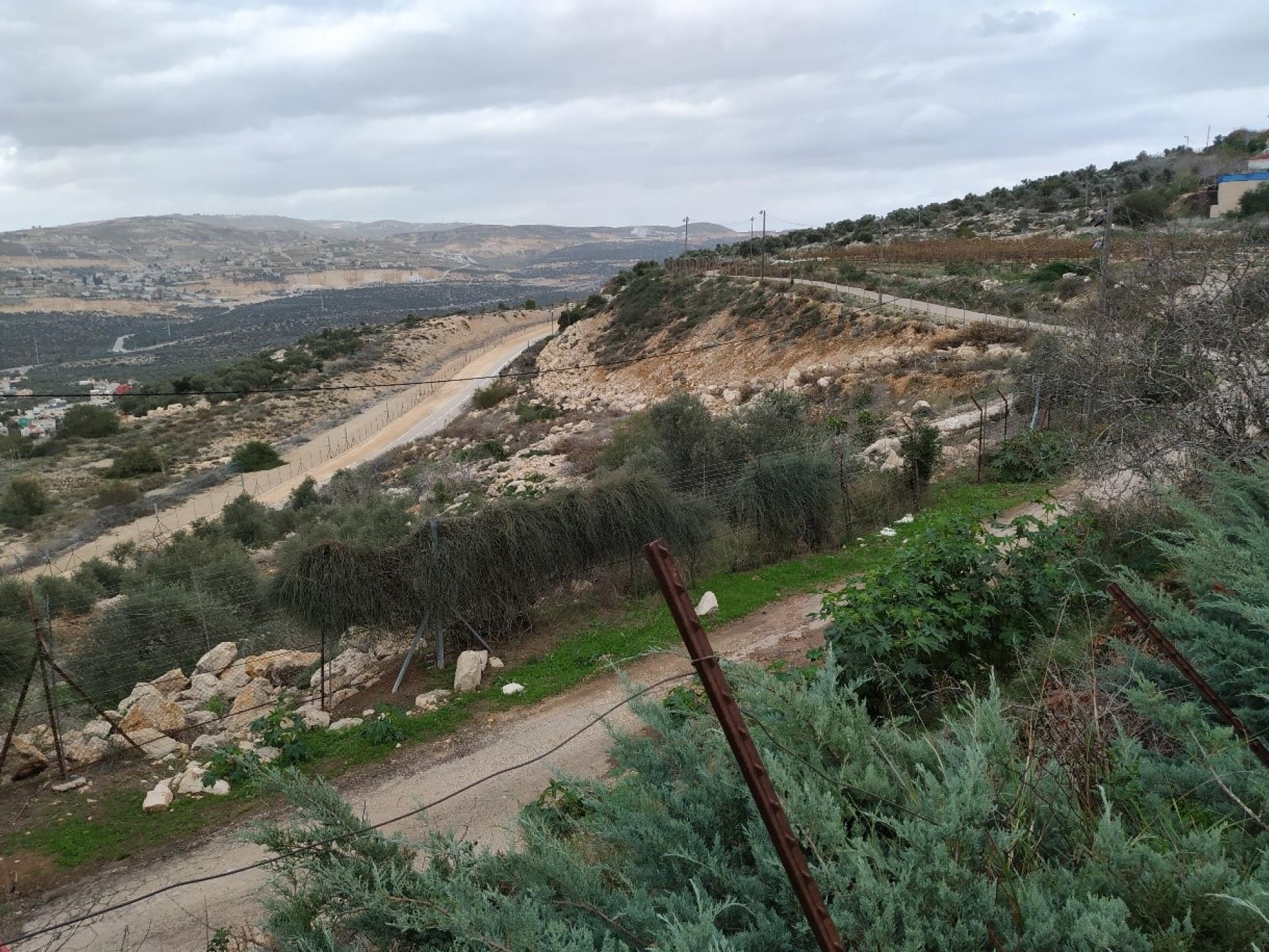
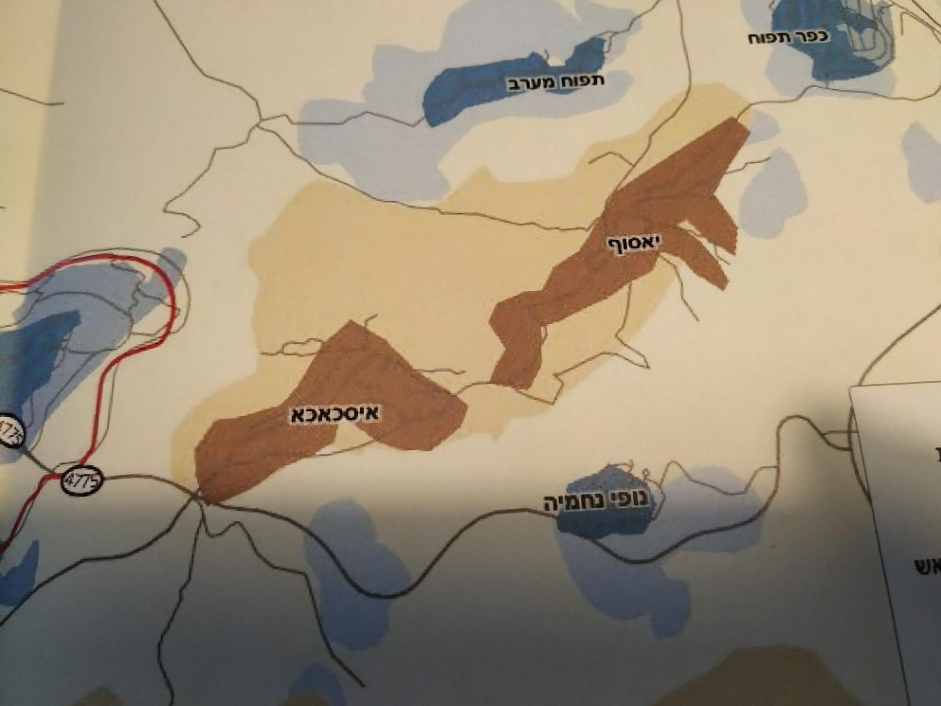
The expansion and growth aspirations to the west of the settler-colonist city of Ariel (central West Bank) is backed up by other smaller settler-colonies and outpost that grip the Palestinian villages of Yassouf and Iskaka from all directions. The settler-colonies are the contractors-on-the-ground of the state policy of dispossessing Palestinians of the lands that is still at their disposal after the settler-colonies of Ariel and others were founded. The work is perfectly divided between Ariel – with its respectable cultural image as the city in which Israelis study and teach at the “Ariel University in Samaria”, and the rest of the settler-colonies and outposts that constantly aspire to actually generate the “Ariel bloc”. Ariel is situated back-to-back with the Palestinian district town of Salfit, and the two are surrounded by 22 Palestinian villages and 22 settler-colonies and outposts.
After a study of the maps we found that the separation fence erected around Ariel has actually erased maqam Sheikh Ahmad Al Qassab in Marda village (on 55% of whose land Ariel was actually built). From Marda, north of Ariel, only a narrow strip in the shape of a slice of cheese remains between Ariel’s fence and road 505: it’s an elongated triangle with two openings to road 505, with a yellow metal-arm barrier.

The difference between the maps pretty much defines our two focal directions: the fate of the villages caught in between the settler-colonies and outposts (confiscations, demolition orders, setting a village mosque on fire 5 years ago), and the fate of the Palestinian heritage site maqam Sheikh Abu Zarad. Needless to say, no one has asked permission to do this nor sought alternatives to prevent demolishing the maqam. The Amud Ana map is the last witness to this demolition so far.
We went out to examine Ariel’s destructive effect upon the Palestinian space containing 22 villages and the district town of Salfit. We began our journey in Yassouf village, situated in between Ariel, the settler-colony Kefar Tapuach and the Tapuach West outpost and the Rechelim settler-colony with its outpost Nofei Nehemya.
The maqam is situated 2 kilometers east of Ariel, actually right in front of its eastern tip, the site of the Ariel University, the sports field and the student dorms. An ideal place to take nature trips and climb up the hill whose altitude is 680 meters. Over an area of 29 dunams that contains the maqam, a nature reserve has been delineated, named “Alonei Tapuach” nature reserve (officially approved on March 15, 1995 inside the West Bank territories named by Israel Samaria and Judea). However to this day it has not been officially declared for two political reasons: it is located inside (Oslo defined) Area B, and without the approval of the Palestinian Authority it cannot be declared a nature reserve. That is why its official status is that of an unmanaged reserve, a status that may change as the lords of the land please. In the Israel Nature Reserves Guide this one already appeared since 1985 as the “Tel Tapuach nature reserve”.
Why do the Ariel students and other settler-colonists not visit this reserve? After all, the place has been “identified as the ancient town of Tapuach, recognized as the reference point on the border between the tribal estates of Efrayim and Menasse”.
The explanation is available on any relevant website: “The nature reserve is not accessible to travellers at present, and is very close to hostile villages! The reserve is not open to individuals and trips require the approval of the Israeli security forces.”
A surprise awaited us at the Yassouf village council. In response to the maps we brought with us with the information in Hebrew, they spread out for us maps with a detailed plan to erect a Palestinian national park there, in which the PA has expressed its interest including the Palestinian Minister of Culture, the Minister of Tourism and the head of the Salfit Regional Administration. Italian elements are involved in the project. Partners in the creation of the park will be the inhabitants of Yassouf, Marda and Iskaka. And now – the usual obstacle – money…
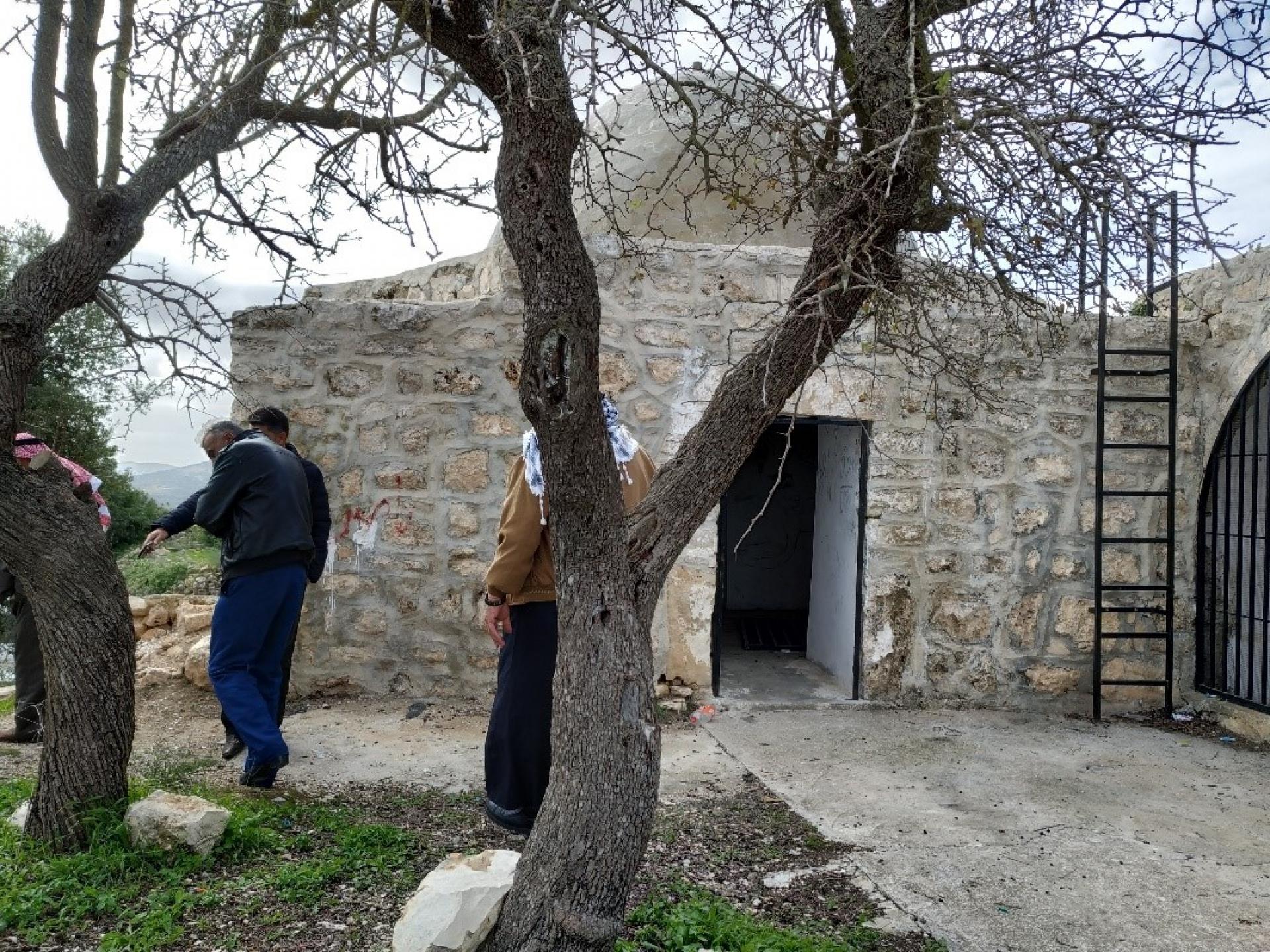
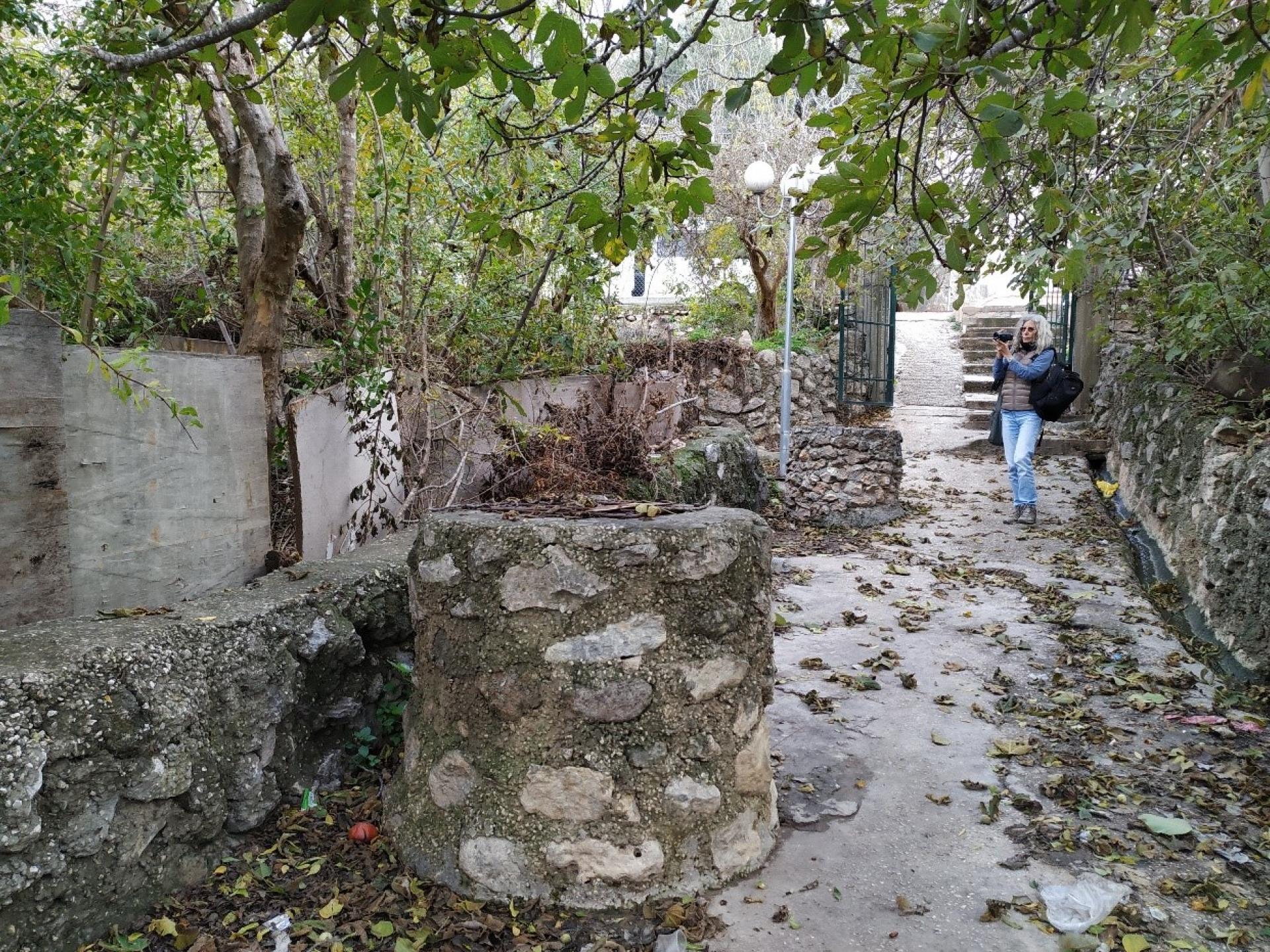
From the village council we headed in a large group for the maqam, and the Iskaka village council head joined. We were shown the Roman foundations upon which the maqam was built and archeological digs that Palestinians have held in situ.
In the distant past, fires were usually lit as a mode of communication between all the peaks where mosques/maqams were built. What admirable courage and vision are needed to draw up such an ambitious environmental plan, 2 kilometers from the settler-colonist city that has now dominated the entire district.
Our visit was terminated in one fell swoop: we wished to photograph the agricultural checkpoint that has been placed on the village lands, approaching “Tapuach West”. Beyond the checkpoint settler-colonists have taken over privately-owned Palestinian lands and planted their own trees there. A petitionby Yesh Din (Israeli human rights organization) has resulted in a ruling to remove them, but the ruling has been overturned and left the land in the hands of the settler-colonists. Our visit and photographing the checkpoint resulted in two army vehicles pouncing on the village, and forcing us to leave rapidly.