
South Hebron Hills - Widening the road on both sides includes stripping cultivated Palestinian lands
Road 60
Flags of governance are flown on both sides of the road, beginning right after Meitar Checkpoint all along the road. Opposite Eshtamoa, a police jeep guards the way exiting to the main road. Waiting to catch violators?
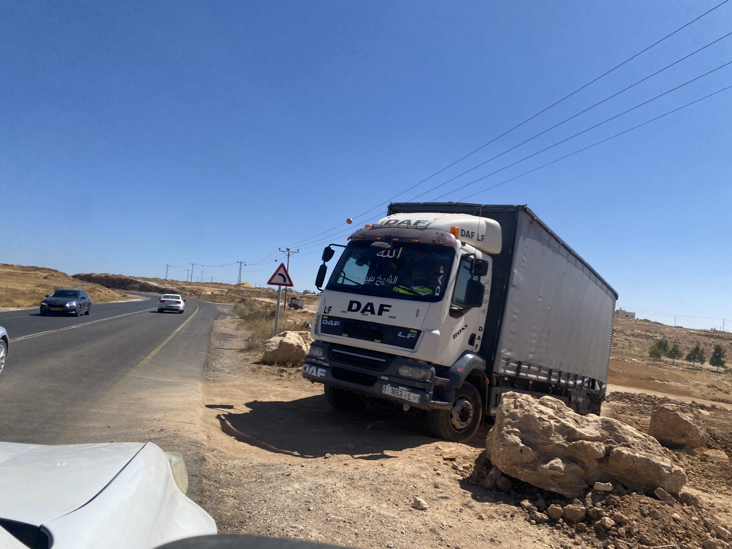
To the north, at the end of the dirt track near Road 60, a car is stuck. Its driver tells us the army caught him, confiscated his licenses and car keys and left it there as punishment and to block the way for other cars.
100 meters on, a truck is stuck the same way. Drivers say they had their phones confiscated too so they cannot call for help, and that a colonist with his flock took advantage of their situation, stopped, swore at them and threatened them with teargas. We handed them water bottles – that was all we could do.
The checkpoint on the road leading to Samu’ is closed and a long line of cars waits – could it be opened soon?
The Dhahariya checkpoint is closed.
In Abda the checkpoint is closed and east of the locality a dirt track has been paved and a sign declares new colonist outpost being built there, “Avuka”.
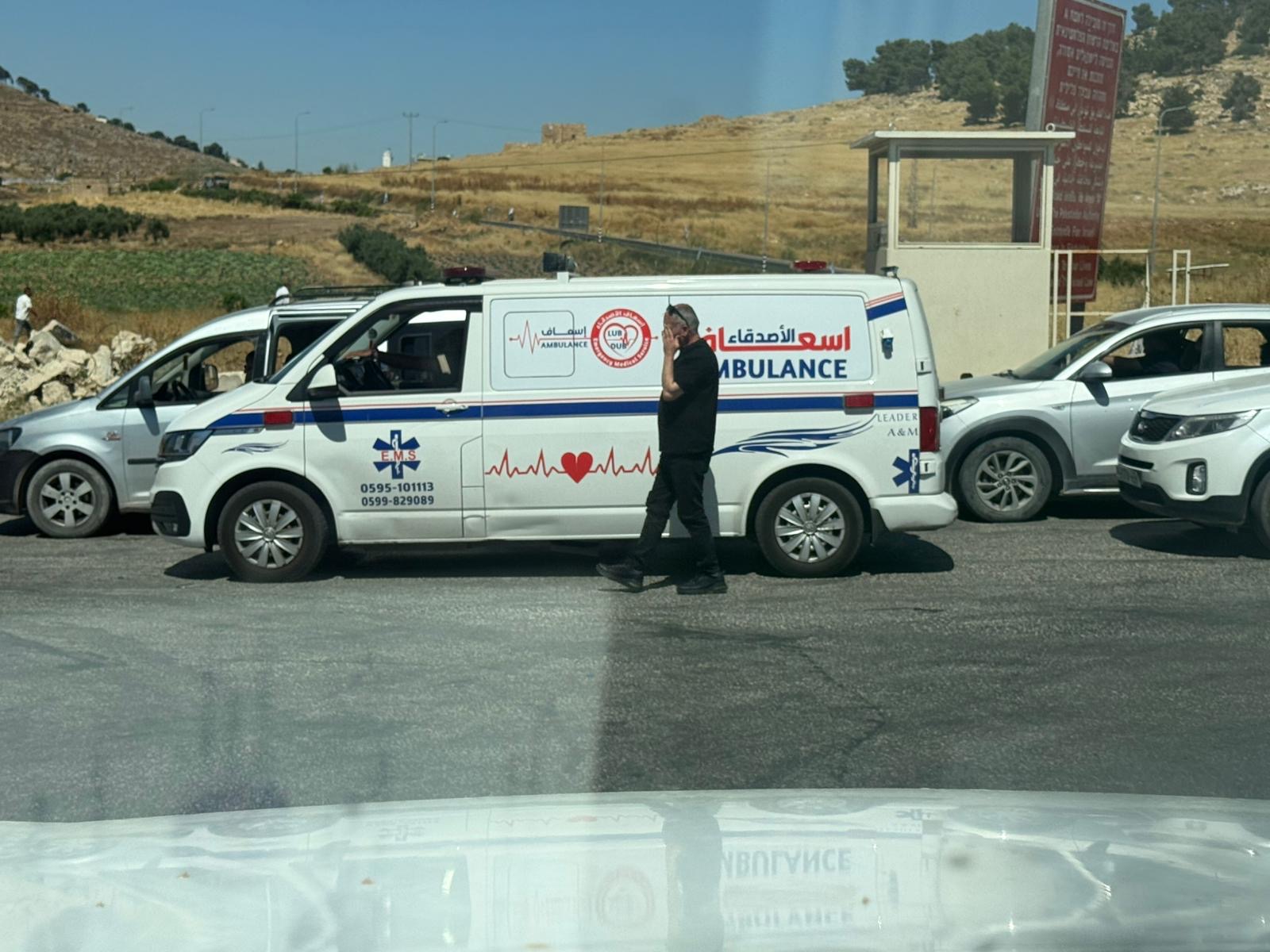
The checkpoint to Dura is opened but opposite, the checkpoint to Al-Fawwar is closed and several cars including an ambulance wait for it to open.
The Sheep Jnciton sports a new roundabout. The checkpoint is only in the direction of Hebron. North of it, a new dirt track is open and a sign declares the outpost name of “Aviad”. All along the road there is heavy traffic, including many cabs and military vehicles.
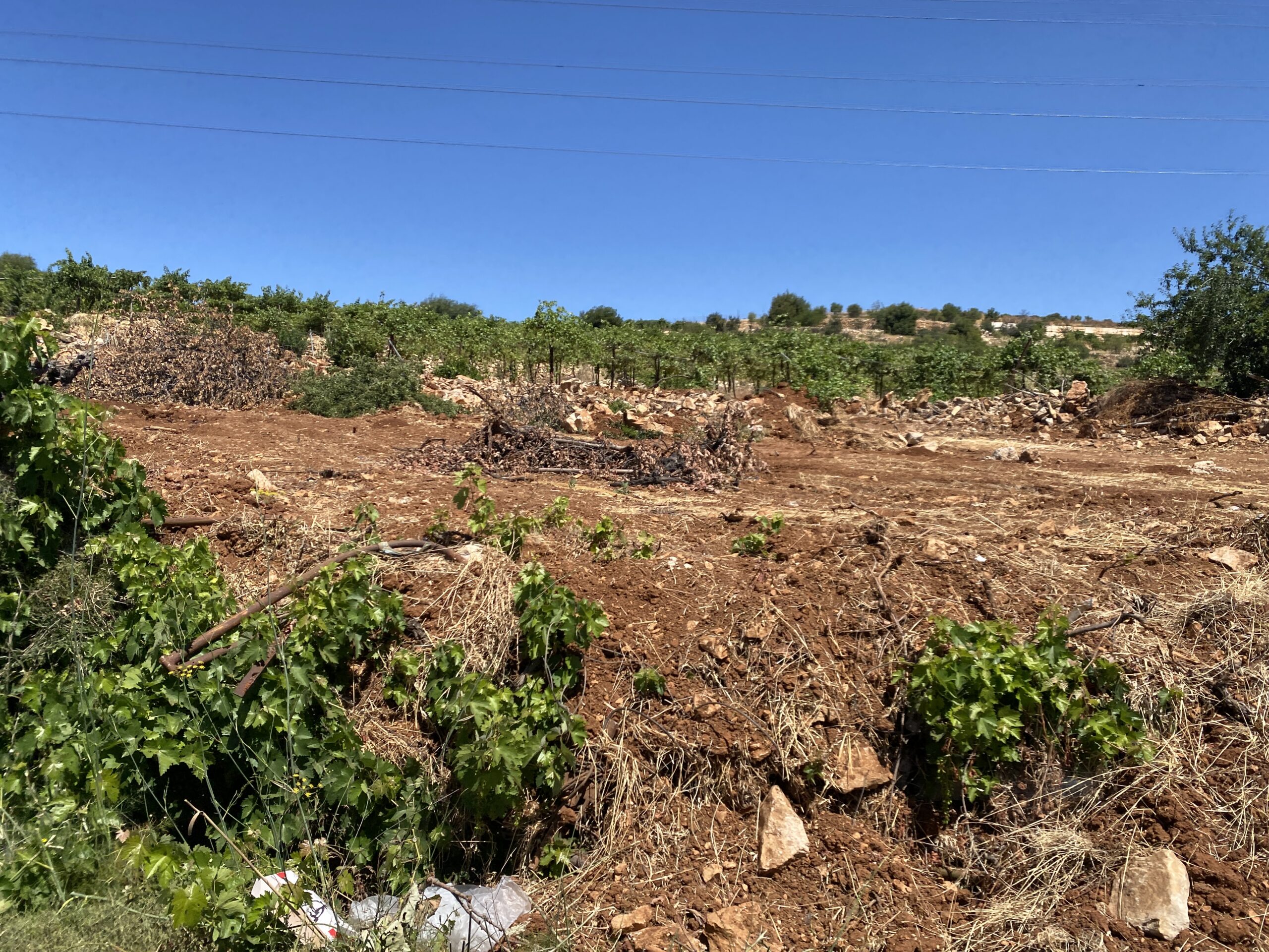
From Bani Naim northward bulldozers are working to widen the road on both sides. This includes razing 13 meters on each side of tended land belonging to Palestinians. Olive trees and vines fall victim to the tractors.
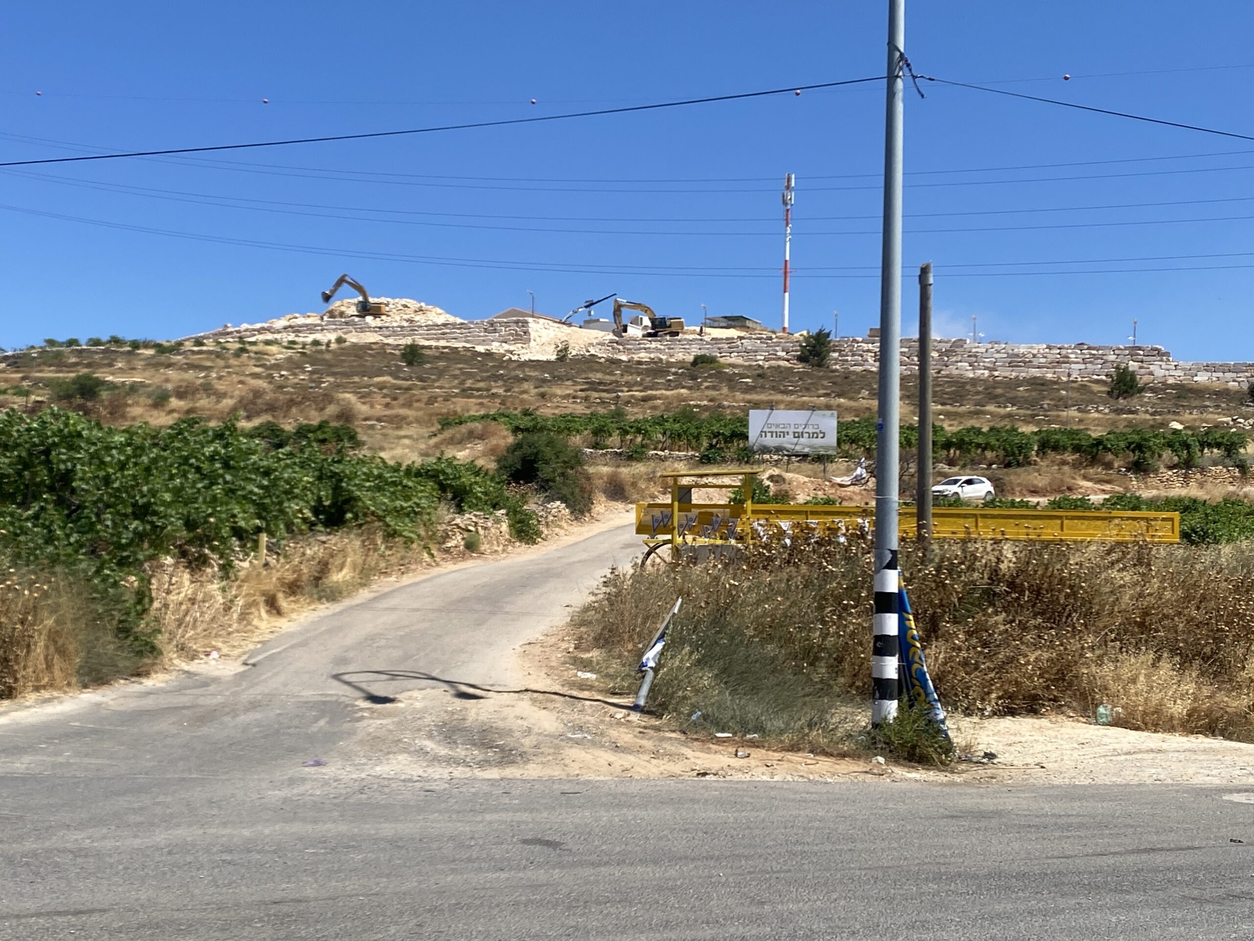
The entrance to Halhul has been closed for two weeks now, tells us Muhammad, the Zoom Arabic teacher who met us to get his fees sent him by his Jewish students. The hill above the village is now being worked by bulldozers building another outpost – “Merom Yehuda”.
Sa’ir Junction checkpoint is closed. We meet Ahmad who also receives money and tells us of surveyors that have arrived at the hill south of Beit Anun, probably planning a new colonist outpost on the hill range.
Road 356
At Zif Junction the checkpoint is open. We leave money for Ziad at the grocery store – he was expelled from his village and moved to Yatta and from there he has a hard time getting out to collect the money himself.
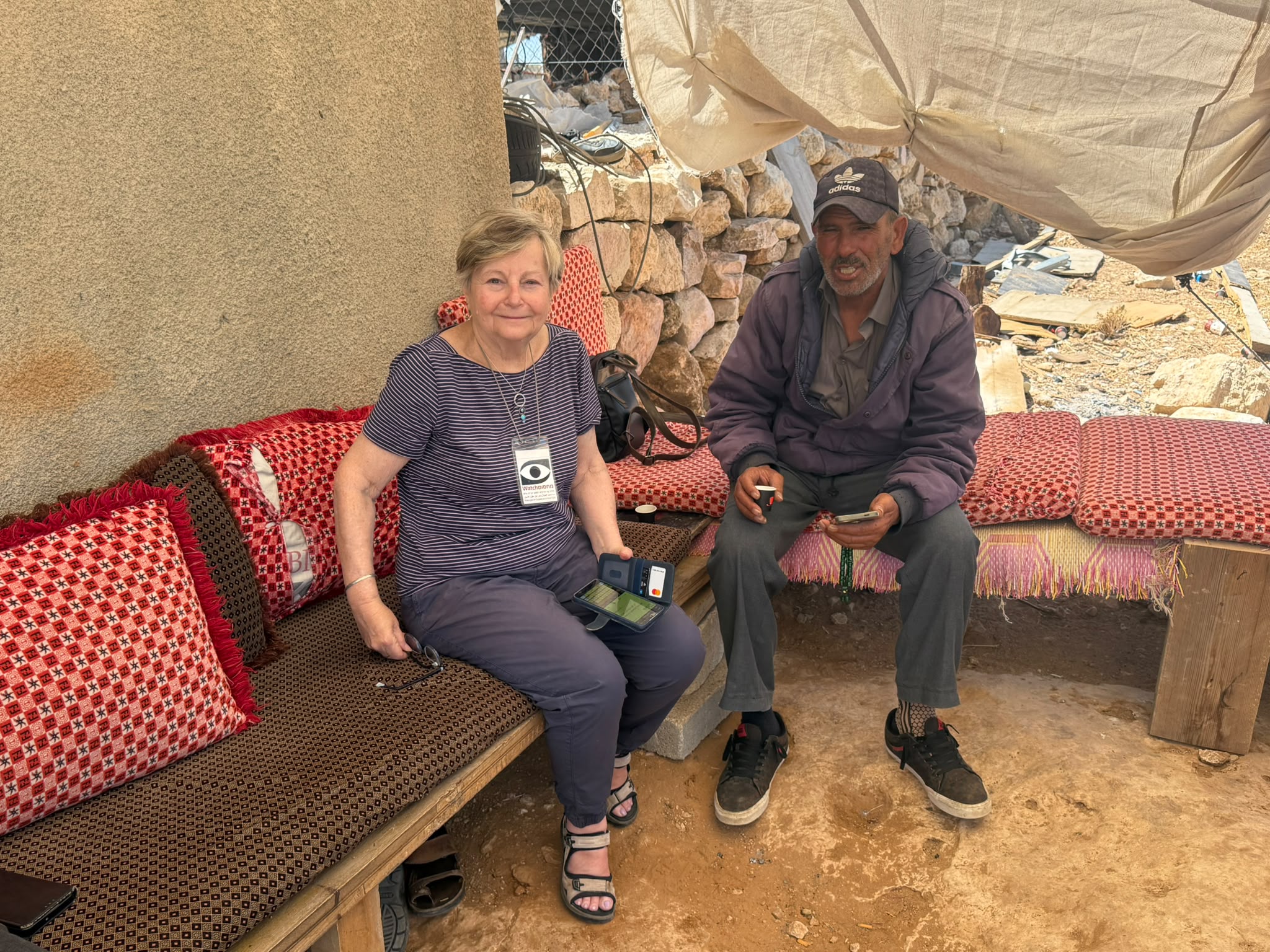
Out last stop is at Susiya, visiting Ahmad and Halima. At the grocery store at Zif Junction we bought them basic food stuff and left them lots of clothes and beddings. Ahmad tells us of repeated attacks by colonists at night. Once they burnt his tent and a chicken coop. Two days ago, when he was out inside the village to graze the flock, colonists came on a motorcycle and almost ran him over. In all this hardship and harassment, they groom green flower pots and some trees where a bed can be placed for the two daughters who sleep there in the summer.
Location Description
Dura Al-Fawwar Junction
See all reports for this place-
Junction on Route 60: west - the town of El Dura, east - the Al Fawwar refugee camp. There is a manned pillbox at the junction. From time to time the army sets up flying checkpoints at the entrance to El Fawwar and Al Dura. Al-Fawwar is a large refugee camp (7,000 inhabitants in 2007) established in 1949 to accommodate Palestinian refugees from Be'er Sheva and Beit Jubrin and environs. There are many incidents of stone-throwing. In the vicinity of the pillbox there are excellent agricultural areas, Farmers set up stalls adjacent to the plots close to the road. In recent months the civil administration has set up dirt embankments thereby blocking access to the stalls, and making it impossible for the farmers to sell their vegetables. Updated April 2021, Michal T.
-
Hakvasim (sheep) Junction
See all reports for this place-
One of the roadblocks (earthworks, rocks, concrete blocks or iron gates) that prevent transit of vehicles to Route 60 in the southern West Bank and block the southern entrance to Hebron. A manned pillbox supervises the place.
-
Meitar checkpoint / Sansana
See all reports for this place-
Meitar Checkpoint / Sansana The checkpoint is located on the Green Line and serves as a border crossing between Israel and the West Bank. It is managed by the Border Crossing Authority of the Defense Ministry. It is comprised of sections for the transfer of goods as well as a vehicle checkpoint (intended for holders of blue identity cards, foreign nationals or diplomats and international organizations). Passing of Palestinians is prohibited, except for those with entry permits to Israel. Palestinians are permitted to cross on foot only. The crossing has a DCO / DCL / DCL / DCL (District Coordination Office), a customs unit, supervision, and a police unit. In the last year, a breach has been opened in the fence, not far from the crossing. This breach is known to all, including the army. There does not appear to be any interest in blocking it, probably as it permits needed Palestinian workers without the bureaucratic permits to get to work in Israel. Food stalls and a parking area economy have been created, but incidents of violent abuse by border police have also been recorded. Updated April 2022
-
Sa'ir
See all reports for this place-
A relatively affluent suburb of Palestinian Hebron. West of Highway 60 leading from Bethlehem to Hebron. The entrance to Highway 60 and to Shuyukh and Beit Einun to the east is open, but is subject to changes - concrete blocks denying passage are stationed according to the needs of the army.
-
South Hebron Hills
See all reports for this place-
South Hebron Hills
South Hebron Hills is a large area in the West Bank's southern part.
Yatta is a major city in this area: right in the border zone between the fertile region of Hebron and its surroundings and the desert of the Hebron Hills. Yatta has about 64,000 inhabitants.
The surrounding villages are called Masafer Yatta (Yatta's daughter villages). Their inhabitants subsist on livestock and agriculture. Agriculture is possible only in small plots, especially near streams. Most of the area consists of rocky terraces.Since the beginning of the 1980s, many settlements have been established on the agricultural land cultivated by the Palestinians in the South Hebron Hills region: Carmel, Maon, Susia, Masadot Yehuda, Othniel, and more. Since the settlements were established and Palestinians cultivation areas have been reduced; the residents of the South Hebron Hills have been suffering from harassment by the settlers. Attempts to evict and demolish houses have continued, along with withholding water and electricity. The military and police usually refrain from intervening in violent incidents between settlers and Palestinians do not enforce the law when it comes to the investigation of extensive violent Jewish settlers. The harassment in the South Hebron Hills includes attacking and attempting to burn residential tents, harassing dogs, harming herds, and preventing access to pastures.
There are several checkpoints in the South Hebron Hills, on Routes 317 and 60. In most of them, no military presence is apparent, but rather an array of pillboxes monitor the villages. Roadblocks are frequently set up according to the settlers and the army's needs. These are located at the Zif Junction, the Dura-al Fawwar crossing, and the Sheep Junction at the southern entrance to Hebron.
Updated April 2022
 Muhammad D.Jul-12-2026Smadar with Taleb on duty at Qawawis
-
Susiya
See all reports for this place-
Susiya The Palestinian area lies between the settlement of Susya and a military base. The residents began to settle in areas outside the villages in the 1830s and lived in caves, tents and sukkot. To this day they maintain a traditional lifestyle and their livelihood is based on agriculture and herding. Until the 1948 war, the farmers cultivated areas that extended to the Arad area. As a result of the war, a significant portion of their land left on the Israeli side was lost. After the 1967 war and the Israeli occupation, military camps were established in the area, fire zones and nature reserves were declared, and the land area was further reduced. The Jewish settlement in Susya began in 1979. Since then, there has been a stubborn struggle to remove the remains of Palestinian residents who refuse to leave their place of birth and move to nearby town Yatta. With the development of a tourist site in Khirbet Susya in the late 1980s (an ancient synagogue), dozens of families living in caves in its vicinity were deported. In the second half of the 1990s, a new form of settlement developed in the area - shepherds' farms of individual settlers. This phenomenon increased the tension between the settlers and the original, Palestinian residents, and led to repeated harassment of the residents of the farms towards the Palestinians. At the same time, demolition of buildings and crop destruction by security forces continued, as well as water and electricity prevention. In the Palestinian Susya, as in a large part of the villages of the southern Hebron Mountains, there is no running water, but the water pipe that supplies water to the Susya Jewish settlement passes through it. Palestinians have to buy expensive water that comes in tankers. Solar electricity is provided by a collector system, installed with donation funds. But the frequent demolitions in the villages do not spare water cisterns or the solar panels and power poles designed to transfer solar electricity between the villages. Updated April 2021, Anat T.
-
Zif Junction
See all reports for this place-
Zif Junction located on the crossroads that directs towards Road 356 to Yata. Yata is the district city of the southern Hebron Mountains. Usually, this junction is open to traffic. The nearby pillbox is unmanned. But the army and police are present occasionally, sometimes setting up a checkpoint and sometimes detaining residents from the big city. Often, the Israeli policemen inspect vehicles and distribute driving reports to Palestinian vehicles. s
-