
South Hebron Hills - Settlers move herds of cows across Palestinian lands
We entered through the Meitar checkpoint, as usual, almost deserted and the parking lot almost empty. Since October 23rd, no entry for Palestinians into Israel and they are therefore, not allowed to work (except for a few essential jobs). No work and no livelihood, for over two years now and the economic mental pressure, is increasing, and this is in addition to the pressure from the constant abuse by settlers.
We drove on Highway 60 in the direction of Simiya.
The entrance to Samu’ is completely open.
The entrance to Dahariya is closed with a checkpoint. People have to cross on foot and board transportation on the other side.
At the entrance/exit further east of Dahariya, two Palestinian vehicles standing there, as a blockade. The soldiers took the keys, and they went off. This is a familiar practice of blocking entrances/exits and punishing.
A little before Simiya, on the main road, they placed a memorial stone for a settler from Kiryat Arba, who was killed in an attack 10 years ago. They arrived by bus, with the participants who held a ceremony and closed the main road for about an hour.
We arrived at Simiya, the entrance is blocked, so we enter from a bypass crossing, which is also used to cross to Dahariya, the entrances to which are blocked, as described here. The crossing, of course, is longer, passing through fields, through olive groves, etc.
In short, harassment of the Palestinians.
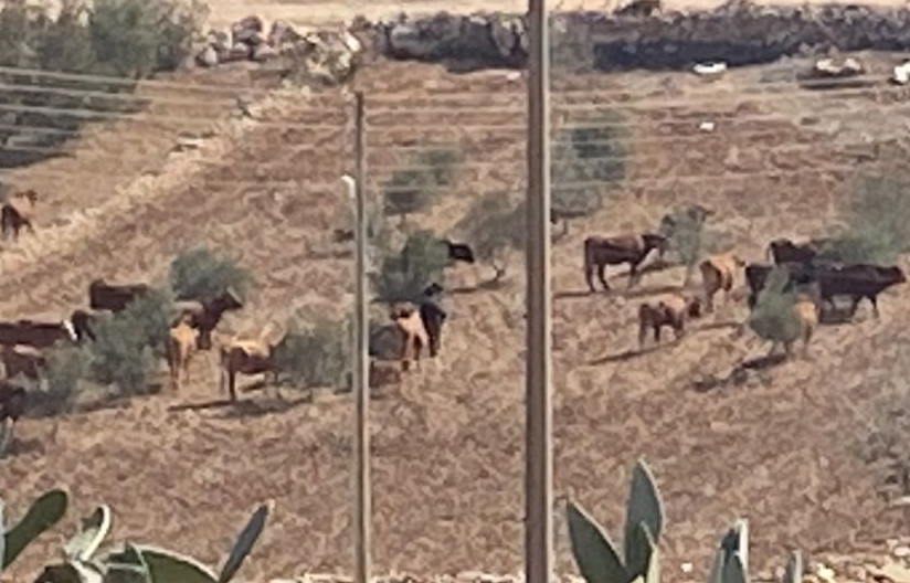
While sitting with Farhan, we see from the other side of the main road, settlers, with horses and a tractor, leading a herd of cows, which pass through the agricultural areas (olive trees and potatoes) and not on the path designated for crossing, and of course they destroyed the crops.
The herd comes from the Meitarim farm, near Zanuta (The abandoned one!). The herd had left about 40 days ago going north, a herd of about 60, 70 cows and now, are making their way back, through agricultural areas, to the settlement. The owner of the land, shouted at them which was brave of him, but of course it didn’t help… Luckily for him, they didn’t hurt him and just kept going….
Afterwards, the cows crossed the road and continued to other plots, leaving a trail of damage.
We continued in the direction of the al-Fawwar junction. The junction is open, for entrances to Dura and al–Fawwar.
From what Muhammad said, this is the second day that it has been open, but only at noon, between 11:00 and 13:00. (It is more important that it should be open in the morning, when people go to work, but then it is closed!).
From the pillbox at the junction, you can see the barrel of a gun, aimed at the junction and a call is made to pedestrians, not to stand at the junction! Just pass and move forward….
Once, there were vegetable/fruit stands there from the region and much movement of the Palestinians. But this is no more!
Location Description
Dura Al-Fawwar Junction
See all reports for this place-
Junction on Route 60: west - the town of El Dura, east - the Al Fawwar refugee camp. There is a manned pillbox at the junction. From time to time the army sets up flying checkpoints at the entrance to El Fawwar and Al Dura. Al-Fawwar is a large refugee camp (7,000 inhabitants in 2007) established in 1949 to accommodate Palestinian refugees from Be'er Sheva and Beit Jubrin and environs. There are many incidents of stone-throwing. In the vicinity of the pillbox there are excellent agricultural areas, Farmers set up stalls adjacent to the plots close to the road. In recent months the civil administration has set up dirt embankments thereby blocking access to the stalls, and making it impossible for the farmers to sell their vegetables. Updated April 2021, Michal T.
-
Meitar checkpoint / Sansana
See all reports for this place-
Meitar Checkpoint / Sansana The checkpoint is located on the Green Line and serves as a border crossing between Israel and the West Bank. It is managed by the Border Crossing Authority of the Defense Ministry. It is comprised of sections for the transfer of goods as well as a vehicle checkpoint (intended for holders of blue identity cards, foreign nationals or diplomats and international organizations). Passing of Palestinians is prohibited, except for those with entry permits to Israel. Palestinians are permitted to cross on foot only. The crossing has a DCO / DCL / DCL / DCL (District Coordination Office), a customs unit, supervision, and a police unit. In the last year, a breach has been opened in the fence, not far from the crossing. This breach is known to all, including the army. There does not appear to be any interest in blocking it, probably as it permits needed Palestinian workers without the bureaucratic permits to get to work in Israel. Food stalls and a parking area economy have been created, but incidents of violent abuse by border police have also been recorded. Updated April 2022
-
South Hebron Hills
See all reports for this place-
South Hebron Hills
South Hebron Hills is a large area in the West Bank's southern part.
Yatta is a major city in this area: right in the border zone between the fertile region of Hebron and its surroundings and the desert of the Hebron Hills. Yatta has about 64,000 inhabitants.
The surrounding villages are called Masafer Yatta (Yatta's daughter villages). Their inhabitants subsist on livestock and agriculture. Agriculture is possible only in small plots, especially near streams. Most of the area consists of rocky terraces.Since the beginning of the 1980s, many settlements have been established on the agricultural land cultivated by the Palestinians in the South Hebron Hills region: Carmel, Maon, Susia, Masadot Yehuda, Othniel, and more. Since the settlements were established and Palestinians cultivation areas have been reduced; the residents of the South Hebron Hills have been suffering from harassment by the settlers. Attempts to evict and demolish houses have continued, along with withholding water and electricity. The military and police usually refrain from intervening in violent incidents between settlers and Palestinians do not enforce the law when it comes to the investigation of extensive violent Jewish settlers. The harassment in the South Hebron Hills includes attacking and attempting to burn residential tents, harassing dogs, harming herds, and preventing access to pastures.
There are several checkpoints in the South Hebron Hills, on Routes 317 and 60. In most of them, no military presence is apparent, but rather an array of pillboxes monitor the villages. Roadblocks are frequently set up according to the settlers and the army's needs. These are located at the Zif Junction, the Dura-al Fawwar crossing, and the Sheep Junction at the southern entrance to Hebron.
Updated April 2022
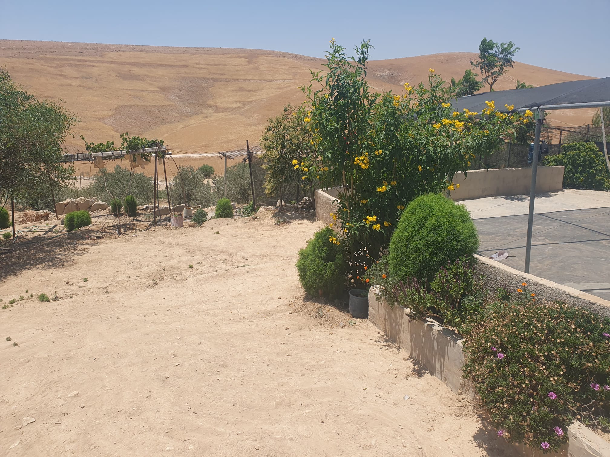 Smadar BeckerJun-28-2026The vegetation that Najh planted around the house in Umm Qusa
-
Zanuta
See all reports for this place-
Zanuta was a small rural Palestinian locality until its demolition. It was situated in the space around the town Dahariya in the South Hebron Hills, about a ten-minute ride from Meitar Checkpoint. There are documented remains of a large Byzantine settlement in the area. Since the Ottoman (Turkish Empire) period (1516-1917) Zanuta was documented as a locality of shepherds and farmers who live in the remains of the ancient structures and the residential caves near them.
Two individual ranches of colonists were created next to Zanuta: Meitarim (of the colonist Yinon Levi) to the east, and Yehudah (of the colonist Elyashiv Nachum) to the north. Endless attacks, harassments and attempt to chase away the Zanuta villagers have originated in these two outposts.
Until the expulsion, four families lived in the village: A-Samama, Al-Tel, Al Batat, and Al-Qaisia. Farming constituted their main economic activity and employed most of the villagers. The total area of the village is about 12,000 dunams, of which about 3,000 are tended, mostly with field crops.
This village has never had a master plan that would legitimize construction permits. The Civil Administration claimed it was too small and the distance to the next town, Dahariya, too great. For this reason, the Israeli authorities pressured the villagers to leave. The colonists did the job for them.
-