
Route 60 - Uprooting vines and crops for the sake of widening the road
We drove on Route 60 – or by its new name: Lev Yehuda Road. All the villages along the way are blocked. North of the Eshtamoa settlement, a small outpost has popped up on an isolated hill. In Samu’, the checkpoint is manned. As we passed the Dahariya checkpoint, a group of police officers opened the gate. In Abda, the checkpoint is manned. All along the road are Israeli flags – apparently new and clean, larger and more numerous than in the past. On the left side of the road, a new sign points to yet another new outpost/farm: Aviad. Further down the road toward Al-Fawwar, at the turnoff to the village of Khursa, the sign bearing the village’s name was removed. In its place, a large sign declares that this is the turnoff for Adorayim – another newly added outpost or settlement.
The purpose of the day is to visit our friend Atta Jaber, whose wife is ill, to bring him money collected for medications. Also, we wanted to hear from him about the expansion of Route 60 / Lev Yehuda, which is seizing his lands on both sides of the road. A bit north of the entrance to Bani Na’im (which is open), we saw five bulldozers busy tearing down grapevines and destroying crops for the road expansion. It appears to cover a good few meters on each side. Atta says there is no compensation for the lands confiscated for the road expansion – a road which, in any case, was originally built on his family’s land, apparently back in the 1980s.
We continue to the Sa’ir junction to deliver the Arabic teacher’s salary. Here too, there is a new sign (which was not there a month ago during our last visit) declaring a new settlement: Merom Yehuda. The teacher shares that the checkpoint to the village of Sa’ir is open from 07:00 in the morning until 14:00 in the afternoon; the rest of the time it is blocked.
We head back south to meet Atta: the steep road to his house is totally blocked, and he walks up and down on foot to his sister’s lovely home. The house sits directly adjacent to and below Kiryat Arba – the settlement towers right over the roof. There is harassment from settlers, though apparently not from the “Hilltop Youth.”
The roses cultivated by Atta’s late father are still blooming – perhaps the only sign of hope we saw during the shift!
.We returned the way we came. Samu’ is open now, and it is business as usual.
Location Description
Dura Al-Fawwar Junction
See all reports for this place-
Junction on Route 60: west - the town of El Dura, east - the Al Fawwar refugee camp. There is a manned pillbox at the junction. From time to time the army sets up flying checkpoints at the entrance to El Fawwar and Al Dura. Al-Fawwar is a large refugee camp (7,000 inhabitants in 2007) established in 1949 to accommodate Palestinian refugees from Be'er Sheva and Beit Jubrin and environs. There are many incidents of stone-throwing. In the vicinity of the pillbox there are excellent agricultural areas, Farmers set up stalls adjacent to the plots close to the road. In recent months the civil administration has set up dirt embankments thereby blocking access to the stalls, and making it impossible for the farmers to sell their vegetables. Updated April 2021, Michal T.
-
South Hebron Hills
See all reports for this place-
South Hebron Hills
South Hebron Hills is a large area in the West Bank's southern part.
Yatta is a major city in this area: right in the border zone between the fertile region of Hebron and its surroundings and the desert of the Hebron Hills. Yatta has about 64,000 inhabitants.
The surrounding villages are called Masafer Yatta (Yatta's daughter villages). Their inhabitants subsist on livestock and agriculture. Agriculture is possible only in small plots, especially near streams. Most of the area consists of rocky terraces.Since the beginning of the 1980s, many settlements have been established on the agricultural land cultivated by the Palestinians in the South Hebron Hills region: Carmel, Maon, Susia, Masadot Yehuda, Othniel, and more. Since the settlements were established and Palestinians cultivation areas have been reduced; the residents of the South Hebron Hills have been suffering from harassment by the settlers. Attempts to evict and demolish houses have continued, along with withholding water and electricity. The military and police usually refrain from intervening in violent incidents between settlers and Palestinians do not enforce the law when it comes to the investigation of extensive violent Jewish settlers. The harassment in the South Hebron Hills includes attacking and attempting to burn residential tents, harassing dogs, harming herds, and preventing access to pastures.
There are several checkpoints in the South Hebron Hills, on Routes 317 and 60. In most of them, no military presence is apparent, but rather an array of pillboxes monitor the villages. Roadblocks are frequently set up according to the settlers and the army's needs. These are located at the Zif Junction, the Dura-al Fawwar crossing, and the Sheep Junction at the southern entrance to Hebron.
Updated April 2022
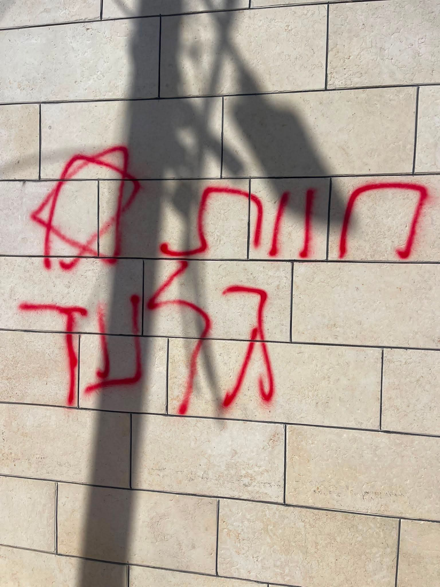 A Palestinian residentJul-19-2026Graffiti sprayed in A-Tuwani
-