
Simia - Blockades at the entrance to the village
Meitar checkpoint, abandoned since the beginning of the war, October ‘23! Which means that the Palestinians have no work and no livelihood…. The consequences are unbearable.
We drove towards Simia, to visit Farhan.
On the way, opposite Zanuta, which is destroyed and abandoned (after they were expelled from the village), there is a new vineyard owned by Yinon Levi (yes, this is the man who shot and killed a Palestinian in Umm al-Khair).
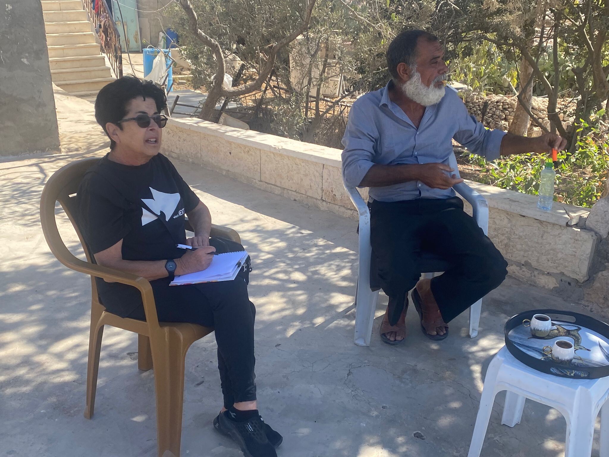
We arrived at Simia, at Farhan. We sat in the courtyard overlooking the entire area, good air, a pastoral view, deceptive and unfortunate, which you can’t really enjoy, like in any normal place….
He tells about the fact that settlers, although they don’t come to them anymore recently, do pass by them, mainly to the checkpoints. They come with a tractor, which blocks the entrance to the village every time…
Yesterday, school started, and the blockades are preventing teachers from getting to school. In general, the blockades are annoying, prolonging every trip, and interfering with a relatively normal life, of traveling to work, shopping, medical treatment, family visits, etc. At the same time, there are those who open a crossing somewhere else, but the army could arrive at any moment to close it, arrest people, etc.
Farhan underwent catheterization a few weeks ago at a hospital in East Jerusalem (a Jewish friend, one of the activists, came to take him to Jerusalem) after a failed catheterization in Hebron. In the meantime, he feels much better. His son who is currently not working, works at the school in his place. It should be noted that teachers and other employees only receive about 30% of their salary. Farhan’s son, who lives in Ramallah, also receives only partial salaries. There is no money available to pay full salaries.
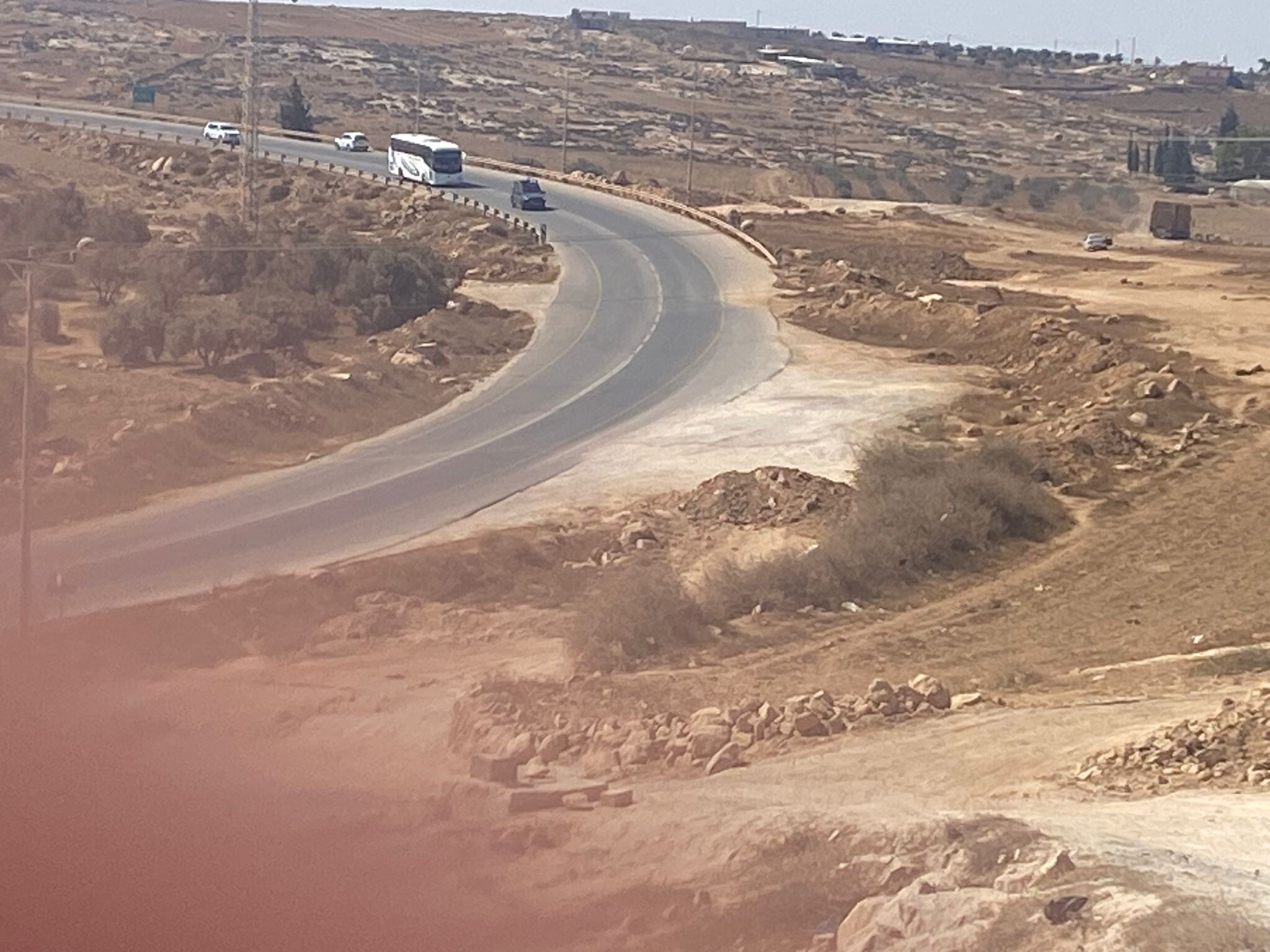
On the way back from Farhan, we saw the entrance to Samu’, which is open, without inspection and soldiers.
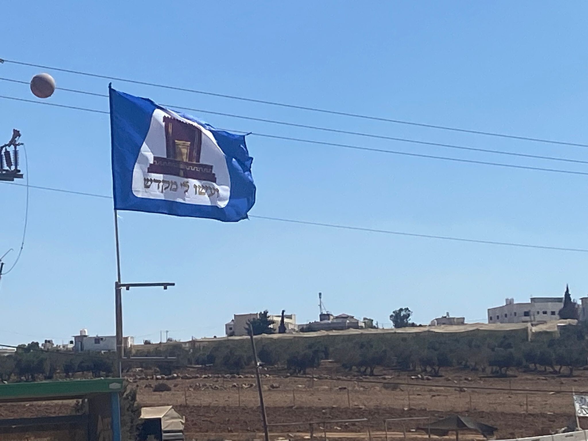
On the way, we also see new flags, not Israeli flags, but those of the re-building of the Temple. It represents the messianic hysteria of the settlers and other groups which is sweeping Israel.
Location Description
Meitar checkpoint / Sansana
See all reports for this place-
Meitar Checkpoint / Sansana The checkpoint is located on the Green Line and serves as a border crossing between Israel and the West Bank. It is managed by the Border Crossing Authority of the Defense Ministry. It is comprised of sections for the transfer of goods as well as a vehicle checkpoint (intended for holders of blue identity cards, foreign nationals or diplomats and international organizations). Passing of Palestinians is prohibited, except for those with entry permits to Israel. Palestinians are permitted to cross on foot only. The crossing has a DCO / DCL / DCL / DCL (District Coordination Office), a customs unit, supervision, and a police unit. In the last year, a breach has been opened in the fence, not far from the crossing. This breach is known to all, including the army. There does not appear to be any interest in blocking it, probably as it permits needed Palestinian workers without the bureaucratic permits to get to work in Israel. Food stalls and a parking area economy have been created, but incidents of violent abuse by border police have also been recorded. Updated April 2022
-
South Hebron Hills
See all reports for this place-
South Hebron Hills
South Hebron Hills is a large area in the West Bank's southern part.
Yatta is a major city in this area: right in the border zone between the fertile region of Hebron and its surroundings and the desert of the Hebron Hills. Yatta has about 64,000 inhabitants.
The surrounding villages are called Masafer Yatta (Yatta's daughter villages). Their inhabitants subsist on livestock and agriculture. Agriculture is possible only in small plots, especially near streams. Most of the area consists of rocky terraces.Since the beginning of the 1980s, many settlements have been established on the agricultural land cultivated by the Palestinians in the South Hebron Hills region: Carmel, Maon, Susia, Masadot Yehuda, Othniel, and more. Since the settlements were established and Palestinians cultivation areas have been reduced; the residents of the South Hebron Hills have been suffering from harassment by the settlers. Attempts to evict and demolish houses have continued, along with withholding water and electricity. The military and police usually refrain from intervening in violent incidents between settlers and Palestinians do not enforce the law when it comes to the investigation of extensive violent Jewish settlers. The harassment in the South Hebron Hills includes attacking and attempting to burn residential tents, harassing dogs, harming herds, and preventing access to pastures.
There are several checkpoints in the South Hebron Hills, on Routes 317 and 60. In most of them, no military presence is apparent, but rather an array of pillboxes monitor the villages. Roadblocks are frequently set up according to the settlers and the army's needs. These are located at the Zif Junction, the Dura-al Fawwar crossing, and the Sheep Junction at the southern entrance to Hebron.
Updated April 2022
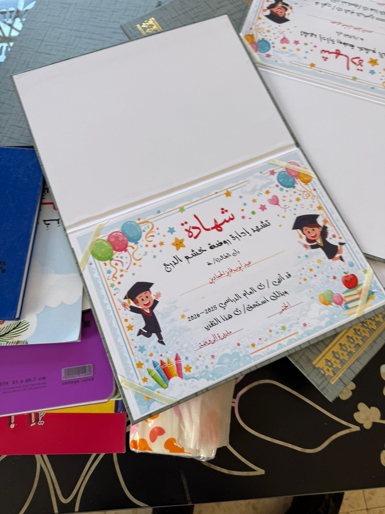 Smadar BeckerMay-10-2026A personal certificate for every child who finishes the year at Huda's kindergarten, Hashem Al-Daraj
-
Zanuta
See all reports for this place-
Zanuta was a small rural Palestinian locality until its demolition. It was situated in the space around the town Dahariya in the South Hebron Hills, about a ten-minute ride from Meitar Checkpoint. There are documented remains of a large Byzantine settlement in the area. Since the Ottoman (Turkish Empire) period (1516-1917) Zanuta was documented as a locality of shepherds and farmers who live in the remains of the ancient structures and the residential caves near them.
Two individual ranches of colonists were created next to Zanuta: Meitarim (of the colonist Yinon Levi) to the east, and Yehudah (of the colonist Elyashiv Nachum) to the north. Endless attacks, harassments and attempt to chase away the Zanuta villagers have originated in these two outposts.
Until the expulsion, four families lived in the village: A-Samama, Al-Tel, Al Batat, and Al-Qaisia. Farming constituted their main economic activity and employed most of the villagers. The total area of the village is about 12,000 dunams, of which about 3,000 are tended, mostly with field crops.
This village has never had a master plan that would legitimize construction permits. The Civil Administration claimed it was too small and the distance to the next town, Dahariya, too great. For this reason, the Israeli authorities pressured the villagers to leave. The colonists did the job for them.
-