
A visit to Khursa
Sunday, Meitar, busy as usual.
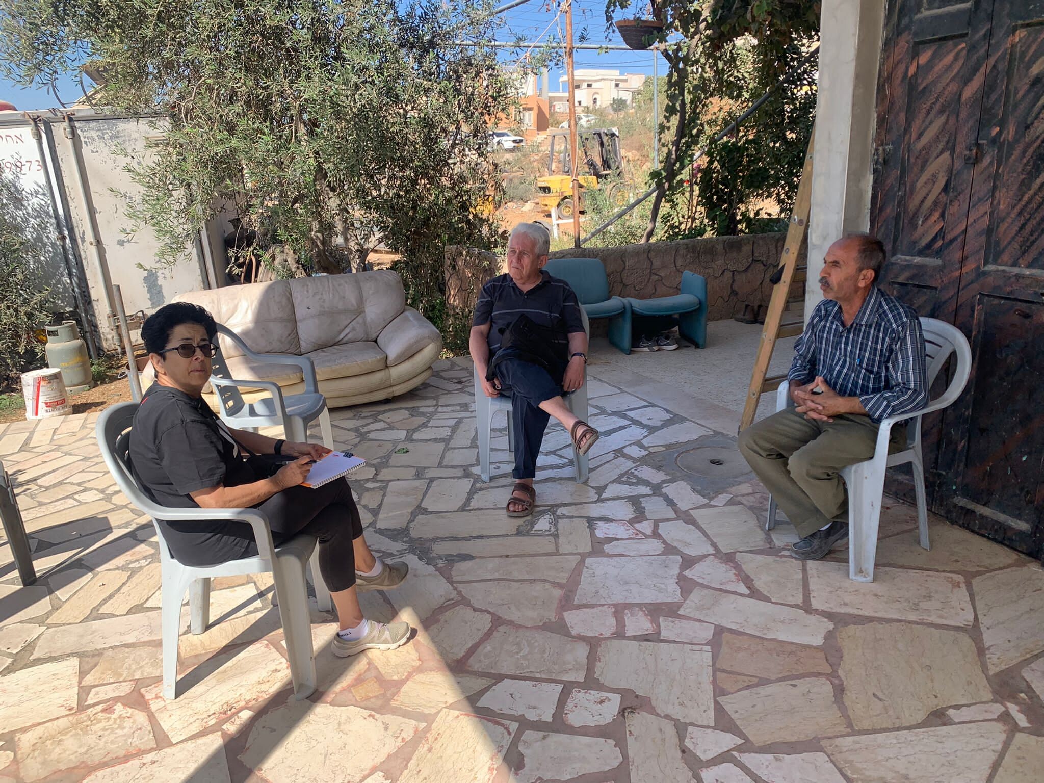
We drove on road 60, to Tawfiq in Khursa, (near the settlement Nagohot).
We met Tawfiq, who lives next to the pillbox, and a checkpoint, which forces the residents to make a long detour.
He told us about the difficult economic situation of the people, the pressure which this creates, about the Palestinian Authority which is so weak. Also about the army, which in every way , increases anger and hatred! In addition, there are also internal conflicts and the large quantity of weapons which circulate and are used not only against Jews. In general, it is reported that the situation is calmer and the army unit which is now in the area bothers them less, but still he told about 2 incidents:
– Stones were thrown, and the army entered one of the businesses in the area and threatened the business owner that if he did not tell who of the children threw stones, they would throw tear gas into the business….
– There was a shooting incident in the Negohot area, they put a curfew on the area and took cameras. Two hours later the curfew was lifted (only a vehicle damaged).
Khursa / Al Marajem
See all reports for this place-
Khursa / Al Marajam
Khursa is a small village of about 2,500 inhabitants in Area A, on a hill on the way to Negohot settlement. At the end of September 2017, a pillbox watchtower was set up in the heart of the village, adjacent to the village's diwan, which is a sort of community center for celebrations such as weddings, or used as mourning tent. The army declared the place a closed military zone. In 2018, we saw another aggravation: a barrier of about 50 m, which divides the road into two, and a prohibition on passing vehicles, and then also a prohibition on pedestrians, who have to walk around on a dirt road - during winter on a mud road. Since the checkpoint was established, the army has required special permits to hold an event in Diwan and the permits must be requested at least two days in advance. Of course, the dying are not always cooperative ...together with the villagers we wondered what the meaning of this strange barrier in Area A, which is supposed to be under full control of the Palestinian Authority. Conclusion: It seems that in order to secure the way to the Negohot, the residents are forced to live with a closed military zone and a watchtower in the village center, and suffer many restrictions. (From Watch Checkpoint reports).
Recently, the Israeli authorities began, in the middle of the night, to pave a new bypass road from the nearby village Fuqeiqis to Negohot, Trying to establish facts and aiming to enlarge the settlement.
Updated in April 2021 by Anat T.
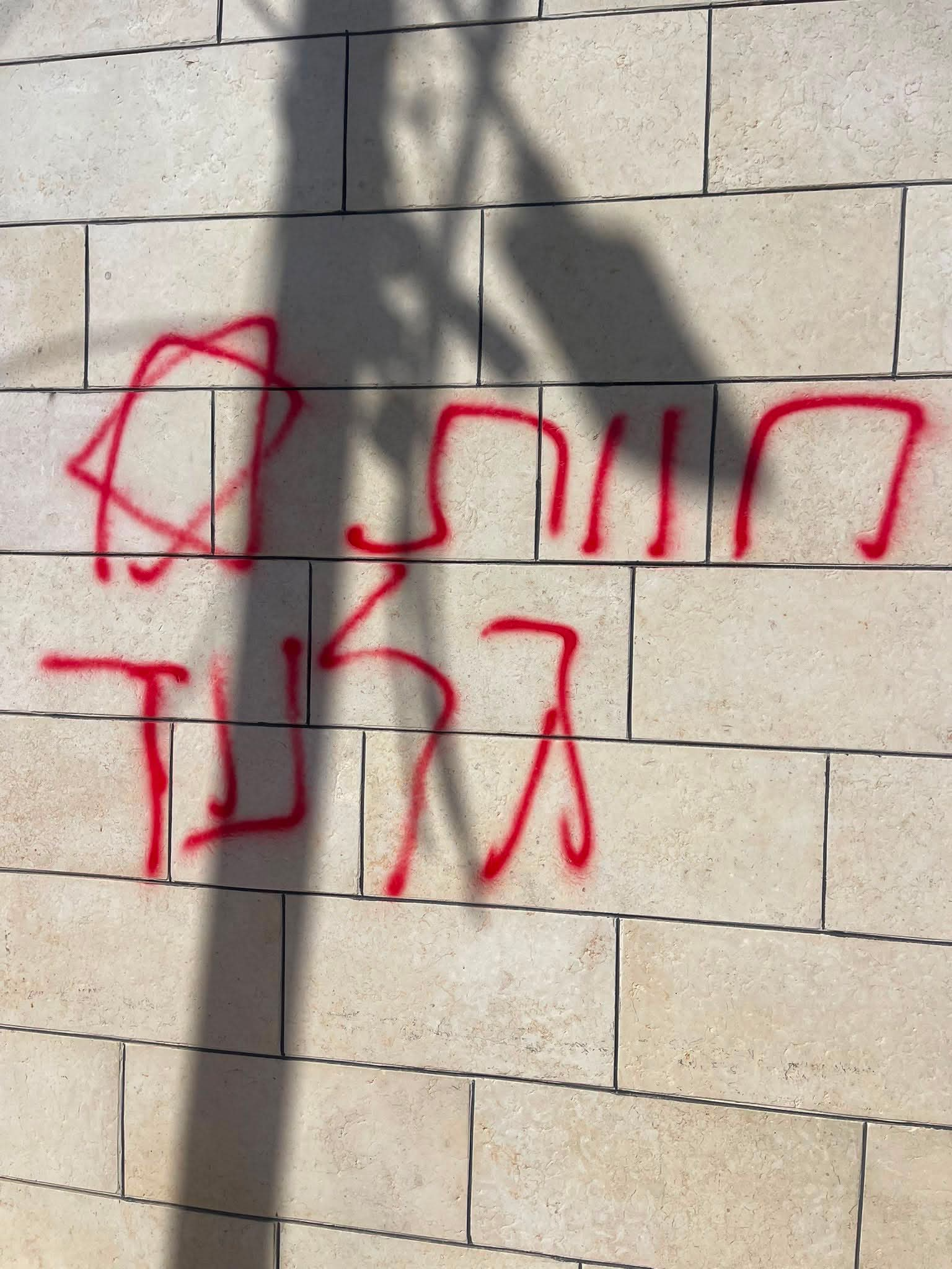 A Palestinian residentJul-19-2026Graffiti sprayed in A-Tuwani
-
South Hebron Hills
See all reports for this place-
South Hebron Hills
South Hebron Hills is a large area in the West Bank's southern part.
Yatta is a major city in this area: right in the border zone between the fertile region of Hebron and its surroundings and the desert of the Hebron Hills. Yatta has about 64,000 inhabitants.
The surrounding villages are called Masafer Yatta (Yatta's daughter villages). Their inhabitants subsist on livestock and agriculture. Agriculture is possible only in small plots, especially near streams. Most of the area consists of rocky terraces.Since the beginning of the 1980s, many settlements have been established on the agricultural land cultivated by the Palestinians in the South Hebron Hills region: Carmel, Maon, Susia, Masadot Yehuda, Othniel, and more. Since the settlements were established and Palestinians cultivation areas have been reduced; the residents of the South Hebron Hills have been suffering from harassment by the settlers. Attempts to evict and demolish houses have continued, along with withholding water and electricity. The military and police usually refrain from intervening in violent incidents between settlers and Palestinians do not enforce the law when it comes to the investigation of extensive violent Jewish settlers. The harassment in the South Hebron Hills includes attacking and attempting to burn residential tents, harassing dogs, harming herds, and preventing access to pastures.
There are several checkpoints in the South Hebron Hills, on Routes 317 and 60. In most of them, no military presence is apparent, but rather an array of pillboxes monitor the villages. Roadblocks are frequently set up according to the settlers and the army's needs. These are located at the Zif Junction, the Dura-al Fawwar crossing, and the Sheep Junction at the southern entrance to Hebron.
Updated April 2022
A Palestinian residentJul-19-2026Graffiti sprayed in A-Tuwani
-