
Al Fawwar – sudden road blocks again

A foggy and dusty day.
We drove along Route 60 and Route 356.
Israeli flags are flying in every corner.
Opposite the Shim’ah settlement on the west side of road 60 is the Yehuda farm, of which we wrote about in recent years. In the application of paths in Israel, Amud Anan, it is defined as an agricultural farm for raising sheep. This week a very large Star of David was added, which according to Muhammad is also illuminated at night. This is in addition to the giant flag that has been there for some time, and has already been reported. From the road you hear the sounds of a bulldozer that is probably preparing the ground for another building.
In front of the spring near the Dura al Fawwar intersection, today the cement barriers are manned and the soldiers are standing with weapons, possibly loaded, and the Israeli flag next to them. We didn’t manage to take pictures, but we felt the nationalism in the air. At the al Fawwar grocery store, they say that the soldiers once again started making sudden roadblocks at the intersection at all hours of the day.
There are many vehicles in the parking lot of the Hebron Police Station – Yehuda brigade. People say that recently they can make an appointment to arrange permits of various kinds through an app. This might make things a little easier and save waiting times.
Route 356:
In front of Ad-Dirat (eastern Yatta and Khalet-al-Miya) again we see unusual security: a soldier with a loaded weapon and a large Israeli flag next to him. We are really afraid to get close.
But, near the entrance to Bani Naim, the almond trees are blooming. They bring some beauty for the soul in this area.
Dura Al-Fawwar Junction
See all reports for this place-
Junction on Route 60: west - the town of El Dura, east - the Al Fawwar refugee camp. There is a manned pillbox at the junction. From time to time the army sets up flying checkpoints at the entrance to El Fawwar and Al Dura. Al-Fawwar is a large refugee camp (7,000 inhabitants in 2007) established in 1949 to accommodate Palestinian refugees from Be'er Sheva and Beit Jubrin and environs. There are many incidents of stone-throwing. In the vicinity of the pillbox there are excellent agricultural areas, Farmers set up stalls adjacent to the plots close to the road. In recent months the civil administration has set up dirt embankments thereby blocking access to the stalls, and making it impossible for the farmers to sell their vegetables. Updated April 2021, Michal T.
-
South Hebron Hills
See all reports for this place-
South Hebron Hills
South Hebron Hills is a large area in the West Bank's southern part.
Yatta is a major city in this area: right in the border zone between the fertile region of Hebron and its surroundings and the desert of the Hebron Hills. Yatta has about 64,000 inhabitants.
The surrounding villages are called Masafer Yatta (Yatta's daughter villages). Their inhabitants subsist on livestock and agriculture. Agriculture is possible only in small plots, especially near streams. Most of the area consists of rocky terraces.Since the beginning of the 1980s, many settlements have been established on the agricultural land cultivated by the Palestinians in the South Hebron Hills region: Carmel, Maon, Susia, Masadot Yehuda, Othniel, and more. Since the settlements were established and Palestinians cultivation areas have been reduced; the residents of the South Hebron Hills have been suffering from harassment by the settlers. Attempts to evict and demolish houses have continued, along with withholding water and electricity. The military and police usually refrain from intervening in violent incidents between settlers and Palestinians do not enforce the law when it comes to the investigation of extensive violent Jewish settlers. The harassment in the South Hebron Hills includes attacking and attempting to burn residential tents, harassing dogs, harming herds, and preventing access to pastures.
There are several checkpoints in the South Hebron Hills, on Routes 317 and 60. In most of them, no military presence is apparent, but rather an array of pillboxes monitor the villages. Roadblocks are frequently set up according to the settlers and the army's needs. These are located at the Zif Junction, the Dura-al Fawwar crossing, and the Sheep Junction at the southern entrance to Hebron.
Updated April 2022
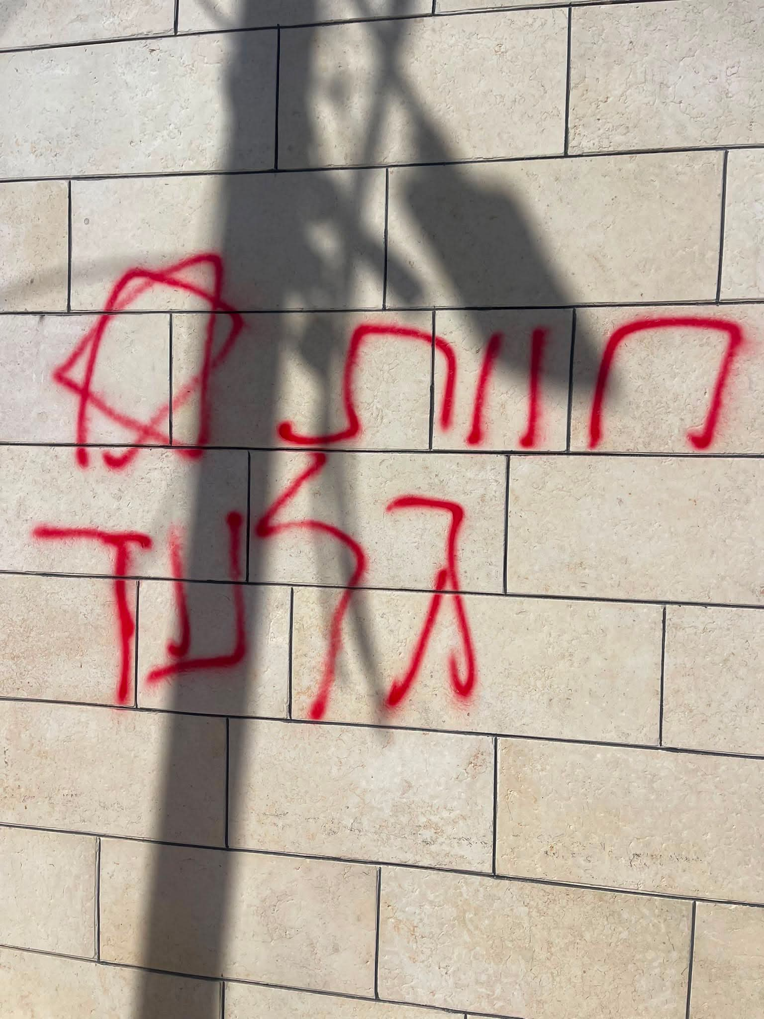 A Palestinian residentJul-19-2026Graffiti sprayed in A-Tuwani
-