
‘Anabta, ‘Azzun, Deir Sharaf, Jubara (Kafriat), Qalqiliya, Ras ‘Atiya, Sun 8.11.09, Afternoon
Summary
"Occupation doldrums" should be the title of today's shift. There's a
kind of inertia in the air, not a blade of grass seeming to stir in the
hills of the OPT, mirrored by the becalmed, still Mediterranean, the
sight of which is always a relief after the harshness of Occupation.
12:10 Habla Agricultural Gate
Two jeeps of six soldiers; the gate is still open as a small truck,
bearing a large group of young papaya trees, impresses the soldiers
stationed here. A young Palestinian man, who looks old enough to have
his own ID, card can't cross the Seam Line: "What can I do"? he asks us
without expecting an answer. "I need my father!"
Near Alfe Menashe
Not a truck, not a workman in sight by the new Separation Wall, and
little work has been done since our last visit a week ago either here
or at what we assume will be the new checkpoint kilometers away from
its present location on the Seam Line.
Ras Atiya
Soldiers here, checking cars and people coming out of the village
against a list, tell us there's no way to cross over to the other side
of the Seam Line, "it's Area A" (really)? As for the newly being built
Separation Wall, the commander asks if we know the Wall in Jerusalem:"
It's to save us from shots" (really)? Small children, unaware of this
farcical conversation, pass us as they make their way homewards after
school, crossing the Seam Line checkpoint, without being bothered. We
wonder what will happen to them once this checkpoint is closed and the
new one, kilometers away from their schools and homes, is in operation?
Qalqiliya – no checkpoint today
Azzun – no earth mound today
All along Route 55 little traffic, as if the world has taken a holiday,
or as if the Occupation has become tired or bored: not a single Hummer
or jeep or Safari to be seen until we reach Jubara.
Qedumim – But here settlement building, of course, continues
apace. A vast new yellow crane is working on the south side of the
settlement.
Deir Sharaf – The soldiers sit under their awning, a coffee or card
table in front of them. They are busy shooting the breeze, doing
nothing to check the vehicles, Israeli (yellow license plates) or
Palestinian that pass the checkpoint in either direction.
Anabta – very little traffic which moves freely
Jubara – The soldiers seem not to know what to do with us. They
don't know MachsomWatch. Say we should wait until they find out if we
can go through the gate up to the village and on to Gate 753. We wait
and wait. We usually don't mention this, but two of the four soldiers
wear kipot. We see them making phone calls. Nothing happens. Fifteen
minutes later, a Safari, bearing a new shift appears. It's obvious, we
are not going to get up to Gate 753 today.
Last, but not least, a non army truck appears, from the Israel proper
side of the checkpoint, stops on the south side of the Jubara
checkpoint, and from it descend one male soldier, the driver and three
female soldiers. The dog, visible inside, stays put, but the four
soldiers "get dressed," by donning their flak vests. They are now ready
to drive onwards into the heart of an area that is teeming with
terrorists!
'Anabta CP
See all reports for this place-
'Anabta CP
The checkpoint is located south of the village of 'Anabta, at the intersection of Road 60 (leading to Nablus at the entrance to Area A), with Road (57, 557, 5576) facing west towards the Einav settlement and the checkpoint at the exit from the West Bank - Figs checkpoint. Until 2010 we used to watch the intersection and report the long columns created due to a slow inspection of the vehicles in both directions. Oct-28-2011Anabta checkpoint 24.10.11
-
'Azzun
See all reports for this place-
Azoun (updated February 2019)
A Palestinian town situated in Area B (under civil Palestinian control and Israeli security control),
on road 5 between Nablus and Qalqiliya, east of Nabi Elias village. The inhabitants are allowed to construct and improve infrastructures. The Separation Fence has confiscated lands belonging to the town's people. In 2018 olive tree groves owned by one of its inhabitants were confiscated for the sake of paving a road to bypass Nabi Elias. Azoun population numbers 13,000, its economic state dire. Its infrastructures are poor, neglect and poverty rampant. In the meantime, the town council has completed paving an internal road for the inhabitants' welfare.
Because of its proximity to the Jewish settler-colony of Karnei Shomron and its outposts, the town suffers the intense presence of the Israeli army, especially at nighttime: soldiers enter homes, arrest suspects, trash the house and sometimes ruin it, as they do in numerous places in the West Bank. At times a checkpoint closes the entrance to the town, so no one can come in or get out.
-
Deir Sharaf checkpoint
See all reports for this place-
Deir Sharaf checkpoint is located west of Nablus and south of the settlement of Shavei Shomron, at the entrance to the village of Deir Sharaf on the road leading to Nablus. The checkpoint was activated in early March 2009 after the Beit Iba checkpoint was closed. Palestinians are allowed through the checkpoint , but not for Israelis. Unlike the checkpoints leading to Qalqilya and Tulkarm, crossing of Israeli Palestinians is only allowed on Saturdays.
 Nina SebaFeb-28-2024Deir Sharaf - the entrance to the village
-
Jubara (Kafriat)
See all reports for this place-
The Jabra checkpoint was on Road 557, south of Tulkarm, on the side of the Figs Pass, which is located within the Palestinian Authority (a few kilometers east of the Green Line), and serves as an entry barrier from the territories to Israel. The checkpoint to the village of Jubara, which until 2013 was in the seam area, blocked and surrounded by a fence, was intended for the passage of the family members of the house next to the checkpoint, and also for the MachsomWatch volunteers (with special permission only), on their way to checkpoint 753. on the other side of the village. The soldiers supervising the "fig crossing" also supervised the crossing at this checkpoint, in our shifts we often waited a long time until the key was found and the gate opened. The checkpoint was abolished and became part of the separation fence that was moved west following the High Court.
-
Qalqiliya checkpoint
See all reports for this place-
Qalqilya is surrounded on all sides by the separation barrier. The only exit from the city is in the east of the city on the road that leaves the city in an easterly direction. This is where the checkpoint was located. When the checkpoint was active until 2009 our shifts watched long queues of cars being inspected at the only exit from the city to the West Bank. The checkpoint was canceled, but there is a military presence at the entrance to the city.
 Nina SebaAug-18-2025Azzun: Enclosed by a high fence and the gate to the village is closed
-
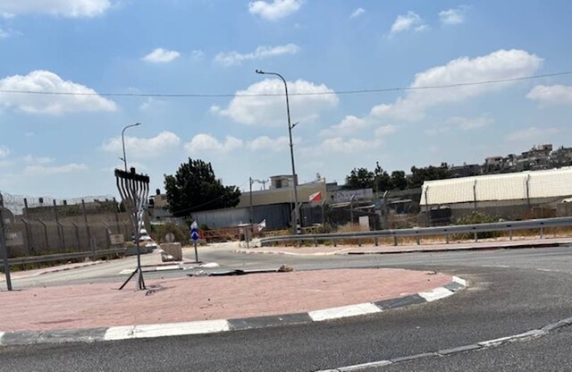
Ras 'Atiya
See all reports for this place-
The checkpoint is presently on the Separation Barrier roadway, manned and open 12 hours a day, from 6:30 to 18:30. West of it is the large Seam Line village whose school is attended by children from the nearby villages east of the Barrier and many of whose inhabitants have permits to work in Israel. How long this checkpoint will remain in place is unknown, since construction of the Separation Wall, just by the settlement of Alfe Menashe, east of the present Separation Barrier, is endless, as is the creation of a new road and, obviously, a new checkpoint.
-