
‘Anabta, Habla, Irtah (Sha’ar Efrayim), Jubara (Kafriat), Sun 17.7.11, Afternoon
Summary
As MachsomWatchers, we bear witness to what is going on in the OPT, drive through a landscape that is by now familiar to us at all times of the year, scarred only by increasing settlement growth and land grab, but unless we take visitors with us, we rarely look at the map. When we do, we note that the Israeli road atlas appears to incorporate all of Palestine, since the Green Line is little more than a faint, dotted line, like this: ———-The checkpoints appear as a Tsadik צ . And around each settlement, not indicated as such, is a security road, also lightly marked, but pretty, like a seed pearl necklace, —o—–o—–.The map we usually look at, from B‘tselem, resembles a Jackson Pollock painting, and shows all the checkpoints, all the settlements and the growing envelopment of the Separation Barrier. Not a pretty picture!
13:07 Habla
All gates open, the newly created pedestrian gate seemingly forgotten. One horse and cart with straw, another with “Alte Zachen” (secondhand stuff). Unlike on previous occasions, nothing is examined, these soldiers seem easy. The man with the cart piled high with straw, drives to the other side of the Separation Barrier, returns, to the center, says something to the military policewoman who is standing in the shelter with two soldiers (only two this week) and walks over to us, asking for help for his 30 year old son, out of work, none to be found, seven children and blacklisted. The father speaks good Hebrew, and we ask him to talk to S., who will listen to yet another sad tale of woe from the OPT and do her best to help.
Another hot summer’s day, and we note the new crops peeking up above the ground, fed from the spring, housed where Catholic Relief Services and the Mennonites gave help, in 2002. The owner of these 8 dunams, from Habla, tells us that one crop, where we stand is the eponymous “lubia” (green bean), and next to the tall growing corn, is food for horses, since the latest IDF ruling is that no animal foods may be transported across the Separation barrier. Moreover, the huge, rusty water container, fit to hold hundreds of
liters cannot be revitalized. No paint may be brought across the Separation Barrier…We turn to leave as the owner of his lands goes across to the concrete hut on the far side of the Barrier, to show ID which has to be shown several times a day as yet one more Palestinian makes his way to and from his own home and his own lands. The humbling experiences of everlasting Occupation.
Later, we hear of a sick horse which had been brought to the area of the nurseries, had stayed there overnight and then was not allowed back… rules made on the ground by overbearing soldiers.
Route 55
15:00 At the Eliahu Gateway, plain clothes police stand and look into vehicles, but don’t stop them. Building and reconstruction going on here to create a bigger and better entry to the OPT (as if the Seam Zone were open lands)! Just beyond, at the entry way to Qalqilya (sorry, nobody can know that the roadway off to the left leads to an enclosed city of 45,000 people) a blue police van, checking cars coming from that city.
Along the road, a lot of traffic, mainly Israeli cars (yellow license plates), but one has to notice that the Palestinian cars we see today are newer vehicles than a year or two ago.
Ramat Gilad
A new banner, in large letter Hebrew, “Rise and Go up Now,” with smaller letters which can’t be read as we climb up the hill towards Al Funduk. Here a bulletproof police van, similar to an army Hummer, is seen on the road.
Route 57
16:00 Ramin
Nothing changes. The mounds and ditches still cut the village off from the road. People climb across the IDF built mound by the main road towards two waiting vehicles.
Anabta
Traffic moves slowly through the checkpoint but there don’t seem to be any soldiers visible. Stickers, in Hebrew, placed on the signpost with the junction at Route 57 say nothing more innocuous than “Netanya.”
16: 10 Jubara
Abu Ghatem’s house seems squeezed in between the huge, gleaming white rocks, his land clearly having given way to the newly (still being built) Separation Barrier.
Border guards inspecting vehicles going into the West Bank.
16:15 Irtah (Sha’ar Efraim)
Noise of drilling going on, from the direction of the back-to-back facility. More construction? A steady stream of returning workers, guards no longer interested in them. Three unlock a padlocked gate leading to the back-to-back area and one asks, “So what do you want?” We answer that we’re “MachsomWatch,” and, sotto voce, “We want an end to Occupation.”
'Anabta CP
See all reports for this place-
'Anabta CP
The checkpoint is located south of the village of 'Anabta, at the intersection of Road 60 (leading to Nablus at the entrance to Area A), with Road (57, 557, 5576) facing west towards the Einav settlement and the checkpoint at the exit from the West Bank - Figs checkpoint. Until 2010 we used to watch the intersection and report the long columns created due to a slow inspection of the vehicles in both directions.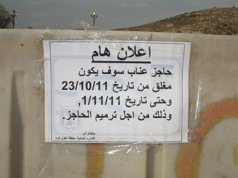 Oct-28-2011Anabta checkpoint 24.10.11
-
Habla
See all reports for this place-
Habla CP (1393)
The Habla checkpoint (1393) was established on the lands of the residents of Qalqilya, on the short road that
connected it for centuries to the nearby town of Habla. The separation barrier intersects this road twice and cut off the residents of Qalqilya from their lands in the seam zone.(between the fence and the green line).
There is a passage under Road 55 that connects Qalqilya to the sabotage This agricultural barrier is used by the farmers and nursery owners established along Road 55 from the Green Line and on both sides of the kurkar road leading to the checkpoint.
This agricultural checkpoint serves the residents of Arab a-Ramadin al-Janoubi (detached from the West Bank), who pass through it to the West Bank and back to their homes. The opening hours (3 times a day) of this agricultural checkpoint are longer than usual, about an hour (recently shortened to 45 minutes), and are coordinated with the transportation hours of a-Ramadin children studying in the occupied in the West Bank.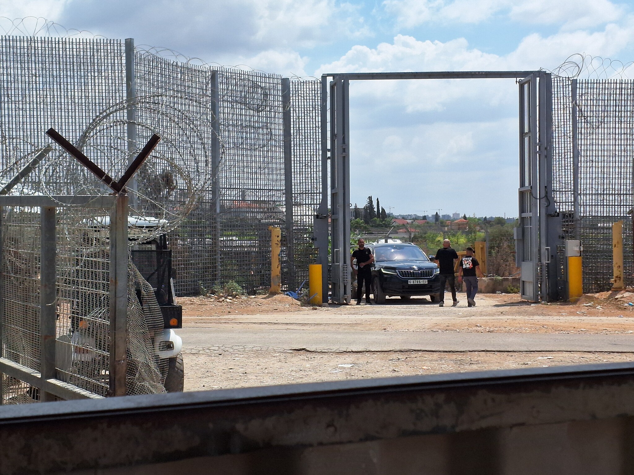 Ronit Dahan-RamatiAug-31-2026Habla. The gate is open
-
Irtah (Sha'ar Efrayim)
See all reports for this place-
The checkpoint is for Palestinians only. It is the main barrier to the passage of workers from the northern West Bank to Israel. Workers with a permit to work in Israel and also for trade (with appropriate permissions), medicine, and visiting prisoners. One can cross the checkpoint only on foot. The checkpoint is located north of Road 557 and south of Tulkarm. Operated by a civil security company, opening hours: between 4:00 and 19:00 on weekdays. As members of Machsom Watch, we began our shifts to this location in 2007. We arrived before it opened at 4 in the morning and report since, on the harsh conditions and the long and crowded queues of workers. The workers who pass by continue their journey by transportation to work throughout Israel. In the first period of its activity, about 3,000 and then 5,000 people passed through this checkpoint every day. Due to the small number of checking points and arbitrary delays for long periods of time in the "rooms", workers feared losing their transportation. Hence workers leave their homes at 2:30 at night to be among the first. Today, 15,000 pass and the transition is faster. Workers are still leaving their homes very early to get past the checkpoint at 7 p.m. In an adjacent compound, there is a terminal for the transfer of goods on a commercial scale, using the back-to-back method.
-
Jubara (Kafriat)
See all reports for this place-
The Jabra checkpoint was on Road 557, south of Tulkarm, on the side of the Figs Pass, which is located within the Palestinian Authority (a few kilometers east of the Green Line), and serves as an entry barrier from the territories to Israel. The checkpoint to the village of Jubara, which until 2013 was in the seam area, blocked and surrounded by a fence, was intended for the passage of the family members of the house next to the checkpoint, and also for the MachsomWatch volunteers (with special permission only), on their way to checkpoint 753. on the other side of the village. The soldiers supervising the "fig crossing" also supervised the crossing at this checkpoint, in our shifts we often waited a long time until the key was found and the gate opened. The checkpoint was abolished and became part of the separation fence that was moved west following the High Court.
-
