
'Anata-Shu'afat, Ar-Ram, Beit Ijza 6179, Hizma, Qalandiya


Jerusalem/Al Quds, “The Forbidden City”
07:15 Bethlehem checkpoint (300)
The day after Christmas, somewhat fewer workers than usual on the way from the checkpoint. A Border Police flying checkpoint on the road to Rachel Tomb’s checkpoint. Chana says it’s been there for a few days, checking documents of vehicles passing through. Because of the attacks? Shacks among the olive trees by the roadside. Their purpose is unclear. A very new hotel almost opposite the checkpoint. What a wonderful view for tourists!
Light traffic on the Israeli side of the checkpoint. The women’s lane is closed. We asked a few workers and also checkpoint personnel about Omicron restrictions, but apparently all the workers crossing have received a third shot and are not subject to restrictions. The security personnel were friendly. We left quickly. As is well known, the problem is one of great congestion , mainly on the Palestinian side, where there are only two revolving gates for entry.
Vehicle checkpoint, Shu’afat refugee camp, ‘Anata (we drove through the checkpoint; we didn’t get out)
We were pleased to see that the traffic light at the Jerusalem and Pisgat Ze’ev exit has apparently been synchronized – it had caused massive traffic jams leaving the Shu’afat camp via the checkpoint. And – the children are on a two-week break and there is no pupil transport to Jerusalem.
Shops along the main road through the Shu’afat camp to ‘Anata are still closed, and it’s very dirty. The municipality cleans here – up to the Shalom neighborhood, whose residents are categorized as Jerusalem residents – but not sufficiently. The UN cleans within the refugee camp. The Palestinian Authority cleans in ‘Anata, which looks a little better.
Hizma, Jaba, Sha’ar Binyamin, construction at Qalandiya and ‘Atarot
We took Highway 437 to Hizma and Jaba. The army has piled earth and rocks at some of the exits from Hizma, and entry to the town is no longer possible there. Soldiers at the main entrance to Hizma – one at the traffic circle with weapon drawn, one inspecting documents and one supervising, A major traffic jam at the exit during the morning is extremely annoying. The supervising soldier explains (including with photos on his cell phone) that stones were thrown at cars and buses traveling along the road to ‘Anatot and Baq’a. They apparently know what they’re looking for, which is whey they’re checking documents. What’s strange is that Kamal, our driver, who’s a resident of Shu’afat and drives along this road, hasn’t heard of such incidents.
We continue to Jaba. The checkpoint is deserted and at the Sha’ar Binyamin industrial zone junction on Highway 60 we turn around and head back toward A-Ram and the Qalandiya checkpoint. On the way to the demolished traffic circle the work to lower the apartheid road, which will be restricted to holders of blue ID cards, continues apace. They’ll pass under the traffic circle and connect via Highway 45 directly with Highway 443 to Tel Aviv or Jerusalem.
We wanted this time to get an overall view of the work going on in the area so Kamal brought us to a hill on the outskirts of A-Ram which overlooks the entire area (see photo). Hanna noted that she finally understands the reason for the monstrous bridge over the Qalandiya vehicle checkpoint: it will connect to a terminal for buses to Jerusalem via ‘Atarot along the road running beside A-Ram’s wall. Everyone crossing through the checkpoint on their way to and from Jerusalem will use it. The remaining area of the ‘Atarot airport runways, which were demolished a few months ago, will be reserved for the new Jewish settlement at ‘Atarot which hasn’t yet been established (the plans were recently delayed at the last minute).
Via Highway 443 to Giv’at Ze’ev, and on to the checkpoints of the Bidu-Beit Iksa salient
Nothing new at these checkpoints that separate the salient’s farmers from their lands in the Giv’at Ze’ev – Giv’on Ha’hadasha- Ramot Shmuel-Ramot bloc. They also separate the residents of Nabi Samwil from their remaining land in the salient. We’ve never seen that these checkpoints were open.
Below the Biddu checkpoint is a “quality of life” road to an additional salient – Bir Nabala. We discovered on a fenced area near the checkpoint an interesting sign: “Private propery: Ofra Cooperative Village,” with a phone number where no one answered. Hagit Ophran from Peace Now is familiar with the location. It was purchased by the settlers in anticipation that the agricultural land would be released to expand the area’s settlements. The settlers arrange for everything to be taken care of “upstairs”!
The Bet Ijza checkpoint, adjacent to the Ramot Shmuel settlement, is an exception. There’s a wide gap in the fence where people go through on foot. The new addition here for the winter is a large carpet over the mud at the exit from the gap. Our Hanna crossed on the carpet and only because she ran out of time didn’t reach the next checkpoint in the salient that, in addition, divides villages within the salient from each other…
There’s no doubt that Jerusalem/Al Quds is “the Forbidden City” for all the residents of the nearby Palestinian villages and towns.
A-Ram
See all reports for this place-
two kilometers south of Qalandiya and 300 metres north of Neve Yaacov Junction, in Dahiyat el-Barid Quarter. Checkpoint has operated since 1991, in a Palestinian area annexed to Jerusalem in 1967. The checkpoint has been inactive since the middle of 2009.
The wall was built on the road that led to Jerusalem. Since then the situation in the town has deteriorated. Houses are abandoned and half finished, most of the businesses have closed. Severe neglect around the fence and on the streets. Those who could left. Updated January 2024
-
Beit Ijza (6179) CP
See all reports for this place-
Beit Ijza CP- the outskirts of the new Givon: The checkpoint placed on the separation barrier consists of several high gates and fences that surround a Palestinian house cage from the village of Beit Ijaza, which the separation wall left in the area of the new Givon settlement. The settlement did not give up any space around the trapped house. The residents of the house are Palestinians and their entire lives have remained beyond the fence. They can move to Beit Ijaza only with special permits.
Read about MachsomWatch tour to Beit Ijza: https://machsomwatch.org/en/node/20941
-
Bethlehem (300)
See all reports for this place-
Located adjacent to the Separation Wall ("Jerusalem Wrap") at the north entrance to Bethlehem, this checkpoint cuts off Bethlehem and the entire West Bank from East Jerusalem, with all the serious implications for health services, trade, education, work and the fabric of life. The checkpoint is manned by the Border police and private security companies. It is an extensive infrastructure barrier and is designated as a border terminal, open 24 hours a day for foreign tourists. Israeli passport holders are not allowed to pass to Bethlehem, and Palestinian residents are not allowed to enter Jerusalem, except those with entry permits to Israel and East Jerusalem residents. Israeli buses are allowed to travel to Bethlehem only through this checkpoint.The checkpoint, which demonstrated harsh conditions of crowding and extreme passage delays for years, started employing advanced electronic identification posts and has upgraded its gates' system as of the middle of 2019 - and conditions improved.Adjacent to the checkpoint, in an enclosure between high walls and another passage, is the historic Rachel's Tomb, which is now embedded within a concrete fortified building. It contains prayer and study complexes for Jews only, as well as a residential complex. updated November 2019 .
-
Checkpoint Shu'afat camp / Anata-Shu'afat (Jerusalem)
See all reports for this place-
The Shu’afat checkpoint is located in the northern part of East Jerusalem at the exit from the village of Anata and the Shu’afat refugee camp, which are located in the area annexed to Jerusalem in 1967. The refugee camp borders the Shu’afat neighborhood to the west, Pisgat Ze’ev to the north, the French Hill neighborhood to the south and the planned expansion of Ma’aleh Adumim to E-1 in the east. It was established in 1966 for 1948 refugees from the West Bank and was populated after the Six Day War by persons who had been expelled from the Jewish Quarter. Today its population comprises some 25,000 people holding blue ID cards and some 15,000 people with Palestinian ID cards. The camp lacks adequate infrastructure and services, and suffers from poverty, neglect and overcrowding. All its buildings are connected to the public electricity and water infrastructure, but not all are connected to the sewer system. The camp’s services are provided by UNRWA, except for those such as health clinics and transportation of pupils to schools in Jerusalem. In 2005, the Israeli High Court of Justice rejected a suit by the residents requesting that the route of the separation fence be drawn such that the camp would remain on the Israeli side, but conditioned its approval of the route on the establishment of a convenient and rapid crossing facility for the inhabitants of the neighborhood, most of whom are residents of Jerusalem.
A temporary checkpoint operated there until December, 2011. It was extremely congested during rush hours, and dangerous for pedestrians (especially children) because of inadequate safety provisions. The new checkpoint was inaugurated south of the old one, for public and private transportation and for pedestrians, intended solely for the residents of the camp – holders of blue ID cards, and those with Palestinian ID cards who possess appropriate permits. There are five vehicle inspection stations at the checkpoint, and two for pedestrians (one of which is currently closed) where scanners have been installed but are not yet operating. According to the army, representatives of government agencies will also be present to provide services to residents of the neighbourhood. The pedestrian lanes are very long, located far from the small parking lots, and accessible through only a single revolving gate. Anat TuegJan-25-2026Anata: A new outpost has been built south of the junction
-
Hizma
See all reports for this place-
Hizma
A checkpoint at the north-eastern entrance to the Jerusalem area which was annexed in 1967, at Pisgat Zeev. The passage is allowed to bearers of blue IDs only. Open 24 hours a day.
-
Qalandiya Checkpoint / Atarot Pass (Jerusalem)
See all reports for this place-
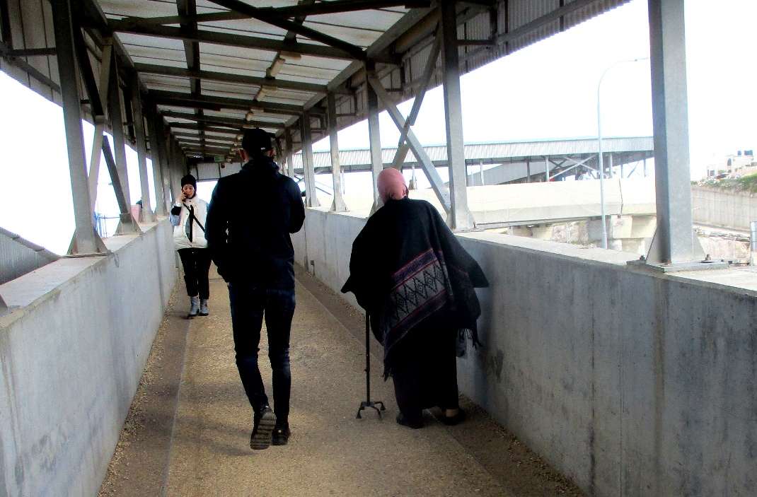
Click here to watch a video from Qalandiya checkpoint up to mid 2019 Three kilometers south of Ramallah, in the heart of Palestinian population. Integrates into "Jerusalem Envelope" as part of Wall that separates between northern suburbs that were annexed to Jerusalem in 1967: Kafr Aqab, Semiramis and Qalandiya, and the villages of Ar-Ram and Bir Nabala, also north of Jerusalem, and the city itself. Some residents of Kafr Aqab, Semiramis and Qalandiya have Jerusalem ID cards. A terminal operated by Israel Police has functioned since early 2006. As of August 2006, northbound pedestrians are not checked. Southbound Palestinians must carry Jerusalem IDs; holders of Palestinian Authority IDs cannot pass without special permits. Vehicular traffic from Ramallah to other West Bank areas runs to the north of Qalandiya. In February 2019, the new facility of the checkpoint was inaugurated aiming to make it like a "border crossing". The bars and barbed wire fences were replaced with walls of perforated metal panels. The check is now performed at multiple stations for face recognition and the transfer of an e-card. The rate of passage has improved and its density has generally decreased, but lack of manpower and malfunctions cause periods of stress. The development and paving of the roads has not yet been completed, the traffic of cars and pedestrians is dangerous, and t the entire vicinity of the checkpoint is filthy. In 2020 a huge pedestrian bridge was built over the vehicle crossing with severe mobility restrictions (steep stairs, long and winding route). The pedestrian access from public transport to the checkpoint from the north (Ramallah direction) is unclear, and there have been cases of people, especially people with disabilities, who accidentally reached the vehicle crossing and were shot by the soldiers at the checkpoint. In the summer of 2021, work began on a new, sunken entrance road from Qalandiya that will lead directly to Road 443 towards Jerusalem and Tel Aviv. At the same time, the runways of the old Atarot airport were demolished and infrastructure was prepared for a large bus terminal. (updated October 2021)
 Tamar FleishmanJun-28-2026Qalandiya. The bridge leading from Jerusalem to the Qalandiya checkpoint
-