
At-Tuwani - living conditions are difficult and life has become unbearable


At the Meitar checkpoint, the morning is particularly hot, there are few vehicles in the parking lot. According to Musa al Batat, these are probably the vehicles of the 150 workers with special permission to work in Israel.
On Route 60, on the side of the road in Zanuta, two jeeps watch over the deserted area. All the residents left for Dahariya for fear of the settlers.
The illegal outpost in Eshtmoa’ is growing and gaining development momentum in the area, many trucks are seen from the road.
The entrances to the Palestinian settlements on Route 60 are closed:
Daharyia North
Dura Al Fawwar
Qilqis
The Sheep Junction
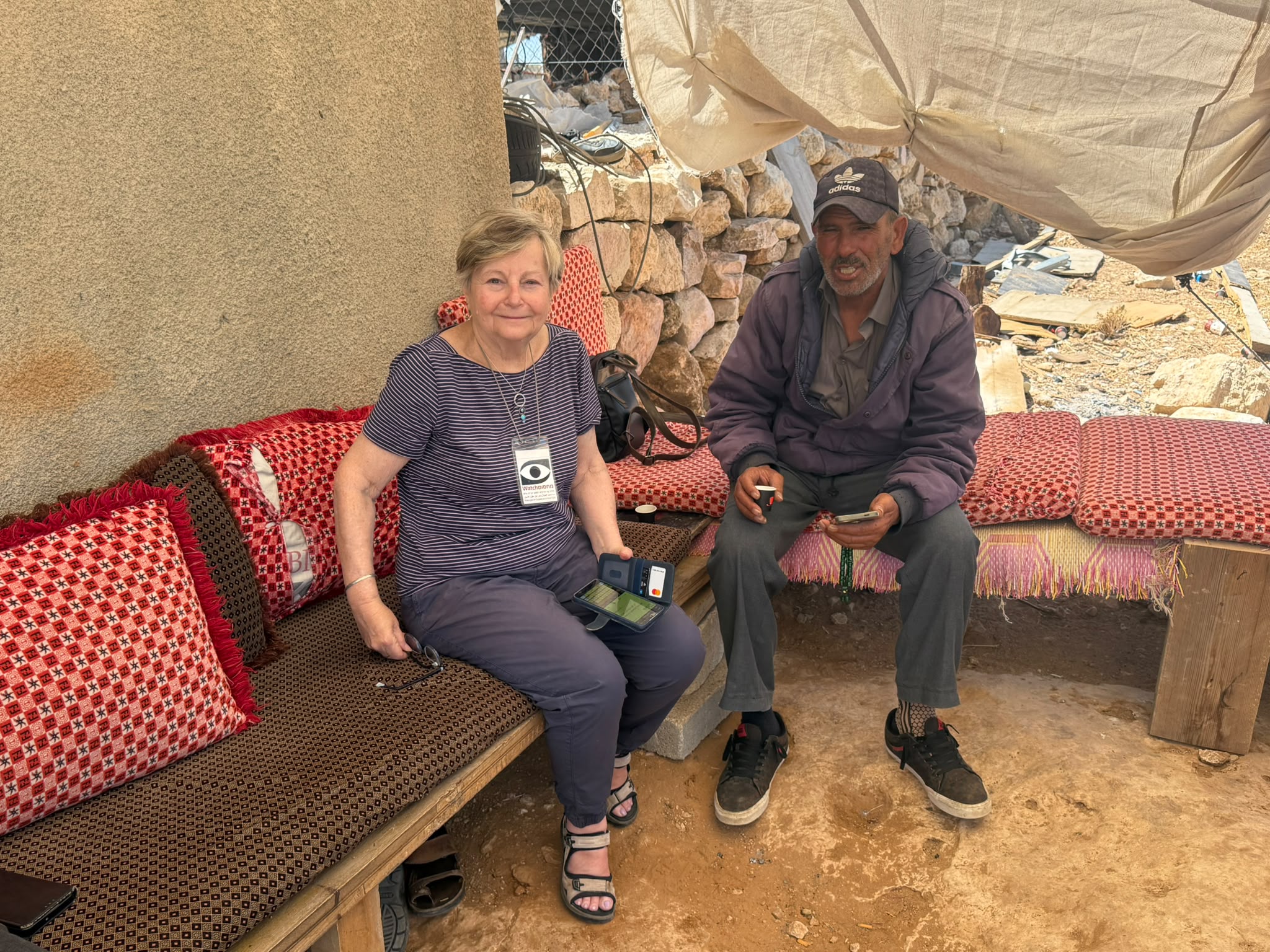
In At-Tuwani, road 317, Nasser tells us that the living conditions are difficult and life has become unbearable, two days ago the Civil Administration came to destroy one of their houses.
A-Tuwani
See all reports for this place-
A-Tuwani
The locals came to a-Tuwani during the 20th century from the village of Yatta. They settled in abandoned ruins, utilizing the arable land, pastures for grazing sheep and the abundance of natural caves for habitation. The residents who settled in the caves came from families who could not purchase land for houses in the mother villages, as well as shepherds who did not have enough land to graze. They were joined by clan members who quarreled with other families in the mother locality.
Some of the residents today live in concrete buildings built above the caves. In the area of the village are several water cisterns and an ancient water well called 'Ein a-Tuwani. Local residents are forced to buy water in containers and transport them through many road blocks to the village. With the help of international organizations, an electrical system was installed in the village. In the late 90s of the 20tTh century, an elementary school was established in the serving several small villages in the area.
In 2004, MachsomWatch began visiting and reporting from the Khirbet Tuwani cave village, which suffers badly from the settlers of nearby outposts, and especially from the extremist Ma'on outpost. . The settlers contaminate cisterns, poison the flocks and uproot trees.Particularly notable is the harassment of children from the surrounding villages on their way to school in a-Tuwani, so much so that military escort of children is required to separate them from the attackers (this was arranged following an initiative of the organization's members). In the past year, the escort has been without the vital presence of overseas volunteers.
Near a-Tuwani there are several families who have returned to the caves due to the incessant demolitions of the civil administration (as there is a total construction ban in all of area C). Destroyed are not only residential and agricultural buildings, but also water pipes, machinery. Even water cisterns are clogged up. a-Tuwani residents have created an association for non-violent demolition protests, but in the past year the army’s harsh harassment and settler violence have intensified and escalated. The incident of the small generator confiscation, which left a young man paralyzed, is one of many examples - any legitimate protection of property rights leads to violence and even shootings by the army and the civil administration.
Updated April 2022
 Muhammad D.Jul-12-2026Smadar with Taleb on duty at Qawawis
-
Dura Al-Fawwar Junction
See all reports for this place-
Junction on Route 60: west - the town of El Dura, east - the Al Fawwar refugee camp. There is a manned pillbox at the junction. From time to time the army sets up flying checkpoints at the entrance to El Fawwar and Al Dura. Al-Fawwar is a large refugee camp (7,000 inhabitants in 2007) established in 1949 to accommodate Palestinian refugees from Be'er Sheva and Beit Jubrin and environs. There are many incidents of stone-throwing. In the vicinity of the pillbox there are excellent agricultural areas, Farmers set up stalls adjacent to the plots close to the road. In recent months the civil administration has set up dirt embankments thereby blocking access to the stalls, and making it impossible for the farmers to sell their vegetables. Updated April 2021, Michal T.
-
Hakvasim (sheep) Junction
See all reports for this place-
One of the roadblocks (earthworks, rocks, concrete blocks or iron gates) that prevent transit of vehicles to Route 60 in the southern West Bank and block the southern entrance to Hebron. A manned pillbox supervises the place.
-
Meitar checkpoint / Sansana
See all reports for this place-
Meitar Checkpoint / Sansana The checkpoint is located on the Green Line and serves as a border crossing between Israel and the West Bank. It is managed by the Border Crossing Authority of the Defense Ministry. It is comprised of sections for the transfer of goods as well as a vehicle checkpoint (intended for holders of blue identity cards, foreign nationals or diplomats and international organizations). Passing of Palestinians is prohibited, except for those with entry permits to Israel. Palestinians are permitted to cross on foot only. The crossing has a DCO / DCL / DCL / DCL (District Coordination Office), a customs unit, supervision, and a police unit. In the last year, a breach has been opened in the fence, not far from the crossing. This breach is known to all, including the army. There does not appear to be any interest in blocking it, probably as it permits needed Palestinian workers without the bureaucratic permits to get to work in Israel. Food stalls and a parking area economy have been created, but incidents of violent abuse by border police have also been recorded. Updated April 2022
-
South Hebron Hills
See all reports for this place-
South Hebron Hills
South Hebron Hills is a large area in the West Bank's southern part.
Yatta is a major city in this area: right in the border zone between the fertile region of Hebron and its surroundings and the desert of the Hebron Hills. Yatta has about 64,000 inhabitants.
The surrounding villages are called Masafer Yatta (Yatta's daughter villages). Their inhabitants subsist on livestock and agriculture. Agriculture is possible only in small plots, especially near streams. Most of the area consists of rocky terraces.Since the beginning of the 1980s, many settlements have been established on the agricultural land cultivated by the Palestinians in the South Hebron Hills region: Carmel, Maon, Susia, Masadot Yehuda, Othniel, and more. Since the settlements were established and Palestinians cultivation areas have been reduced; the residents of the South Hebron Hills have been suffering from harassment by the settlers. Attempts to evict and demolish houses have continued, along with withholding water and electricity. The military and police usually refrain from intervening in violent incidents between settlers and Palestinians do not enforce the law when it comes to the investigation of extensive violent Jewish settlers. The harassment in the South Hebron Hills includes attacking and attempting to burn residential tents, harassing dogs, harming herds, and preventing access to pastures.
There are several checkpoints in the South Hebron Hills, on Routes 317 and 60. In most of them, no military presence is apparent, but rather an array of pillboxes monitor the villages. Roadblocks are frequently set up according to the settlers and the army's needs. These are located at the Zif Junction, the Dura-al Fawwar crossing, and the Sheep Junction at the southern entrance to Hebron.
Updated April 2022
Muhammad D.Jul-12-2026Smadar with Taleb on duty at Qawawis
-
Zanuta
See all reports for this place-
Zanuta was a small rural Palestinian locality until its demolition. It was situated in the space around the town Dahariya in the South Hebron Hills, about a ten-minute ride from Meitar Checkpoint. There are documented remains of a large Byzantine settlement in the area. Since the Ottoman (Turkish Empire) period (1516-1917) Zanuta was documented as a locality of shepherds and farmers who live in the remains of the ancient structures and the residential caves near them.
Two individual ranches of colonists were created next to Zanuta: Meitarim (of the colonist Yinon Levi) to the east, and Yehudah (of the colonist Elyashiv Nachum) to the north. Endless attacks, harassments and attempt to chase away the Zanuta villagers have originated in these two outposts.
Until the expulsion, four families lived in the village: A-Samama, Al-Tel, Al Batat, and Al-Qaisia. Farming constituted their main economic activity and employed most of the villagers. The total area of the village is about 12,000 dunams, of which about 3,000 are tended, mostly with field crops.
This village has never had a master plan that would legitimize construction permits. The Civil Administration claimed it was too small and the distance to the next town, Dahariya, too great. For this reason, the Israeli authorities pressured the villagers to leave. The colonists did the job for them.
-