
‘Atarot, Ar-Ram, Jaba (Lil), Qalandiya, Rafat (Bir Nabala), Wed 13.1.10, Afternoon
|
Blocks on Route 60 – Northern Section We went to see the obstructions that block the villages in Ramallah District from Route 60. Between Hizme Checkpoint and Huwarra Checkpoint Route 60 is still open to Palestinian cars. Some of the villages are blocked off from the road and their only exit for cars is in the direction of Ramallah from the north.
There are more than 3,000 souls living at Ein Yavrud. They have no exit to Route 60 and are blocked by concrete slabs strewn across the connecting road. Travel to Nablus and Ramallah necessitates wide detours.
At Silwad, where 10,000 people live, Route 60 is blocked by an iron arm which was removed a year ago only for two weeks. At Yavrud there is also an earthwork blocking the road. Thus, without fence or wall, these communities are also separated from roads on which Israelis travel, especially settlers from the northern West Bank. The three villages are very close to the settlements of Ofrah and its spread on to Givat Assaf. They of course have free access to the road.
Jaba Checkpoint Checkpoint for Israeli vehicles. There are concrete blocks and soldiers to prevent Israelis from reaching A-Ram and Kalandia from the northern side of the separation wall. There is also prohinbition of transit of cars of Palestinian drivers from Jerusalem, who are almost certainly driving to see relatives in A-Ram. In the opposite direction travel is permitted. The arguments and contention that we weren’t driving to Ramallah but rather only to Kalandia did not help – we were not allowed to continue to Kalandia Checkpoint which can be approached by Israeli cars only from its southern “Israeli” side.
Atarot Checkpoint The supervisor of entry for Israeli cars from Route 443 to Jerusalem is functioning. A fair sized line of cars stretches in the direction of nearby Rafat . Atarot only has to roads connecting to Ramallah.
|
.
'Atarot
See all reports for this place-
Atarot
Atarot was a workers' settlement destroyed during the War of Independence, where the Arab village of Qalandiya now stands, in the southwestern part of Atarot Airport, built by the British Mandate. After 1967, the Atarot industrial zone was established nearby, and until the completion of the wall from the Qalandiya checkpoint to Road 443, a checkpoint was in place. A new Jewish neighborhood is currently planned for the old airport area.
-
A-Ram
See all reports for this place-
two kilometers south of Qalandiya and 300 metres north of Neve Yaacov Junction, in Dahiyat el-Barid Quarter. Checkpoint has operated since 1991, in a Palestinian area annexed to Jerusalem in 1967. The checkpoint has been inactive since the middle of 2009.
The wall was built on the road that led to Jerusalem. Since then the situation in the town has deteriorated. Houses are abandoned and half finished, most of the businesses have closed. Severe neglect around the fence and on the streets. Those who could left. Updated January 2024
-
Jaba' (Lil)
See all reports for this place-
Jaba' (Lil) In fact, the Jaba checkpoint is east of the Qalandiya checkpoint. Its declared purpose is the prevention of Israeli citizens from entering Area A. A road checkpoint for vehicles, located on Road 65, borders the southern fence of Kfar Jaba, about three kilometers east of the Qalandiya checkpoint, on the road leading to the settlement of Adam on Road 60. Archaeological excavations within the village found the remains of a cloth house from the First Temple period. The events that led to the construction of the checkpoint are precisely here: on the day of the abduction of Gilad Shalit and before the outbreak of the Second Lebanon War, a 17-year-old man from one of the settlements was abducted by a Palestinian cell. His body was found several days later at the entrances to Ramallah. A military investigation revealed that his abductors had taken him along this route. The checkpoint was set up to prevent future kidnappings and to warn settlers from traveling to Ramallah and entering Area A (which is forbidden for Israelis). The checkpoint that operates around the clock. Usually only vehicles traveling in the direction of Ramallah are inspected. (November 2016): Every morning, when the settlers en masse travel to Jerusalem on Route 60 and every afternoon they return from Jerusalem on Route 60, the army initiates a traffic jam at the entrance to the Jaba checkpoint and stops the movement of Palestinians traveling toward Route 60. (February 2020): In the last two years the checkpoint has not always been manned. Sometimes the soldiers come and just stand, sometimes they come and stop and check those who enter the village, sometimes they patrol the alleys of the village, sometimes they fire stun grenades and gas and sometimes they invade houses and stop young people, say those passing through the Hazma checkpoint. (Updated February 2020)
-
Qalandiya Checkpoint / Atarot Pass (Jerusalem)
See all reports for this place-
Click here to watch a video from Qalandiya checkpoint up to mid 2019 Three kilometers south of Ramallah, in the heart of Palestinian population. Integrates into "Jerusalem Envelope" as part of Wall that separates between northern suburbs that were annexed to Jerusalem in 1967: Kafr Aqab, Semiramis and Qalandiya, and the villages of Ar-Ram and Bir Nabala, also north of Jerusalem, and the city itself. Some residents of Kafr Aqab, Semiramis and Qalandiya have Jerusalem ID cards. A terminal operated by Israel Police has functioned since early 2006. As of August 2006, northbound pedestrians are not checked. Southbound Palestinians must carry Jerusalem IDs; holders of Palestinian Authority IDs cannot pass without special permits. Vehicular traffic from Ramallah to other West Bank areas runs to the north of Qalandiya. In February 2019, the new facility of the checkpoint was inaugurated aiming to make it like a "border crossing". The bars and barbed wire fences were replaced with walls of perforated metal panels. The check is now performed at multiple stations for face recognition and the transfer of an e-card. The rate of passage has improved and its density has generally decreased, but lack of manpower and malfunctions cause periods of stress. The development and paving of the roads has not yet been completed, the traffic of cars and pedestrians is dangerous, and t the entire vicinity of the checkpoint is filthy. In 2020 a huge pedestrian bridge was built over the vehicle crossing with severe mobility restrictions (steep stairs, long and winding route). The pedestrian access from public transport to the checkpoint from the north (Ramallah direction) is unclear, and there have been cases of people, especially people with disabilities, who accidentally reached the vehicle crossing and were shot by the soldiers at the checkpoint. In the summer of 2021, work began on a new, sunken entrance road from Qalandiya that will lead directly to Road 443 towards Jerusalem and Tel Aviv. At the same time, the runways of the old Atarot airport were demolished and infrastructure was prepared for a large bus terminal. (updated October 2021)
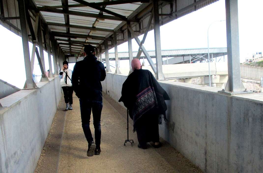 Tamar FleishmanJun-28-2026Qalandiya. The bridge leading from Jerusalem to the Qalandiya checkpoint
-
Rafat (Bir Nabala)
See all reports for this place-
Rafat (Bir Nabala) With the completion of the Bir Nabala enclave, which includes also Al Jib, Al Judeira and Beit Hanina al Balad, a checkpoint was put at enclave exit. The passage into the enclave is allowed only to the enclave inhabitants and to Ramallah District people.
-