
‘Awarta, ‘Azzun, Burin (Yitzhar), Eliyahu Crossing, Habla, Mas’ha, Nabi Ilyas, Za’tara (Tapuah)
A quite routine report but the occupation is even more routine and ongoing …
14.00 Habla
The checkpoint is empty. It is noon time and especially is is the end of the olive picking season.
14.10 Eliyahu Gate
A bus which transports Palestinians who work in Israel, back and forth, is waiting alongside the checkpoint.
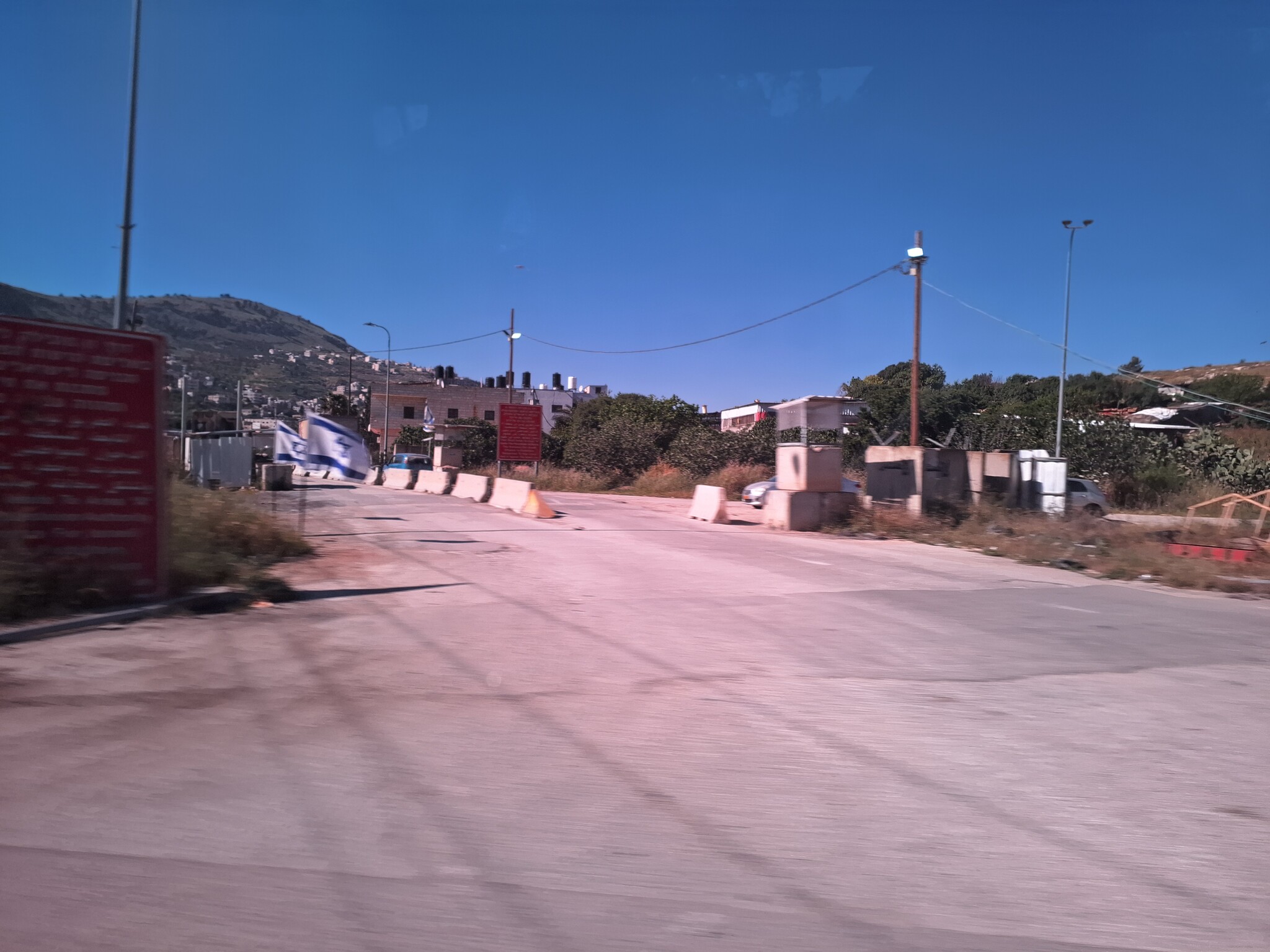
14.20 Nebi Iliyas, Azzun
There are no soldiers at the entrance. Opposite us rise the house of Moshe Zar! Not a pleasant sight…
14.25 Four military jeeps on their way westwards, also a police vehicle.
On our way we pass Shavey Shomron and Kedumim. Further on there is an enormous traffic jam, for a change not because of military reasons but owing to road works (That is to say settlement interests…)
14.50 Burin
Opposite the school at Burin there is a military post (a tower) manned by soldiers.
At Burin we heard from a woman who lives there, that they have an olive grove near the pond which they went to harvest, two days ago, in coordination with the army. The settlers came down from the hills and tried to shy them away!!! They contacted the Army. The army did indeed arrive and watched over them but pressed them to finish quickly. They did not manage to completely finish the harvest “for the glory of the State of Israel….
15.00 Beit Furik
The tower is manned. Next to it the soldiers stop a private Palestinian vehicle. They check. For what reason? We look on. The soldiers are already consulting over 15 minutes about the vehicle and look at us from time to time (they probably wait for an answer from the DCO). Later a military jeep arrived, probably the military command. We watch. The Palestinians are still sitting in their car. The Palestinians car has been released!!! They drive on.
15.35 Awarta beneath Itamar
We talked with a chance man we met in Awarta and as much as he knew there were no harassments from the Itamar people during the olive picking. Could the municipality have approached the army? It seems the municipality had approached the army and for the first time there was a military accompaniment.
16.10 Za’atra intersection
The intersection is very packed. There are soldiers on both tracks. There is a new post opposite the old one. In the tower there are 2 soldiers. This time there were no settlers at the bus station.
Ariel intersection
There are many Palestinians who return from their work in Israel. Near the parking lot where they leave their cars in the morning.
Mas’ha intersection
At the bus station there are two soldier and to the left, a bit further on, there are other soldiers.
end
Location Description
'Awarta
See all reports for this place-
Awarta, an internal checkpoint in the heart of the West Bank, is located east of the Hawara checkpoint, at the junction of Roads 555 (which was forbidden for Palestinian traffic in this area) and the entrance road to Nablus. It was one of the four checkpoints that surrounded Nablus until 2009. We used to watch it at Huwwara shifts because it was the only one where goods could be transferred to and from Nablus, using the back-to-back method. It was operated by the army, from 06:00 to 20:00. Until 2009.
 Ronit Dahan-RamatiApr-23-2026Awarta Checkpoint is empty
-
'Azzun
See all reports for this place-
Azoun (updated February 2019)
A Palestinian town situated in Area B (under civil Palestinian control and Israeli security control),
on road 5 between Nablus and Qalqiliya, east of Nabi Elias village. The inhabitants are allowed to construct and improve infrastructures. The Separation Fence has confiscated lands belonging to the town's people. In 2018 olive tree groves owned by one of its inhabitants were confiscated for the sake of paving a road to bypass Nabi Elias. Azoun population numbers 13,000, its economic state dire. Its infrastructures are poor, neglect and poverty rampant. In the meantime, the town council has completed paving an internal road for the inhabitants' welfare.
Because of its proximity to the Jewish settler-colony of Karnei Shomron and its outposts, the town suffers the intense presence of the Israeli army, especially at nighttime: soldiers enter homes, arrest suspects, trash the house and sometimes ruin it, as they do in numerous places in the West Bank. At times a checkpoint closes the entrance to the town, so no one can come in or get out.
-
A-Nabi Elias
See all reports for this place-
A-Nabi Elias this is a Palestinian village in the northern West Bank, east of Qalqilia on Road 55, north-east of Alfei Menashe colony and west of Karnei Shomron colony and the Palestinian city of Nablus. As of 2016, the village was populated by 1,458 inhabitants.
Near the village is a maqam (holy site memorializing a sanctified person) - the prophet Elisha. Until 2021 Road 55 crossed the village. Then a bypass road was paved through olive groves that were sequestered from the villagers. Consequently, the farmers were left with small olive groves that they could not access nor cultivate. Inhabitants protested against the road for weeks, supported by peace activists, but nothing helped and the road is now a given fact.
The village's main street had been a shopping center for all residents, including colonists. We even saw a Kashrut (kosher food) inspector in a butcher shop close to the falafel stand… The bypass road, according to tradesmen, has impacted their businesses and clients, while others claim that there are customers now for parking has become easier.
Alfei Menashe and Tzofim colonies nibble at the village lands from the north and south and get closer to it all the time. Colonists of Alfei Menashe have outdone themselves, sending their surplus sewage from the oxygenation pools toward a-Nabi Elias land, even reaching the houses.
The villagers are known as seekers of peace. For years there was no hostility towards Israelis. On the contrary, we were always welcomed warmly and stopped there to enjoy their delicious, inexpensive falafel.
-
Burin (Yitzhar)
See all reports for this place-
Burin (Yitzhar)
This is a Palestinian village in the Nablus governorate, a little south of Nablus, on the main road passing through the West Bank. The settlements: Yitzhar and Har Bracha, settled in locations that surrounded the village, placed fences so it is cut off the main road.
There are around 4000 inhabitants. Most of them are engaged in agriculture and pasture, although many graduates of the two secondary schools continue to study at the university. Academic positions are hardly available, they find work as builderd, or leave for the Gulf countries.
The village lands were appropriated several times for the establishment of Israeli settlements and military bases, and as a result, Burin's land and water resources dwindled. lSince 1982, more than 2,000 dunams of village land have been declared "state land" and then transferred to Har Bracha settlement.
Over the past few years and more so since 2017, the villagers have been terrorized by the residents of Yitzhar and Har Bracha, the Givat Ronen outpost and others. Despite the close proximity of soldiers to an IDF base close to one of the village's schools, residents are suffering from numerous stone-throwing events, vehicle and fire arson, also reported in the press.
In 2023, the prevention of the olive harvest in the village plot was more violent than ever. Soldiers and settlers walked with drawn weapons between the houses of the village and demanded that people stop harvesting in the village itself and in the private plots outside the village. The settlers from Yitzhar and Giv'at Roned raided the olive groves and stole crops. 300 olive trees belonging to the residents of Burin, near Yitzhar, were uprooted. The loss of livelihood from the olives causes long-term economic damage to the farmers' families, bringing them to the point of starvation.
(updated for November 2023)
-
Eliyahu CP (109) / Crossing
See all reports for this place-
Eliyahu CP (109) / Crossing This checkpoint, also known as the Fruit Crossing, is one of the main checkpoints between Israel and the West Bank. It is located on Route 55 between Alfei Menashe and the turn to Qalqilya and Zufin, more than 4 km east of the Green Line, in the separation fence, which separates Qalqilya from its lands to the south, thus leaving Alfei Menashe West of the fence - the Seam Zone. This checkpoint, a few kilometers across the Green Line, is intended for "Israeli settlement in the West Bank and the population of the Seam Zone." It is managed by a civil company. Palestinians with a special permit for their lands in the seam area are also allowed to pass through it, on foot, and sometimes by car.
-
Habla
See all reports for this place-
Habla CP (1393)
The Habla checkpoint (1393) was established on the lands of the residents of Qalqilya, on the short road that
connected it for centuries to the nearby town of Habla. The separation barrier intersects this road twice and cut off the residents of Qalqilya from their lands in the seam zone.(between the fence and the green line).
There is a passage under Road 55 that connects Qalqilya to the sabotage This agricultural barrier is used by the farmers and nursery owners established along Road 55 from the Green Line and on both sides of the kurkar road leading to the checkpoint.
This agricultural checkpoint serves the residents of Arab a-Ramadin al-Janoubi (detached from the West Bank), who pass through it to the West Bank and back to their homes. The opening hours (3 times a day) of this agricultural checkpoint are longer than usual, about an hour (recently shortened to 45 minutes), and are coordinated with the transportation hours of a-Ramadin children studying in the occupied in the West Bank. Nina SebaAug-18-2025Habla: The gate is in the process of closing
-
Mas'ha / Hani’s Home
See all reports for this place-
Mas'ha / Hani’s Home
Hani's home enclaved between the separaion wall and the fence of Elkana settlement
-
Za'tara (Tapuah)
See all reports for this place-
Za'tara (Tapuah) Za'tara is an internal checkpoint in the heart of the West Bank, at the intersection of Road 60 and Road 505 (Trans-Samaria), east of the Tapuah settlement. This checkpoint is the "border" marked by the IDF between the north and south of the West Bank, in accordance with the policy of separation between the two parts of the West Bank that has been in place since December 2005. At the Za'tara checkpoint, there are separate routes for Israelis and Palestinians. In the route for Israelis, there are no inspections and the route for Palestinians inspects. The queue lengthens and shortens suits. The checkpoint is open 24 hours a day. The checkpoint is partially staffed and the people who pass through it are checked at random.
 Ronit Dahan-RamatiJun-9-2026Za'atara (Tapuach Junction). The Temple Flag Above a Station
-