
‘Awarta, ‘Azzun, Eliyahu Crossing, Habla, Huwwara, Za’tara (Tapuah), Sun 15.5.11, Morning
Nakba Day – Increased military presence everywhere
11:00 We meet W.M., whom the police have forbidden to enter Israel, and have him sign a power of attorney for a lawyer.
11:10 Tapuach junction. There is a Hummer and a military ambulance at the traffic circle. Two armed soldiers next to the concrete position. No traffic delays. Settlers and soldiers waiting at the bus stop.
11:15 Huwwara. The main street is quiet. Nothing is unusual, except for the presence of military vehicles.
11:30 Huwwara checkpoint. Light traffic. An officer and soldier come toward us and say the only cars they’re stopping are those with Israeli license plates.
11:40 We continue toward Alon Moreh. Awarta junction – a military vehicle leaves the village. We give a ride to five women, who crowd into the back seat, and continue uphill toward the mosque. We reach the municipal building through the narrow alleys. A municipal employee tells us: the day before yesterday (Friday night) soldiers went through the village streets but nothing unusual happened. Twenty youths are still in jail. Schools and offices are open today until 11:00; most stores are open.
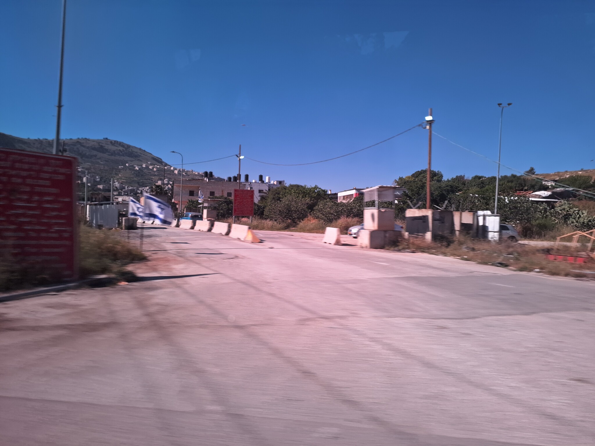
12:00 Awarta checkpoint –There isa military vehicle with four soldiers next to it. No traffic.
A sign before the right turn to Yitzhar: “Checkpoint;” a military vehicle and three soldiers next to it.
We return to Huwwara and turn onto Route 505.
12:50 Al Funduq. Life seems to go on normally. A few shops are closed.
13:00 There is a military ambulance before the entrance to Karnei Shomron. The IDF is ready for everything.
We drive into Izbat Tabib, hoping to meet the village mukhtar. But it’s quiet near his house. No one enters or leaves, and we continue to 'Azzun. Quiet. Is it the afternoon siesta or shops closed for Nakba Day?
We see the remnants of a burning tire. We go into a stop to ask about it. An hour and a half ago the army showed up, children threw stones, the soldiers fired into the air and shot tear gas. The children burned a tire. The Palestinian police made the children leave (photo attached).
Leaving 'Azzun, we see rocks scattered on the road, a reminder of what happened an hour and a half ago (photo attached).
13:40 Eliyahu gate – Only a few cars go through.
13:45 Habla – Two military vehicles on the patrol road and two more on the Israeli side. No Palestinians entering or leaving.
.
'Awarta
See all reports for this place-
Awarta, an internal checkpoint in the heart of the West Bank, is located east of the Hawara checkpoint, at the junction of Roads 555 (which was forbidden for Palestinian traffic in this area) and the entrance road to Nablus. It was one of the four checkpoints that surrounded Nablus until 2009. We used to watch it at Huwwara shifts because it was the only one where goods could be transferred to and from Nablus, using the back-to-back method. It was operated by the army, from 06:00 to 20:00. Until 2009.
 Ronit Dahan-RamatiApr-23-2026Awarta Checkpoint is empty
-
'Azzun
See all reports for this place-
Azoun (updated February 2019)
A Palestinian town situated in Area B (under civil Palestinian control and Israeli security control),
on road 5 between Nablus and Qalqiliya, east of Nabi Elias village. The inhabitants are allowed to construct and improve infrastructures. The Separation Fence has confiscated lands belonging to the town's people. In 2018 olive tree groves owned by one of its inhabitants were confiscated for the sake of paving a road to bypass Nabi Elias. Azoun population numbers 13,000, its economic state dire. Its infrastructures are poor, neglect and poverty rampant. In the meantime, the town council has completed paving an internal road for the inhabitants' welfare.
Because of its proximity to the Jewish settler-colony of Karnei Shomron and its outposts, the town suffers the intense presence of the Israeli army, especially at nighttime: soldiers enter homes, arrest suspects, trash the house and sometimes ruin it, as they do in numerous places in the West Bank. At times a checkpoint closes the entrance to the town, so no one can come in or get out.
-
Eliyahu CP (109) / Crossing
See all reports for this place-
Eliyahu CP (109) / Crossing This checkpoint, also known as the Fruit Crossing, is one of the main checkpoints between Israel and the West Bank. It is located on Route 55 between Alfei Menashe and the turn to Qalqilya and Zufin, more than 4 km east of the Green Line, in the separation fence, which separates Qalqilya from its lands to the south, thus leaving Alfei Menashe West of the fence - the Seam Zone. This checkpoint, a few kilometers across the Green Line, is intended for "Israeli settlement in the West Bank and the population of the Seam Zone." It is managed by a civil company. Palestinians with a special permit for their lands in the seam area are also allowed to pass through it, on foot, and sometimes by car.
-
Habla
See all reports for this place-
Habla CP (1393)
The Habla checkpoint (1393) was established on the lands of the residents of Qalqilya, on the short road that
connected it for centuries to the nearby town of Habla. The separation barrier intersects this road twice and cut off the residents of Qalqilya from their lands in the seam zone.(between the fence and the green line).
There is a passage under Road 55 that connects Qalqilya to the sabotage This agricultural barrier is used by the farmers and nursery owners established along Road 55 from the Green Line and on both sides of the kurkar road leading to the checkpoint.
This agricultural checkpoint serves the residents of Arab a-Ramadin al-Janoubi (detached from the West Bank), who pass through it to the West Bank and back to their homes. The opening hours (3 times a day) of this agricultural checkpoint are longer than usual, about an hour (recently shortened to 45 minutes), and are coordinated with the transportation hours of a-Ramadin children studying in the occupied in the West Bank. Nina SebaAug-18-2025Habla: The gate is in the process of closing
-
Huwwara
See all reports for this place-
The Huwwara checkpoint is an internal checkpoint south of the city of Nablus, at the intersection of Roads 60 and 5077 (between the settlements of Bracha and Itamar). This checkpoint was one of the four permanent checkpoints that closed on Nablus (Beit Furik and Awarta checkpoints to the east and the Beit Iba checkpoint to the west). It was a pedestrian-only barrier. As MachsomWatch volunteers, we watched therre since 2001 two shifts a day - morning and noon, the thousands of Palestinians leaving Nablus and waiting for hours in queues to reach anywhere else in the West Bank, from the other side of the checkpoint the destination could only be reached by public transport. In early June 2009, as part of the easing of Palestinian traffic in the West Bank, the checkpoint was opened to vehicular traffic. The passage was free, with occasional military presence in the guard tower. Also, there were vehicle inspections from time to time. Since the massacre on 7.10.2023, the checkpoint has been closed to Palestinians.
On February 26, 2023, about 400 settlers attacked the town's residents for 5 hours and set fire to property, such as houses and cars. Disturbances occurred in response to a shooting of two Jewish residents of Har Bracha by a Palestinian Terrorist. The soldiers stationed in the town did not prevent the arson and rescued Palestinian families from their homes only after they were set on fire. No one was punished and Finance Minister Smotrich stated that "the State of Israel should wipe out Hawara." Left and center organizations organized solidarity demonstrations and support actions for the residents of Hawara.Hawara continued to be in the headlines in all the months that followed: more pogroms by the settlers, attacks by Palestinians and a massive presence of the army in the town. It amounted to a de facto curfew of commerce and life in the center of the city. On October 5, 2023, MK Zvi established a Sukkah in the center of Hawara and hundreds of settlers backed the army blocked the main road and held prayers in the heart of the town all night and the next day. On Saturday, October 7, 23 The "Swords of Iron" war began with an attack by Hamas on settlements surrounding Gaza in the face of a poor presence of the IDF. Much criticism has been made of the withdrawal of military forces from the area surrounding Gaza and their placement in the West Bank, and in the Hawara and Samaria region in particular, as a shield for the settlers who were taking over and rioting.
On November 12, 2023, the first section of the Hawara bypass road intended for Israeli traffic only was opened. In this way, the settlers can bypass the road that goes through the center of Hawara, which is the main artery for traffic from the Nablus area to Ramallah and the south of the West Bank. For the construction of the road, the Civil Administration expropriated 406 dunams of private land belonging to Palestinians from the nearby villages. The settlers are not satisfied with this at the moment, and demand to also travel through Hawara itself in order to demonstrate presence and control.(updated November 2023)
. Shoshi AnbarMay-18-2025Huwara: The old houses in Area C
-
Za'tara (Tapuah)
See all reports for this place-
Za'tara (Tapuah) Za'tara is an internal checkpoint in the heart of the West Bank, at the intersection of Road 60 and Road 505 (Trans-Samaria), east of the Tapuah settlement. This checkpoint is the "border" marked by the IDF between the north and south of the West Bank, in accordance with the policy of separation between the two parts of the West Bank that has been in place since December 2005. At the Za'tara checkpoint, there are separate routes for Israelis and Palestinians. In the route for Israelis, there are no inspections and the route for Palestinians inspects. The queue lengthens and shortens suits. The checkpoint is open 24 hours a day. The checkpoint is partially staffed and the people who pass through it are checked at random.
 Ronit Dahan-RamatiJun-9-2026Za'atara (Tapuach Junction). The Temple Flag Above a Station
-