
‘Awarta, Burin (Yitzhar), Madama

A historical map which shows the grave of the Sheikh Mufadi clearly

Israeli map, from "mapa", showing how the graves turned to be Jewish

This is today's appearance of the grave of the "70 Elders" which is in Yitzchak Danziger's book from 1982, appearing as the grave of the Sheikh Mufadi.
.
.

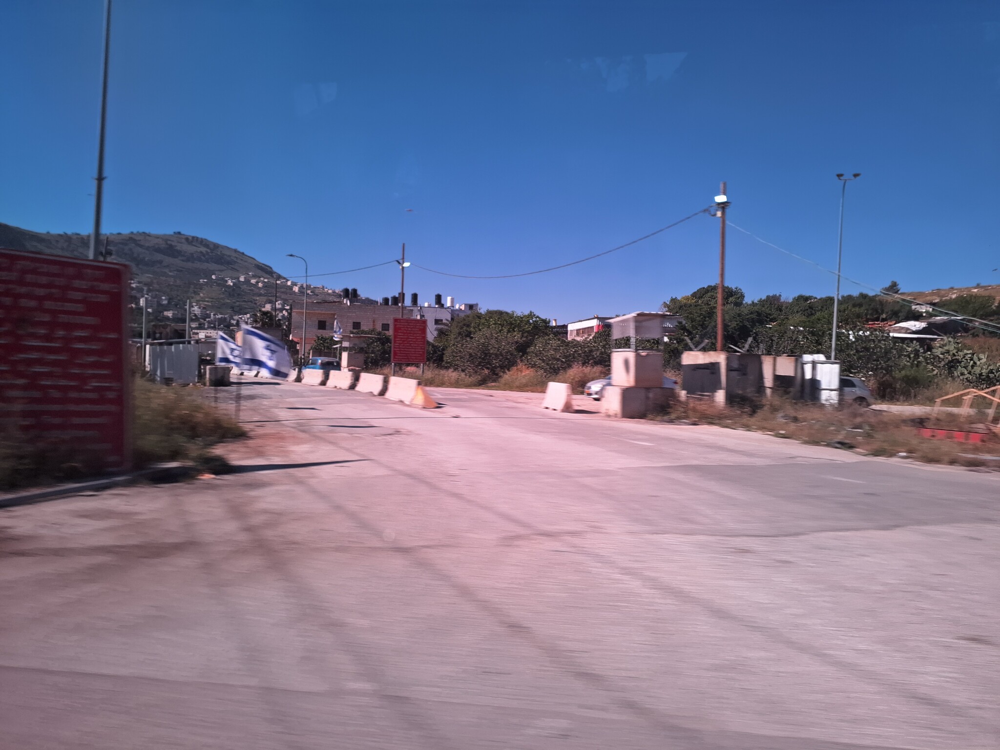
Double sand blockade on the way to Huwarra.
A partial blockade at the exit from Beita, in the direction of Huwarra, because of work on the road; manned by soldiers.


Map detailing the detour which we were forced to make because of the blockade next to Huwarra.
On the way back, on highway #5, we passed the industrial zone of Barkan where there used to be a waterfall of sewage but today this is concentrated into a pipe which descends from the cliff. Further down along the canal, on the side of the road, the sewage streams very violently as it comes out of the pipe..

'Awarta
See all reports for this place-
Awarta, an internal checkpoint in the heart of the West Bank, is located east of the Hawara checkpoint, at the junction of Roads 555 (which was forbidden for Palestinian traffic in this area) and the entrance road to Nablus. It was one of the four checkpoints that surrounded Nablus until 2009. We used to watch it at Huwwara shifts because it was the only one where goods could be transferred to and from Nablus, using the back-to-back method. It was operated by the army, from 06:00 to 20:00. Until 2009.
 Ronit Dahan-RamatiApr-23-2026Awarta Checkpoint is empty
-
Burin (Yitzhar)
See all reports for this place-
Burin (Yitzhar)
This is a Palestinian village in the Nablus governorate, a little south of Nablus, on the main road passing through the West Bank. The settlements: Yitzhar and Har Bracha, settled in locations that surrounded the village, placed fences so it is cut off the main road.
There are around 4000 inhabitants. Most of them are engaged in agriculture and pasture, although many graduates of the two secondary schools continue to study at the university. Academic positions are hardly available, they find work as builderd, or leave for the Gulf countries.
The village lands were appropriated several times for the establishment of Israeli settlements and military bases, and as a result, Burin's land and water resources dwindled. lSince 1982, more than 2,000 dunams of village land have been declared "state land" and then transferred to Har Bracha settlement.
Over the past few years and more so since 2017, the villagers have been terrorized by the residents of Yitzhar and Har Bracha, the Givat Ronen outpost and others. Despite the close proximity of soldiers to an IDF base close to one of the village's schools, residents are suffering from numerous stone-throwing events, vehicle and fire arson, also reported in the press.
In 2023, the prevention of the olive harvest in the village plot was more violent than ever. Soldiers and settlers walked with drawn weapons between the houses of the village and demanded that people stop harvesting in the village itself and in the private plots outside the village. The settlers from Yitzhar and Giv'at Roned raided the olive groves and stole crops. 300 olive trees belonging to the residents of Burin, near Yitzhar, were uprooted. The loss of livelihood from the olives causes long-term economic damage to the farmers' families, bringing them to the point of starvation.
(updated for November 2023)
-
Madama
See all reports for this place-
Madama
This village is situated in the Nablus district, about 5 kilometers south of the city of Nablus, at an altitude of 517 meters above sea level. Madama was founded 400 years ago and its villagers originate from the Arabian Peninsula. It numbered 1,728 inhabitants in 2007. 62% of the village area is categorized as Area B, and 38% as Area C.
Over the years, hundreds of dunams have been robbed of the village for the purpose of building settler-colonies, army bases, and paving roads:139 dunams were sequestered to found settler-colony Yitzhar south of the village, and the land was also confiscated for paving road 60. The road and its buffer zone (75 meters on each side) lined by barbed wire fences separate the village’s farmlands to the north and the village farmers are denied access to tend them. The road also separates Madama and Burin, two villages with close neighborly ties, and now not able to access the road directly.
The settler-colony Yitzhar has become a daily threat to the village. The settler-colonists planted trees in fenced-in groves, steal crops, burn, uproot and vandalize Palestinians’ trees, and harm both holy sites and property. They also attack the Palestinian landowners in order to terrorize them and prevent them from accessing their lands.
For further information: http://vprofile.arij.org/nablus/pdfs/vprofile/Madama_vp_en.pdf
-
