
‘Azzun, Deir Sharaf, Eliyahu Crossing, Habla, Huwwara, Jit Junction , Qalqiliya, Shave Shomron, Za’tara (Tapuah), Mon 12.12.11, Morning
After Sunday’s reports about checkpoints being established at many locations, we decided to make a complete circuit to see what’s going on. We saw no flying checkpoints other than one that was removed while we were in the field. There were more military vehicles than usual on the roads, but they didn’t interfere with Palestinian traffic.
06:40 Eliyahu crossing – A number of cars at the inspection station for Palestinians (from Israel as well as from Palestine). Crossing takes 5-6 minutes. The cars are checked by dogs and also by people. Not many people on the pedestrian line, but we couldn’t time how long it took them to get through because no one wore clothes that stood out and we were standing too far away to identify those entering and remember them. People coming out said it took about 10 minutes to cross.
07:10 Habla – The gate is already open and we see that many people crossed. On average, it takes ten people about 6 minutes to go through. Initially, people were inspected at the guard station, where there was a soldier with a portable computer and a second soldier with a scanner. Later the computer in the inspection room was turned on and people again crossed there. At 07:20 the children’s bus arrives, the driver waits for the soldiers to notice him and wave him over to the inspection stations. He said that people with a 00 license go through without having to stop at the inspection station, and he’ll try to get one. Then the bus advances to the middle of the crossing and a soldier inspects its baggage compartments – as if something would be smuggled into Habla!
Tractors cross with tools, material, olive seedlings – there’s a great deal going on here. If only people could live here without the damn checkpoint.
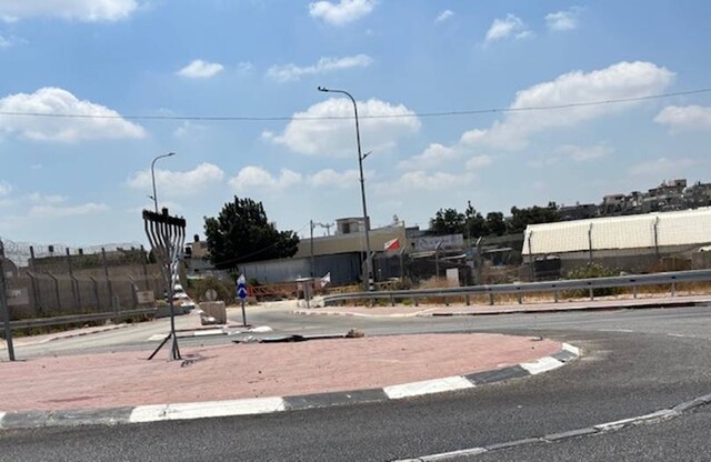
We continued via the entrance to Qalqilya and drove through 'Azzun – no soldiers at the entrances; they’re open (the previous day soldiers were reported to have been there).
08:10 Jit junction – From a distance we saw military vehicles and what looked like a flying checkpoint at the Sara/Huwwara junction. We decided to first stop by Deir Sharaf – the road to Shavei Shomron. The checkpoint was open but the police officers standing there stopped a Palestinian for inspection, and us as well. After inspecting my documents – driver’s license, vehicle registration – and finding out that we just want to see what’s going on here, they let us continue.
We stopped at the bakery in Deir Sharaf. They told us that Jit junction is closed to traffic driving toward Huwwara.
08:50 Back to Jit junction. Now two military cars were standing on the side above the junction, but the soldiers were lounging in the cars, apparently not doing anything. Another military car and civilian pickup truck stood on the side of the road to Huwwara, not doing anything, electrical cables and tools alongside them. The crossing was open in all directions. Apparently there’d been a flying checkpoint there which had been dismantled by the time we arrived. We watched what was going on for a while and then continued to Huwwara.
09:10 Huwwara – The crossing is open. No soldiers on the road.
09:30 Beit Furiq – The crossing is open, no soldiers on the road except for the one who’s always at the ascent to Mt. Gerizim.
09:50 Za’tara junction – Soldiers are present who from time to time ask some driver something, but the crossing is open, even if slow. In fact, we crawled all the way up because the crossing went so slowly.
10:00 The entrance to Ariel/Salfit – No military. We entered in the direction of the entrance to Salfit to see what’s happening there. Two soldiers stood at the entrance to the road to Salfit (where there’s a yellow gate that can block the road) who told us we can’t drive to Salfit in a car with an Israeli license plate. We turned around and returned home.
.
'Azzun
See all reports for this place-
Azoun (updated February 2019)
A Palestinian town situated in Area B (under civil Palestinian control and Israeli security control),
on road 5 between Nablus and Qalqiliya, east of Nabi Elias village. The inhabitants are allowed to construct and improve infrastructures. The Separation Fence has confiscated lands belonging to the town's people. In 2018 olive tree groves owned by one of its inhabitants were confiscated for the sake of paving a road to bypass Nabi Elias. Azoun population numbers 13,000, its economic state dire. Its infrastructures are poor, neglect and poverty rampant. In the meantime, the town council has completed paving an internal road for the inhabitants' welfare.
Because of its proximity to the Jewish settler-colony of Karnei Shomron and its outposts, the town suffers the intense presence of the Israeli army, especially at nighttime: soldiers enter homes, arrest suspects, trash the house and sometimes ruin it, as they do in numerous places in the West Bank. At times a checkpoint closes the entrance to the town, so no one can come in or get out.
-
Deir Sharaf checkpoint
See all reports for this place-
Deir Sharaf checkpoint is located west of Nablus and south of the settlement of Shavei Shomron, at the entrance to the village of Deir Sharaf on the road leading to Nablus. The checkpoint was activated in early March 2009 after the Beit Iba checkpoint was closed. Palestinians are allowed through the checkpoint , but not for Israelis. Unlike the checkpoints leading to Qalqilya and Tulkarm, crossing of Israeli Palestinians is only allowed on Saturdays.
 Nina SebaFeb-28-2024Deir Sharaf - the entrance to the village
-
Eliyahu CP (109) / Crossing
See all reports for this place-
Eliyahu CP (109) / Crossing This checkpoint, also known as the Fruit Crossing, is one of the main checkpoints between Israel and the West Bank. It is located on Route 55 between Alfei Menashe and the turn to Qalqilya and Zufin, more than 4 km east of the Green Line, in the separation fence, which separates Qalqilya from its lands to the south, thus leaving Alfei Menashe West of the fence - the Seam Zone. This checkpoint, a few kilometers across the Green Line, is intended for "Israeli settlement in the West Bank and the population of the Seam Zone." It is managed by a civil company. Palestinians with a special permit for their lands in the seam area are also allowed to pass through it, on foot, and sometimes by car.
-
Habla
See all reports for this place-
Habla CP (1393)
The Habla checkpoint (1393) was established on the lands of the residents of Qalqilya, on the short road that
connected it for centuries to the nearby town of Habla. The separation barrier intersects this road twice and cut off the residents of Qalqilya from their lands in the seam zone.(between the fence and the green line).
There is a passage under Road 55 that connects Qalqilya to the sabotage This agricultural barrier is used by the farmers and nursery owners established along Road 55 from the Green Line and on both sides of the kurkar road leading to the checkpoint.
This agricultural checkpoint serves the residents of Arab a-Ramadin al-Janoubi (detached from the West Bank), who pass through it to the West Bank and back to their homes. The opening hours (3 times a day) of this agricultural checkpoint are longer than usual, about an hour (recently shortened to 45 minutes), and are coordinated with the transportation hours of a-Ramadin children studying in the occupied in the West Bank. Nina SebaAug-18-2025Habla: The gate is in the process of closing
-
Huwwara
See all reports for this place-
The Huwwara checkpoint is an internal checkpoint south of the city of Nablus, at the intersection of Roads 60 and 5077 (between the settlements of Bracha and Itamar). This checkpoint was one of the four permanent checkpoints that closed on Nablus (Beit Furik and Awarta checkpoints to the east and the Beit Iba checkpoint to the west). It was a pedestrian-only barrier. As MachsomWatch volunteers, we watched therre since 2001 two shifts a day - morning and noon, the thousands of Palestinians leaving Nablus and waiting for hours in queues to reach anywhere else in the West Bank, from the other side of the checkpoint the destination could only be reached by public transport. In early June 2009, as part of the easing of Palestinian traffic in the West Bank, the checkpoint was opened to vehicular traffic. The passage was free, with occasional military presence in the guard tower. Also, there were vehicle inspections from time to time. Since the massacre on 7.10.2023, the checkpoint has been closed to Palestinians.
On February 26, 2023, about 400 settlers attacked the town's residents for 5 hours and set fire to property, such as houses and cars. Disturbances occurred in response to a shooting of two Jewish residents of Har Bracha by a Palestinian Terrorist. The soldiers stationed in the town did not prevent the arson and rescued Palestinian families from their homes only after they were set on fire. No one was punished and Finance Minister Smotrich stated that "the State of Israel should wipe out Hawara." Left and center organizations organized solidarity demonstrations and support actions for the residents of Hawara.Hawara continued to be in the headlines in all the months that followed: more pogroms by the settlers, attacks by Palestinians and a massive presence of the army in the town. It amounted to a de facto curfew of commerce and life in the center of the city. On October 5, 2023, MK Zvi established a Sukkah in the center of Hawara and hundreds of settlers backed the army blocked the main road and held prayers in the heart of the town all night and the next day. On Saturday, October 7, 23 The "Swords of Iron" war began with an attack by Hamas on settlements surrounding Gaza in the face of a poor presence of the IDF. Much criticism has been made of the withdrawal of military forces from the area surrounding Gaza and their placement in the West Bank, and in the Hawara and Samaria region in particular, as a shield for the settlers who were taking over and rioting.
On November 12, 2023, the first section of the Hawara bypass road intended for Israeli traffic only was opened. In this way, the settlers can bypass the road that goes through the center of Hawara, which is the main artery for traffic from the Nablus area to Ramallah and the south of the West Bank. For the construction of the road, the Civil Administration expropriated 406 dunams of private land belonging to Palestinians from the nearby villages. The settlers are not satisfied with this at the moment, and demand to also travel through Hawara itself in order to demonstrate presence and control.(updated November 2023)
. Shoshi AnbarMay-18-2025Huwara: The old houses in Area C
-
Jit Junction
See all reports for this place-
The checkpoint is located on Route 60 near at the junction with Route 55, near the village of Jit. There was a checkpoint for vehicles passing between the north and south of the West Bank, which was abolished towards 2010. Since then, surprise checkpoints have been set up there from time to time with a police or Border Police vehicle, and vehicles and their passengers are inspected.
 Anat PolakJul-17-2025Yitzhar Road, Jit Junction: traffic jam
-
Qalqiliya checkpoint
See all reports for this place-
Qalqilya is surrounded on all sides by the separation barrier. The only exit from the city is in the east of the city on the road that leaves the city in an easterly direction. This is where the checkpoint was located. When the checkpoint was active until 2009 our shifts watched long queues of cars being inspected at the only exit from the city to the West Bank. The checkpoint was canceled, but there is a military presence at the entrance to the city.
 Nina SebaAug-18-2025Azzun: Enclosed by a high fence and the gate to the village is closed
-
Shave Shomron Checkpoint
See all reports for this place-
The checkpoint is on Route 60 (the main road to the northern West Bank), opposite settlement. Has been blocked to Palestinians since disengagement from Gaza and northern Samaria.
-
Za'tara (Tapuah)
See all reports for this place-
Za'tara (Tapuah) Za'tara is an internal checkpoint in the heart of the West Bank, at the intersection of Road 60 and Road 505 (Trans-Samaria), east of the Tapuah settlement. This checkpoint is the "border" marked by the IDF between the north and south of the West Bank, in accordance with the policy of separation between the two parts of the West Bank that has been in place since December 2005. At the Za'tara checkpoint, there are separate routes for Israelis and Palestinians. In the route for Israelis, there are no inspections and the route for Palestinians inspects. The queue lengthens and shortens suits. The checkpoint is open 24 hours a day. The checkpoint is partially staffed and the people who pass through it are checked at random.
 Shoshi AnbarSep-27-2023Za'atra (Tapuah Intersection). Signs
-