
Beit Amin Checkpoint (1447), Habla Checkpoint (1393), Jalud, Kufr Thulth
Many gates were closed; finally one was open.
‘Azzun
We stopped at Z.’s shop and dropped off the parcels we’d brought him. We’re pleased his condition is improving. But he still has a long way to go.
Thult seasonal gate 1263.
We continue south to meet M., from Thult. About five months ago 14 of his family’s olive trees were uprooted by a bulldozer. Earlier, the land had been stolen.
On the way to El Matan – a settlement belonging to Ma’aleh Shomron, established 17 years ago by a group of young people from settlements in the area. The residents live in trailers and IDF soldiers provide security. We were there a year ago, reported, photographed and told Mison from Yesh Din about it. Since then work has been underway to pave a road to the small settlement. Heavy equipment moves earth from a higher to a lower area, places boulders and grades the land. All for the benefit of the settlers, lords of the land.
M. says they have asked that the seasonal gate to Harish be opened. It’s hard for them (for us too) to obtain answers from the Israeli DCL. As far as they know, the gate will be opened Sunday, 26.2.17, for two weeks.
The Palestinian DCL told them when the gate will be opened: from 09:00 to 19:00. That enrages them. It’s unacceptable. They’re farmers who want to reach their land at 07:00 and return home at 15:30. That’s a long enough workday. They have no reason to remain when it grows dark. But the army has its own rules and doesn’t care what the Palestinians need.
I tried to contact the DCL officers, but to no avail. Can anyone help?
M. and his family have 300 dunums of land. They grow olives and almonds. At this time they’re plowing, pruning, spraying, and taking care of the trees, some of which are more than 100 years old.
Jaloud, gate 1419

Apparently, the gate didn’t open in the afternoon.

Gate 1443, opposite Oranit (my photograph from four years ago)
We continue searching for agricultural gates. We reach one with the assistance of a Palestinian, who has offered to help.
Sha’arei Tiqva on the right, Beit Amin on the left. The number of the gate and the opening hours are not posted. It may be a seasonal gate. We’ll try to find out.
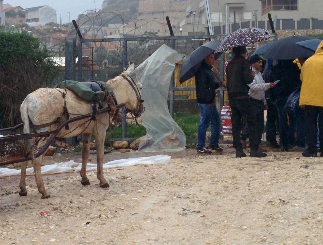
Beit Amin (Abu Salman) gate 1447
A car with three Palestinians stops. We ask for directions to the Palestinian side of gate 1447. They gladly volunteer to help and drive ahead of us. We follow, turn to a dirt road, go through a puddle and, with their help, arrive at the gate we had been seeking also on previous shifts.
A., a landowner, has serious complaints:About a month ago the gate closed permanently. The Beit Amin 1447 gate has been eliminated. Why? Because!
Gate 1443 was opened instead. It was opened for too short a time, just after construction of the Wall has been completed. Then it closed, to the chagrin of residents of ‘Azzun ‘Atma and Beit Amin.
For them, a trip in a donkey cart that used to take less than ten minutes now lasts about an hour. Tractors usually aren’t allowed through. The situation is unbearable.
(We have to find out the opening hours of this checkpoint)
A 65-year-old man. His sons can’t obtain permits to reach his land. He no longer has the strength for farm work (the land is registered in his father’s name). A few days ago he arrived at the checkpoint with his daughter and both went through. On their way home in the afternoon his daughter was detained. During the course of the day she’d turned into a suspicious person, just like that…
We asked him to give us the details: when did he apply to the Palestinian DCL and when did the Palestinians transmit the requests to the Israeli DCL.
Habla – checkpoint 1393, the town side
Finally, an open gate. Sparse traffic. The plant nursery’s vehicle is transporting seedlings.
Beit Amin South / Abu Salman (1447)
See all reports for this place-
Beit Amin South / Abu Salman (1447) An agricultural checkpoint in the village of Abu Salman, which opens three times a day and is used by the farmers of Beit Amin and Abu Salman, and since the nearby gate has been inactive, also residents of 'Azzun' Atma, to reach their lands in the seamline zone adjacent to the settlement of Oranit.
-
Habla CP (1393)
See all reports for this place-
Habla CP (1393)
The Habla checkpoint (1393) was established on the lands of the residents of Qalqilya, on the short road that
connected it for centuries to the nearby town of Habla. The separation barrier intersects this road twice and cut off the residents of Qalqilya from their lands in the seam zone.(between the fence and the green line).
There is a passage under Road 55 that connects Qalqilya to the sabotage This agricultural barrier is used by the farmers and nursery owners established along Road 55 from the Green Line and on both sides of the kurkar road leading to the checkpoint.
This agricultural checkpoint serves the residents of Arab a-Ramadin al-Janoubi (detached from the West Bank), who pass through it to the West Bank and back to their homes. The opening hours (3 times a day) of this agricultural checkpoint are longer than usual, about an hour (recently shortened to 45 minutes), and are coordinated with the transportation hours of a-Ramadin children studying in the occupied in the West Bank.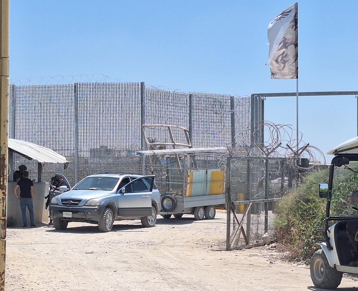 Shoshi AnbarJul-29-2026Habla. The gate is open for vehicle crossing
-
Jalud
See all reports for this place-
Jalud
A Palestinian village, about 15 km south of Nablus: to the south are the settlements of Shiloh, Shvut-Rachel, and another settlement. Ge'ulat _Zion, is about to be built on its lands. The violent outposts of Esh Kodesh, Kida, Yeshuv Hda'at, Ahaya, and Adei Ad. Some outposts were established on Jalud lands, and are about to receive kosher. The village is planning to fight for its land.
85% of the village's lands are in area C, and its residents are anxious that they may be taken from them. In fact, throughout the years of occupation, thousands of dunams of agricultural land were expropriated from Jalud and the surrounding villages for military and settlement purposes. These are lands that were cultivated for generations by Palestinians and were taken from them without the possibility of resistance.
Since the death of the 16-year-old boy from the hills, Ahuvia Sendak, in December 2020, during a police chase near the settlement of Kochav Hashar, there has been a significant increase in the number of violent attacks by settlers, which have already become routine all over the West Bank. The attacks include breaking into the village mainly at night, setting fire to vehicles, smashing windows and windshields, demolishing construction sites and stealing equipment, shooting with live fire, blocking roads, and more. In recent years, IDF soldiers have been backing and sponsoring these riots. -
Jalud A Palestinian village, about 15 km south of Nablus: to the south are the settlements of Shiloh, Shvut-Rachel, and another settlement. Ge'ulat _Zion, is about to be built on its lands. The violent outposts of Esh Kodesh, Kida, Yeshav Ya'at, Ahaya, and Adei Ad. Some outposts were established on Jalud lands, and are about to receive kosher. The village is planning to fight for its land. 85% of the village's lands are in area C, and its residents are anxious that they may be taken from them. In fact, throughout the years of occupation, thousands of dunams of agricultural land were expropriated from Jalud and the surrounding villages for military and settlement purposes. These are lands that were cultivated for generations by Palestinians and were taken from them without the possibility of resistance. Since the death of the 16-year-old boy from the hills, Ahuvia Sendak, in December 2020, during a police chase near the settlement of Kochav Hashar, there has been a significant increase in the number of violent attacks by settlers, which have already become routine all over the West Bank. The attacks include breaking into the village mainly at night, setting fire to vehicles, smashing windows and windshields, demolishing construction sites and stealing equipment, shooting with live fire, blocking roads, and more. In recent years, IDF soldiers have been backing and sponsoring these riots.
-
Kufr Thulth
See all reports for this place-
Kufr Thulth is located in the western part of the West Bank, in the Qalqiliya district. According to archeological evidence, this village was inhabited as early as the Early Bronze Age. Findings have been dated there to Hellenistic, Roman, and Byzantine times. The village is situated on road 446, south of the Palestinian town of Azoun and north of Qanah River. It numbers 5,606 inhabitants as of 2017.
After the signing of the Oslo Accords, the built-up southern part of the village was categorized as Area B, comprising about 11% of its area, but nearly all of its farmland is classified as Area C.
Israel has confiscated 367 dunams of the village lands, and the area of neighboring village Arab Al Hula, in order to construct the settler-colonies of Karnei Shomron, Ginot Shomron, Ma’ale Shomron, and Immanuel, as well as the Separation Fence (splitting the village itself), and prevented villagers to access their farmlands lying near the settler-colonies. The authorities declared the area a nature reserve, and thus prevented access or any tending that would change the nature of the local land.
The Israeli army and the settler-colonists continue to harass the Palestinian farmers who visit their own lands, attack their herds and destroy trees and any other kind of farm crop, uproot trees and pollute water sources with sewage or toxic waste in order to make the Palestinians leave.
For further information: http://vprofile.arij.org/qalqiliya/pdfs/vprofile/kufrthulth_vp_en.pdf
-
