
Carmel settlement imposes siege on residents of Umm al-Khair by surrounding it with buildings
Meitar Checkpoint – about 20 cars in the car-park. Perhaps several Palestinians have entry permits to Israel?
Road 317
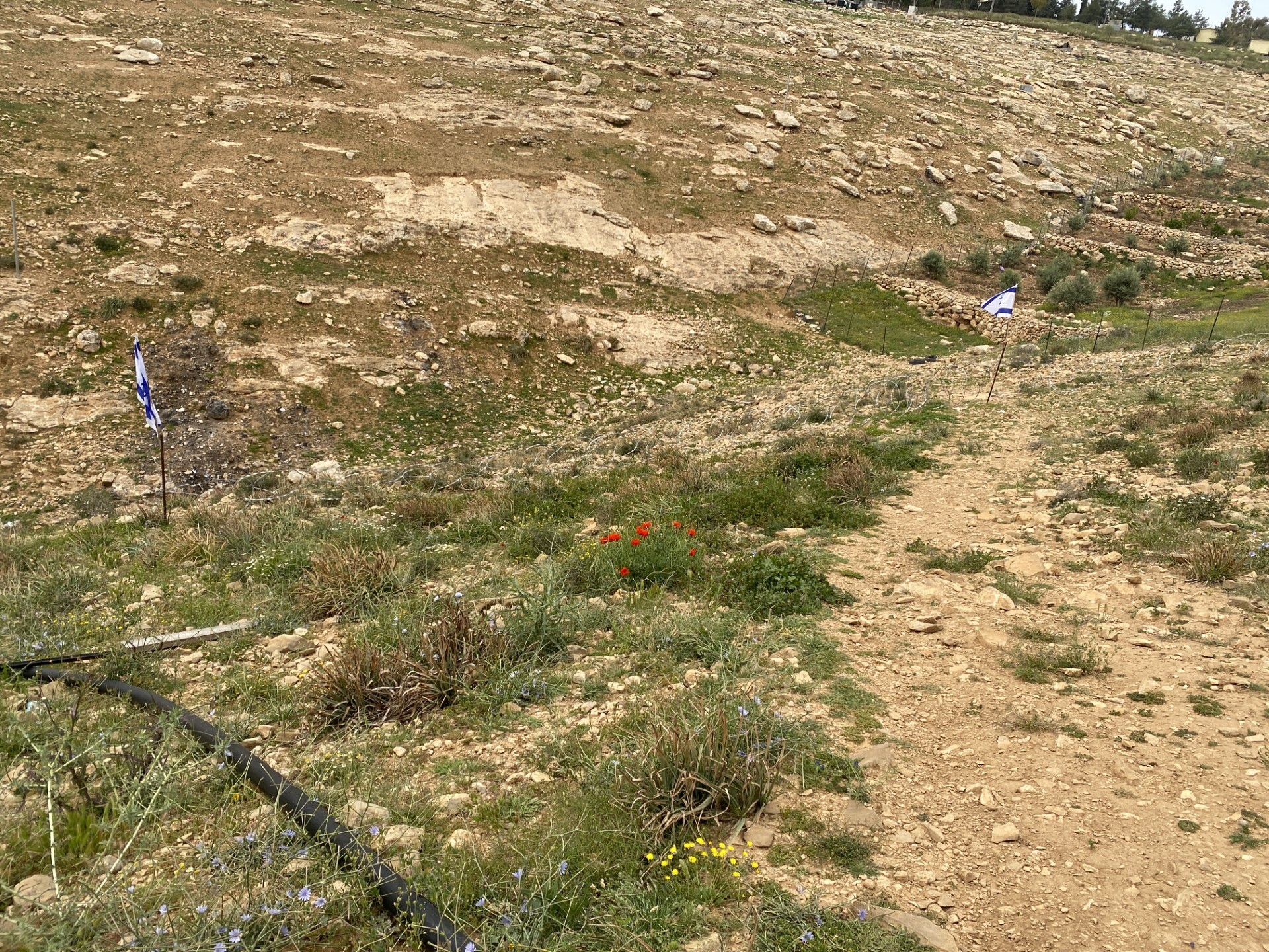
From Omarim Industrial Zone, all along the way are Israeli flags meant to remain there after Independence Day. They also welcome those coming to Umm al Khair. They are placed on the water reservoir, along the road to the village’s public structures and what have you.
The hills are green, the grass press but there are hardly any Palestinians’ flocks to be seen, only the cattle flock belonging to Yinon, grazing the grounds of abandoned Zanuta.
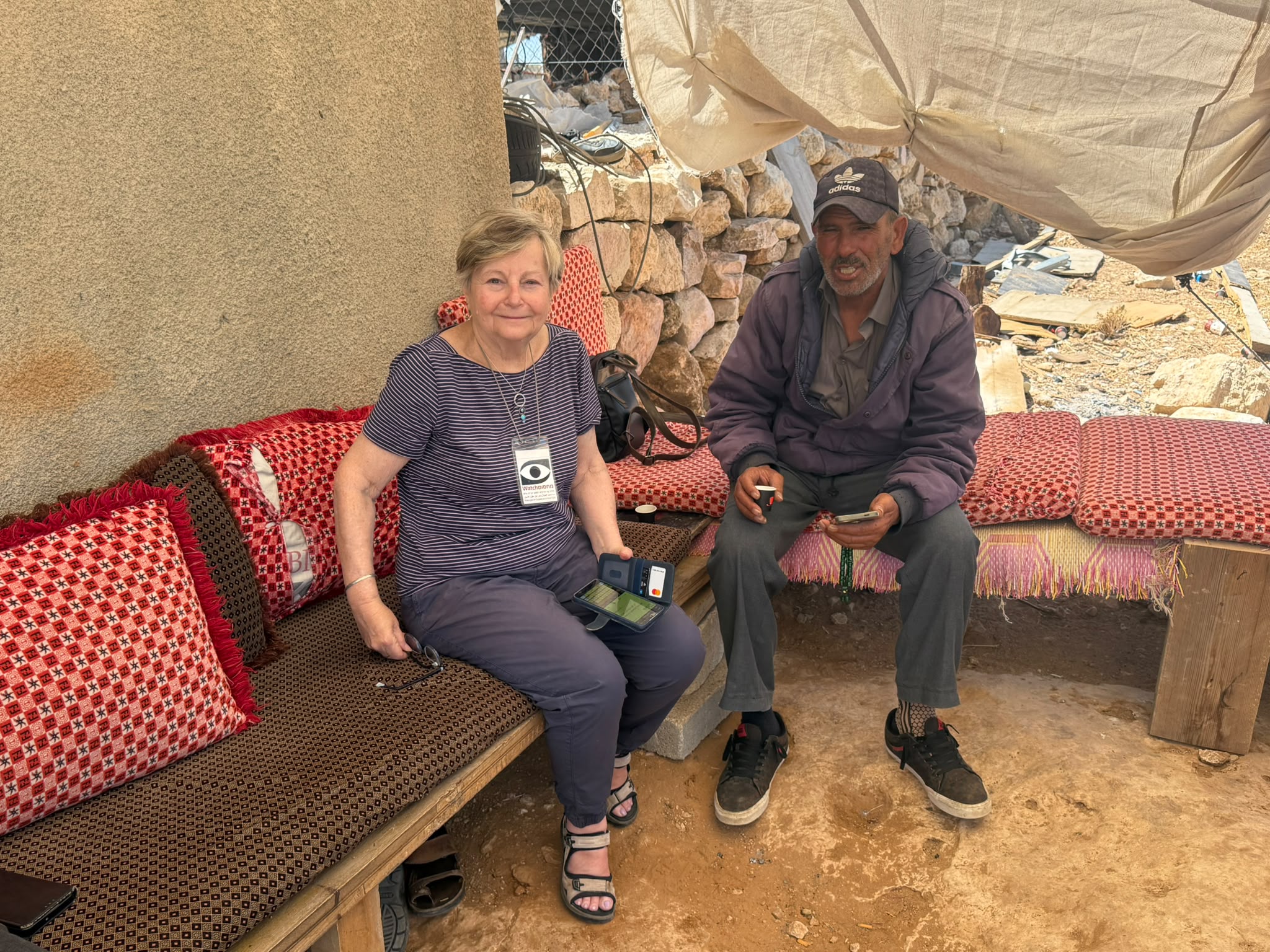
Umm al Khair
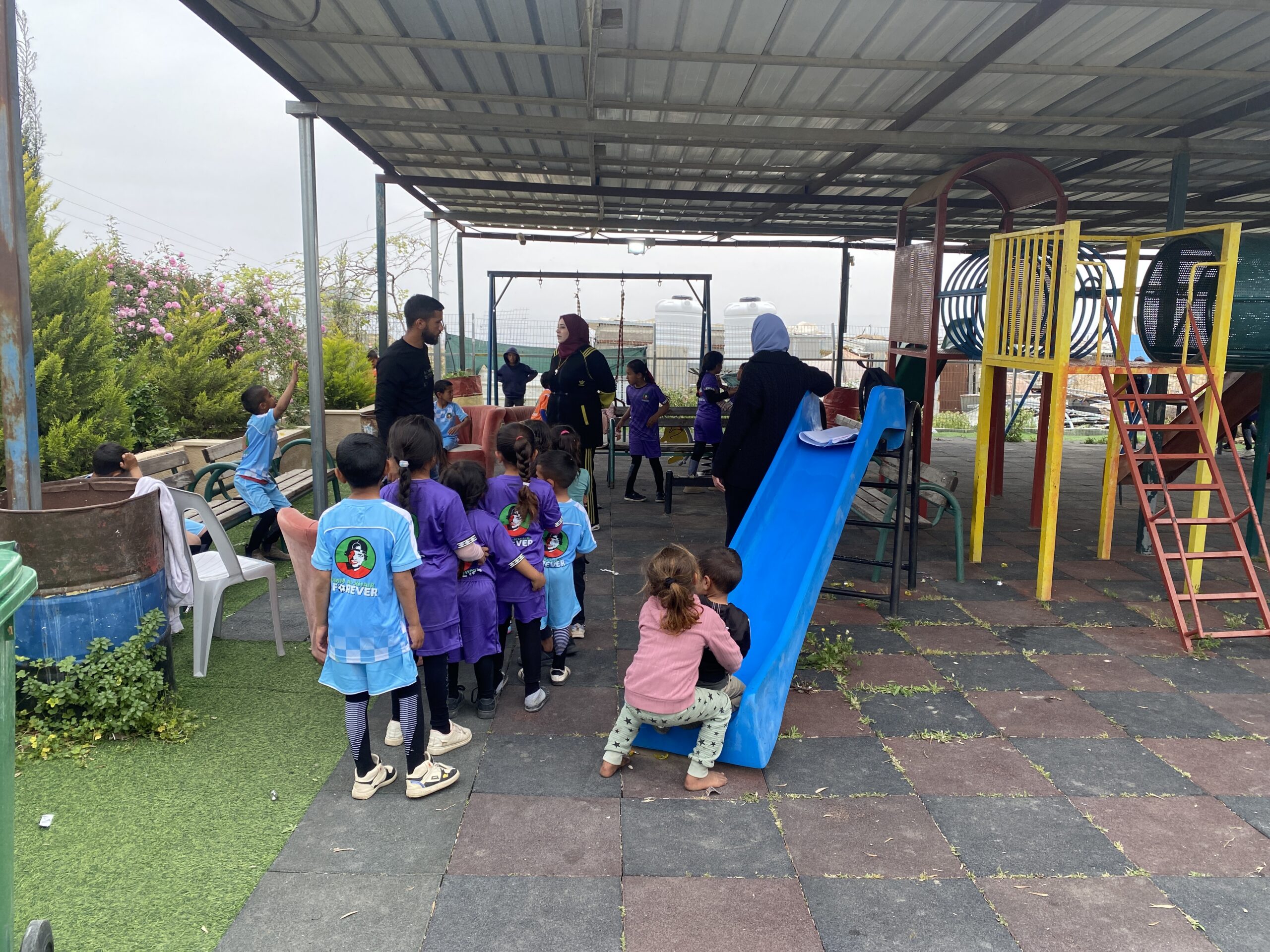
There is learning activity going on for children’s kindergarten-school because they do not go to school. We were called to report the new developments there, caused by the takeover by Carmel settlement in the entire area. Khalil (head of the local council) and Eid explain the situation to us:
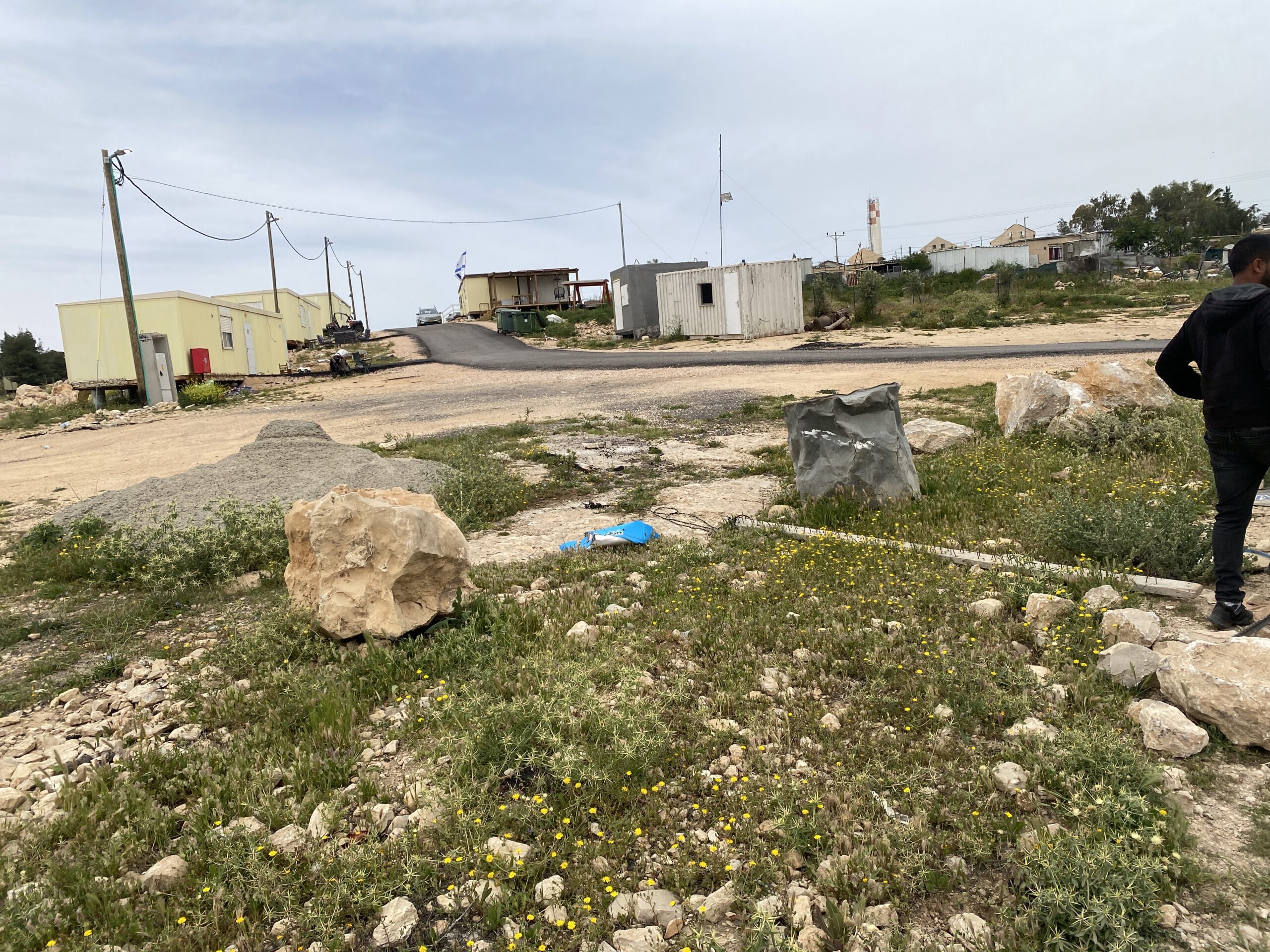
During the war, the village had no safety measures in blatant contrast to the five new caravans which Carmel settlers placed right next to the village houses which had a safe space brought to them.
Australia film crew, invited by the head of the council to document the situation in wartime, was attacked by Nevo, the security official of Carmel, who claimed that this invitation was forbidden political activity. This whole time, schools were not functioning as well as the clinic next door, so everyone was delighted as the schools were re-opened last Monday (13.4).
To their surprise it turned out that the asphalt road leading to public institutions now had a barrier of buckets and stones is closed every evening and opened partially every morning – an action undertaken by the Carmel hill youth, while the dirt track descending from the village to the wadi and joining the road beyond the checkpoint has now been blocked by barbed wire flanked on both sides by Israeli flags proving governance.
The Umm al Khair residents summoned the police, the army arrived and in response to the students present covered them with teargas and caused general fear. Since then, the 55 children of the village are under siege and do not study. The checkpoints give the villagers a hard time as they try to get to the mosque and the clinic, all along the same road.
The DCO was summoned to solve the problem, and in discussion with the police, without participation of the local residents, reached a solution: the army would accompany the schoolchildren on their way to school along the paved road. This is not acceptable to Umm al Khair – the soldiers of this army are local settlers who have no intention of protecting the villagers.
The solution offered by the head of the council is to order public transportation, buses that would transport the schoolchildren back and forth to school and at the same time, also serve women on their way to the clinic. We were asked to help them get funds to finance the buses.
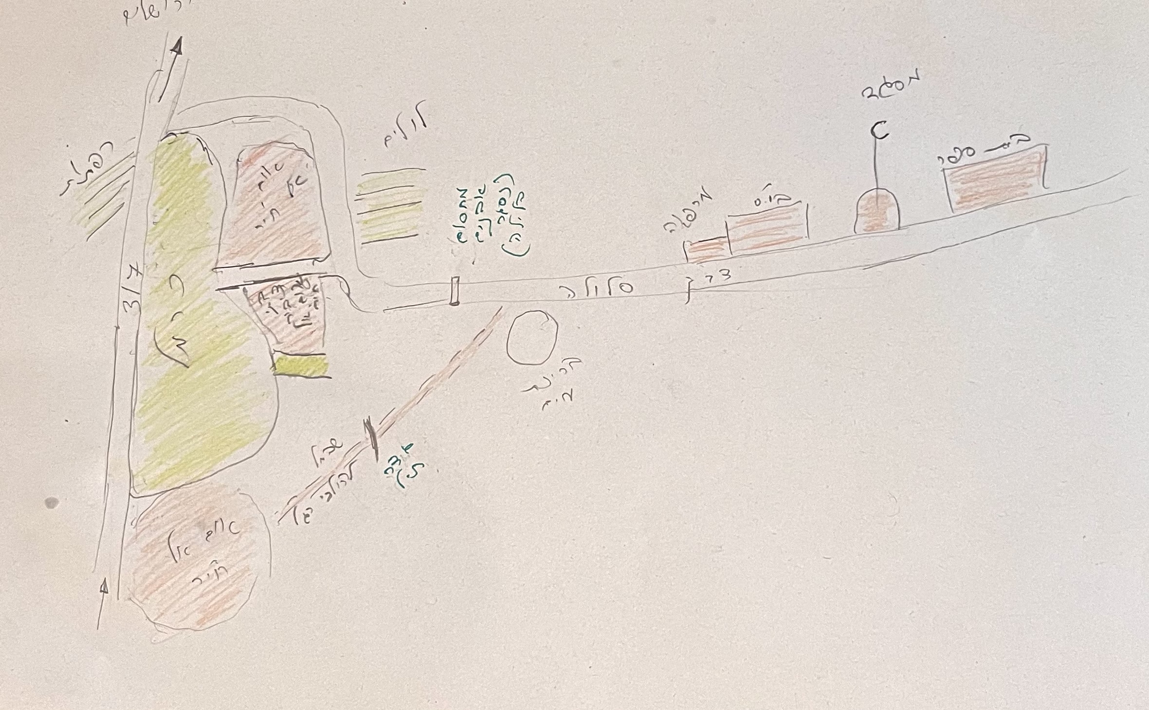
The graphics clarify the siege Carmel settlement imposes on Umm al Khair residents by surrounding the village and blocking their way out.
Road 60
During the war, all checkpoints in entrance to localities from the road are closed. This week they are opened at least partially:
At Sheep Junction, the checkpoint is opened in the direction of Hebron but closed in the direction of Yatta.
At Dura-Al Fawwar Junction it is opened in the direction of Al Fawwar, and in Dura soldiers were seen there as well.
Energetic vehicular traffic was seen all along the road as well as at the checkpoint.
Location Description
Dura Al-Fawwar Junction
See all reports for this place-
Junction on Route 60: west - the town of El Dura, east - the Al Fawwar refugee camp. There is a manned pillbox at the junction. From time to time the army sets up flying checkpoints at the entrance to El Fawwar and Al Dura. Al-Fawwar is a large refugee camp (7,000 inhabitants in 2007) established in 1949 to accommodate Palestinian refugees from Be'er Sheva and Beit Jubrin and environs. There are many incidents of stone-throwing. In the vicinity of the pillbox there are excellent agricultural areas, Farmers set up stalls adjacent to the plots close to the road. In recent months the civil administration has set up dirt embankments thereby blocking access to the stalls, and making it impossible for the farmers to sell their vegetables. Updated April 2021, Michal T.
-
Hakvasim (sheep) Junction
See all reports for this place-
One of the roadblocks (earthworks, rocks, concrete blocks or iron gates) that prevent transit of vehicles to Route 60 in the southern West Bank and block the southern entrance to Hebron. A manned pillbox supervises the place.
-
Meitar checkpoint / Sansana
See all reports for this place-
Meitar Checkpoint / Sansana The checkpoint is located on the Green Line and serves as a border crossing between Israel and the West Bank. It is managed by the Border Crossing Authority of the Defense Ministry. It is comprised of sections for the transfer of goods as well as a vehicle checkpoint (intended for holders of blue identity cards, foreign nationals or diplomats and international organizations). Passing of Palestinians is prohibited, except for those with entry permits to Israel. Palestinians are permitted to cross on foot only. The crossing has a DCO / DCL / DCL / DCL (District Coordination Office), a customs unit, supervision, and a police unit. In the last year, a breach has been opened in the fence, not far from the crossing. This breach is known to all, including the army. There does not appear to be any interest in blocking it, probably as it permits needed Palestinian workers without the bureaucratic permits to get to work in Israel. Food stalls and a parking area economy have been created, but incidents of violent abuse by border police have also been recorded. Updated April 2022
-
South Hebron Hills
See all reports for this place-
South Hebron Hills
South Hebron Hills is a large area in the West Bank's southern part.
Yatta is a major city in this area: right in the border zone between the fertile region of Hebron and its surroundings and the desert of the Hebron Hills. Yatta has about 64,000 inhabitants.
The surrounding villages are called Masafer Yatta (Yatta's daughter villages). Their inhabitants subsist on livestock and agriculture. Agriculture is possible only in small plots, especially near streams. Most of the area consists of rocky terraces.Since the beginning of the 1980s, many settlements have been established on the agricultural land cultivated by the Palestinians in the South Hebron Hills region: Carmel, Maon, Susia, Masadot Yehuda, Othniel, and more. Since the settlements were established and Palestinians cultivation areas have been reduced; the residents of the South Hebron Hills have been suffering from harassment by the settlers. Attempts to evict and demolish houses have continued, along with withholding water and electricity. The military and police usually refrain from intervening in violent incidents between settlers and Palestinians do not enforce the law when it comes to the investigation of extensive violent Jewish settlers. The harassment in the South Hebron Hills includes attacking and attempting to burn residential tents, harassing dogs, harming herds, and preventing access to pastures.
There are several checkpoints in the South Hebron Hills, on Routes 317 and 60. In most of them, no military presence is apparent, but rather an array of pillboxes monitor the villages. Roadblocks are frequently set up according to the settlers and the army's needs. These are located at the Zif Junction, the Dura-al Fawwar crossing, and the Sheep Junction at the southern entrance to Hebron.
Updated April 2022
 Muhammad D.Jul-12-2026Smadar with Taleb on duty at Qawawis
-
Umm al-Khair
See all reports for this place-
Umm al-Kheir
A Palestinian village in the southern Hebron governorate, populated by five families. The Palestinian residents settled there decades ago, after Israel expelled them from the Arad desert and purchased the land from the residents of the Palestinian village of Yatta. The village suffers from the violence of nearby Carmel settlers, from water shortage and is subject to frequent demolition of buildings by the Civil Administration.
-
Zanuta
See all reports for this place-
Zanuta was a small rural Palestinian locality until its demolition. It was situated in the space around the town Dahariya in the South Hebron Hills, about a ten-minute ride from Meitar Checkpoint. There are documented remains of a large Byzantine settlement in the area. Since the Ottoman (Turkish Empire) period (1516-1917) Zanuta was documented as a locality of shepherds and farmers who live in the remains of the ancient structures and the residential caves near them.
Two individual ranches of colonists were created next to Zanuta: Meitarim (of the colonist Yinon Levi) to the east, and Yehudah (of the colonist Elyashiv Nachum) to the north. Endless attacks, harassments and attempt to chase away the Zanuta villagers have originated in these two outposts.
Until the expulsion, four families lived in the village: A-Samama, Al-Tel, Al Batat, and Al-Qaisia. Farming constituted their main economic activity and employed most of the villagers. The total area of the village is about 12,000 dunams, of which about 3,000 are tended, mostly with field crops.
This village has never had a master plan that would legitimize construction permits. The Civil Administration claimed it was too small and the distance to the next town, Dahariya, too great. For this reason, the Israeli authorities pressured the villagers to leave. The colonists did the job for them.
-