
Central West Bank: New outposts and blocked roads
This time we entered the region through Eyal Checkpoint. The road bypasses Qalqiliya and connects with road 55, shortly after Eliahu Checkpoint. The first locality is Nabi Elias. In the past all traffic passed through this village, but several years ago the bypass road was paved with two entrances to Nabi Elias – from east to west. Since October 7th, the eastern entrance has been closed. We were surprised to discover this time that the western entrance as well – the main gate of Nabi Elias, the only one usually open – closed with two red metal gates. We stopped and disembarked to see what was happening.
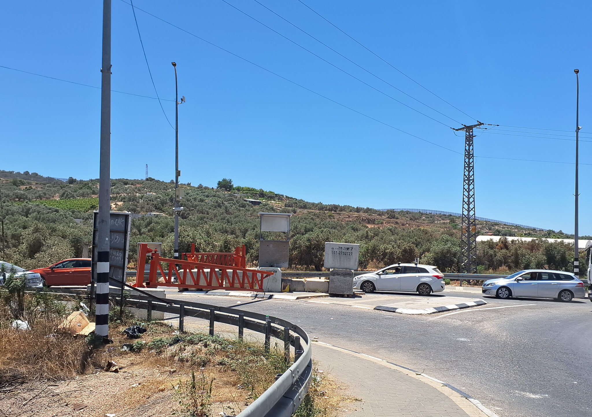
We were told that the gate was closed since Saturday, because of Netanyahu’s visit at Karnei Shomron settlement on Sunday (we visited Thursday noontime). Why was it still closed? It was claimed that boys from Azoun threw stones (some claiming they were aiming at the Prime Minister’s convoy) and that was the reason the gates were still closed. This claim seemed doubtful, for Azoun (closed since October 7, 2023 and its residents driving through Nabi Elias) was now surrounded with tall metal fences meant to prevent stone-throwing at the road. Anyway, why close off Nabi Elias, a quiet village with no usual problems?
Anyway, as a result vehicles reaching the gate (including Jews coming to eat, shop, fix their cars etc.) were surprised to find it closed and forced to turn back. Trucks and vehicles loaded with goods unload their cargo in the back-to-back method. On the site are young men helping to direct traffic and hand over the goods.
We continued on Road 55 toward Funduk, where – there too – paving works of a bypass road were developed. We stopped there to meet someone from Sara village who was supposed to sign original documents in order to receive a copy of his medical records from an Israeli hospital. We were glad to hear from him that in spite of a security prevention imposed on him for some reason, he was permitted for a single day to reach a session of National Security, and that was positive. We continued on our way and realized that Sara Checkpoint was open, unmanned. That was so on our way back, as well.
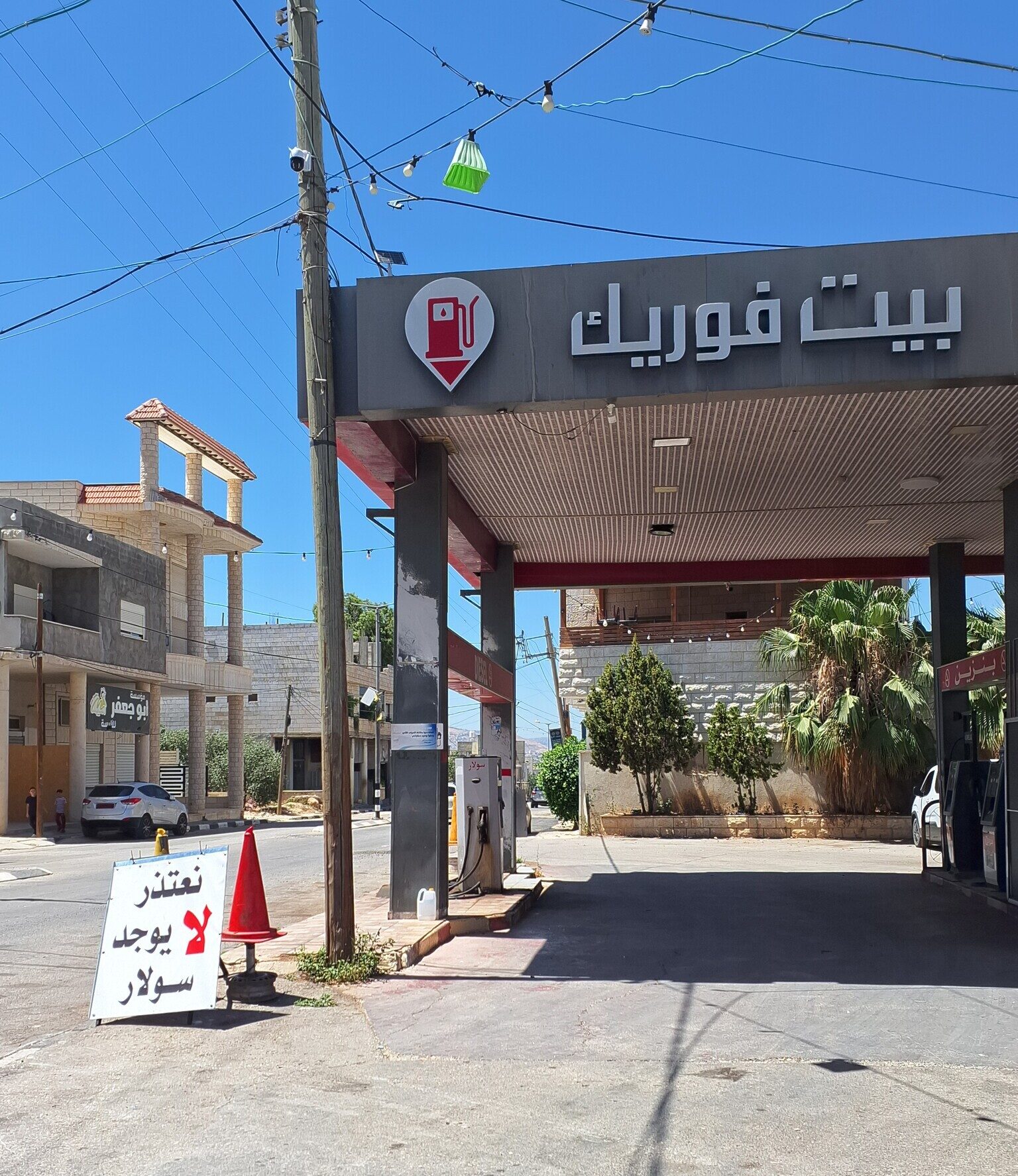
We went to check the situation in the Awarta and Beit Furik Checkpoints, and there too there were no soldiers and traffic to and from Nablus flowed. At Beit Furik we stopped at a gas station and asked what was happening there. They immediately invited us to sit with them, treated us to coffee and cold drinks, and called up the village council. One of its workers joined the meeting. He told us that settlers from Itamar accompanied by soldiers chased away all residents of Izbet Tana who were living in caves with their sheep, and replaced them.
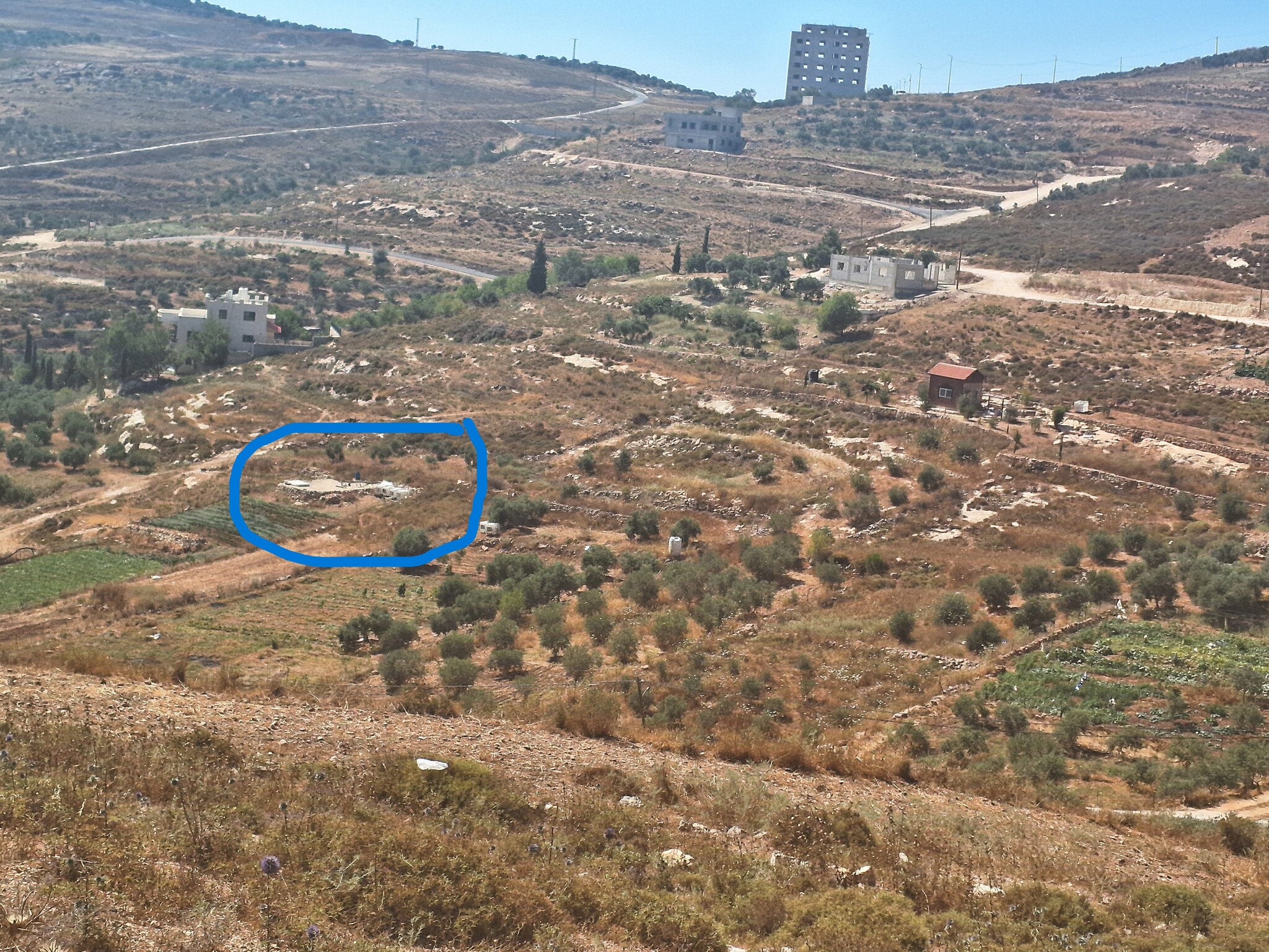
Then he took us to a different place on the outskirts of the village where he showed us the outpost erected lately on the north-western side of Beit Furik. The outpost containing several caravans situated itself close to the fields and olive groves of the villagers, nor far from the last houses of the village. According to the residents, the settlers challenge them all the time, bothering their work.
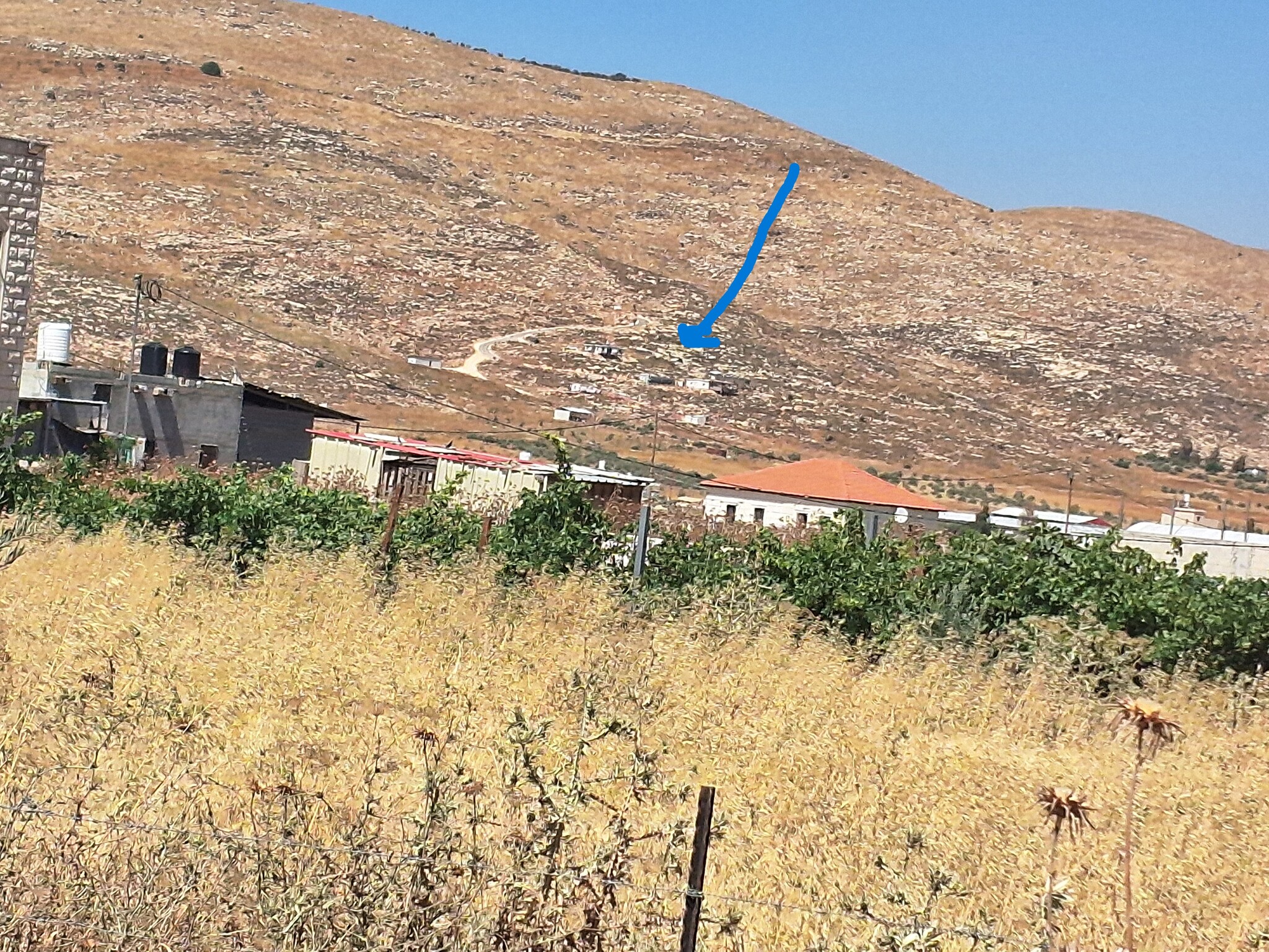
Most residents of Beit Furik worked inside Israel at construction before the current war. Now, as they can no longer work there, they must tend their land. Their livelihood was based on vegetable growing and olive harvest, but according to them the settlers attack them again and again.
The villagers told us that Beit Furik Checkpoint was closed at 11 p.m. and opened only at 5 a.m. This meant that a person ill or a woman in labor after 11 p.m. posed a difficult problem. In this case the patients are to be passed like goods in the back-to-back method from one ambulance to another in order to go to hospital in Nablus.
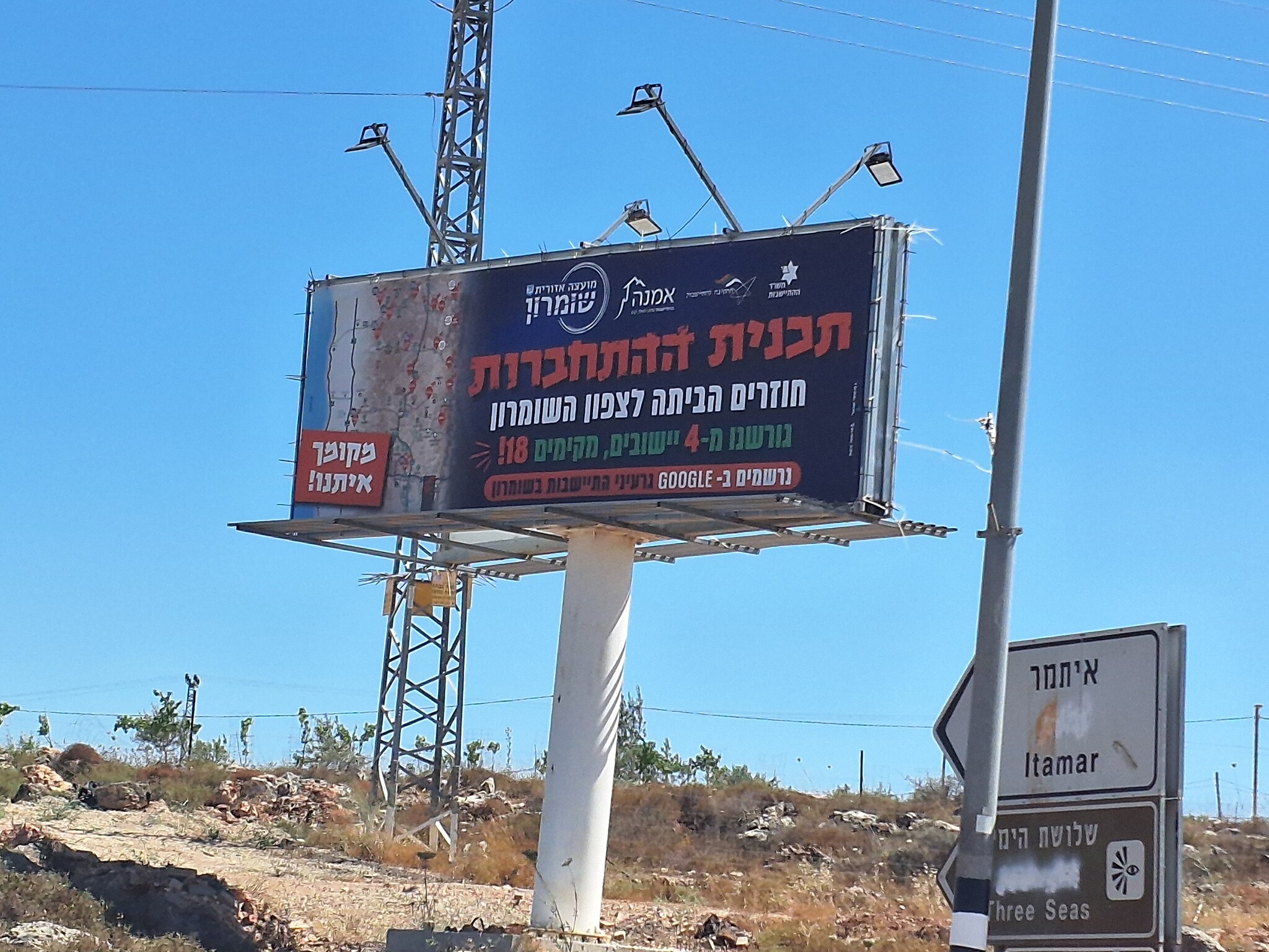
We took out leave and drove back toward Burin and Madama. On our way, near the Itamar entrance we saw a new sign calling for registration to settling groups in the northern West Bank. The sign noted Minister Struck’s settling ministry and the Northern West Bank regional council. The re-settling of Sanur – a settlement emptied under the Disengagement Plan – was no longer enough. The sign spoke of “Engagement Plan” in which 18 rather than 4 settlements would now be established… We later saw a similar sign near Havat Gil’ad and at least at one more site.
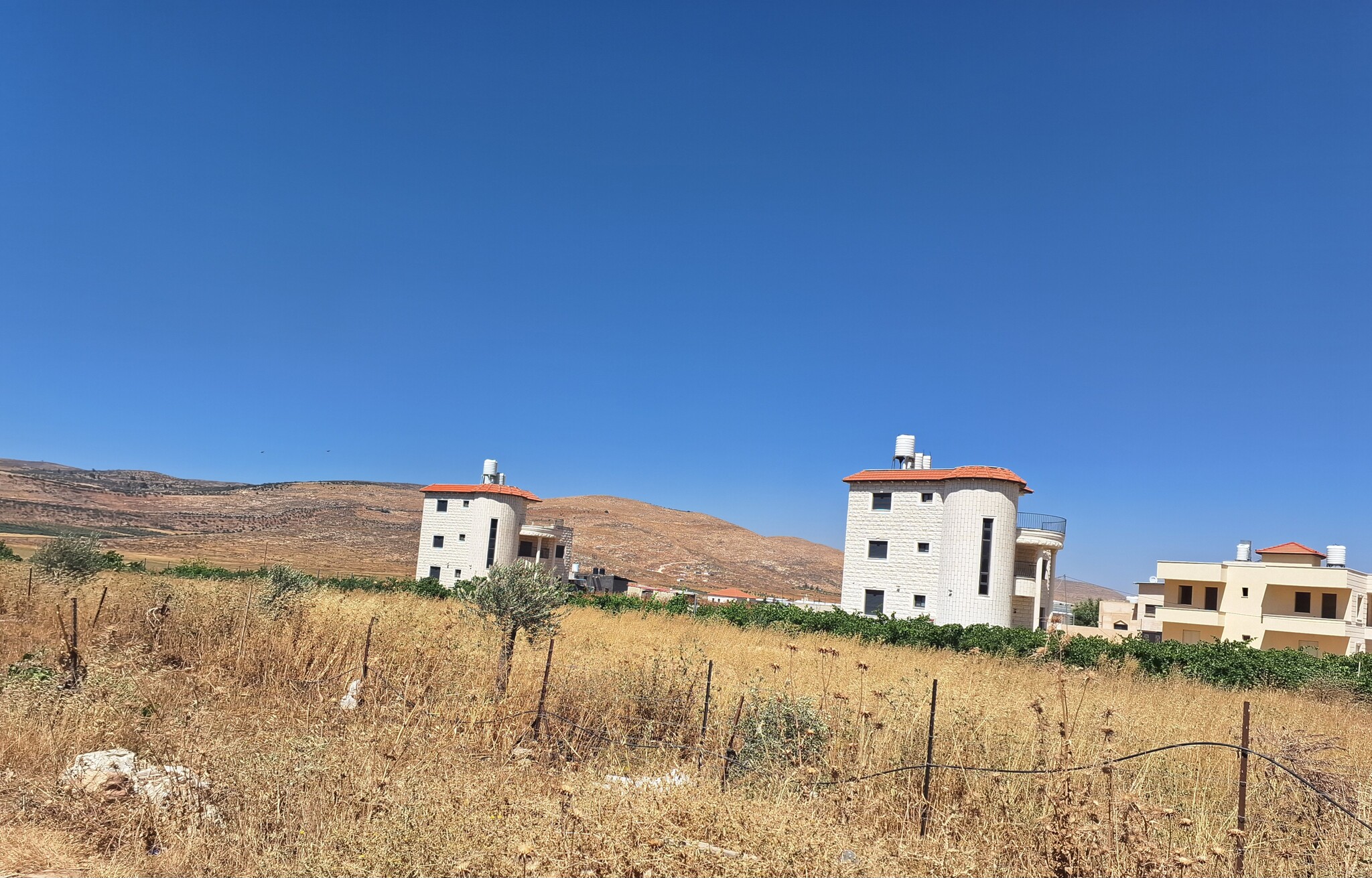
Our friend Doha was not home at Burin, but we decided to enter and see what happened with the outpost lately erected at the Madama outskirts. The man we had spoken with last time was not home, but when we stopped near the house at the village entrance to view the outpost, women and children came out to the porch. First fearful, but when they realized who we were and that we had just arrived, they immediately invited us to enter. We refused for it was already late, but promised to come next time. They said that the settlers now added 4 caravans to the two placed there on village land a month ago. The mother told us that the settlers often throw stones. She said her 5-year-old son playing with his bicycle near the home was nearly run over by them with an ATV. Since then, the child is afraid to play outside and they lock the home the whole time.
They also told us that five shepherds from the village were shot and wounded. The settlers take water from the spring that belongs to the village, from which the villagers themselves pump water. They are afraid that settlers would poison that water. The settlers also take electricity from the village illegally.
Location Description
A-Nabi Elias
See all reports for this place-
A-Nabi Elias this is a Palestinian village in the northern West Bank, east of Qalqilia on Road 55, north-east of Alfei Menashe colony and west of Karnei Shomron colony and the Palestinian city of Nablus. As of 2016, the village was populated by 1,458 inhabitants.
Near the village is a maqam (holy site memorializing a sanctified person) - the prophet Elisha. Until 2021 Road 55 crossed the village. Then a bypass road was paved through olive groves that were sequestered from the villagers. Consequently, the farmers were left with small olive groves that they could not access nor cultivate. Inhabitants protested against the road for weeks, supported by peace activists, but nothing helped and the road is now a given fact.
The village's main street had been a shopping center for all residents, including colonists. We even saw a Kashrut (kosher food) inspector in a butcher shop close to the falafel stand… The bypass road, according to tradesmen, has impacted their businesses and clients, while others claim that there are customers now for parking has become easier.
Alfei Menashe and Tzofim colonies nibble at the village lands from the north and south and get closer to it all the time. Colonists of Alfei Menashe have outdone themselves, sending their surplus sewage from the oxygenation pools toward a-Nabi Elias land, even reaching the houses.
The villagers are known as seekers of peace. For years there was no hostility towards Israelis. On the contrary, we were always welcomed warmly and stopped there to enjoy their delicious, inexpensive falafel.
-
Beit Furik checkpoint
See all reports for this place-
One of the three internal checkpoints that closed on the city of Nablus - Beit Furik to the east, Hawara to the south, Beit Iba to the west. The checkpoint is located at the junction of Roads 557 (an apartheid road that was forbidden for Palestinians), leading to the Itamar and Alon Morea settlements and Road 5487. The checkpoint was established in 2001 for pedestrians and vehicles; The opening hours were short and the transition was slow and very problematic.Allegedly, the checkpoint is intended to monitor the movement to and from Nablus of the residents of Beit Furik and Beit Dajan, being the only opening outside their villages. Since May 2009 the checkpoint is open 24 hours a day, the military presence is limited, vehicles can pass through it without inspections, except for random inspections. (Updated April 2010)
-
Madama
See all reports for this place-
Madama
This village is situated in the Nablus district, about 5 kilometers south of the city of Nablus, at an altitude of 517 meters above sea level. Madama was founded 400 years ago and its villagers originate from the Arabian Peninsula. It numbered 1,728 inhabitants in 2007. 62% of the village area is categorized as Area B, and 38% as Area C.
Over the years, hundreds of dunams have been robbed of the village for the purpose of building settler-colonies, army bases, and paving roads:139 dunams were sequestered to found settler-colony Yitzhar south of the village, and the land was also confiscated for paving road 60. The road and its buffer zone (75 meters on each side) lined by barbed wire fences separate the village’s farmlands to the north and the village farmers are denied access to tend them. The road also separates Madama and Burin, two villages with close neighborly ties, and now not able to access the road directly.
The settler-colony Yitzhar has become a daily threat to the village. The settler-colonists planted trees in fenced-in groves, steal crops, burn, uproot and vandalize Palestinians’ trees, and harm both holy sites and property. They also attack the Palestinian landowners in order to terrorize them and prevent them from accessing their lands.
For further information: http://vprofile.arij.org/nablus/pdfs/vprofile/Madama_vp_en.pdf
-