
Hakvasim (sheep) Junction, South Hebron Hills, Zif Junction
1. Travel north on Route 60. The square at the entrance to the village of Kaliklis (east of Beit Hagai) has been completed, and the road south towards the village is opn. Opposite north towards Hebron – warning regarding entry into Area A.
2. From the Sheep Junction we drove north, through the southern industrial area of Hebron, towards the entrance to the DCO, (the entrance – on the right). There is no queue, whoever arrives enters immediately.
We talked to a young man who exited. He had waited half an hour – a normal bureaucracy … but he is prevented from entering Israel, both a GSS and a police. He claims that it took him a year and a half of coming and going to get a paper that even says it! The paper, of course, is in Hebrew and we translated it for him. He was a denied entrance to Israel for 10 years because he participated in a demonstration in which he threw bricks , 2 years for participating in riots, and 10 years for throwing a brick (we were not convinced that there was proof that he threw the brick). Years have passed and it is clearly written that we are no longer a GSS engine. He is stil prevented and we gave him the phones of Chaya Ofek in the hope that she would be able to arrange for him to settle the payments on the fines, otherwise the period of prevention will be renewed again and again and the fine will only swell. It is clear that they did not explain to him at all what was written in the paper that was finally given to him.
3. The southern entrance to Bani Naim is open (with the warning sign for entry into Area A).
4. Back via Route 317. At the Zif junction there are again cameras on the road.
5. M. tells me that there are a number of black families in the area. Probably descendants of slaves from Africa.
6. The new farm in front of the Maon-Carmel barn is thriving rapidly. The water pipe is visible, of course only to Jews. A large area is fenced and arranged for planting a vineyard. Since the coming year is a Shmita year, the date of planting fruit trees was only until Tu B’Av, which passed a few days ago, so the expectation for planting the vines will only be over in a year. No matter, the whole area seems ready and built for the task.
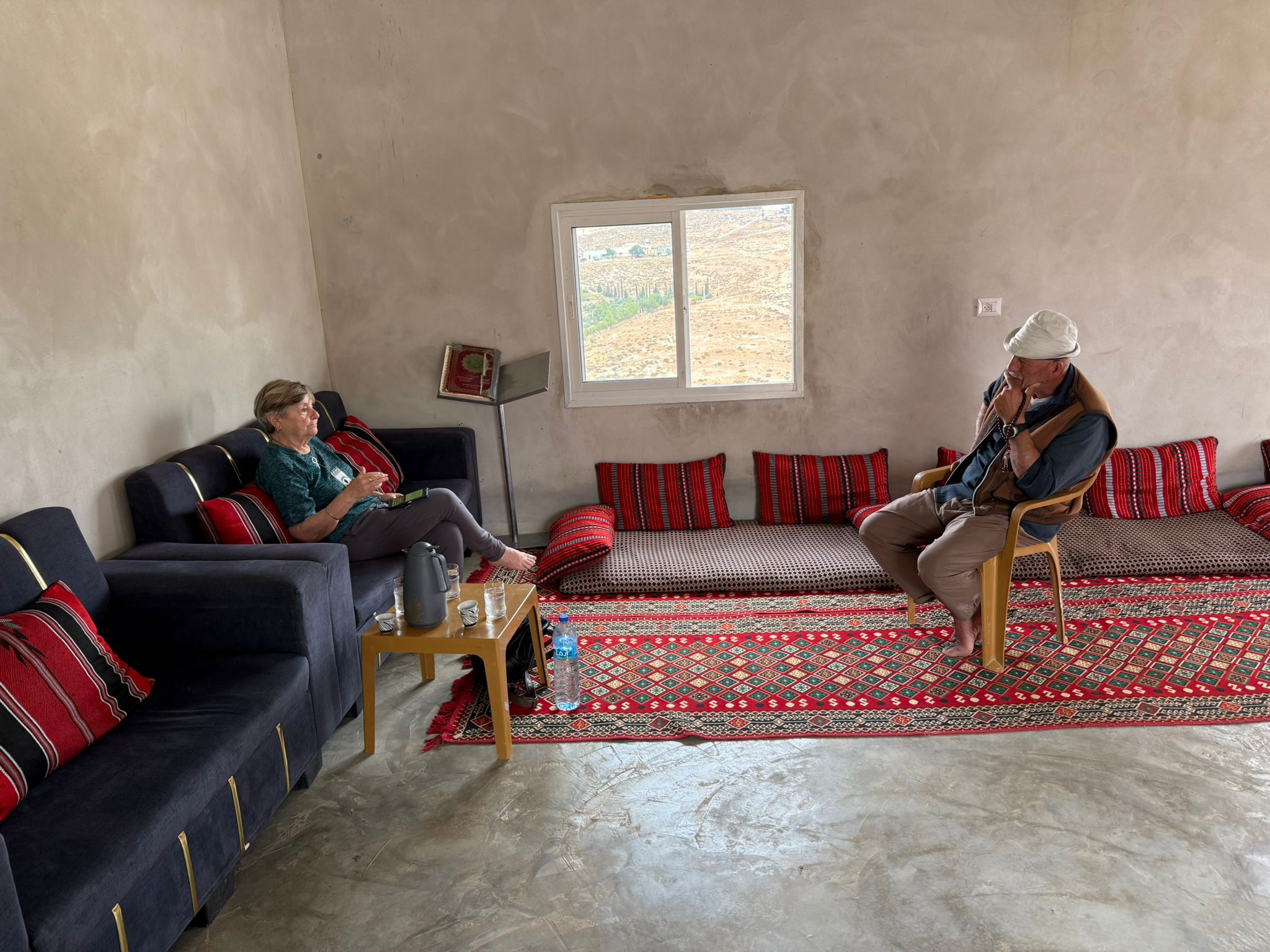
.7. Visit to Abu Safi, southeast of Asa’el. Coffee, cold sabras, yogurt like in the Balkans (Iran, in Turkish). I also got a tip as to why the vine in my yard is dead – it is too close to the fig tree! He reports to us:
A. His daughter lives with her family in Zanuta. His son-in-law reports that the Civil Administration has pasted ads on the houses to be demolished and recommends that residents demolish the houses themselves. Today the Civil Administration came and photographed the houses and left – seems like preparations for demolition.
B. Yesterday morning, Israel Kaplan, the settler on the farm between him and Asa’el, brought his herd into Abu Safi’s barley field, which he had not yet harvested. The herd consumed the grain, a loss of 4 shekels per kilogram, it is a native barley which is a remedy for high sugar.
Hakvasim (sheep) Junction
See all reports for this place-
One of the roadblocks (earthworks, rocks, concrete blocks or iron gates) that prevent transit of vehicles to Route 60 in the southern West Bank and block the southern entrance to Hebron. A manned pillbox supervises the place.
-
South Hebron Hills
See all reports for this place-
South Hebron Hills
South Hebron Hills is a large area in the West Bank's southern part.
Yatta is a major city in this area: right in the border zone between the fertile region of Hebron and its surroundings and the desert of the Hebron Hills. Yatta has about 64,000 inhabitants.
The surrounding villages are called Masafer Yatta (Yatta's daughter villages). Their inhabitants subsist on livestock and agriculture. Agriculture is possible only in small plots, especially near streams. Most of the area consists of rocky terraces.Since the beginning of the 1980s, many settlements have been established on the agricultural land cultivated by the Palestinians in the South Hebron Hills region: Carmel, Maon, Susia, Masadot Yehuda, Othniel, and more. Since the settlements were established and Palestinians cultivation areas have been reduced; the residents of the South Hebron Hills have been suffering from harassment by the settlers. Attempts to evict and demolish houses have continued, along with withholding water and electricity. The military and police usually refrain from intervening in violent incidents between settlers and Palestinians do not enforce the law when it comes to the investigation of extensive violent Jewish settlers. The harassment in the South Hebron Hills includes attacking and attempting to burn residential tents, harassing dogs, harming herds, and preventing access to pastures.
There are several checkpoints in the South Hebron Hills, on Routes 317 and 60. In most of them, no military presence is apparent, but rather an array of pillboxes monitor the villages. Roadblocks are frequently set up according to the settlers and the army's needs. These are located at the Zif Junction, the Dura-al Fawwar crossing, and the Sheep Junction at the southern entrance to Hebron.
Updated April 2022
 Muhammad D.Jul-5-2026Fares's guestroom in Shweika
-
Zif Junction
See all reports for this place-
Zif Junction located on the crossroads that directs towards Road 356 to Yata. Yata is the district city of the southern Hebron Mountains. Usually, this junction is open to traffic. The nearby pillbox is unmanned. But the army and police are present occasionally, sometimes setting up a checkpoint and sometimes detaining residents from the big city. Often, the Israeli policemen inspect vehicles and distribute driving reports to Palestinian vehicles. s
-