
Hebron, Sansana (Meitar Crossing), South Hebron Hills, Susiya
Meitar checkpoint: The parking lot on the Palestinian side is full to capacity. There is no closure on the Sabbath. Muhammad says that there is a problem with sewage or water purification
In the morning when there are many people, the installation (or pipe) cannot carry the load, and there is a flood of sewage. For the attention of those who operate the checkpoint
Hebron: Because of the holiday (perhaps the blessing of the priests in the Cave of the Patriarchs), cars are not allowed in to the center of Jewish Hebron – the neighborhoods of Avraham Avinu, Beit Romano, Tel Rumeida, Givat HaAvot. You can only get there on foot or use the bus shuttle from the center of Kiryat Arba. The parking lots in Kiryat Arba are full. Police checkpoints at every turn
Therefore, we could not check out the complaint of the residents of Tel Rumeida, that the Givati soldiers who replaced the paratroopers in Hebron, have been stopping them at checkpoints and forcing them to undergo a scan of the magnetometers. This is in contrast to the agreements, according to which the residents of the neighborhood are exempt from repeated tests of a magnetometer. The soldiers have lists of residents
I have not been to Kiryat Arba for a long time – the growth of the settlement and the new neighborhoods is impressive (or scary – depending on the point of view of the observer).
Road 356 and 317: We returned through the outposts of 317.
Palestinian Susiya: As before, there is no running water and no power line. Residents bring it in containers which is very expensive, and use solar panels to generate electricity. Nasser reports daily on the problems of the shepherds from Susiya – the settlement. In the morning, a settler from the settlement, with his sheep invaded their field which was just beginning to grow. The Palestinian residents called the army – it took the army an hour to arrive (remember – in the southern Hebron Mountains there are no traffic jams now …). When the army arrived, it took them three quarters of an hour to debate with the Palestinians and call their commanders. Only after an hour and three quarters of an hour, the sheep, which had already eaten for a large part of the field, were removed. Is the IDF always so slow in its reactions?..
There is now a new outpost in front of the settlement of Susiya: The establishment of this outpost, next to the plant nursery, has already been reported. There is now an asphalt road leading to the outpost. The entrance to the outpost is blocked by a large gate.
The method of expanding the sheep farm in the southern Hebron Mountains: It has already been reported here, and also by Gideon Levy in Haaretz, that the current method of expanding the settlement is through sheep farms, and grazing the cultivated Palestinian areas. On Road 317 and next to it we see: (1) the farm of Israel Kaplan, at the end of the outpost Asael (threatening the settlement of Abu Safi, below it); (2) the new outpost opposite Susוya; (3) a new farm near Znuta (entrance from the Meitarim area); (4) Expansion of Havat Maon.
The south of Mount Hebron is green now, and more pastoral than ever. Really reminiscent of the Tuscan hills. There seems to be no shortage of space. And I wonder to myself – was it possible that everything could have been different, as the song says ? Could it have been that the residents of the Susiya settlement could have shared their water and power line with their Palestinian neighbors? Could Carmel residents have bought bread from the oven (which they destroyed) in Umm al-Kheir? Israel Kaplan, the violent settler, could have shared the grazing with his neighbor Abu Safi? It seems that everyone would benefit if they just replaced a diskette, could have gone from an endless quarrel to a good neighborly relationship and friendship.
Hebron
See all reports for this place-
According to Wye Plantation Accords (1997), Hebron is divided in two: H1 is under Palestinian Authority control, H2 is under Israeli control. In Hebron there are 170,000 Palestinian citizens, 60,000 of them in H2. Between the two areas are permanent checkpoints, manned at all hours, preventing Palestinian movement between them and controlling passage of permit holders such as teachers and schoolchildren. Some 800 Jews live in Avraham Avinu Quarter and Tel Rumeida, on Givat HaAvot and in the wholesale market.
Checkpoints observed in H2:
- Bet Hameriva CP- manned with a pillbox
- Kapisha quarter CP (the northern side of Zion axis) - manned with a pillbox
- The 160 turn CP (the southern side of Zion axis) - manned with a pillbox
- Avraham Avinu quarter - watch station
- The pharmacy CP - checking inside a caravan with a magnometer
- Tarpat (1929) CP - checking inside a caravan with a magnometer
- Tel Rumeida CP - guarding station
- Beit Hadassah CP - guarding station
Three checkpoints around the Tomb of the Patriarchs
 Muhammad D.May-13-2026Hebron - Request for compensation for land expropriation
-
Meitar checkpoint / Sansana
See all reports for this place-
Meitar Checkpoint / Sansana The checkpoint is located on the Green Line and serves as a border crossing between Israel and the West Bank. It is managed by the Border Crossing Authority of the Defense Ministry. It is comprised of sections for the transfer of goods as well as a vehicle checkpoint (intended for holders of blue identity cards, foreign nationals or diplomats and international organizations). Passing of Palestinians is prohibited, except for those with entry permits to Israel. Palestinians are permitted to cross on foot only. The crossing has a DCO / DCL / DCL / DCL (District Coordination Office), a customs unit, supervision, and a police unit. In the last year, a breach has been opened in the fence, not far from the crossing. This breach is known to all, including the army. There does not appear to be any interest in blocking it, probably as it permits needed Palestinian workers without the bureaucratic permits to get to work in Israel. Food stalls and a parking area economy have been created, but incidents of violent abuse by border police have also been recorded. Updated April 2022
-
South Hebron Hills
See all reports for this place-
South Hebron Hills
South Hebron Hills is a large area in the West Bank's southern part.
Yatta is a major city in this area: right in the border zone between the fertile region of Hebron and its surroundings and the desert of the Hebron Hills. Yatta has about 64,000 inhabitants.
The surrounding villages are called Masafer Yatta (Yatta's daughter villages). Their inhabitants subsist on livestock and agriculture. Agriculture is possible only in small plots, especially near streams. Most of the area consists of rocky terraces.Since the beginning of the 1980s, many settlements have been established on the agricultural land cultivated by the Palestinians in the South Hebron Hills region: Carmel, Maon, Susia, Masadot Yehuda, Othniel, and more. Since the settlements were established and Palestinians cultivation areas have been reduced; the residents of the South Hebron Hills have been suffering from harassment by the settlers. Attempts to evict and demolish houses have continued, along with withholding water and electricity. The military and police usually refrain from intervening in violent incidents between settlers and Palestinians do not enforce the law when it comes to the investigation of extensive violent Jewish settlers. The harassment in the South Hebron Hills includes attacking and attempting to burn residential tents, harassing dogs, harming herds, and preventing access to pastures.
There are several checkpoints in the South Hebron Hills, on Routes 317 and 60. In most of them, no military presence is apparent, but rather an array of pillboxes monitor the villages. Roadblocks are frequently set up according to the settlers and the army's needs. These are located at the Zif Junction, the Dura-al Fawwar crossing, and the Sheep Junction at the southern entrance to Hebron.
Updated April 2022
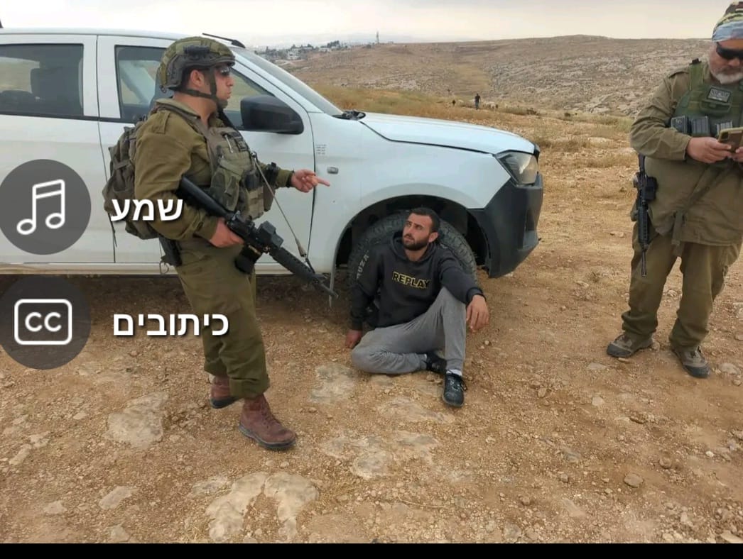 A Palestinian residentJul-6-2026Sha'ab al-Butum - M. and F. Jabarin arrested after settler attack on their home
-
Susiya
See all reports for this place-
Susiya The Palestinian area lies between the settlement of Susya and a military base. The residents began to settle in areas outside the villages in the 1830s and lived in caves, tents and sukkot. To this day they maintain a traditional lifestyle and their livelihood is based on agriculture and herding. Until the 1948 war, the farmers cultivated areas that extended to the Arad area. As a result of the war, a significant portion of their land left on the Israeli side was lost. After the 1967 war and the Israeli occupation, military camps were established in the area, fire zones and nature reserves were declared, and the land area was further reduced. The Jewish settlement in Susya began in 1979. Since then, there has been a stubborn struggle to remove the remains of Palestinian residents who refuse to leave their place of birth and move to nearby town Yatta. With the development of a tourist site in Khirbet Susya in the late 1980s (an ancient synagogue), dozens of families living in caves in its vicinity were deported. In the second half of the 1990s, a new form of settlement developed in the area - shepherds' farms of individual settlers. This phenomenon increased the tension between the settlers and the original, Palestinian residents, and led to repeated harassment of the residents of the farms towards the Palestinians. At the same time, demolition of buildings and crop destruction by security forces continued, as well as water and electricity prevention. In the Palestinian Susya, as in a large part of the villages of the southern Hebron Mountains, there is no running water, but the water pipe that supplies water to the Susya Jewish settlement passes through it. Palestinians have to buy expensive water that comes in tankers. Solar electricity is provided by a collector system, installed with donation funds. But the frequent demolitions in the villages do not spare water cisterns or the solar panels and power poles designed to transfer solar electricity between the villages. Updated April 2021, Anat T.
-