
Hebron, Sansana, South Hebron Hills, Tue 19.10.10, Morning
Translator: Charles K.
Sansana-Meitar
At 6:40am, the relatives of prisoners go through in three buses. The laborers have already crossed. The young man from Hebron who works for the Red Cross coordinating the crossing – wearing a white shirt, looks like a tourist, a real stud – asks me how it was in Australia and talks about emigrating. The market outside is open as usual and there are many more cars in the parking lot than there were last time I was here.
I wonder to myself whether the economic situation in Palestine has improved, and hope, for their sake, it has. The fences keeping people in line in the waiting area are waist-high, and people can escape the line if necessary (if they feel nauseous or sick). Much more humane than at Tarquimyya, where the fences are like huge pens. Trucks carrying sand go through as before, the parking lot is larger, as is the inspection sheds. A real “terminal.” The dust covering the Middle East and the architecture of occupation cast a shadow on the thought that perhaps, one day…
Route 60
It’s obvious that the road is no longer an apartheid route and many Palestinian cars – some, appearing new – are on it. A temporary checkpoint at the entrance to Dahariyya: an army jeep with four soldiers, two of whom stop cars, often also inspecting ID papers. They let some cars go through. They’re from a combat engineer unit, the commander a lieutentant.
What’s most obvious, and new to me, is the pillbox that’s been built on the hill between Deir Razak and Abda – the spy balloon next to it – the highest hill in the area. Arik Sharon’s vision is coming true. “Big brother” watches day and night. The settlements are all on the hilltops, the Palestinian localities down below. At the turn to what was once the Adurayyim combat engineers base (the Palestinians called it the “Majnuna”) there’s a large sign on the road – to Negohot. We didn’t take that road because there’s the usual warning – Entry to Area A Prohibited – but apparently entry isn’t prohibited to settlers. The road doesn’t appear in the road atlas, but its essentially an east-west road connecting Route 60 and Route 638.
Dura Elfawwar: The crossing is open and there’s no flying checkpoint.
Kvasim junction: The sheep market is open, and we suddenly realize where the name comes from [“Kvasim” is Hebrew for “sheep”]. The gate there is also open and cars go through without hindrance.
The entrance to Kiryat Arba: Seven months ago no soldier was stationed at the entrance; now there is one: The guard in the booth and Muhammad know each other, and he lets us go through without any problems. The entry road is being widened, and instead of a sliding gate there’s one that’s raised and lowered.The outpost to the right of the road seems to be expanding. The trailers changed color, and now they’re wooden structures painted a sort of orange. They’re visible from farther away. One looks demolished but the others – I counted five – stand in place.
Hebron
A jeep is parked at the entrance to Beit Ha’meriva, but we don’t see any detainees. Another jeep is parked at the entrance to the Jabel Muhar neighborhood. Soldiers from the Lavie battalion are in charge now.
Curve 160: The gate is closed as usual, and children go around it on both sides on their way to school.
No one is crossing at the Pharmacy checkpoint and beyond it, on the road leading to the Shouhada Street, there’s another position: yet another pillbox which, seven months ago, was empty but is now manned by a solitary soldier. There’s another position next to Beit Hadassah, with a single soldier.
Tarpa”t checkpoint: A few Palestinians greet us, Muhammad receives a present – a strand of prayer beads – and an army jeep is parked at the checkpoint.
Up at the Tel Rumeida checkpoint the soldiers are sitting on the curb, and next to the settlement at Tel Rumeida another solitary soldier is in position. Another army jeep is parked next to the pillbox above the Ashkenazi cemetery, the children’s clinic and the gynecologist are open – we leave the car there and walk to visit Michael, Tzipi’s son.
On our way back, we pass by the Patriarchs' Tombs' Cave – no detainees there either.
Despair hangs like a black cloud over this place.
Route 60
Shuyukh–Hebron: The stones blocking the entrance are arranged in an amazingly well-ordered manner.On our way back, below Beit Haggai, we see, written in black on a blue concrete cube next to the checkpoint, “Nothing happens here, nothing…”
Also on our way back, below Othniel – a bus belonging to the Hebron Hills regional council is stuck, three soldiers guarding it from fifty meters away.
A Palestinian family is picking olives. For a moment we feared the settlers were once again “exacting a price,” but the phony calm of the area hadn’t been broken.
Sansana: At the checkpoint on our way back they opened the back door of the car to make sure we weren’t smuggling Palestinians. They checked our ID cards as ususal.
Hebron
See all reports for this place-
According to Wye Plantation Accords (1997), Hebron is divided in two: H1 is under Palestinian Authority control, H2 is under Israeli control. In Hebron there are 170,000 Palestinian citizens, 60,000 of them in H2. Between the two areas are permanent checkpoints, manned at all hours, preventing Palestinian movement between them and controlling passage of permit holders such as teachers and schoolchildren. Some 800 Jews live in Avraham Avinu Quarter and Tel Rumeida, on Givat HaAvot and in the wholesale market.
Checkpoints observed in H2:
- Bet Hameriva CP- manned with a pillbox
- Kapisha quarter CP (the northern side of Zion axis) - manned with a pillbox
- The 160 turn CP (the southern side of Zion axis) - manned with a pillbox
- Avraham Avinu quarter - watch station
- The pharmacy CP - checking inside a caravan with a magnometer
- Tarpat (1929) CP - checking inside a caravan with a magnometer
- Tel Rumeida CP - guarding station
- Beit Hadassah CP - guarding station
Three checkpoints around the Tomb of the Patriarchs
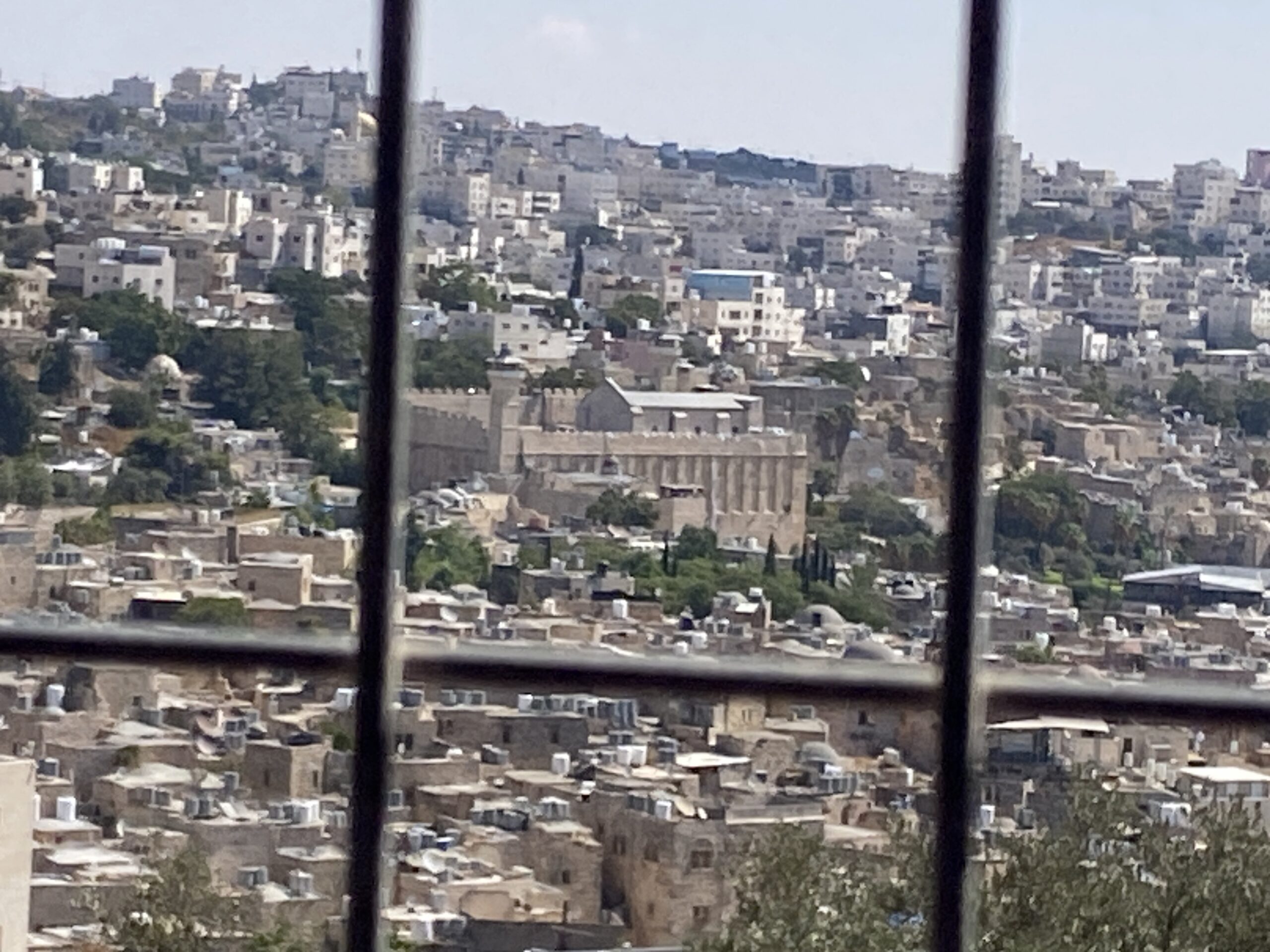 Yael ZoranSep-24-2026Hebron and the Cave of the Patriarchs from Beit Hashalom
-
Meitar checkpoint / Sansana
See all reports for this place-
Meitar Checkpoint / Sansana The checkpoint is located on the Green Line and serves as a border crossing between Israel and the West Bank. It is managed by the Border Crossing Authority of the Defense Ministry. It is comprised of sections for the transfer of goods as well as a vehicle checkpoint (intended for holders of blue identity cards, foreign nationals or diplomats and international organizations). Passing of Palestinians is prohibited, except for those with entry permits to Israel. Palestinians are permitted to cross on foot only. The crossing has a DCO / DCL / DCL / DCL (District Coordination Office), a customs unit, supervision, and a police unit. In the last year, a breach has been opened in the fence, not far from the crossing. This breach is known to all, including the army. There does not appear to be any interest in blocking it, probably as it permits needed Palestinian workers without the bureaucratic permits to get to work in Israel. Food stalls and a parking area economy have been created, but incidents of violent abuse by border police have also been recorded. Updated April 2022
-
South Hebron Hills
See all reports for this place-
South Hebron Hills
South Hebron Hills is a large area in the West Bank's southern part.
Yatta is a major city in this area: right in the border zone between the fertile region of Hebron and its surroundings and the desert of the Hebron Hills. Yatta has about 64,000 inhabitants.
The surrounding villages are called Masafer Yatta (Yatta's daughter villages). Their inhabitants subsist on livestock and agriculture. Agriculture is possible only in small plots, especially near streams. Most of the area consists of rocky terraces.Since the beginning of the 1980s, many settlements have been established on the agricultural land cultivated by the Palestinians in the South Hebron Hills region: Carmel, Maon, Susia, Masadot Yehuda, Othniel, and more. Since the settlements were established and Palestinians cultivation areas have been reduced; the residents of the South Hebron Hills have been suffering from harassment by the settlers. Attempts to evict and demolish houses have continued, along with withholding water and electricity. The military and police usually refrain from intervening in violent incidents between settlers and Palestinians do not enforce the law when it comes to the investigation of extensive violent Jewish settlers. The harassment in the South Hebron Hills includes attacking and attempting to burn residential tents, harassing dogs, harming herds, and preventing access to pastures.
There are several checkpoints in the South Hebron Hills, on Routes 317 and 60. In most of them, no military presence is apparent, but rather an array of pillboxes monitor the villages. Roadblocks are frequently set up according to the settlers and the army's needs. These are located at the Zif Junction, the Dura-al Fawwar crossing, and the Sheep Junction at the southern entrance to Hebron.
Updated April 2022
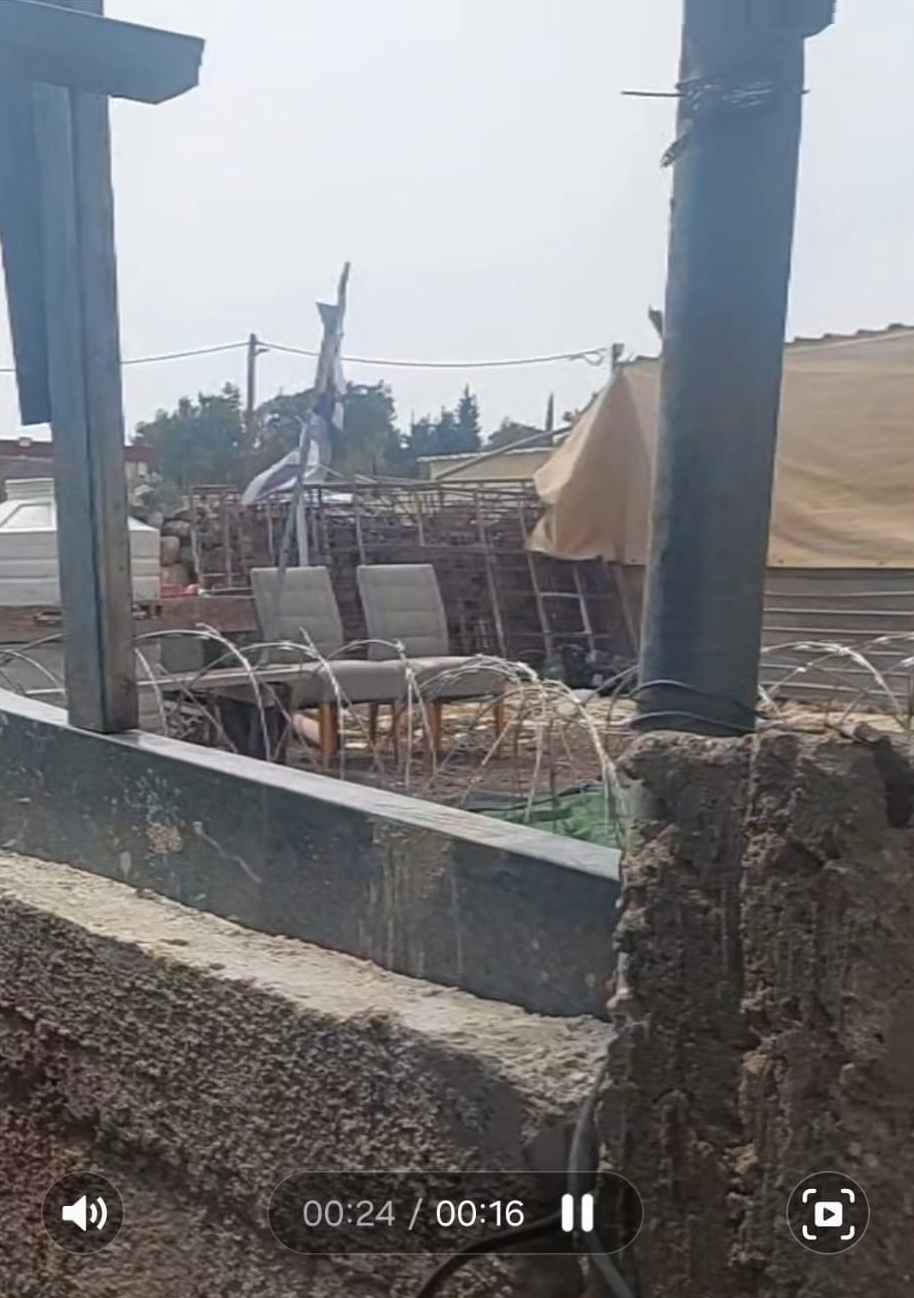 Michal TsadikOct-12-2026Umm al-Khair - Concertina wire and fences
-
