
Hebron, South Hebron Hills
Sparse traffic on Highway 60 except for people selling the tasty figs and perfect grapes by the roadside, and military vehicles.
Hebron
At ‘Abed’s shop opposite the Cave of the Patriarchs is a group of young people hearing from a local guide about how complicated life is here. I joined the conversation and we spoke about the extremists who do horrible things and determine the rules of the game which make it hard for most people.
Someone suggested that if businessmen from both sides were to sit and talk, they’d quickly reach an agreement…
Decorations are being installed at the Cave of the Patriarchs for a wedding to be held in the evening and many people and vehicles are there as part of the event, but otherwise the area is deserted and depressing.
We met Abu Nimr, the vegetable merchant, transporting his merchandise with a donkey cart to a grocery near ‘Azzam’s checkpoint. He invited us to his home in Area A for tea but we had to refuse and put him off until next week.
We climbed up to Abraham’s Spring on the way to Tel Rumeida. The water is cool and refreshing despite the extreme heat.
A resident of one of the Palestinian homes next to the spring complained she’s forced to walk home with all her baskets and purchases, and it’s impossible to reach her home in any kind of vehicle… The route up to her home is steep and difficult. How depressing, annoying and sad.
The routine inspections continue at the other checkpoints in town, making life difficult.
It’s inhuman in 2015 to live in such unreasonable conditions.
Hebron
See all reports for this place-
According to Wye Plantation Accords (1997), Hebron is divided in two: H1 is under Palestinian Authority control, H2 is under Israeli control. In Hebron there are 170,000 Palestinian citizens, 60,000 of them in H2. Between the two areas are permanent checkpoints, manned at all hours, preventing Palestinian movement between them and controlling passage of permit holders such as teachers and schoolchildren. Some 800 Jews live in Avraham Avinu Quarter and Tel Rumeida, on Givat HaAvot and in the wholesale market.
Checkpoints observed in H2:
- Bet Hameriva CP- manned with a pillbox
- Kapisha quarter CP (the northern side of Zion axis) - manned with a pillbox
- The 160 turn CP (the southern side of Zion axis) - manned with a pillbox
- Avraham Avinu quarter - watch station
- The pharmacy CP - checking inside a caravan with a magnometer
- Tarpat (1929) CP - checking inside a caravan with a magnometer
- Tel Rumeida CP - guarding station
- Beit Hadassah CP - guarding station
Three checkpoints around the Tomb of the Patriarchs
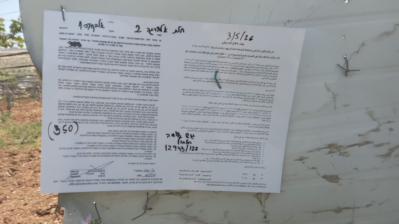 Muhammad D.May-13-2026Hebron - Request for compensation for land expropriation
-
South Hebron Hills
See all reports for this place-
South Hebron Hills
South Hebron Hills is a large area in the West Bank's southern part.
Yatta is a major city in this area: right in the border zone between the fertile region of Hebron and its surroundings and the desert of the Hebron Hills. Yatta has about 64,000 inhabitants.
The surrounding villages are called Masafer Yatta (Yatta's daughter villages). Their inhabitants subsist on livestock and agriculture. Agriculture is possible only in small plots, especially near streams. Most of the area consists of rocky terraces.Since the beginning of the 1980s, many settlements have been established on the agricultural land cultivated by the Palestinians in the South Hebron Hills region: Carmel, Maon, Susia, Masadot Yehuda, Othniel, and more. Since the settlements were established and Palestinians cultivation areas have been reduced; the residents of the South Hebron Hills have been suffering from harassment by the settlers. Attempts to evict and demolish houses have continued, along with withholding water and electricity. The military and police usually refrain from intervening in violent incidents between settlers and Palestinians do not enforce the law when it comes to the investigation of extensive violent Jewish settlers. The harassment in the South Hebron Hills includes attacking and attempting to burn residential tents, harassing dogs, harming herds, and preventing access to pastures.
There are several checkpoints in the South Hebron Hills, on Routes 317 and 60. In most of them, no military presence is apparent, but rather an array of pillboxes monitor the villages. Roadblocks are frequently set up according to the settlers and the army's needs. These are located at the Zif Junction, the Dura-al Fawwar crossing, and the Sheep Junction at the southern entrance to Hebron.
Updated April 2022
 Muhammad D.Jul-13-2026Michal with O.
-