
Hebron, South Hebron Hills
We drove to Hebron.
Everything along the way seemed normal. Except for posters on every concrete barrier and every bus stop: “Time for sovereignty.” Sham’a’s new neighborhood rises gloriously.
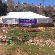
All the entrances to Hebron are open. The roadblocks have been removed. Based on the activity we see at the base at the entrance to Kiryat Arba, the shifts are changing. Giv’ati are leaving, we’ll see who replaces them. The Hazon David synagogue has been rebuilt. It’s now in a large white tent on which is written: “Hazon David synagogue – bravely and courageously onward.” Now it’s being guarded by soldiers.
Not far from there, on the Tzion route near the auto repair shops, there’s a new roadblock – concrete barriers and an emplacement that’s manned sometimes. Why? Because.
At his shop opposite the Cave of the Patriarchs, ‘Abed tries to demonstrate business as usual, with the usual many guests as well as tourists.
We went to a house the settlers claimed they’d purchased. We’d visited it ten months ago and heard how difficult it was for the family living adjacent to the Cave of the Patriarchs. They’re not home today. A new booth next to it, with soldiers, on guard. Piles of garbage, remnants of food and broken items left after the big raid. Opposite this house, all the shops that had been renovated and opened during Ramadan by order of the GOC are now shut. We met someone who lives there and is now unemployed. He says that suddenly, three months ago, they were ordered to close everything. The army stopped providing security, nobody would explain what was going on, female settlers entered the supermarket he’d opened, attacked him and demanded he leave. He now understands it was linked to the raid. He sent me photos of a riot by settlers three days ago. He says there’s continuing agitation and constant incursion attempts. He shows me his small daughters. He says that one, aged two and a half, was injured by tear gas and went to the hospital five times in the past few days because she had difficulty breathing.
Turkish tourists walking around. TIPH personnel are also present. Observing but doing nothing, as usual. There’s also a group of them at the stairs down from the Cordova school, alongside settlers and soldiers, all inspecting those descending the stairs. They’re only the pupils and teachers, or perhaps local residents not permitted to be there. Because it’s directly opposite Beit Hadassah and it’s a totally apartheid road. Soldiers on the road up to Tel Rumeida want to be sure I’m alright and don’t need assistance…

On the way back we see the notorious Anat Cohen driving along Shuhada Street. She passes by, recognizes our car and returns in reverse. Poisonously hisses to M., our driver, “Nu, Ibrahim, do you have the knife?” And continues: “Have you all brought knives?” Suddenly she sees me beside him. I’m silent, looking at her, and then the flood of “pearls” bursts from her mouth and she leaves. So much hatred and brutal racism comes from that woman…
At the first hitchhiking station at the exit from Kiryat Arba is a large sign: “The new neighborhood of Hebron’s Kiryat Arba will be built here.” In fact, we see construction starting.
We returned via Highway 317.
All the settlements – Carmel, Ma’on, Susya – are undergoing expansion, with new neighborhoods.
Hebron
See all reports for this place-
According to Wye Plantation Accords (1997), Hebron is divided in two: H1 is under Palestinian Authority control, H2 is under Israeli control. In Hebron there are 170,000 Palestinian citizens, 60,000 of them in H2. Between the two areas are permanent checkpoints, manned at all hours, preventing Palestinian movement between them and controlling passage of permit holders such as teachers and schoolchildren. Some 800 Jews live in Avraham Avinu Quarter and Tel Rumeida, on Givat HaAvot and in the wholesale market.
Checkpoints observed in H2:
- Bet Hameriva CP- manned with a pillbox
- Kapisha quarter CP (the northern side of Zion axis) - manned with a pillbox
- The 160 turn CP (the southern side of Zion axis) - manned with a pillbox
- Avraham Avinu quarter - watch station
- The pharmacy CP - checking inside a caravan with a magnometer
- Tarpat (1929) CP - checking inside a caravan with a magnometer
- Tel Rumeida CP - guarding station
- Beit Hadassah CP - guarding station
Three checkpoints around the Tomb of the Patriarchs
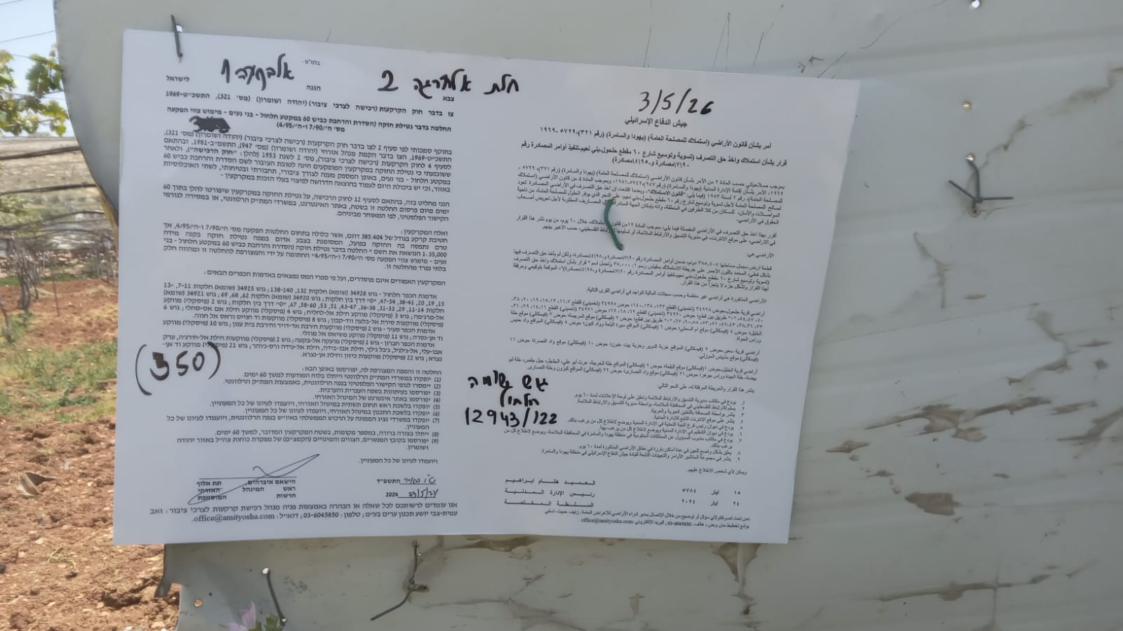 Muhammad D.May-13-2026Hebron - Request for compensation for land expropriation
-
South Hebron Hills
See all reports for this place-
South Hebron Hills
South Hebron Hills is a large area in the West Bank's southern part.
Yatta is a major city in this area: right in the border zone between the fertile region of Hebron and its surroundings and the desert of the Hebron Hills. Yatta has about 64,000 inhabitants.
The surrounding villages are called Masafer Yatta (Yatta's daughter villages). Their inhabitants subsist on livestock and agriculture. Agriculture is possible only in small plots, especially near streams. Most of the area consists of rocky terraces.Since the beginning of the 1980s, many settlements have been established on the agricultural land cultivated by the Palestinians in the South Hebron Hills region: Carmel, Maon, Susia, Masadot Yehuda, Othniel, and more. Since the settlements were established and Palestinians cultivation areas have been reduced; the residents of the South Hebron Hills have been suffering from harassment by the settlers. Attempts to evict and demolish houses have continued, along with withholding water and electricity. The military and police usually refrain from intervening in violent incidents between settlers and Palestinians do not enforce the law when it comes to the investigation of extensive violent Jewish settlers. The harassment in the South Hebron Hills includes attacking and attempting to burn residential tents, harassing dogs, harming herds, and preventing access to pastures.
There are several checkpoints in the South Hebron Hills, on Routes 317 and 60. In most of them, no military presence is apparent, but rather an array of pillboxes monitor the villages. Roadblocks are frequently set up according to the settlers and the army's needs. These are located at the Zif Junction, the Dura-al Fawwar crossing, and the Sheep Junction at the southern entrance to Hebron.
Updated April 2022
 Muhammad D.Jul-13-2026Michal with O.
-