
Hebron, South Hebron Hills, Tue 15.11.11, Morning
Palestinian Independence Day
Meitar-Sansana Crossing
at 09.45 is clear except for goods vehicles waiting to be checked.
Route 60
Fairly busy, because of the holiday a lot of Palestinian vehicles.
The Dura Beit Fuwar checkpoint is open. In the shade of the watch tower a group of soldiers enjoys their elevenses while in the background earth-moving equipment and bitonnadot await action.
At the Kiryat Arba entrance, the guard scolds Muhammed because on a previous visit he had said he was going to K. Arba but went instead to Givat Abshalom. the budding settlement to the north. Nu!
Hebron
Mutatis mutandi after a long absence things seem different but in fact remain the same. There seem to be more, and more vivid, graffiti in both Arabic and Hebrew. At Jewish Tel-Romeida there is a watchtower overlooking the free city of Hebron (H1); opposite the entrance to the Patriarchs' Tombs' Cave, the one for 'Arabs' only, a Border Policeman tells us that no Palestinian may pass in front of the Gutnick building, even if that is the simplest route to his/her house.
The worshippers lane is empty, there are some bright graffiti in Arabic near the top end where two soldiers guard the way, complaining bitterly about the cold. One of them claims that this is a permanent position and that it is staffed 24/7 – although we have not seen soldiers here for some time and its hardly the Champs Elysee that it needs guarding all night!
We go next to visit the J'aber family whose home is right under the entrance to Kiryat Arba. The Jabers' were being interviewed by French TV who also wanted to interview us but we referred them to Michal Tsaddik. The Jabers' suffer ongoing harrassment both from the Civil Adminstration (i.e. the military agency responsible for civilians in the West Bank) and from settlers who regularly steal crops and llivestock, as well as conducting nightime raids, shouting and cursing and throwing stones. The Jabers' have made a video which we will put on Facebook and You-tube and Netanya gave them her telephone number so they can call her in real time if there is an attack. The sad truth is though that given their strategic location (which long precedes that of Kiryat Arba of course) there is little hope that we can help, which is no reason not to try. The family's resistance over the last 20 or more years is truly admirable. The civil administration refuses to supply them with water so they purchase tanks for personal and home use only, meaning they have no agricutural water. This is all part of the plan to get them off their land by fair means or foul. On the family's recommendation we went to see an unstaffed checkpoint, purportedly so narrow that the children have difficulty squeezing through, and then only in single file. Because of the holiday there were no children passing, so we will go next week.
Hebron
See all reports for this place-
According to Wye Plantation Accords (1997), Hebron is divided in two: H1 is under Palestinian Authority control, H2 is under Israeli control. In Hebron there are 170,000 Palestinian citizens, 60,000 of them in H2. Between the two areas are permanent checkpoints, manned at all hours, preventing Palestinian movement between them and controlling passage of permit holders such as teachers and schoolchildren. Some 800 Jews live in Avraham Avinu Quarter and Tel Rumeida, on Givat HaAvot and in the wholesale market.
Checkpoints observed in H2:
- Bet Hameriva CP- manned with a pillbox
- Kapisha quarter CP (the northern side of Zion axis) - manned with a pillbox
- The 160 turn CP (the southern side of Zion axis) - manned with a pillbox
- Avraham Avinu quarter - watch station
- The pharmacy CP - checking inside a caravan with a magnometer
- Tarpat (1929) CP - checking inside a caravan with a magnometer
- Tel Rumeida CP - guarding station
- Beit Hadassah CP - guarding station
Three checkpoints around the Tomb of the Patriarchs
 Muhammad D.May-13-2026Hebron - Request for compensation for land expropriation
-
South Hebron Hills
See all reports for this place-
South Hebron Hills
South Hebron Hills is a large area in the West Bank's southern part.
Yatta is a major city in this area: right in the border zone between the fertile region of Hebron and its surroundings and the desert of the Hebron Hills. Yatta has about 64,000 inhabitants.
The surrounding villages are called Masafer Yatta (Yatta's daughter villages). Their inhabitants subsist on livestock and agriculture. Agriculture is possible only in small plots, especially near streams. Most of the area consists of rocky terraces.Since the beginning of the 1980s, many settlements have been established on the agricultural land cultivated by the Palestinians in the South Hebron Hills region: Carmel, Maon, Susia, Masadot Yehuda, Othniel, and more. Since the settlements were established and Palestinians cultivation areas have been reduced; the residents of the South Hebron Hills have been suffering from harassment by the settlers. Attempts to evict and demolish houses have continued, along with withholding water and electricity. The military and police usually refrain from intervening in violent incidents between settlers and Palestinians do not enforce the law when it comes to the investigation of extensive violent Jewish settlers. The harassment in the South Hebron Hills includes attacking and attempting to burn residential tents, harassing dogs, harming herds, and preventing access to pastures.
There are several checkpoints in the South Hebron Hills, on Routes 317 and 60. In most of them, no military presence is apparent, but rather an array of pillboxes monitor the villages. Roadblocks are frequently set up according to the settlers and the army's needs. These are located at the Zif Junction, the Dura-al Fawwar crossing, and the Sheep Junction at the southern entrance to Hebron.
Updated April 2022
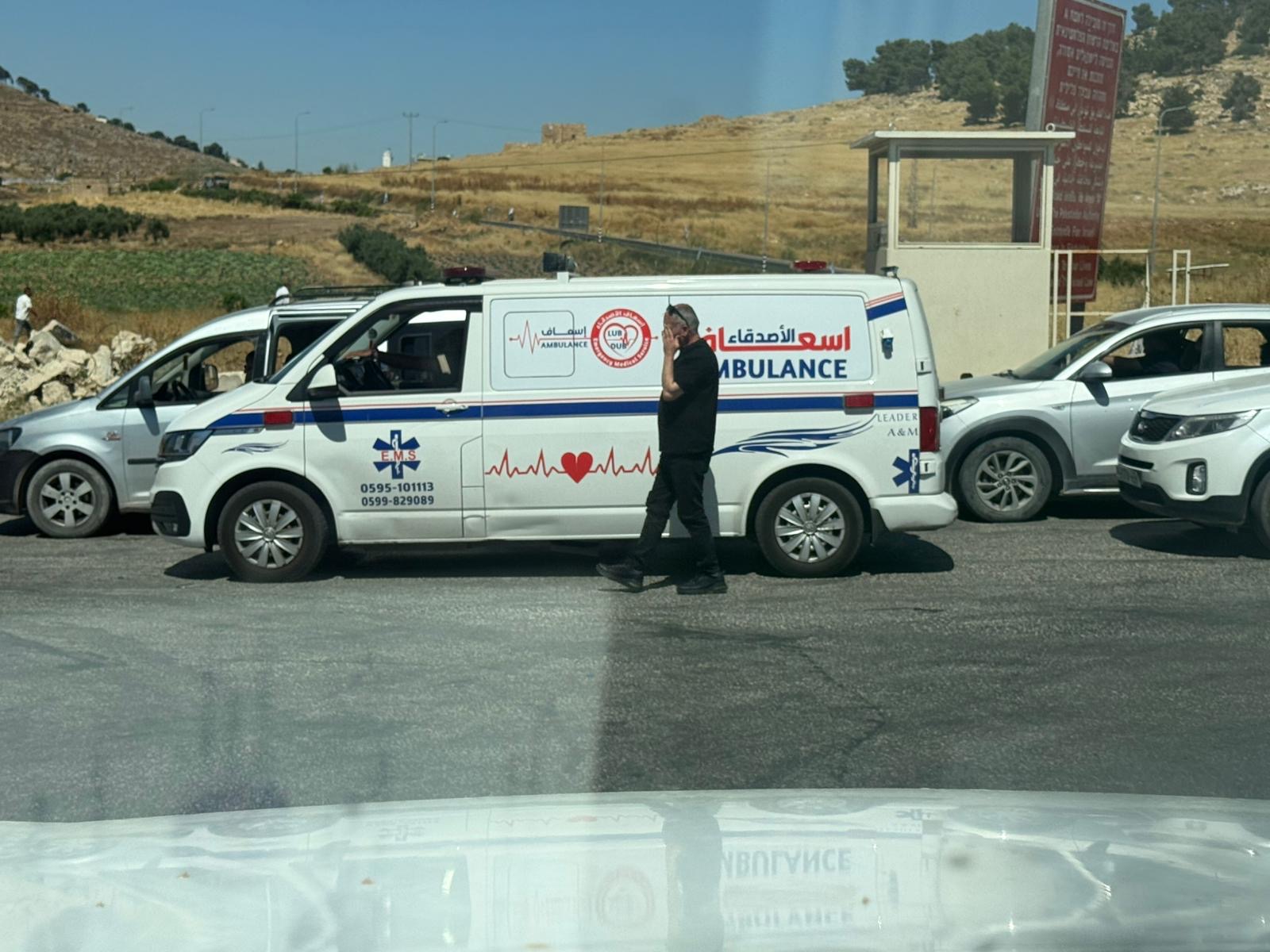 Yael ZoranJun-18-2026An ambulance is waiting in front of the closed checkpoint in El-Fawwar
-