
Hebron, South Hebron Hills, Tue 6.11.12, Morning

Translator: Charles K.
Southern Hebron Hills
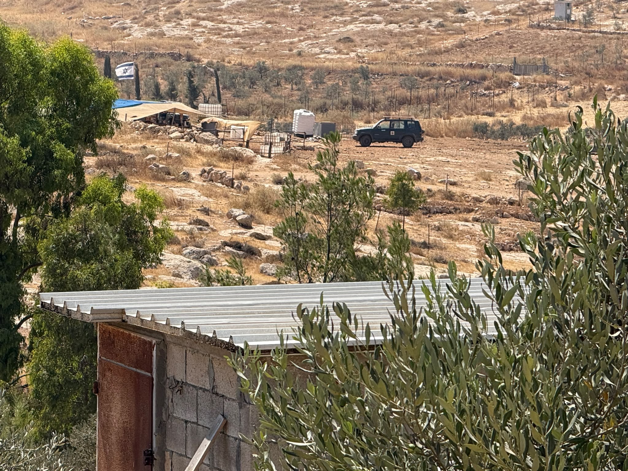
We began on Highway 317 because we’d heard about demolitions in the Sussiya area. It turned out we didn’t have to go there so we drove to see what’s going on at Mitzpeh Avigail. We could already see from the road that the investment of Israel’s government in improving the entrance to the locality.
The cranes, trucks and laborers are Palestinian. The theater of the absurd at its best. The security coordinator doesn’t simply allow himself to transport building materials in his vehicle. The guard in the booth at the entrance is an IDF soldier. Expansion has begun.
As we left we saw shepherds from Al Mafkara, between Avigail and the southern part of Ma’on. They wanted to speak to us; we went down to them. They suffer continually from settlers and from the authorities who want to demolish where they live and expel them, claiming it’s a firing range. A riddle: why are they the only ones interfering with the IDF’s training?! Aren’t the Jewish localities also within range?
The locality, like others in the area, is comprised of dilapidated, heartbreaking structures and caves. Only the school and mosque are more substantial buildings, and they’re also slated for demolition. The school is for first and second graders who aren’t able to walk all the way to A-Tawwani.
We saw the demolition orders, whose implementation has been delayed for now. They don’t know for how long. They say attorneys are handling their case. We’ll follow up.
We drove to Hebron.
Hebron

In the photo: Postal vehicle in Hebron. Only this kind of vehicle is allowed on the streets of H2
In Hebron the quiet chronicle of the occupation continues.
The concrete barriers surrounding Beit HaMeriva [house of contention] are being removed.
It appears that they’re beginning to remove signs of the military position that has been there till now, and are preparing to “recivilianize” the location. We’ll follow up here also.
The notorious revolving gate at Curve 160 has been removed. Should we be glad, or will they now upgrade the barrier with a dignified magnemometer booth? We’ll wait and see.
Many buses in the Cave of the Patriarchs parking lot, bringing pilgrims who appear to be from Africa.
On the portion of Shuhadeh Street near the Cave of the Patriarchs all the shuttered shop doors have been painted the same color, concealing most of the graffiti.
Hebron
See all reports for this place-
According to Wye Plantation Accords (1997), Hebron is divided in two: H1 is under Palestinian Authority control, H2 is under Israeli control. In Hebron there are 170,000 Palestinian citizens, 60,000 of them in H2. Between the two areas are permanent checkpoints, manned at all hours, preventing Palestinian movement between them and controlling passage of permit holders such as teachers and schoolchildren. Some 800 Jews live in Avraham Avinu Quarter and Tel Rumeida, on Givat HaAvot and in the wholesale market.
Checkpoints observed in H2:
- Bet Hameriva CP- manned with a pillbox
- Kapisha quarter CP (the northern side of Zion axis) - manned with a pillbox
- The 160 turn CP (the southern side of Zion axis) - manned with a pillbox
- Avraham Avinu quarter - watch station
- The pharmacy CP - checking inside a caravan with a magnometer
- Tarpat (1929) CP - checking inside a caravan with a magnometer
- Tel Rumeida CP - guarding station
- Beit Hadassah CP - guarding station
Three checkpoints around the Tomb of the Patriarchs
 Muhammad D.May-13-2026Hebron - Request for compensation for land expropriation
-
South Hebron Hills
See all reports for this place-
South Hebron Hills
South Hebron Hills is a large area in the West Bank's southern part.
Yatta is a major city in this area: right in the border zone between the fertile region of Hebron and its surroundings and the desert of the Hebron Hills. Yatta has about 64,000 inhabitants.
The surrounding villages are called Masafer Yatta (Yatta's daughter villages). Their inhabitants subsist on livestock and agriculture. Agriculture is possible only in small plots, especially near streams. Most of the area consists of rocky terraces.Since the beginning of the 1980s, many settlements have been established on the agricultural land cultivated by the Palestinians in the South Hebron Hills region: Carmel, Maon, Susia, Masadot Yehuda, Othniel, and more. Since the settlements were established and Palestinians cultivation areas have been reduced; the residents of the South Hebron Hills have been suffering from harassment by the settlers. Attempts to evict and demolish houses have continued, along with withholding water and electricity. The military and police usually refrain from intervening in violent incidents between settlers and Palestinians do not enforce the law when it comes to the investigation of extensive violent Jewish settlers. The harassment in the South Hebron Hills includes attacking and attempting to burn residential tents, harassing dogs, harming herds, and preventing access to pastures.
There are several checkpoints in the South Hebron Hills, on Routes 317 and 60. In most of them, no military presence is apparent, but rather an array of pillboxes monitor the villages. Roadblocks are frequently set up according to the settlers and the army's needs. These are located at the Zif Junction, the Dura-al Fawwar crossing, and the Sheep Junction at the southern entrance to Hebron.
Updated April 2022
 Muhammad D.Jul-23-2026The new settlement, starting June 1, 2026, opposite Khallet al-Humus.
-
