
Hebron & South Hebron
Hebron and South Hebron Hills Friday 13.5 AMObservers: Judith E, Hanna B, Vivi Z, Yael N (Jerusalemites), Hagit B (reporting in Hebrew) Elena L ( reporting in English)We set out at 06:45 and returned at 11:30South Hebron.Very little traffic and very few people about-it’s Friday. An occasional yellow taxi drives by-in the fields on both sides of the road the farmers are engaged in threshing and also stacking the hay-the pillboxes are manned as usual. At all road junctions and crossroads there are Israeli flags –mementos of Independence Day celebrations. The dirt barriers at the entrance to Samoa are steep and new. We drive for a while behind a bulldozer and the hammer which is protecting it. The preparations for laying the water pipe have reached the junction between route 60 and route 356. On our return to Beersheba we saw a BP flying roadblock on route 357 Since the road is completely empty and not a soul can be seen –its function is a trifle mysterious. Perhaps the BP soldiers are simply resting. The CPs at the turn offs to Yatir and Arad are manned but devoid of Palestinian traffic. At Susiya and Carmel there are new buildings under construction. So much for the principle of not extending the settlements.HebronAt 7:30 we rendezvoused with the Jerusalemites at the southern entrance to Kiryat Arba. Once again there was an argument with the guard whether not allowing our driver who has a blue ID (just like ours) to drive in-without asking for special authorization from above –is a racist act or not. The authorization is given farily quickly and we cross Kirya Arba escorted by its security patrol.Geography lesson: Kiryat Arba is built on two hills and between them lies the Arab quarter Givat Harsina. The roads running through and around Kiryat Arba apartheid- forbidden to Palestinian vehicles. Kiryat Arba has three gateways – one off route 60 near the gas station , a second further to the south, and the third at the exit into Hebron. K.A. is fenced off in every directionand the Palestinians who want to move from one quarter to another must go through checkpoints. Palestinian vehicles can only enter Hebron from the east only via al Fawwar- Dura. There is a road to Hebron from Dhahariya, but it is in Area A and we don’t know what happens there. Palestinian cars can enter Hebron from the North via Halhul. From the West (Idhna, Tarqumiya, Beit Awwa, Sikka) the entrance to Hebron is via Dura. These routes are dirt roads and the journey takes hours Except for the route from Dhahariya, they are all in area B.Hebron itself is divided into 2 areas called H1 and H2 (this was part of the Wye plantation agreements which were signed by Bibi when he was PM). H1 is under Palestinian control and H2 is under Israeli control. The army occupies some buildings and maintains observation posts in H1 as well. This is done in order to protect the Jews in H2.The hill of the Patriarchs: this quarter in Hebron is surrounded on all sides by Palestinian neighborhoods. Two buildings in this quarter serve the army – there is a CP at the entrance and we are escorted by a police patrol which lets us enter and then insists on giving us a lift to the police station at the other end of the quarter. We were shown the “access” the Palestinians have to this police station when the come to lay complaints. They ring a bell and are t let in one by one –there is a far from comfortable shed near the entrance from the Palestinian side in which they can wait for their turn. We did not see any way one could reach this entrance by car.The Prayers’ Axis – We walked along this route and later continued down Erez lane. We saw the pillbox which guards Kiryat Arba and the abandoned houses with racist graffiti (“Death to the Arabs”) on their locked doors, as well as the houses occupied by the army. We also saw the remnants of the outpost which the young girls of Kiryat Arba tried to establish recently. Every Saturday the inhabitants of Kiryat Arba walk down this “axis” in order to pray at the Machpela Cave. Today everything seemed empty and there are army posts at almost every corner. All but two or three of the houses along the “the prayers’ axis” have been abandoned. The Machpela Cave: BP checkpoints are at every corner. In our conversation with the soldiers the political overtones cannot be avoided since on our arrival the following announcement is immediately sent out over the phone: “we have a visit from those peculiar women who write down everything”. However in discussion which follows, the tone remains friendly despite the fact that the soldiers have no doubts about what they are doing in Hebron. All the soldiers we talked to there, both border police and paratroopers, complained about the provocations of the settlers –and their feeling is that they are protecting the Palestinians. They had not heard of Shovrim Shtika and accept from us the name of the website. At the CP next to the path the Machpela Cave for Palestinians only there were two detainees. On being asked the soldier said they had only been there for 15 minutes and indeed a couple of minutes later their IDs were returned to them and they continued on their way.Quarter of the Patriarch Abraham: There are almost no settlers about. One of the Arab inhabitants comes down from the roof of his house at our request to talk to us. He tells V (who translates) that his daily route to work in central Hebron is via the rooftops in order to avoid the necessity of going through the CPs at the beginning of Shuhada street. The entire street resembles that of a ghost town. Oppsote the kindergarden we read the large sign commemorating the baby Shalhevet Paz and see the Palestinian house surrounded by a wall with an army post guarding it. There was no indication of whether the Sharabati family had returned to live there. At the exit from the the Patriarch Abraham’s quarter, in the direction of Gross square, there are two more CPS- one at the bus stop and the other in the direction of the Abu Sna’an quarter. There we observed a scene which had to be seen to believed: a group of children aged between three and eight were throwing stones at a blue police jeep parked there with policemen sitting inside – when the kids saw us with cameras they shouted to each other to stop. The policemen continued throughout to sit quietly in their jeep and didn’t do anything. There were two adult settlers not far away who witnessed what was happening but didn’t say anything to the kids. One cannot avoid thinking about the very different reaction of the police (and adult settlers) if it had been Palestinian children throwing the stones. Romano House (Yeshiva) and the Kasba CP: The road has been opened to traffic but because it was Friday there was very little of it and the bank was closed. The soldiers were in the half –pillbox and from time to time stopped Palestinians and checked their IDs. The road was opened after Passover. Some of the passers-by recognize H. and expressed pleasure that we continue to come and see what is happening.Tel Romeida: From the vantage point of the CP which the settlers call the 1929 CP (when there was a massacre of Jews in Hebron), it is possible to see how lively the Palestinian section of the city is. There is a large notice near the CP warning people that they are about to enter the Palestinian area. The soldier at the CP also complains about settler provocations and says that it is the Palestinians who are perfectly OK here. Right inside the Arab quarter there is a big house now lived in by a settler family. It was bought two months ago from its Arab owner who was clearly forced into selling by threats which can never be proved. The new owner told us –before he knew who we were- that the former owner “had taken the hint”. The new man (who was holding a baby) then asked what our badges said-since he was standing too far away on the veranda of his house to read them. When we said “Machsomwatch”, he was not pleased, and from behind us a settler woman driving a car shouted to him “they are traitors” and continued in this vein directly at us. We tried but failed to refrain entirely from answering back. Not that she stopped screaming at us to listen.In Shuhada street some offensive graffiti which were clearly legible a week or two ago have been blacked out.
Hebron
See all reports for this place-
According to Wye Plantation Accords (1997), Hebron is divided in two: H1 is under Palestinian Authority control, H2 is under Israeli control. In Hebron there are 170,000 Palestinian citizens, 60,000 of them in H2. Between the two areas are permanent checkpoints, manned at all hours, preventing Palestinian movement between them and controlling passage of permit holders such as teachers and schoolchildren. Some 800 Jews live in Avraham Avinu Quarter and Tel Rumeida, on Givat HaAvot and in the wholesale market.
Checkpoints observed in H2:
- Bet Hameriva CP- manned with a pillbox
- Kapisha quarter CP (the northern side of Zion axis) - manned with a pillbox
- The 160 turn CP (the southern side of Zion axis) - manned with a pillbox
- Avraham Avinu quarter - watch station
- The pharmacy CP - checking inside a caravan with a magnometer
- Tarpat (1929) CP - checking inside a caravan with a magnometer
- Tel Rumeida CP - guarding station
- Beit Hadassah CP - guarding station
Three checkpoints around the Tomb of the Patriarchs
 Muhammad D.May-13-2026Hebron - Request for compensation for land expropriation
-
South Hebron Hills
See all reports for this place-
South Hebron Hills
South Hebron Hills is a large area in the West Bank's southern part.
Yatta is a major city in this area: right in the border zone between the fertile region of Hebron and its surroundings and the desert of the Hebron Hills. Yatta has about 64,000 inhabitants.
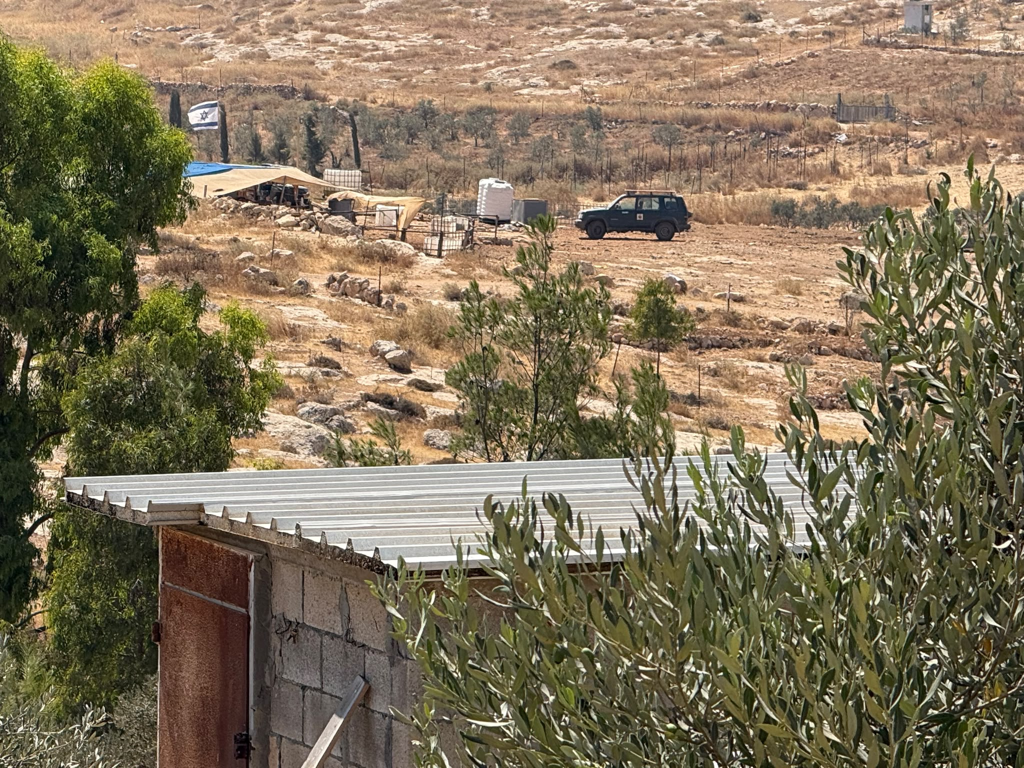
The surrounding villages are called Masafer Yatta (Yatta's daughter villages). Their inhabitants subsist on livestock and agriculture. Agriculture is possible only in small plots, especially near streams. Most of the area consists of rocky terraces.Since the beginning of the 1980s, many settlements have been established on the agricultural land cultivated by the Palestinians in the South Hebron Hills region: Carmel, Maon, Susia, Masadot Yehuda, Othniel, and more. Since the settlements were established and Palestinians cultivation areas have been reduced; the residents of the South Hebron Hills have been suffering from harassment by the settlers. Attempts to evict and demolish houses have continued, along with withholding water and electricity. The military and police usually refrain from intervening in violent incidents between settlers and Palestinians do not enforce the law when it comes to the investigation of extensive violent Jewish settlers. The harassment in the South Hebron Hills includes attacking and attempting to burn residential tents, harassing dogs, harming herds, and preventing access to pastures.
There are several checkpoints in the South Hebron Hills, on Routes 317 and 60. In most of them, no military presence is apparent, but rather an array of pillboxes monitor the villages. Roadblocks are frequently set up according to the settlers and the army's needs. These are located at the Zif Junction, the Dura-al Fawwar crossing, and the Sheep Junction at the southern entrance to Hebron.
Updated April 2022
 Muhammad D.Jul-23-2026The new settlement, starting June 1, 2026, opposite Khallet al-Humus.
-
Susiya
See all reports for this place-
Susiya The Palestinian area lies between the settlement of Susya and a military base. The residents began to settle in areas outside the villages in the 1830s and lived in caves, tents and sukkot. To this day they maintain a traditional lifestyle and their livelihood is based on agriculture and herding. Until the 1948 war, the farmers cultivated areas that extended to the Arad area. As a result of the war, a significant portion of their land left on the Israeli side was lost. After the 1967 war and the Israeli occupation, military camps were established in the area, fire zones and nature reserves were declared, and the land area was further reduced. The Jewish settlement in Susya began in 1979. Since then, there has been a stubborn struggle to remove the remains of Palestinian residents who refuse to leave their place of birth and move to nearby town Yatta. With the development of a tourist site in Khirbet Susya in the late 1980s (an ancient synagogue), dozens of families living in caves in its vicinity were deported. In the second half of the 1990s, a new form of settlement developed in the area - shepherds' farms of individual settlers. This phenomenon increased the tension between the settlers and the original, Palestinian residents, and led to repeated harassment of the residents of the farms towards the Palestinians. At the same time, demolition of buildings and crop destruction by security forces continued, as well as water and electricity prevention. In the Palestinian Susya, as in a large part of the villages of the southern Hebron Mountains, there is no running water, but the water pipe that supplies water to the Susya Jewish settlement passes through it. Palestinians have to buy expensive water that comes in tankers. Solar electricity is provided by a collector system, installed with donation funds. But the frequent demolitions in the villages do not spare water cisterns or the solar panels and power poles designed to transfer solar electricity between the villages. Updated April 2021, Anat T.
-
