
In honor of the Gaza War - Hebron is under curfew


Road 60
Nearing the Meitar Crossing, on the north-eastern side we see the mighty Separation Wall that will perhaps be a border in the future. In this area the wall more or less follows the Green Line, except for obvious bypasses around the colonies of Eshkolot and Sansana (in order to include them inside Israel-proper). On the crossing’s north-eastern side there is no longer a wall, only a renewed fence. It was built here last year after the terrorist attacks that came out of the visible breaches in the previous fence.
Along the entire road all the way to Hebron, all entries to Palestinian villages and towns are blocked by dirt dykes, boulders or metal gates, except for the entrances to Karame and Dayr Razah east of the road and north of Samu’a. For example, if a villager from Simia¸ blocked on all sides, wishes to get to the nearby town of Samu’a, he must go north to Karame and from there get off the road and go south to Samu’a. This is a detour of over an hour. Along the road, one can easily detect the fresh earthen dykes (according to the color of the soil). The army bulldozer works non-stop. At Kliklis Junction, we saw people crossing the road with supermarket carts and bags of products. At the Sheep junction we saw a lot filled with cars on the Yatta side as well as on the other side of Hebron. North of the Sheep Junction we saw the bulldozer working, supervised by an army jeep. We stopped some ways from there in order to photograph it, but the soldiers in the jeep must have noticed us and came in our direction. We took off quickly.
Generally, Palestinians and Israeli soldiers play cat and mouse: the former open the rock and dirt barriers wherever possible, and the latter renew them in Sysiphic perseverance. Blessed use of resources! Thus, M. managed to enter with his jeep yesterday and get products, with donations to Abu Safi, who has been expelled from Massafer Yatta.
Hebron – H2 area, fully controlled by the Israeli occupation
This is our first visit here since war broke out. In the first month of the war (October) the Palestinian area between the Jewish neighborhoods was under curfew. We entered from the south, through the Kiryat Arba colony industrial zone. To our surprise there were no delays. Perhaps I look like a colonist… The gate has been renewed.
Exiting Kiryat Arba to the area between the Jewish neighborhoods is amazing. The place looks fully controlled by the military. The town is closed: all shops, garages, and homes on the Zion Route are shut and there is no one around.
Going uphill to the Disputed House, we saw some women crossing quickly from one side of Palestinian Hebron to the other. There is no one in the streets nor on the rooftops or near the houses. The Cave of the Fathers area is out of bounds. We drove bypassing the girls’ and boys’ schools (which are empty, perhaps it’s vacation time in the Palestinian Authority’s school system). We stopped for a moment to understand whether Liberty House purchased recently has already been populated. A military vehicle popped up behind us right away and would not let our car stop. At the top of the hill, we turned towards the grocery shop, but were immediately stopped by soldiers who would not let us continue. Coming downhill, we were followed by a colonist car.
We wished to meet Palestinian friends, but that’s completely out of the question, especially since we cannot stop and everything is closed. They would not even answer our phone calls.
Truth is, we were afraid. There is no curfew now, but fear of the regime has been internalized.
Jalis neighborhood, opposite the Gal neighborhood
On our way to the exit from Kiryat Arba’s industrial zone, we pass through the Palestinian neighborhood of Jalis, close to which Giv’at Gal was built about twenty years ago. It was first a wild outpost, but eventually became a neighborhood of Kiryat Arba, although the area is not contiguous. The road leading to the neighborhood passes the privately owned area of the Tamimi family, and the neighborhood must have been partly built on private Palestinian land. So what? Nothing! We were here years ago, when the neighborhood had just been built. Now it contains over 50 houses and public buildings.
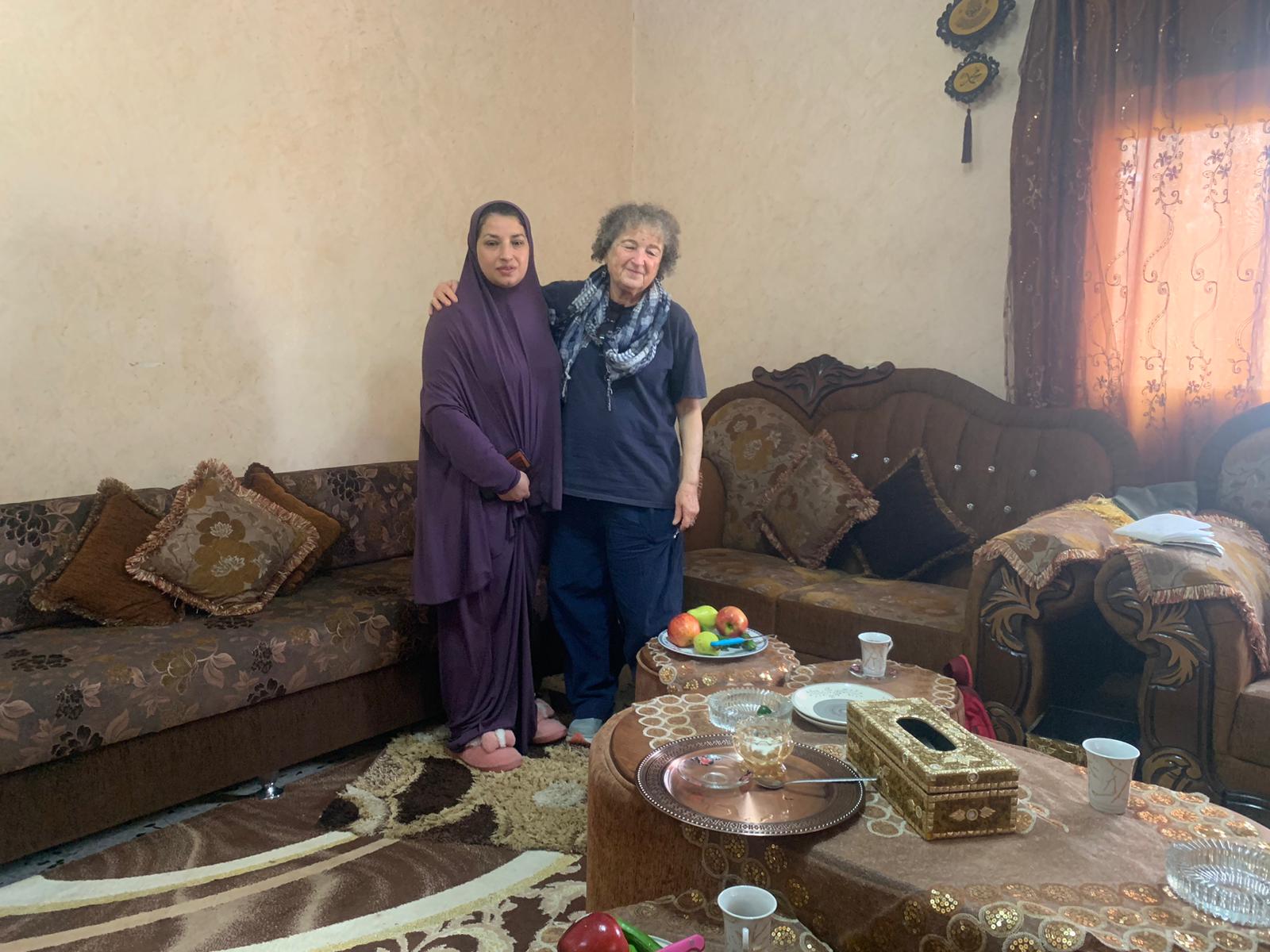
We came in to speak with the Tamimi family. Their house is the first in a row of houses opposite the Gal neighborhood, close to the army base on the opposite hill. We were warmly welcomed by Nura and her daughter Rihan, a special-needs teacher at a Hebron school. 70 members of this extended family live in this well-groomed house. In October, there was curfew here, too. They did not even have two hours every day, to get food, as in Hebron. They were left without water, which was stolen by the colonists of Giv’at Gal. The children were hungry. They sneaked through neighbor homes into the Palestinian neighborhood, to get things and survive. Left only guards in charge of their home. One day they even helped the Gal colonists (only women and children) who remained with no food and water, and sent a child to ask for help…
Since then, the Palestinians are threatened regularly by the colonists of the Gal neighborhood, who now come in army garb, at times masked. They come every two hours, knock on doors, explicitly threatening with revenge for the Hamas massacre of October 7th. Here Rihan’s voice cracked a bit. During our visit we saw a soldier walking around the house. But not too close. Perhaps he had seen our car.
In mid-November, Gal colonists came with bulldozers and covered in asphalt the track crossing the Tamimi land below the house. She called the police. They came. Did nothing. Recommended lodging a complaint… At the police station they waited for 7 hours. Finally, the police confirmed that the Tamimi owned the ground, but announced that Israeli security is above all else (what has Gaza to do with this?). Finally, the paving with asphalt was stopped.
Since them, colonists harass them on a regular basis, every day.
Garbage collection problem
Since war began, the army has transferred the garbage container right opposite the Tamimi home, from its previous site further along the way leading to Giv’at Gal. The garbage truck of the Palestinian Hebron municipality is not allowed to enter the area. God forbid Palestinian garbage could defile Jewish garbage…
The Palestinians’ cars park far away, on the side of Palestinian Hebron. Result: garbage overflows. They cannot manage to remove it manually, to the containers distant from their neighborhood. Rihan tried to burn it, but soldiers – doing the bidding of the Jewish colonists of Giv’at Gal – appeared immediately and forbade her to light a fire. Rihan asked us to try and get help from the DCO. We shall try this week.
Tending the fruit groves of the Tamimi family
Rihan explained that the entire area between their house and Road 60 is planted with olive, nut and plum trees as well as grapevines. This year, they were not allowed to harvest. Or tend to the trees. Everything was wasted.
In the front yard she built a small playground. But the colonists from Givat Gal stopped the works. We saw a see-saw in the making – all it needs now is a concrete base to connect to it. They are not allowed. As soon as the Palestinians try to add anything, a colonist in army garb appears and orders them to stop. Why? Can anyone explain this? Just a children’s playground!
Hebron
See all reports for this place-
According to Wye Plantation Accords (1997), Hebron is divided in two: H1 is under Palestinian Authority control, H2 is under Israeli control. In Hebron there are 170,000 Palestinian citizens, 60,000 of them in H2. Between the two areas are permanent checkpoints, manned at all hours, preventing Palestinian movement between them and controlling passage of permit holders such as teachers and schoolchildren. Some 800 Jews live in Avraham Avinu Quarter and Tel Rumeida, on Givat HaAvot and in the wholesale market.
Checkpoints observed in H2:
- Bet Hameriva CP- manned with a pillbox
- Kapisha quarter CP (the northern side of Zion axis) - manned with a pillbox
- The 160 turn CP (the southern side of Zion axis) - manned with a pillbox
- Avraham Avinu quarter - watch station
- The pharmacy CP - checking inside a caravan with a magnometer
- Tarpat (1929) CP - checking inside a caravan with a magnometer
- Tel Rumeida CP - guarding station
- Beit Hadassah CP - guarding station
Three checkpoints around the Tomb of the Patriarchs
 Muhammad D.May-13-2026Hebron - Request for compensation for land expropriation
-
South Hebron Hills
See all reports for this place-
South Hebron Hills
South Hebron Hills is a large area in the West Bank's southern part.
Yatta is a major city in this area: right in the border zone between the fertile region of Hebron and its surroundings and the desert of the Hebron Hills. Yatta has about 64,000 inhabitants.
The surrounding villages are called Masafer Yatta (Yatta's daughter villages). Their inhabitants subsist on livestock and agriculture. Agriculture is possible only in small plots, especially near streams. Most of the area consists of rocky terraces.Since the beginning of the 1980s, many settlements have been established on the agricultural land cultivated by the Palestinians in the South Hebron Hills region: Carmel, Maon, Susia, Masadot Yehuda, Othniel, and more. Since the settlements were established and Palestinians cultivation areas have been reduced; the residents of the South Hebron Hills have been suffering from harassment by the settlers. Attempts to evict and demolish houses have continued, along with withholding water and electricity. The military and police usually refrain from intervening in violent incidents between settlers and Palestinians do not enforce the law when it comes to the investigation of extensive violent Jewish settlers. The harassment in the South Hebron Hills includes attacking and attempting to burn residential tents, harassing dogs, harming herds, and preventing access to pastures.
There are several checkpoints in the South Hebron Hills, on Routes 317 and 60. In most of them, no military presence is apparent, but rather an array of pillboxes monitor the villages. Roadblocks are frequently set up according to the settlers and the army's needs. These are located at the Zif Junction, the Dura-al Fawwar crossing, and the Sheep Junction at the southern entrance to Hebron.
Updated April 2022
 Muhammad D.Jul-12-2026Smadar with Taleb on duty at Qawawis
-